My usual caveat: To see better the imagery that is shown below, use a large computer monitor, not a cell phone – if you have this option.
For the April 8 2024 solar eclipse that crosses much of the US it will not be as necessary, compared with some previous eclipses, to carefully plan based on the climatological cloudiness of potential observing sites.
The times for the duration of totality below are approximate, but shown to give an idea of how the eclipse duration varies along the path. The point here is that the eclipse duration near Durango, Mexico and central Maine, about as far away from Durango as you can get in the US, is only about 1 minute – it is 76% of maximum totality duration in Maine (or 97% of maximum totality duration in Dallas). These differences are relatively small – and justify not traveling to a site with near-maximum duration. The 7 sec difference between Dallas and Durango is negligible.
DURATION OF TOTALITY
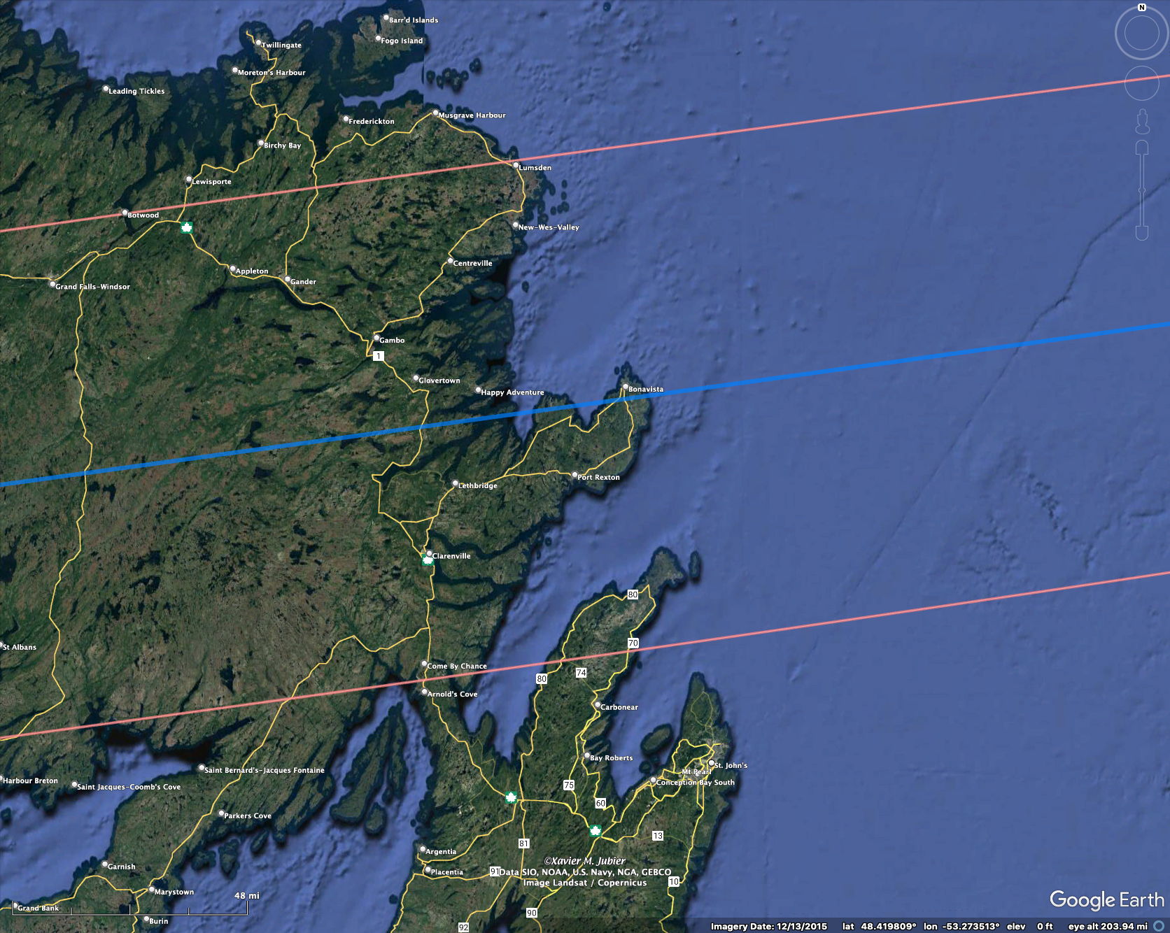
2:54 in Newfoundland as eclipse leaves land
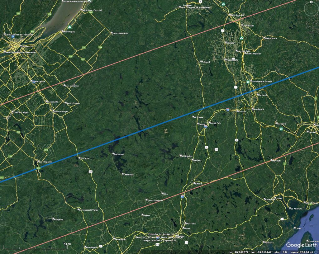
3:25 in central Maine
3:52 near Cleveland, Ohio
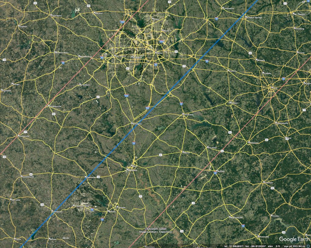
4:21 Dallas, Texas
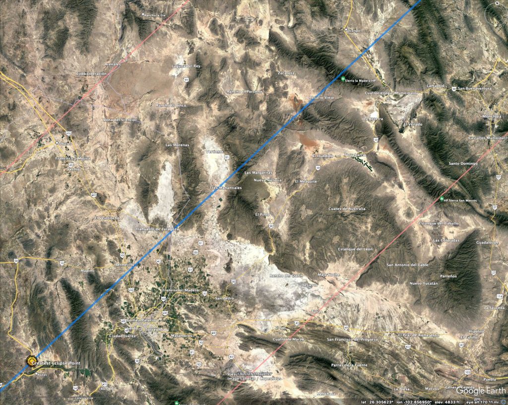
4:28 Durango, Maximum duration of eclipse

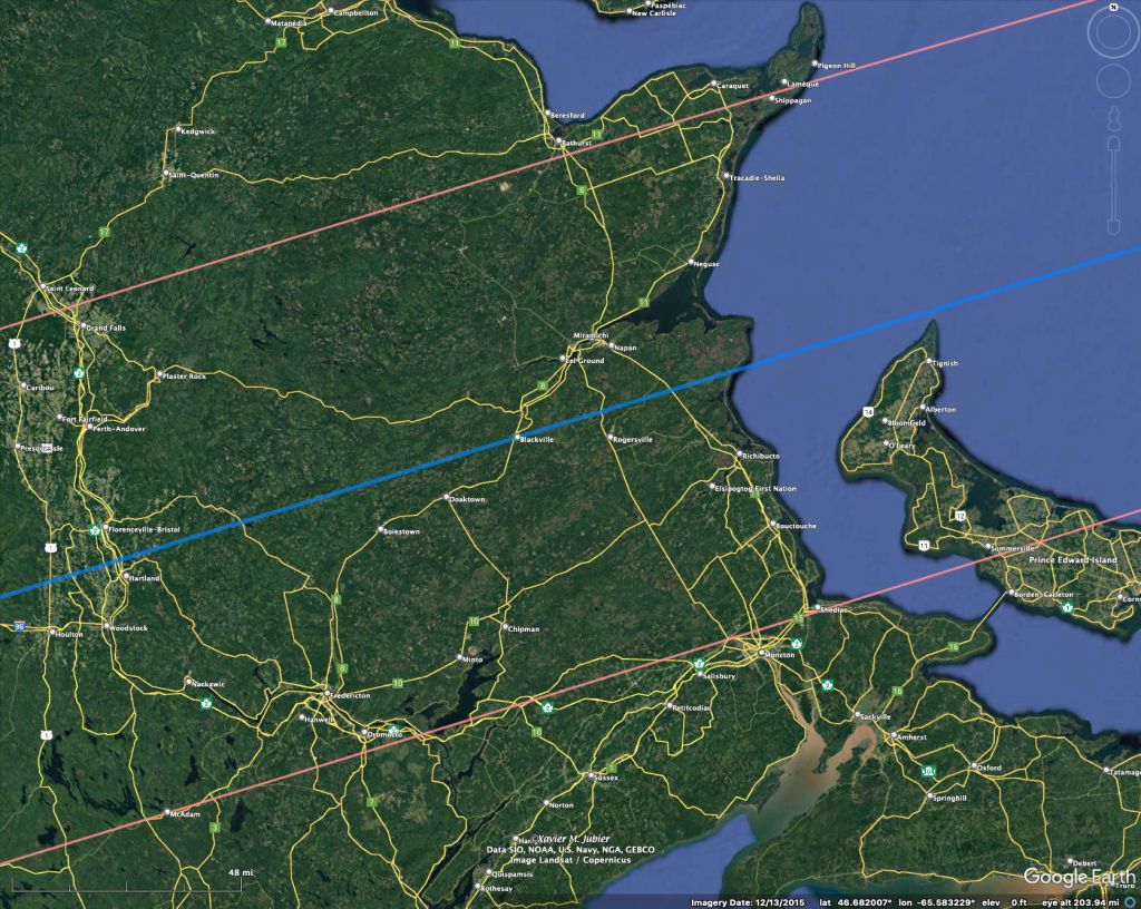
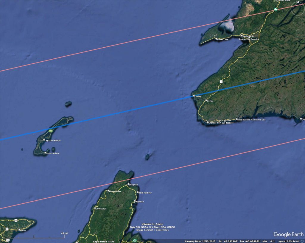
This eclipse track is from the excellent resource by Xavier Jubier at http://xjubier.free.fr/en/site_pages/SolarEclipsesGoogleMaps.html
Thus, your exact location to maximize the totality isn’t too important. Weather will (or should) be the main factor in where you decide to observe.
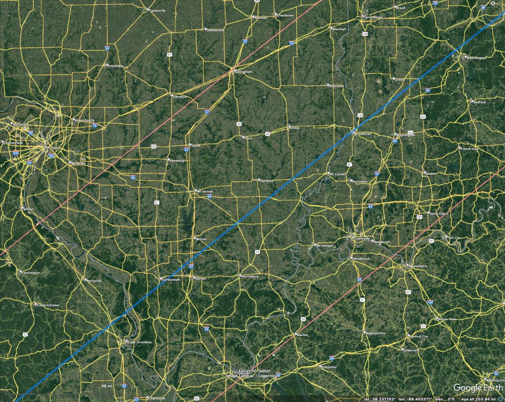
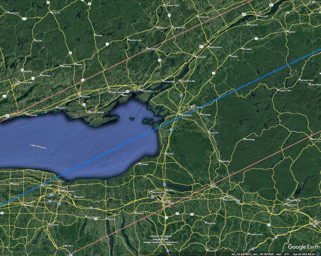
Closer views of the Mexican and US track, as well as some of the Canadian totality track, are in the gallery below. The centerline is in blue while the edges of the path of totality are in red.


The above images show the path of the solar eclipse on April 8th 2024 across North America. A new NASA map (below) provides the local times of mid-eclipse as well. It also shows the path of the October 14 2023 annular eclipse across the US. Click on the map for a larger version.

Given the eclipse is in early April, most of the cloudiness along the eclipse track will be related to clouds associated with large-scale (“synoptic-scale”) features in the atmosphere – the “highs” and “lows” of weather maps. These patterns are predicted out to 15 days with current numerical weather prediction models – though accurate predictions are only half this or less. I would wait for and use only forecasts generated 48-72 hours in advance of the eclipse before deciding whether to move my observing site or not.
Most of the eclipse track in the US is over relatively flat ground, so local topographic effects on the cloudiness will be relatively small. Hence, I would pay attention to the forecast patterns of cloudiness and be ready to move up to 500 miles in the last 24 hr or so, depending on the forecast cloudiness. Actual cloudiness observations from satellite the morning of the eclipse might be used to further fine-tune your observing site.
For a non-statistical but perhaps informative look at what the cloudiness was like over the eclipse track for 19 previous years, images on April 8th from 2003 to 2021 are shown below. I haven’t put the eclipse track on the images but you can compare with the image above.

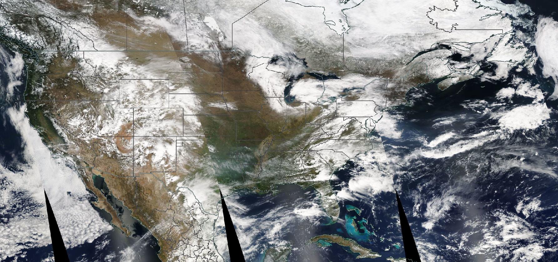
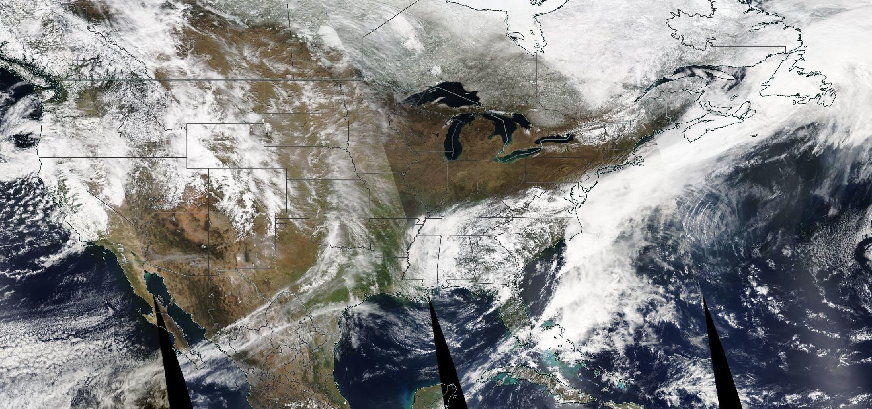

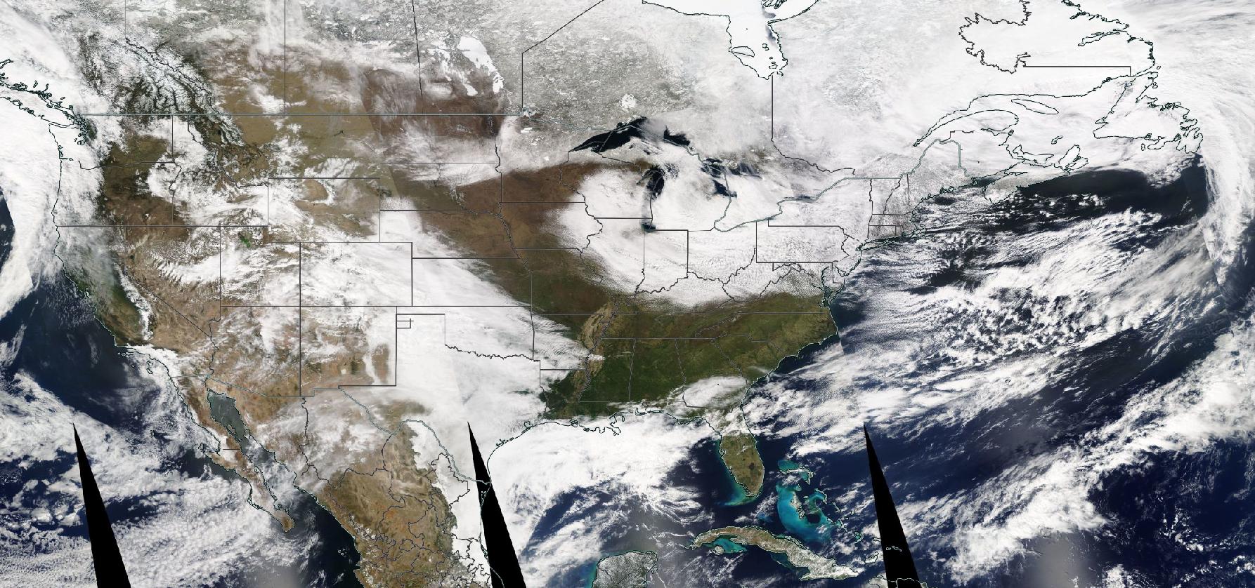
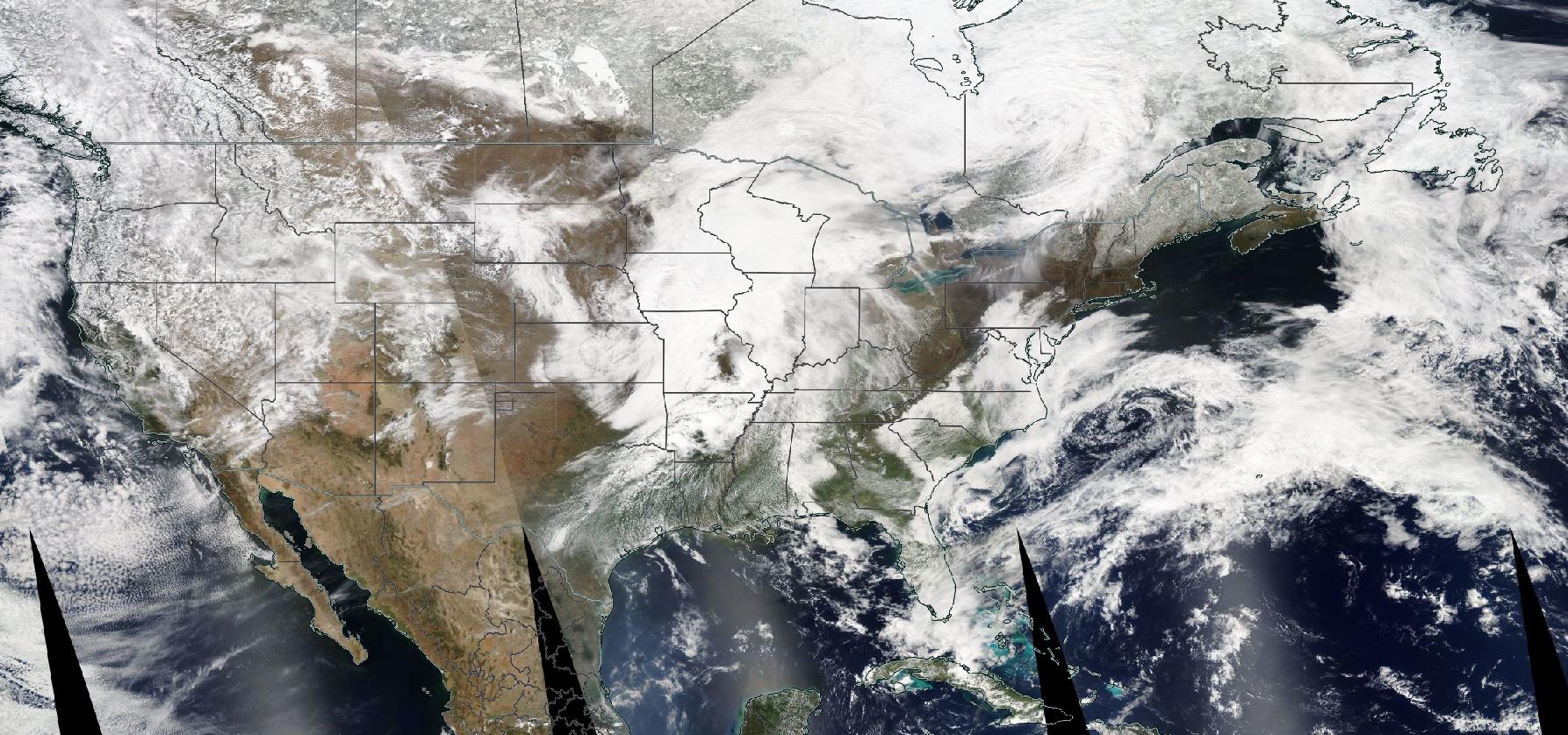
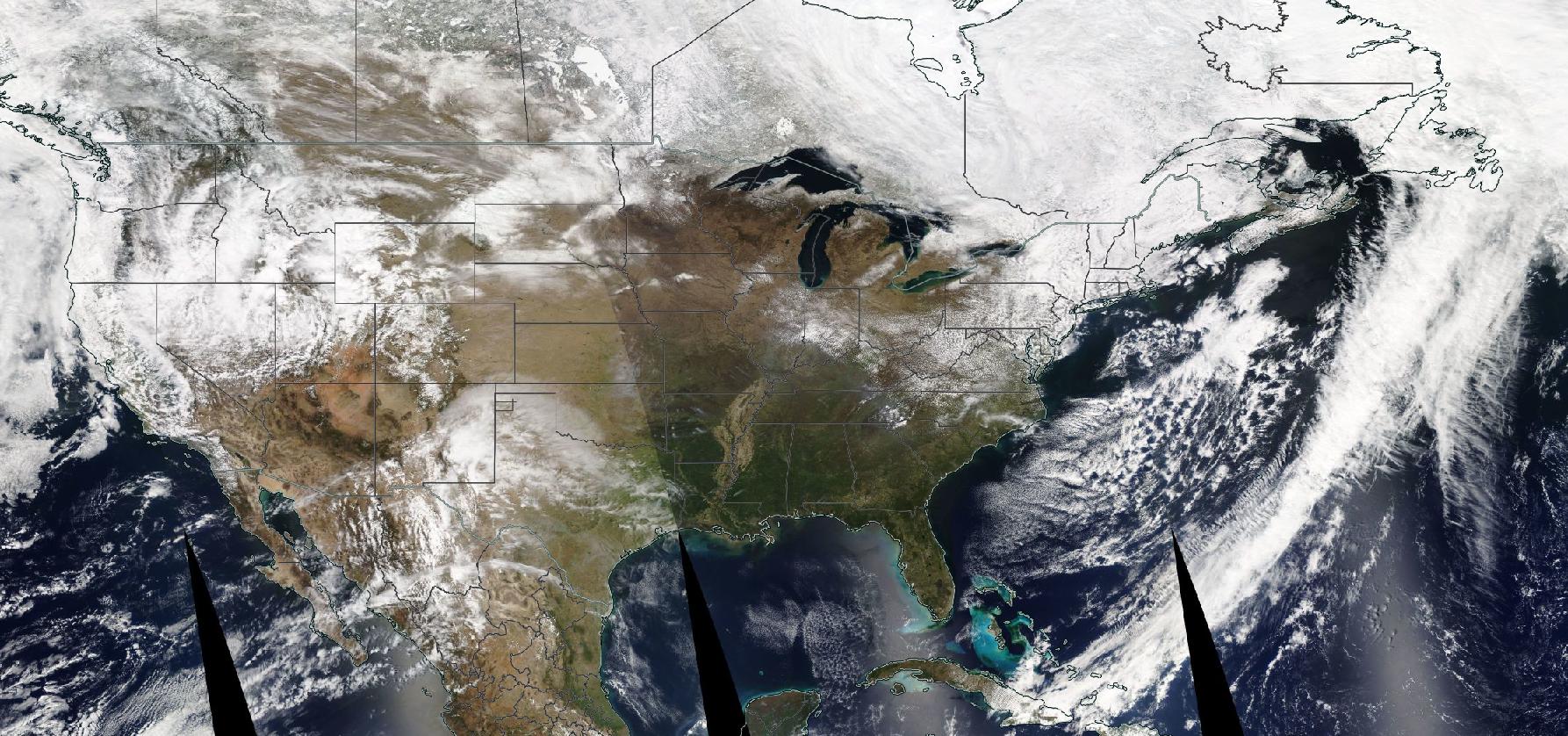


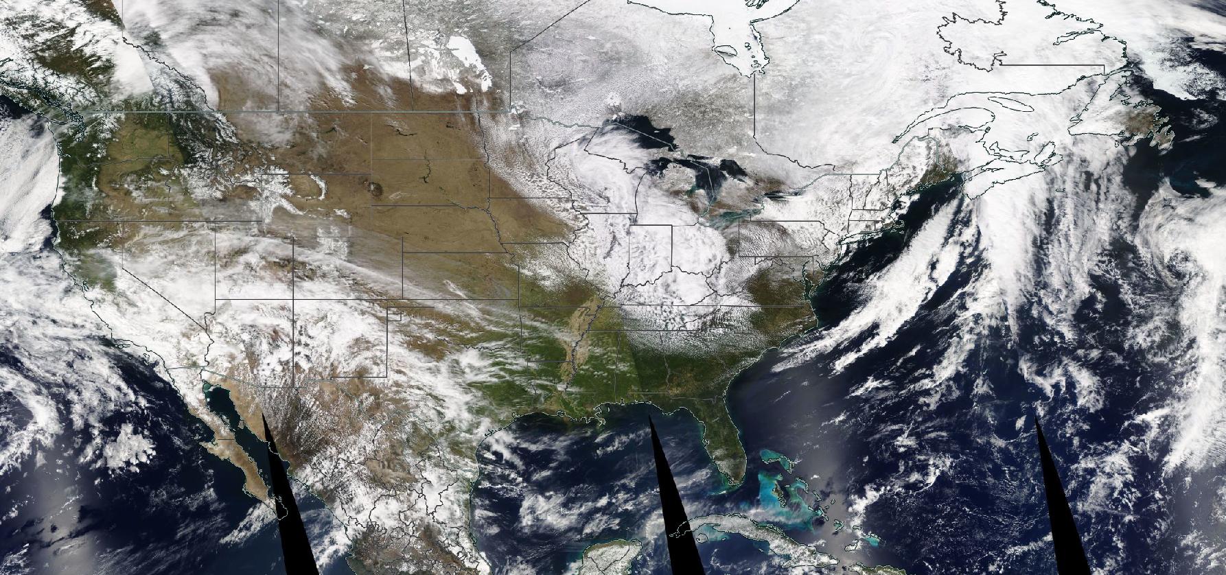


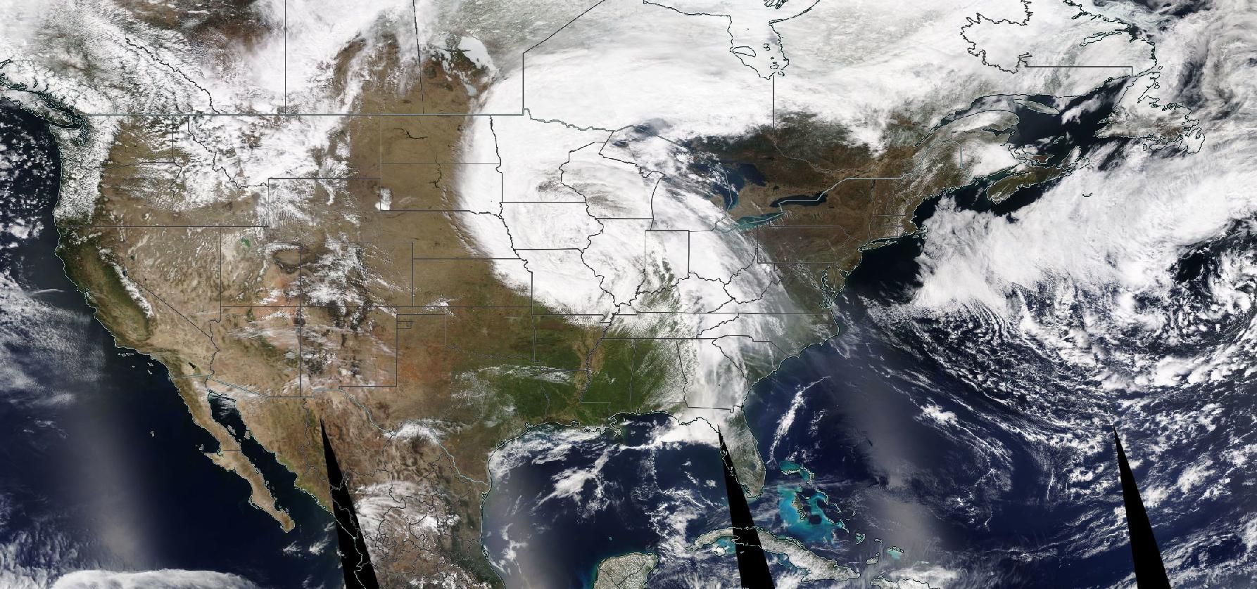
The “true-color” visible images shown in the slide show above are all on April 8th of the years from 2003-2021. They are from the sun-synchronous NASA Aqua satellite that provides its imagery at approximately 1:30 PM local time. This is close to the eclipse time. You can get a flavor for the scale of the cloudiness over the eclipse area. Predicting these large patterns of cloudiness is possible and moderately accurate with current numerical weather prediction models a few days in advance. Pick your favorite location and consider how you might move on the day before the eclipse to improve your chances of having fewer clouds.
Sightseeing in the US or Mexico around the eclipse time
As always, I encourage anyone traveling to see an eclipse to see more than the eclipse. If you travel to northern Mexico, I would suggest spending time around the small town Cuatrocienegas (which unfortunately will likely be overwhelmed by eclipse chasers). We have traveled there in the past to see the succulent plant flora in the surrounding desert.
For foreigners coming to the US to see the eclipse and who are also interested in nature (and I hope this is everyone) I’d suggest looking over the page I wrote up for seeing nature in the US. It was written for non-US residents, but I suspect even many US residents are not familiar with much of the material. There is a link to a talk I gave about Big Bend National Park in Texas buried in the material. A link to that talk (to motivate potential travelers to the eclipse) is here. Note that Big Bend is NOT in the path of totality – the eclipse is about 97% coverage there, and it is about 300 miles (~500 km) from the nearest totality path in south Texas. Just something to consider for before or after eclipse travel.
For the eclipse of April 8 2024 – below are some satellite animation sectors
To use these animations you need to reference maps of the eclipse track to help orient yourself.
Mexico (1km pixels, only country borders)
Texas through Arkansas (1km)
Buffalo to Nova Scotia (1km)
