This section is in response to questions on eclipse forums about what possibilities exist for travel in Chile after (or before) the eclipse. It is hardly exhaustive, and we focus only on some possibilities that won’t easily be found by perusing travel books or the internet. As we have been to Chile a few times, intent on exploring the natural landscapes, some of the ideas here might be useful to some the eclipse-goers who have both some extra time and interest in various natural history subjects besides astronomy.
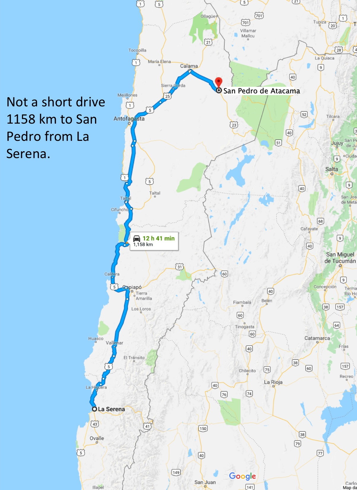
A kmz file suitable for display in Google Earth provides some of the more interesting localities that we remember (download the file and open with Google Earth…also use Google Street View). A general Google Maps route from La Serena to San Pedro de Atacama is shown below:
A logical question first question might be: Should you travel south or north after the eclipse – if you plan to see some of Chile during your visit. Ask almost any Chilean and they will say go south – it rains more in the south, there are forests and snow-capped volcanoes and scenic lakes. In keeping with our website’s focus on the traveling naturalist, we describe our perspectives – they differ from the consensus.
While the south of Chile has many interesting features for the naturalist, it is not really a winter destination. Cold, wet weather along the coast and snow at higher elevations inland is similar to the US Pacific Northwest in winter. Although there are forests in the south, a great part of the easily accessible landscape has been deforested for agriculture and truly pristine forests are in areas that are much farther south or of difficult access.
The “north” – anything north of La Serena, is dry. And along much of the Pan-American Highway route, from about Copiapo to the Peruvian border (and from there to almost the border with Ecuador) is what they call “hyper-arid” with almost no rain. So what is the attraction? The dry environment is the attraction. The main process modifying the Earth’s surface almost everywhere is running water, except in the driest parts of the Atacama desert. On large stretches of northern Chile and Peru there is almost no measurable rainfall, and wind erosion by sand grains lifted by the wind are main source of erosion.
So being desert-lovers, we would urge post-eclipse travelers to head north to expand your geographical perspectives. Here are our main reasons for doing so:
1) The north of Chile has some of the best volcanic landforms you are likely to see anywhere on Earth. This is because the precipitation is very low in the higher Andes and erosion by water and ice is minimal compared with volcanic regions in moister climates.
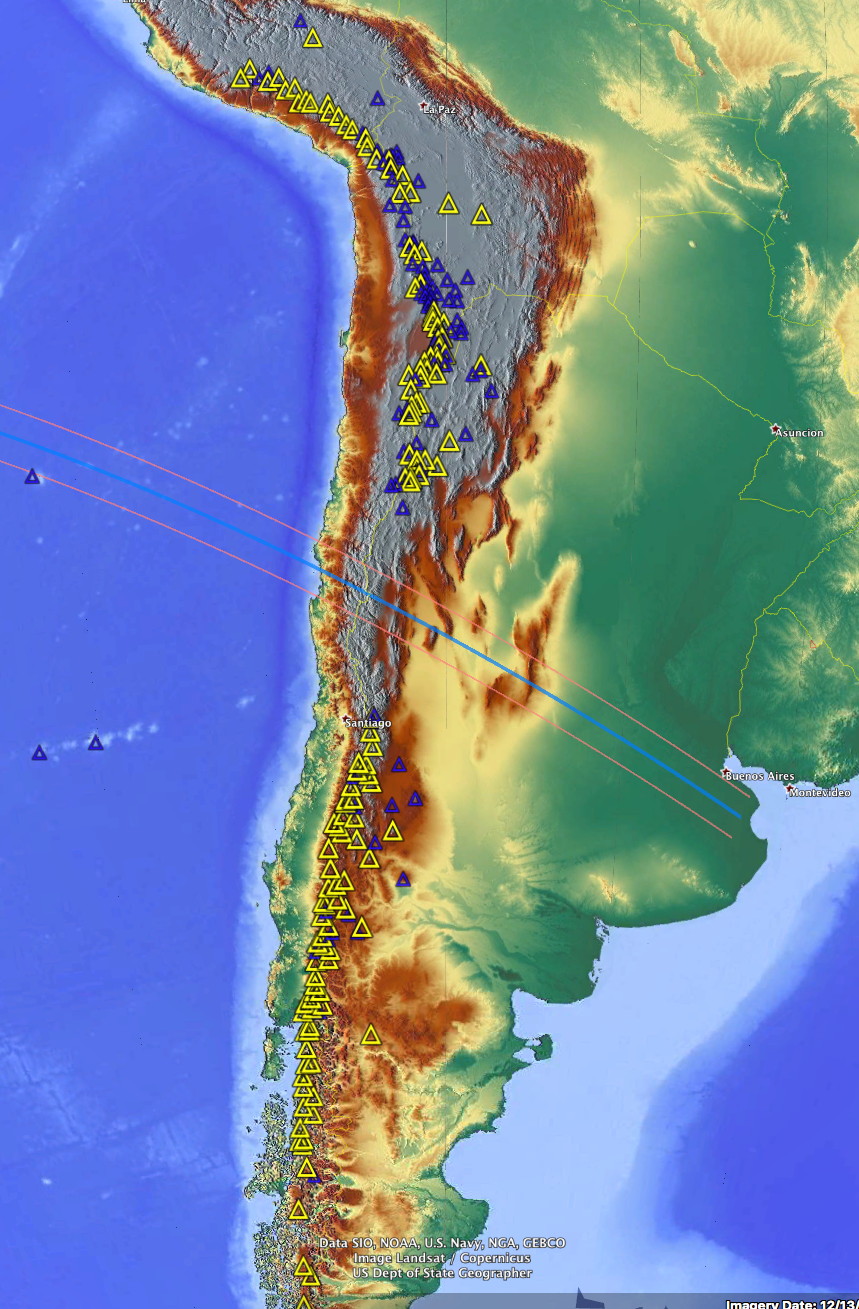
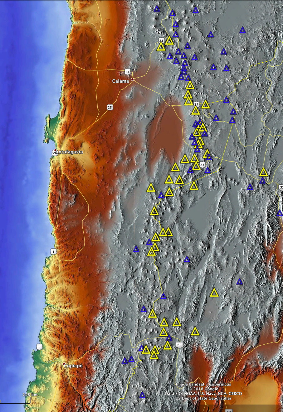


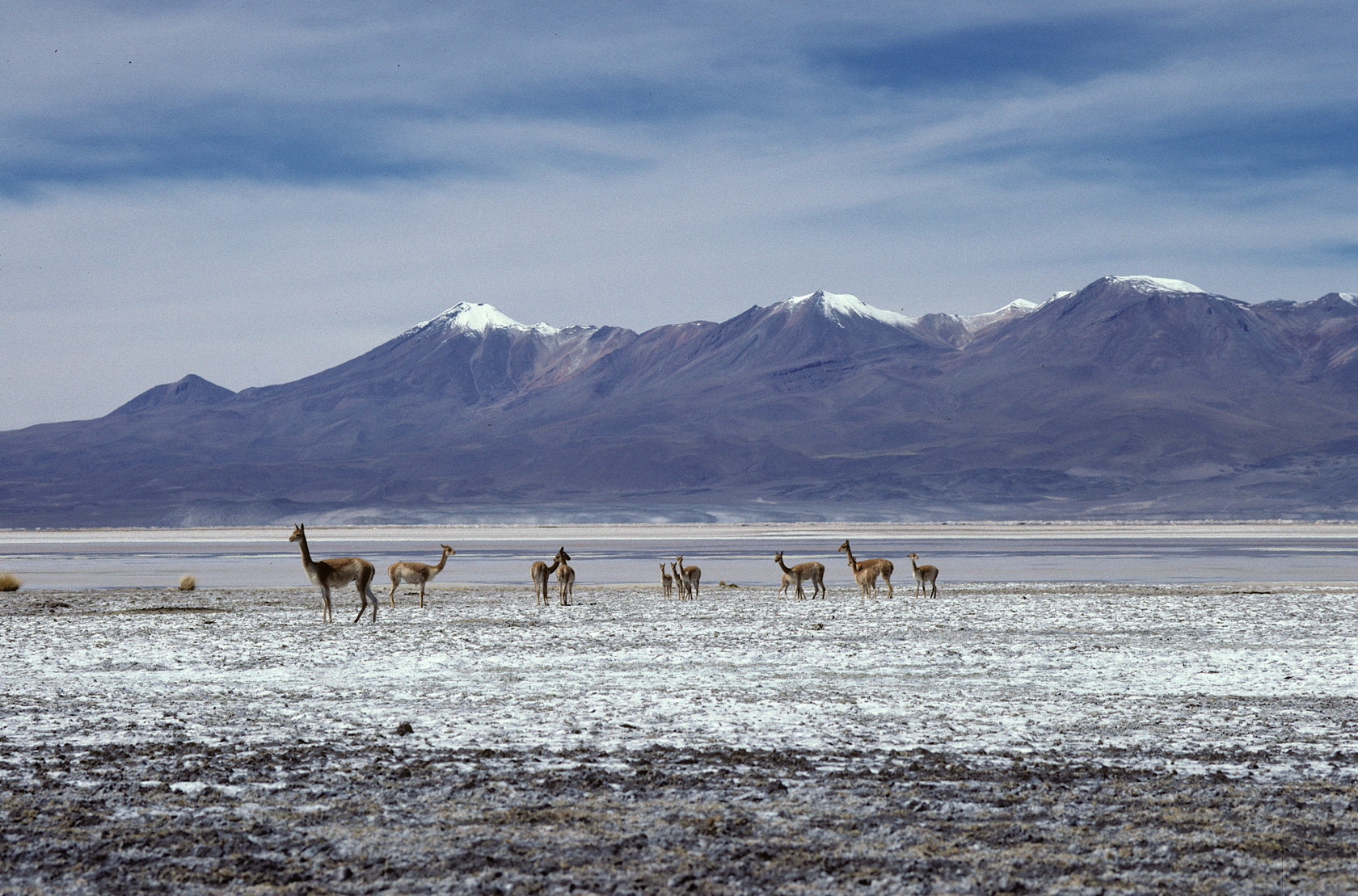
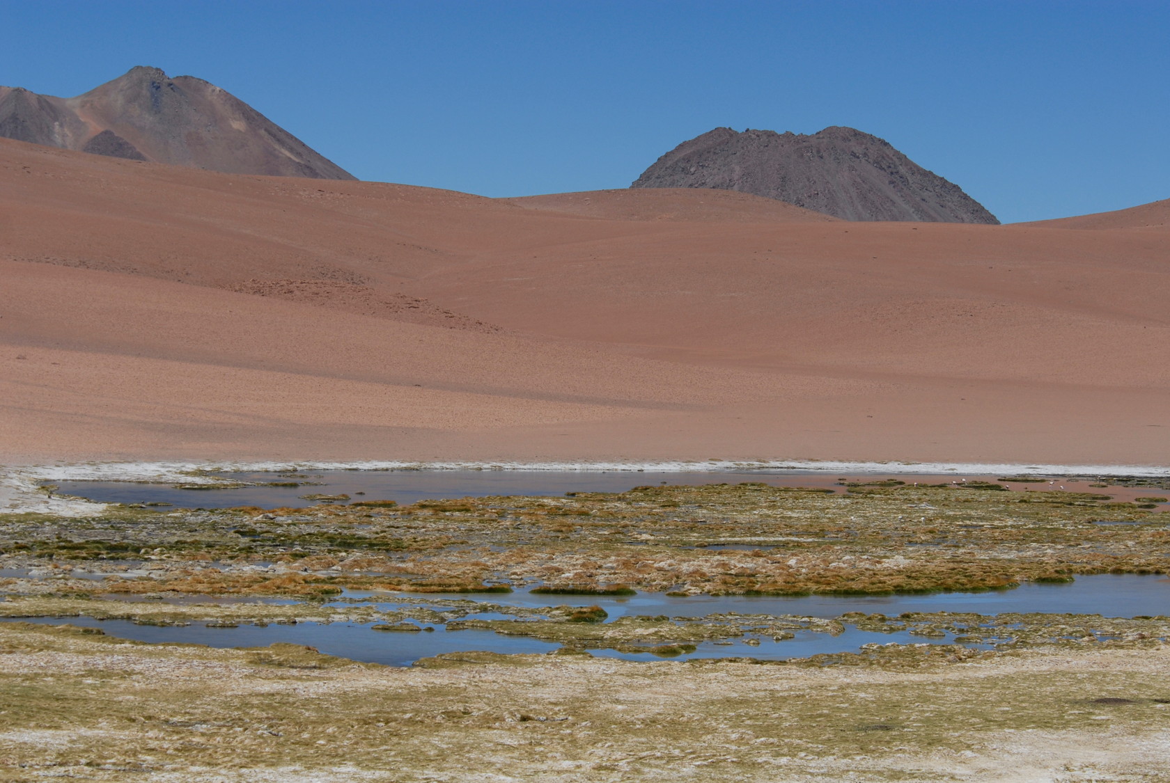
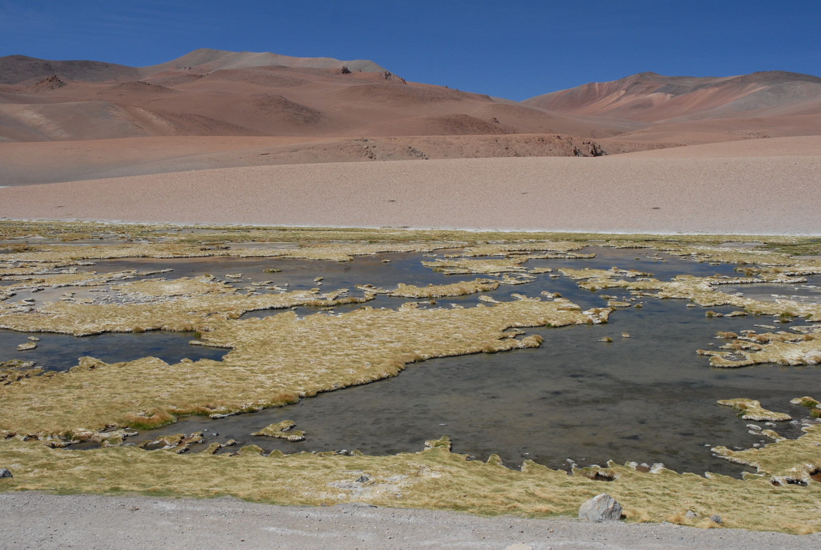
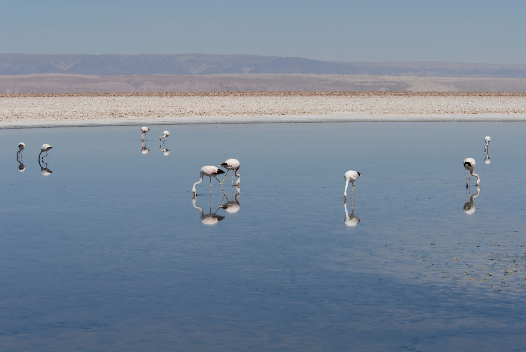
2) The high altitude Andean salares (salt flats) and associated saline lakes and bofedales (high altitude wetlands) have a unique fauna – including several flamingo species, a giant Andean Coot and Rheas. These are areas where you will also see Guanacos and Vicuñas – the native cameloids of South America. (Guanacos range down to sea level along the coast but the Vicuñas are strictly high altitude animals.


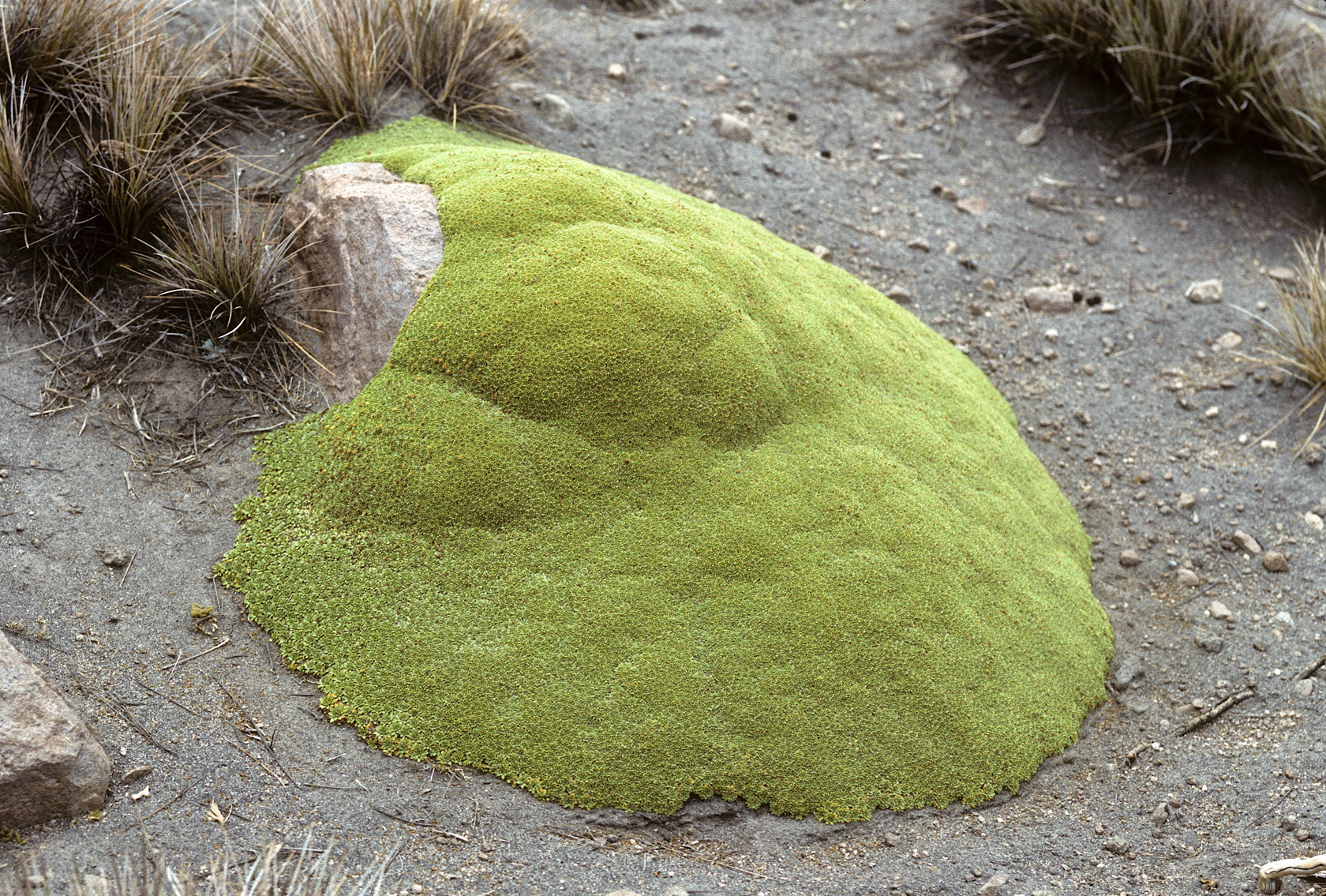
Yareta (Azorella compacta) are high-altitude plants of the Umbelliferae family that grow into a hard mound. The yellow flowers are very small.
3) The Atacama desert (lower than the high Andes but above the coastal low cloud zone) is the driest region on Earth. Here wind and sandblasting are the dominant erosion processes. Most places have no visible vegetation and gulleys formed by running water are not visible. Huge areas are covered by sandblasted stones known as ventifacts.


4) The transition region from the moist part of central Chile (roughly from Santiago and Viña del Mar southward) to the dry north is similar to regions along the California/Baja California coast, the Cape Town to Namibia transition, or the Southwest Australia regional transition. The vegetation is a mix of shrubs, succulents and bulbs (during the wet season) with many fascinating species. Cacti, terrestrial bromeliads and even a native Palm (Jubaea chilensis in La Campana National Park (sadly, their website is poorly designed and “bureaucratic” – like those of many government agencies in Latin America) occur in central Chile, all thinning out as one proceeds north.

5) Last, but certainly not least, is the unique fog-dependent ecosystem that hugs the coast from near La Serena, extending all the way to northern Peru. The impact of the clouds depends on the local topography, but can be dramatic and produces localized fog-induced forests like those in Fry Jorge National Park, just south of La Serena, to hilltops in Pan de Azucar National Park just north of Chañaral. Many other (mostly inaccessible) hillsides are covered with vegetation along the coast towards Peru. In extreme northern Chile and along much of the Peruvian coast there are bromeliad mats – sometimes kilometers across, that exist only on this fog moisture.

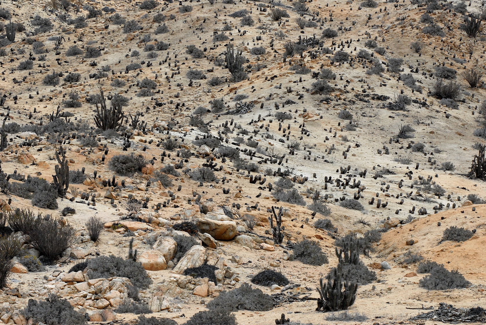

- A view of the landscape dominated by Eulychnia and Copiapoa near the mirador in Pan de Azucar National Park

In summary, we recommend the route shown below for the region between Chañaral and the Antofagasta area. Note that if you are going to San Pedro de Atacama or thereabouts you don’t need to enter Antofagasta – you stay at a few thousand feet elevation and bypass the city.
And, a final comment: July will be low season for Chilean travelers – at least to the North. So almost anywhere you might want to go north of the eclipse path should not be crowded – once the surge of Chilean eclipse-watchers from the northern cities like Antofagasta, Iquique and Arica return home. These locals will probably not spend much time seeing the areas we focus on here – since they prefer to travel during the warmer time of the year.


