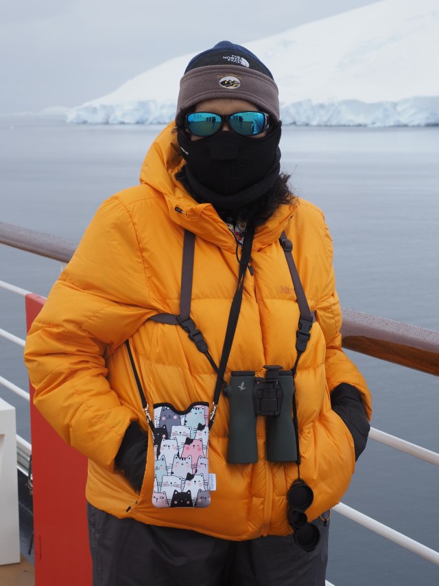
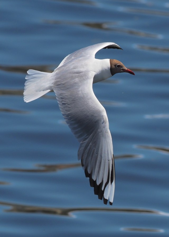
This page shows some photos and maps related to a Holland America cruise from Buenos Aires to Puerto San Antonio, Chile. The cruise took 23 days, depending on when you got on and off the ship (the Oosterdam). The ship can carry about 2500 passengers, though it is usually less as some people have single rooms. This is the only Holland America ship that visits Antarctica regularly. Such cruises take place between mid-December and mid-March, when daylight and ice conditions allow for comfortable cruising. The photos shown here mostly illustrate nature-related subjects than many passengers might not notice. Bird photos were taken with one of several Olympus mirrorless cameras we brought on the cruise and the lens was usually (for birds at least) a 300mm f4 fixed-focal length lens. A bird-tracking algorithm in the camera software allowed for moderate success with photographing flying birds, but you won’t see here the 80% of such shots that were terrible! I have selected the good photos to give you the (erroneous) impression that I am a good photographer!
I should say that we paid for this cruise ourselves – most HAL Antarctic cruises have contracted speakers and such and we , after a couple of askings, decided the only way to do this cruise was to pay for it ourselves. But I was a speaker on the cruise down to South America to Santiago, and we took a two week vacation in Argentina waiting for the cruise to leave Buenos Aires.
Clarification here: Although most of the photos shown here I (Mike) took with Olympus gear, Rosario and to a lesser extent I, took many iPhone photos as well. Some the iPhone photos are generally hers and the Olympus mine. We work as a team for iNaturalist contributions, since those observations require not only photos but also GPS positions (iPhone has it almost always, but only one Olympus camera has GPS and it not always).
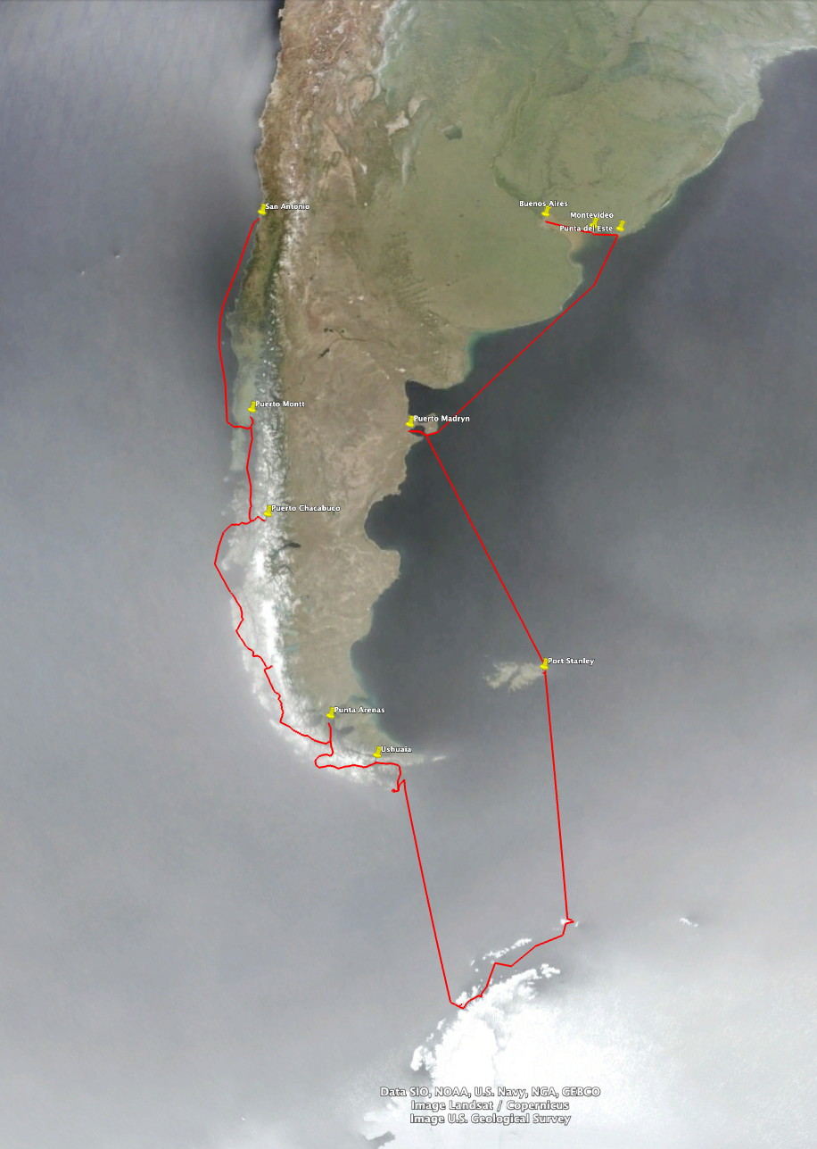
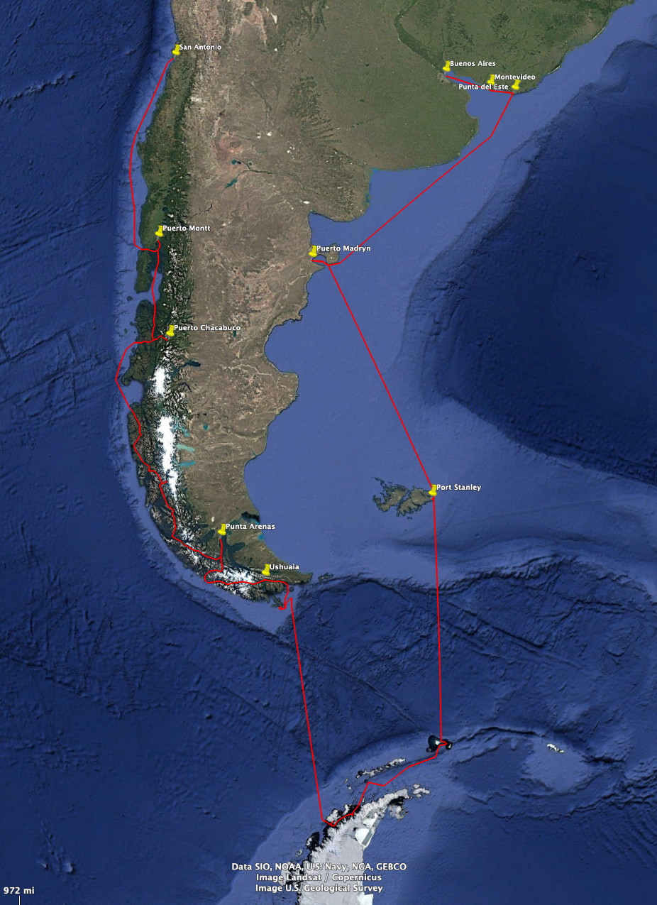
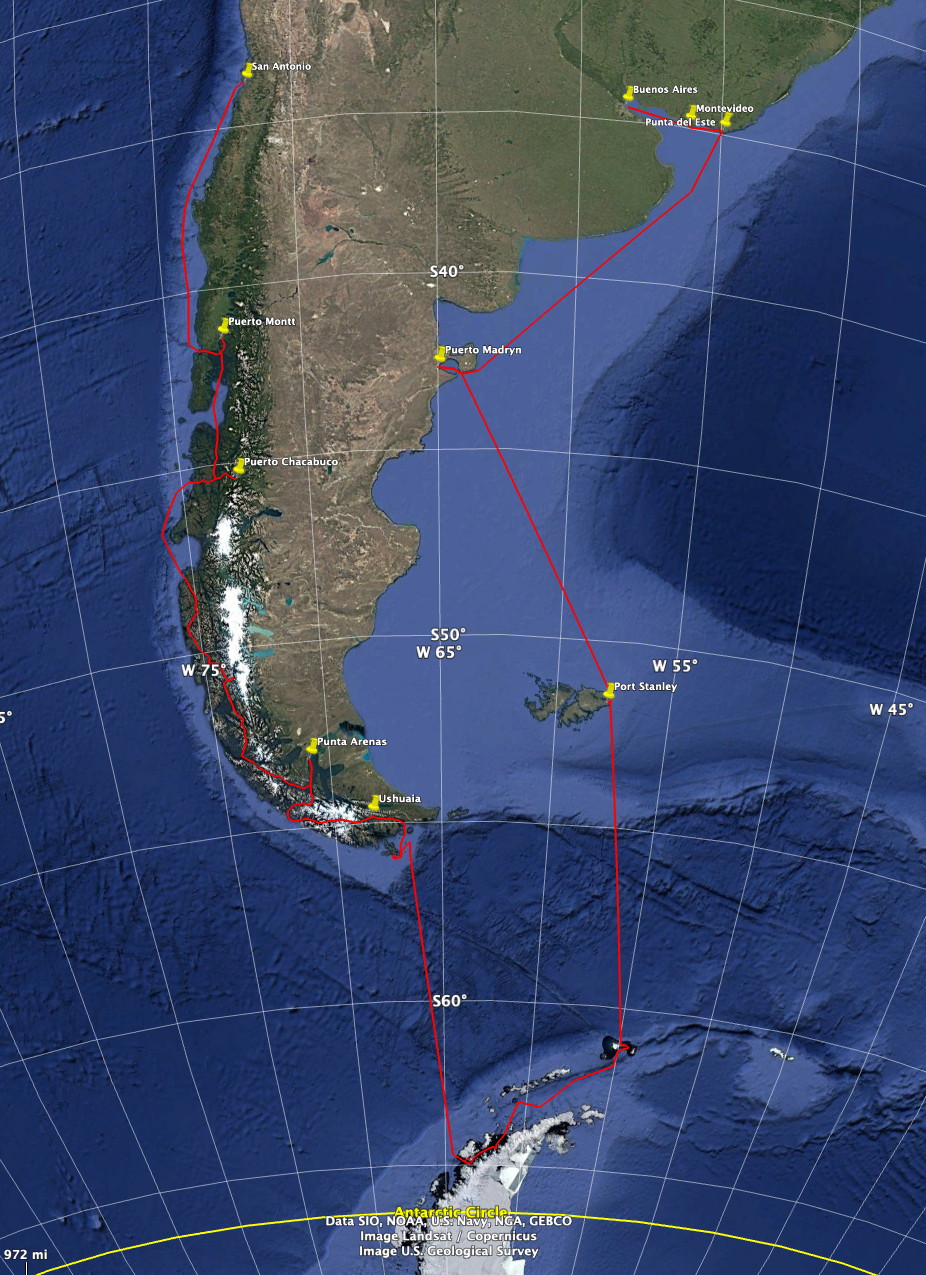
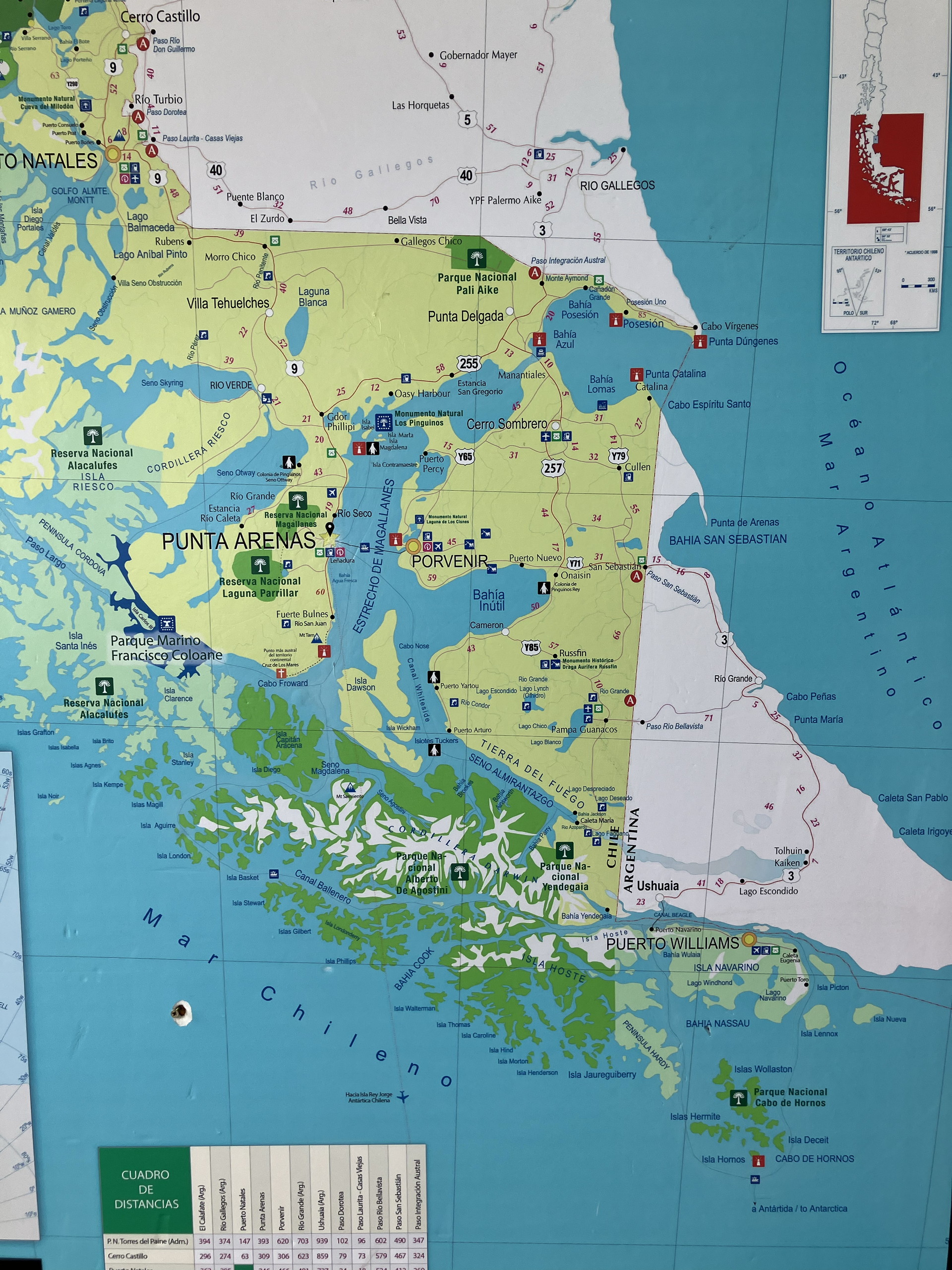
The route of the cruise is shown below. The left image is just the route, for easier viewing. The map at right has the latitude and longitude overlain so you can see that the ship went from 35˚S near Buenos Aires to about 65˚S near the Palmer station. We didn’t cross the Antarctic Circle, but were close enough near December 21 so that there was no real darkness during our Antarctic portion of the cruise. The sun was only a couple of degrees below the horizon.
The organization of this webpage is a bit odd. We will show you first the birds, then some Antarctic scenes, and only then return to the proper order – Montevideo and the other ports in succession. If there is enough time, and people complain enough, we may reorganize it. But with endless travel it is hard to keep up with our website.
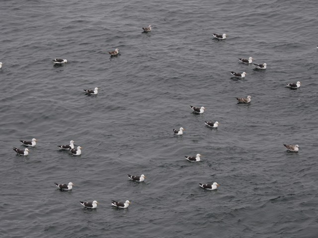
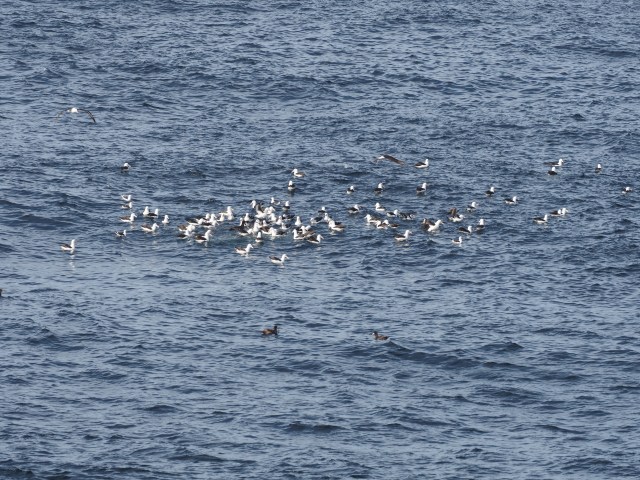
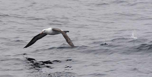
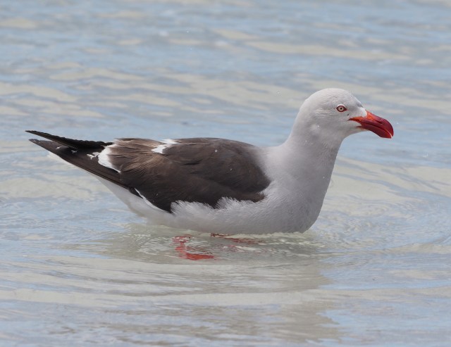
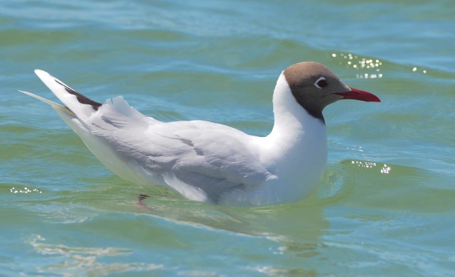
Pelagic Birds
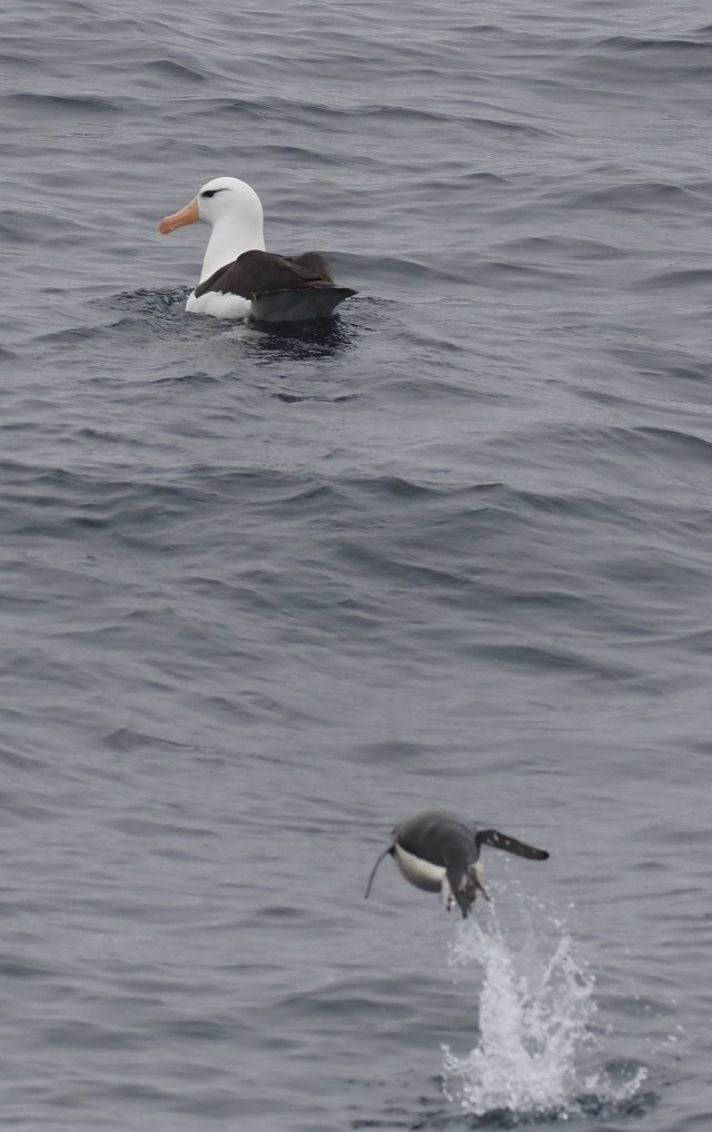
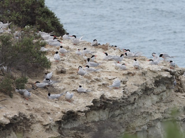
A few pelagic birds are shown below. These are birds you would not normally see from the shore. This is, in fact, one of the main advantages of “cruising”. The cruise is often an extended pelagic birding trip! Of course, only a few percent of the passengers think this way… To see larger images click on the first image in the mosaic and then step through them with the arrow at the right (or swipe with a cell phone). Text accompanies each image.

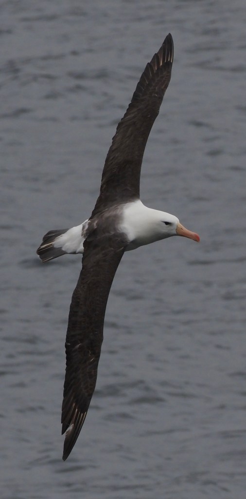
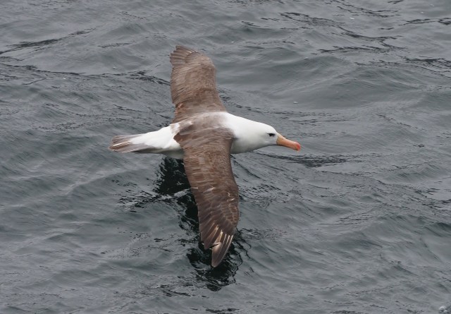
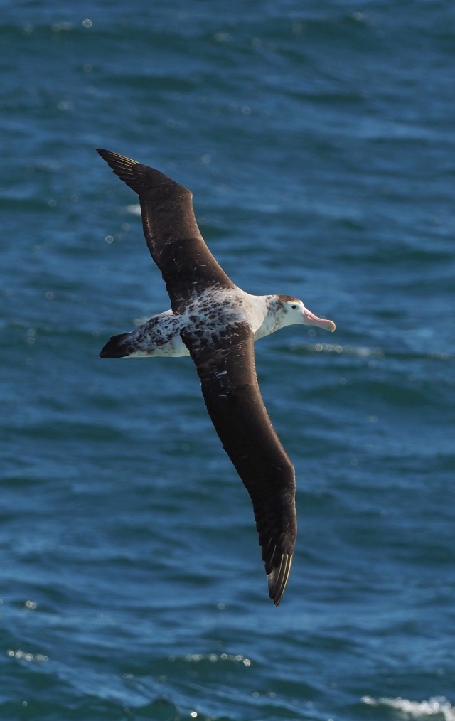
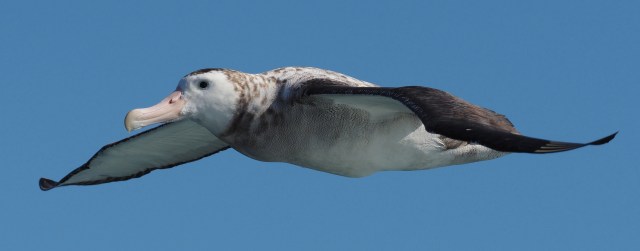
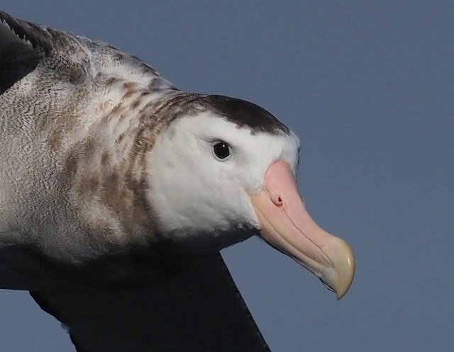
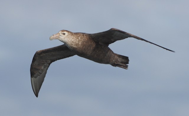
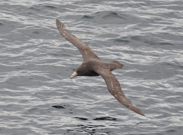
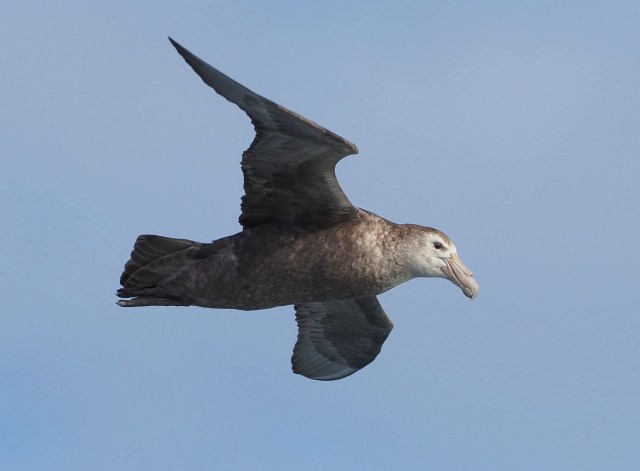

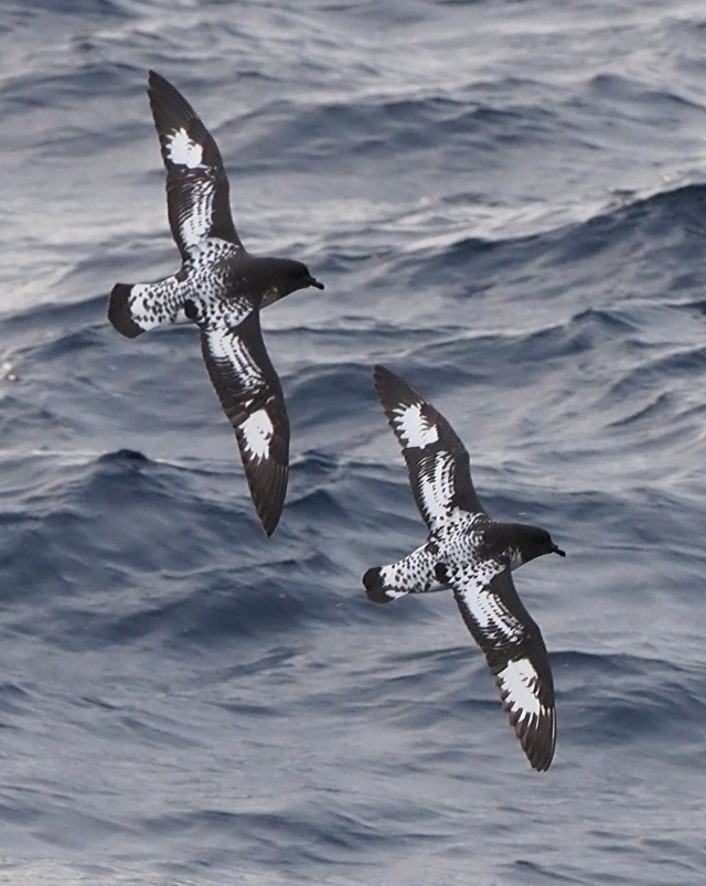

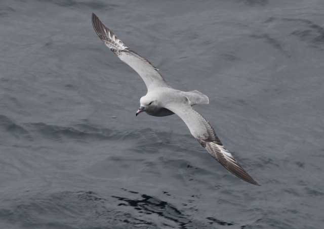
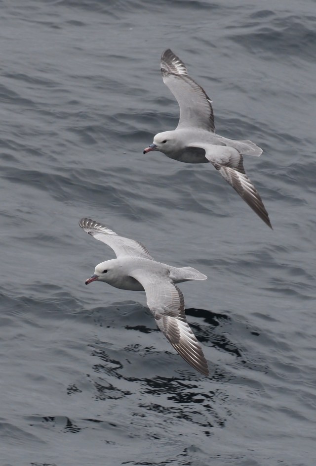
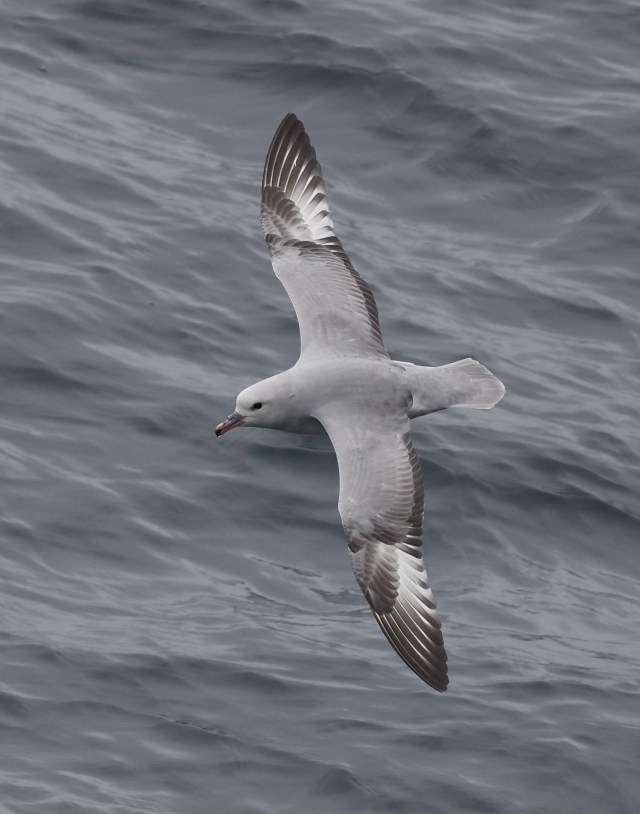


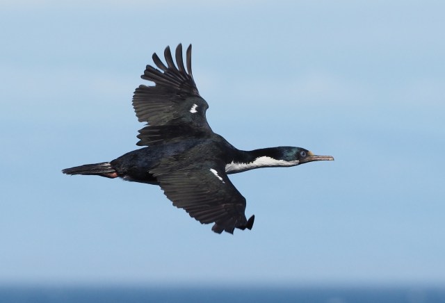
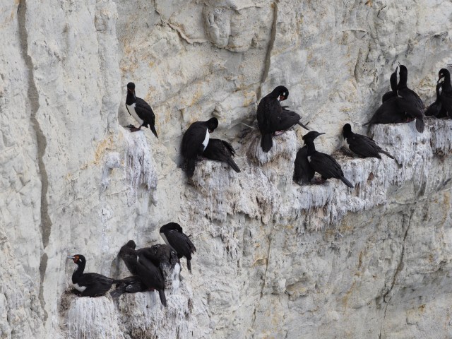
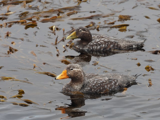
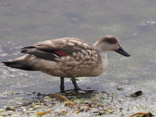
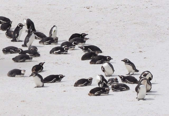
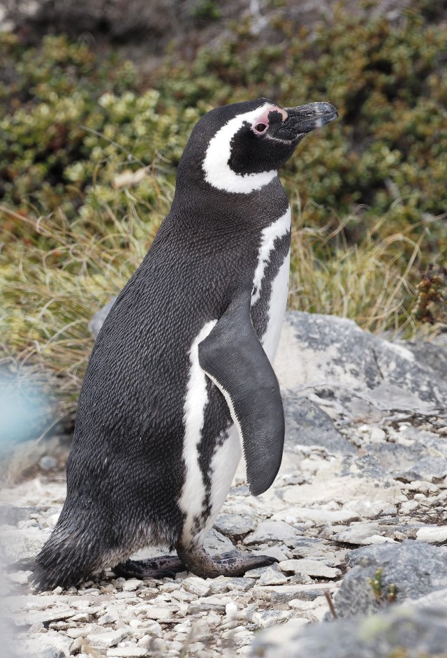
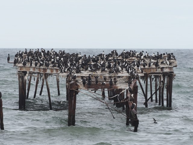
Some mostly Antarctic-restricted birds are shown below. Some of these can be found in Patagonia or the Falkland Islands as well. Few bird species are entirely restricted to near Antarctica.


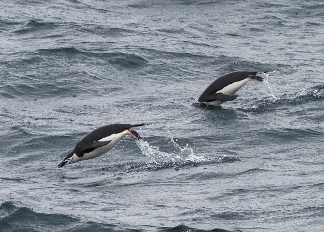


Penguins swim in an unusual manner – alternating hopping out of the water to breathe and then swimming underwater. This apparently is the most effective manner to move quickly through the water. We were surprised to see them doing this, often very far from land.
A closer view of our route near the Antarctic Peninsula is shown below. This is approximate – the ship’s track had many more fine adjustments than shown here.

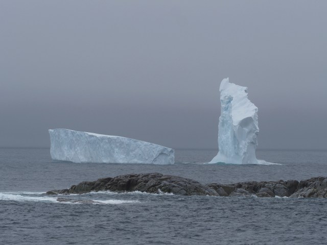
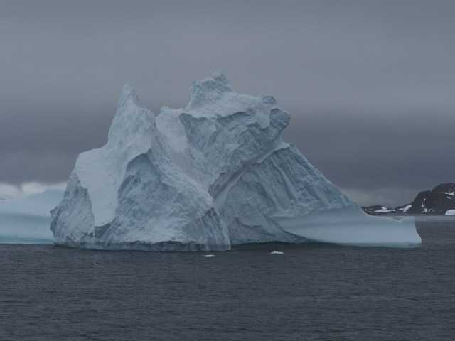
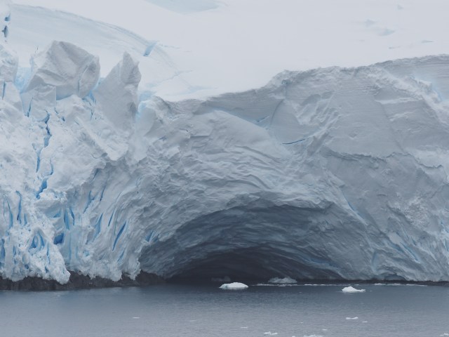
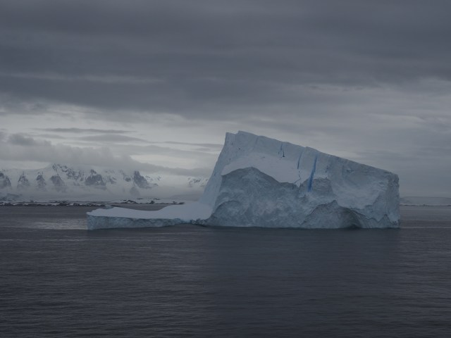
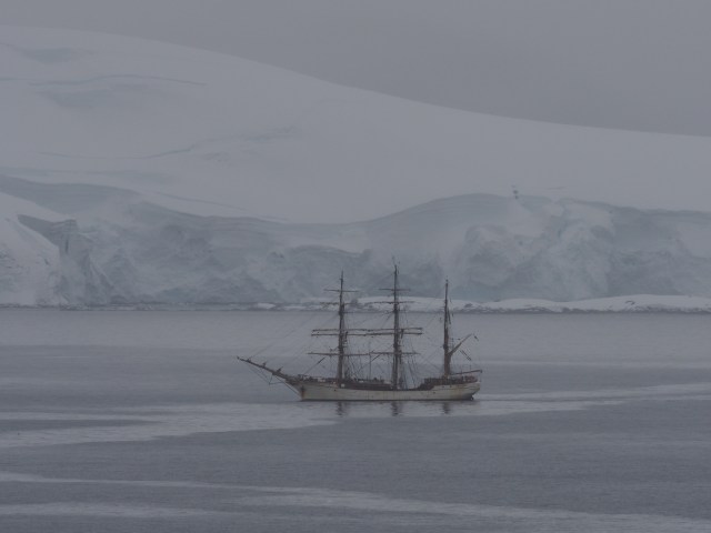
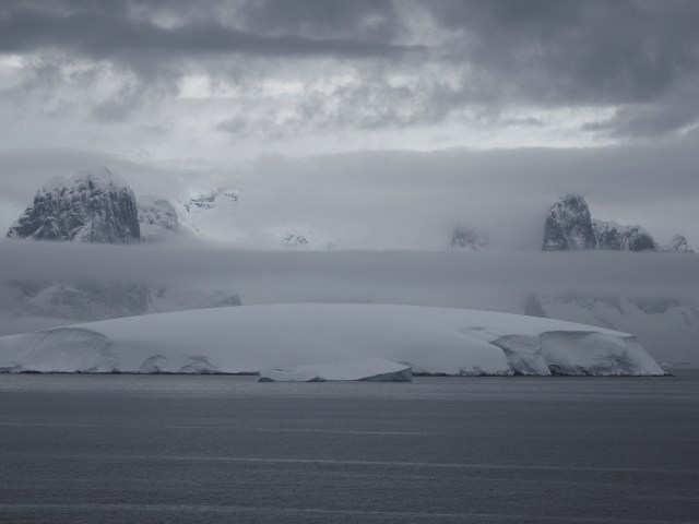
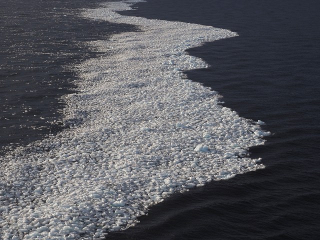
Some scenes of the Antarctic landscapes are below. Temperatures were around 30˚F most of the time because that is near the water temperature. It snowed a few times, though not very much. In theory, we were escaping winter in Oklahoma… Fortunately, because we were usually traveling amongst large islands we were sheltered from large swells and high waves most of the time.
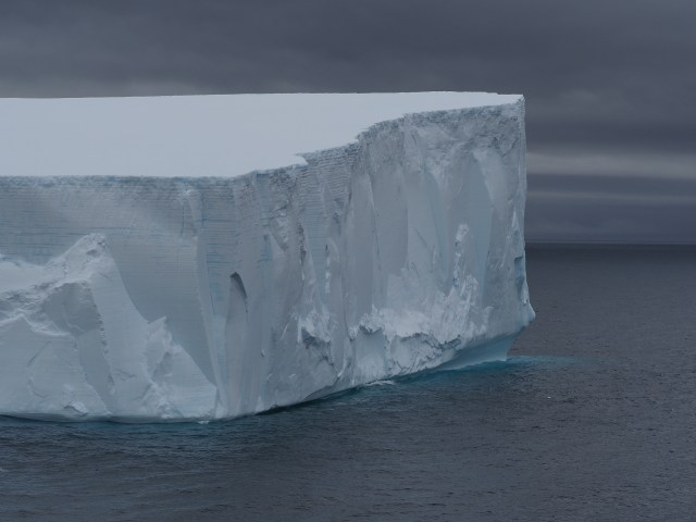
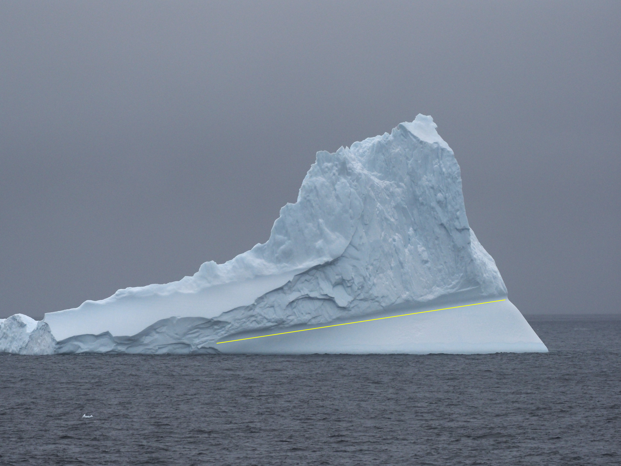
Many of the larger icebergs we saw were likely grounded on the seafloor. Remember that about 90% of the iceberg’s mass is beneath the water (unless it is grounded).


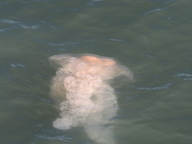
There were birds in the Antarctic waters besides penguins and below is a video of one such event (we didn’t see large concentrations of birds flying around like this very often). The birds are nearly all Southern Fulmars, with the dark birds that occasionally appear being Southern Giant Petrels.
Montevideo scenes
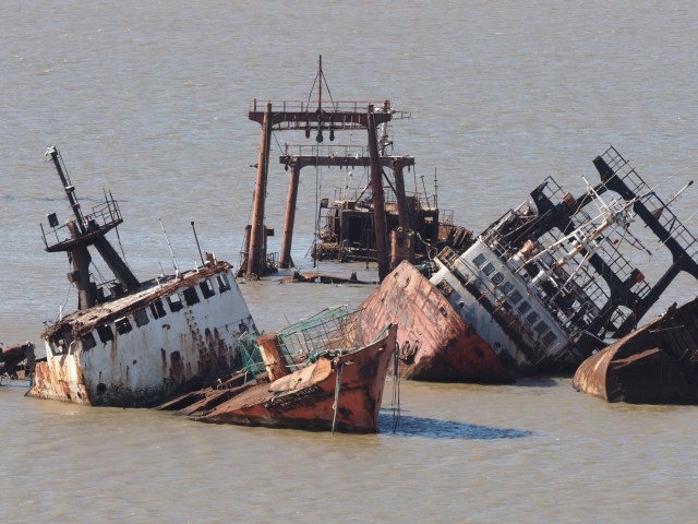
Montevideo was the first port of the cruise after Buenos Aires. Weather was nice, but away from the main few touristy streets there was plenty of graffiti and the neighborhoods didn’t look entirely safe. Our cruise director touted Montevideo as the Switzerland of South America…. we beg to disagree. The abandoned and sunken ships in the port apparently were there because it was not worthwhile to sell them for scrap and the owners just abandoned them.


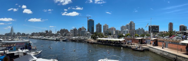
Punta del Este
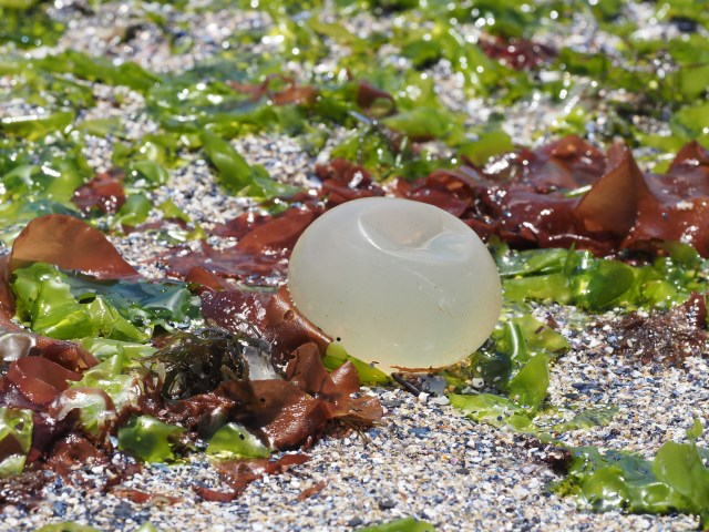
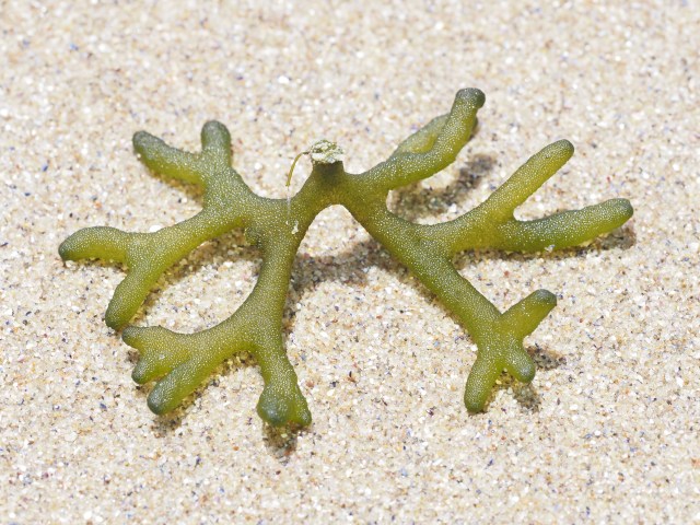
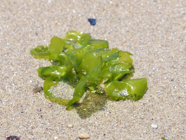
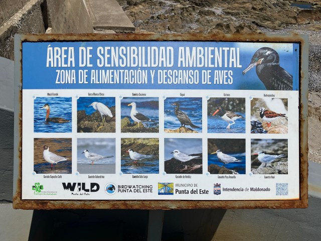
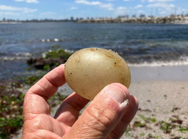
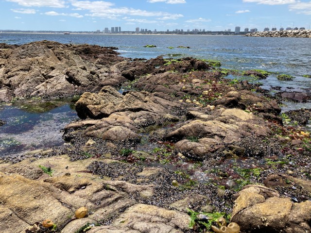
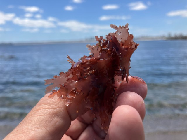
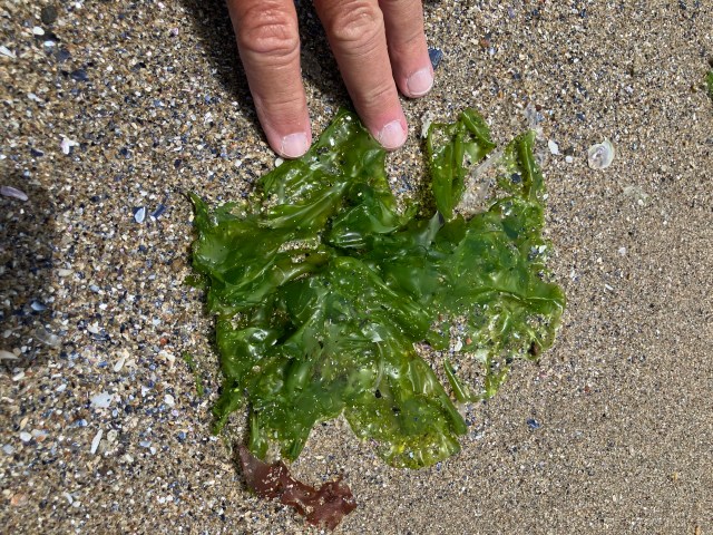
Our second port was only a short distance from Montevideo, but the water is clearer – away from the muddy water of the Rio de la Plata around Montevideo. There was a nice Malecón along the rocky shore – reminiscent of La Jolla – with nice houses. But access to the rocky shore was more difficult. There were large numbers of spherical golden balls among the rocks. With iNaturalist’s help we discovered that they were eggs of a marine snail. There were a variety of terns, gulls, oystercatchers and assorted sandpipers.


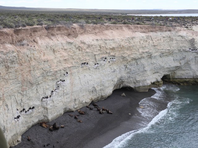
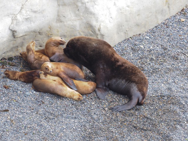
Puerto Madryn, Argentina
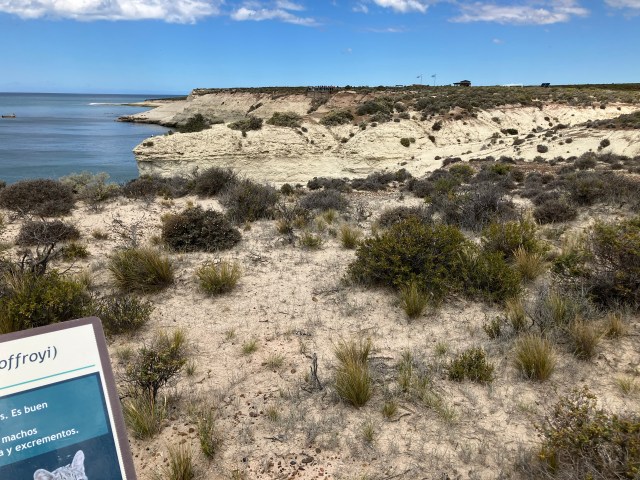
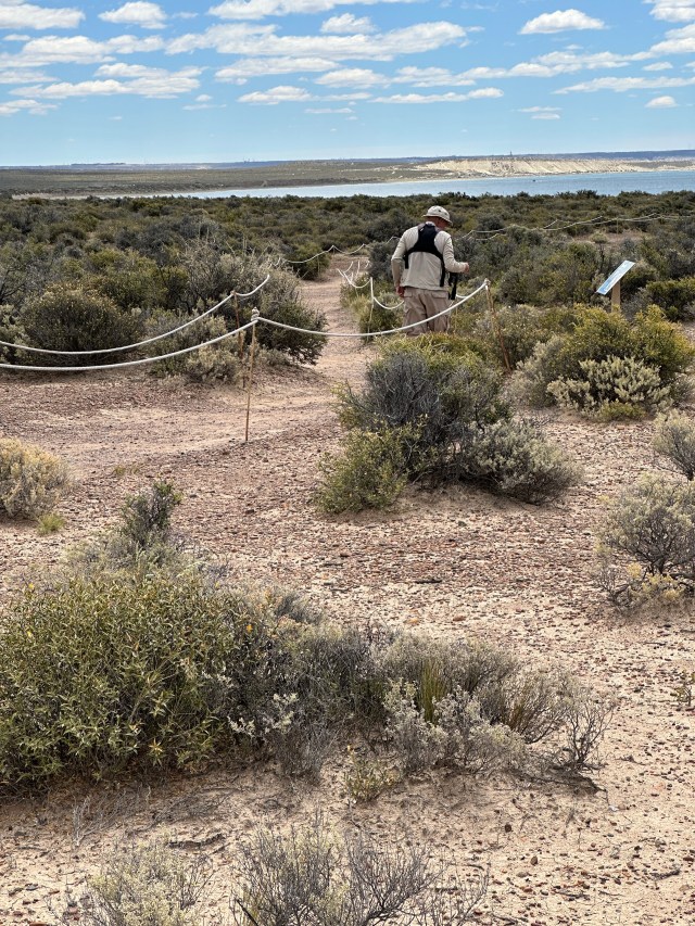
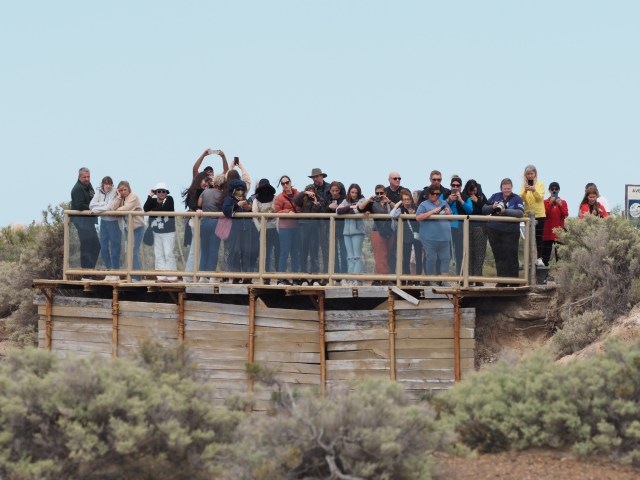
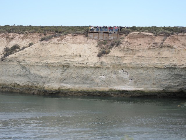
Because of high winds from the land we were delayed about 3 hours in docking at Puerto Madryn and they cancelled our scheduled tour to a penguin colony about 100 miles away. Instead we hired a taxi for 3 hours to take us to a small reserve about 10 miles away. There were less expensive tours to the same place, but such tours never provide enough time to really explore the vegetation or photograph inconspicuous wildlife (e.g. insects and birds).
As a general comment, being able to dock at a port involves various factors. For the ship to dock, the winds cannot be too strong perpendicular to the ship when it is alongside the pier. The bow thrusters and azipods (main propellers in stern) cannot keep the ship steady in winds over about 25 knots. And for tenders, the sea state is crucial – in getting people on and off the tenders on the side of the ship. If swells are too high or winds too strong a port call may be cancelled. In Puerto Madryn, the winds were from the land and up to 60 kts in gusts. While this didn’t create large swells, it was too strong to dock at the pier. Hence the wait for winds to die down.
Some ports, like San Antonio (main port for Santiago, Chile) are narrow and the entrance is exposed to ocean swells. If the swells are more than 2 meters or winds above a certain speed they cannot enter the harbor.


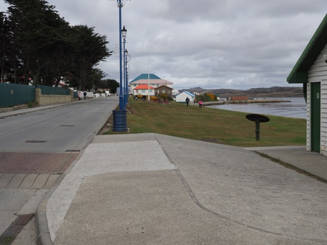
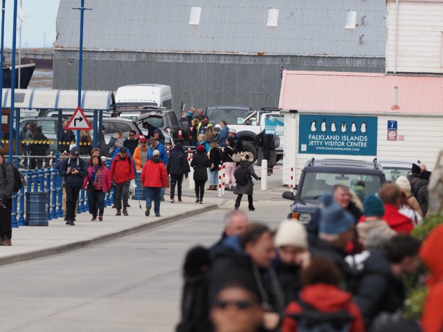
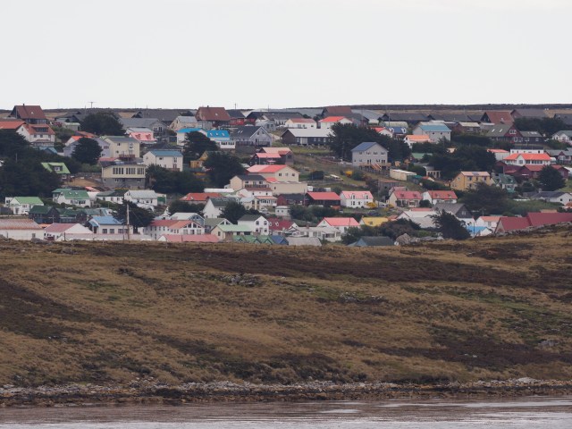
The Falkland Islands (Las Malvinas for Argentineans reading this)
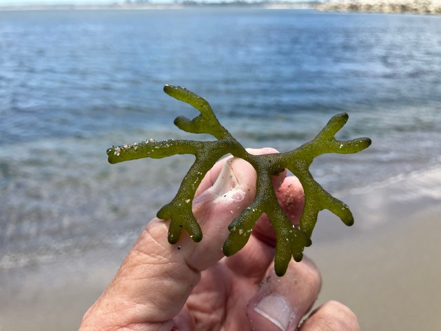
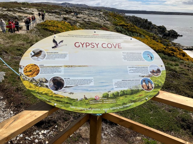
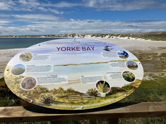
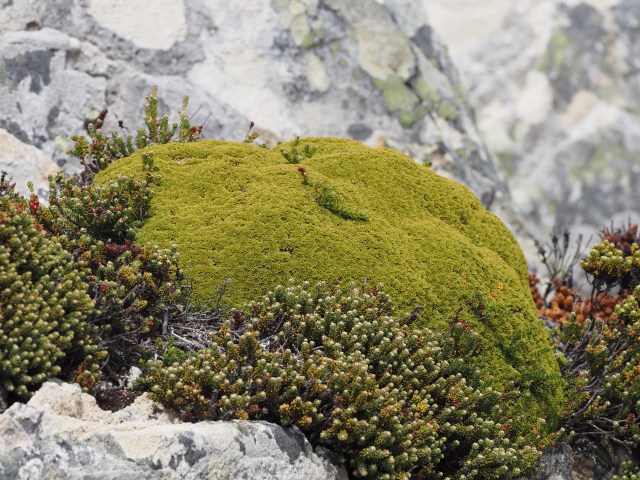
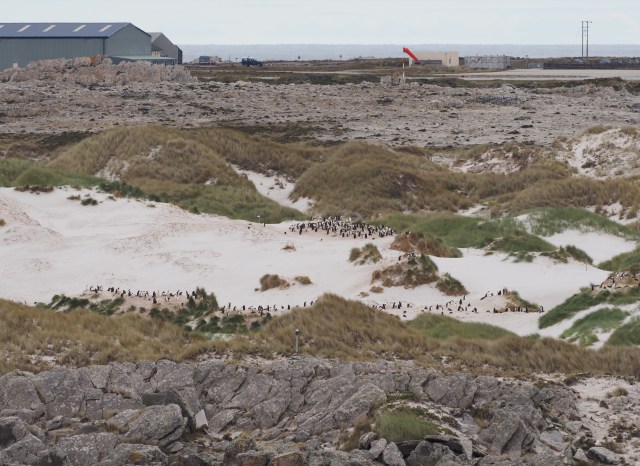
Weather was nearly ideal during our Falklands visit – rare for this port. A 20 minute tender was required to reach the dock, which was walking distance to nearly everything in the town of Stanley. A continuous shuttle bus took people from the port to various locations – we headed to a 5 mile distant penguin colony at Gypsy Cove. We didn’t get close to the larger colonies (a bit too much walking and too little time) but we did see some nice beach scenes and some unusual (to us) plants.


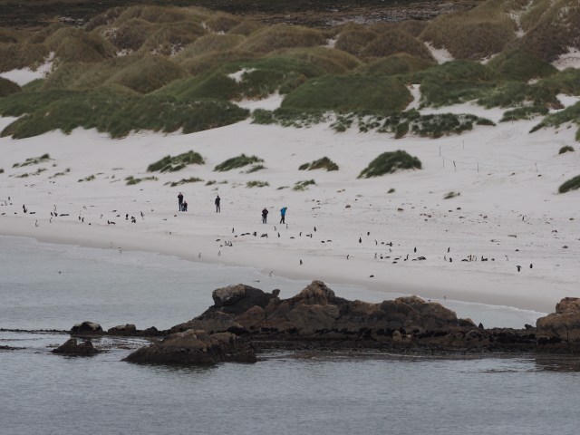


Below is a video shot by Rosario on her iPhone showing two Magellanic Penguins frolicking in the water at Gypsy Cove.
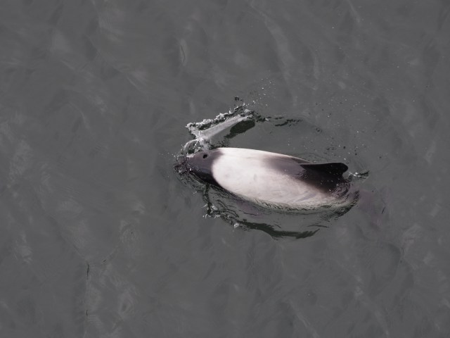
A video of a Commerson’s Dolphin is below. These were easily visible from the ship in the Falklands and also at the tender pier. They “played” with the tenders arriving to the ship, as the video shows.
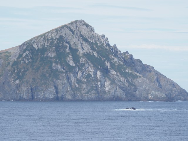
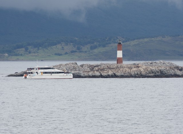
Cape Horn and Ushuaia
After Antarctica we headed north to the tip of South America – Cape Horn. This took longer than expected – we had to meet the pilot well north of the Cape and then return with him to go “round-the-horn”. Cape Horn is on a small island in an archipelago that is a Chilean National Park. Only a small lighthouse family lives on the island.

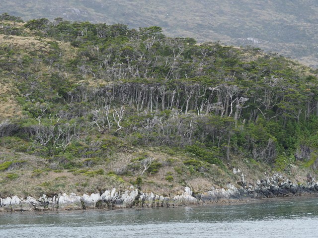
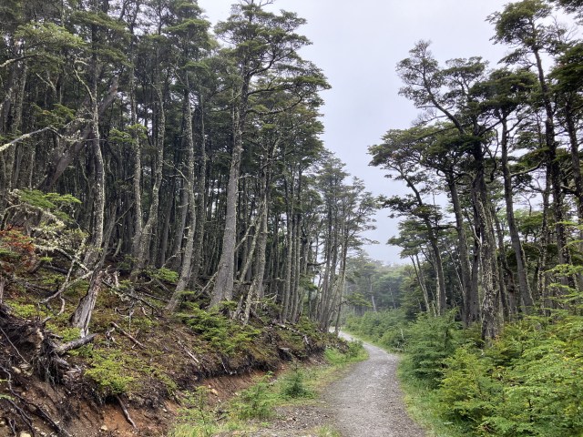
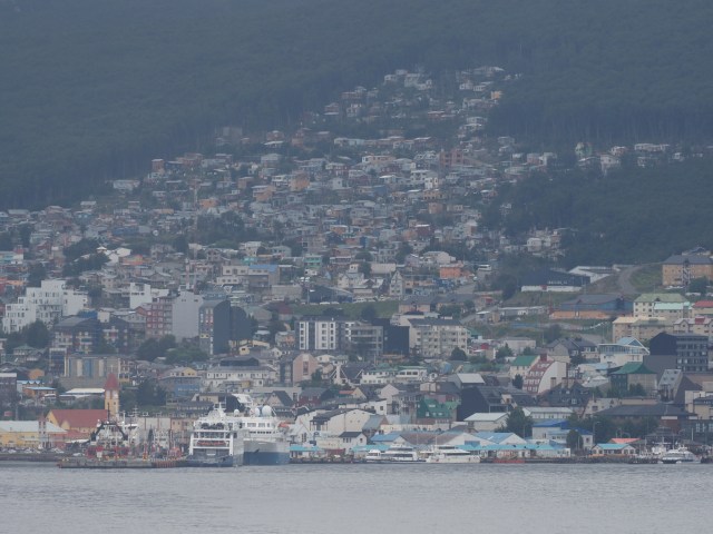
After seeing Cape Horn, we headed to Ushuaia, arriving the following morning. Weather was overcast and drizzly at times, and we rented a taxi to go uphill and explore some forest trails. Light rain complicated photography a bit, but we were impressed by the forest we saw.

Punta Arenas, Chile
Punta Arenas, Chile is along the Straits of Magellan – very wide at this location. We anchored offshore and tendered in to a dock. Interesting was to see the large number of gulls attracted to the wake of the ship when we approached the port and also to the bow-thrusters when the ship used them to maintain its orientation for the tenders. The turbulence induced by the propellers stirred up innumerable small lobster-like arthropods from the bottom and the gulls were incredibly fast in seeing and catching them. These looked to be a few inches long, judging from the photos I took.
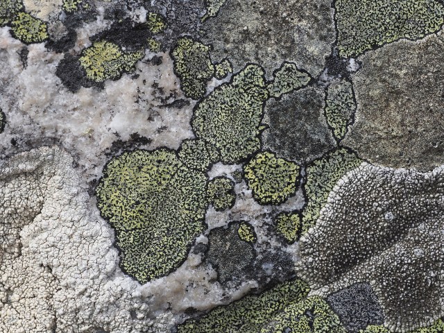
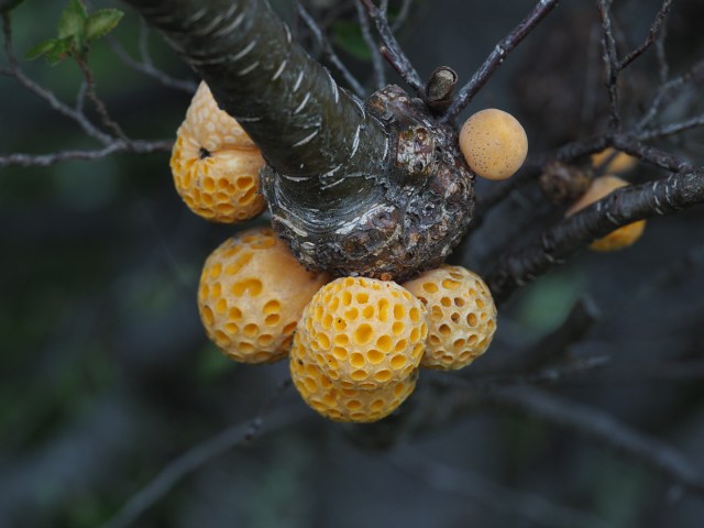
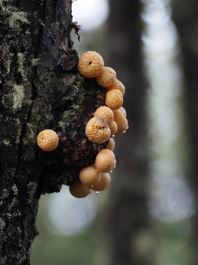
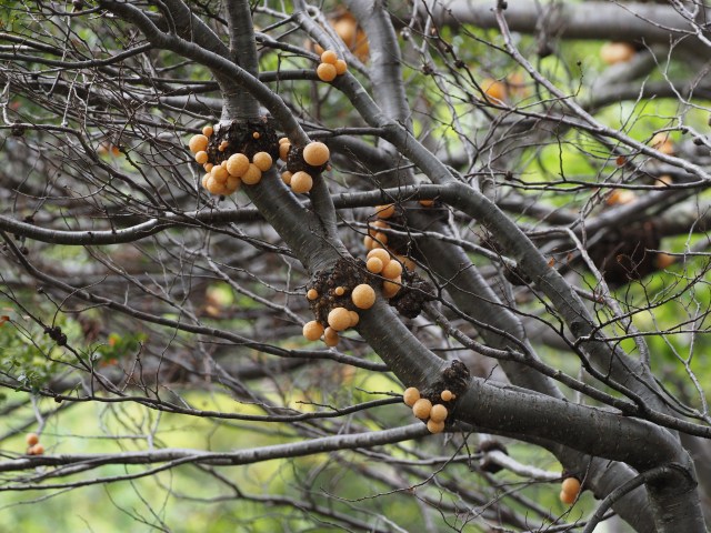
Unfortunately, the National Park we hoped to visit just inland from Punta Arenas was closed – because it was New Year’s eve and it closed at noon. So we couldn’t walk any of the good trails supposedly in the park. Chile’s National Parks are usually closed one day a week in any case – rather unusual and probably indicating a lack of personnel. However, we used a taxi to go a few miles uphill to an area where we were able to walk in relatively natural forests – after crossing a locked gate (others were doing it as well). We saw, as in the Ushuaia forests, the very interesting orange fungi (Darwin’s Fruit) that is widespread on the Nothofagus trees in the forest. Lots of lichens in these forests as well.


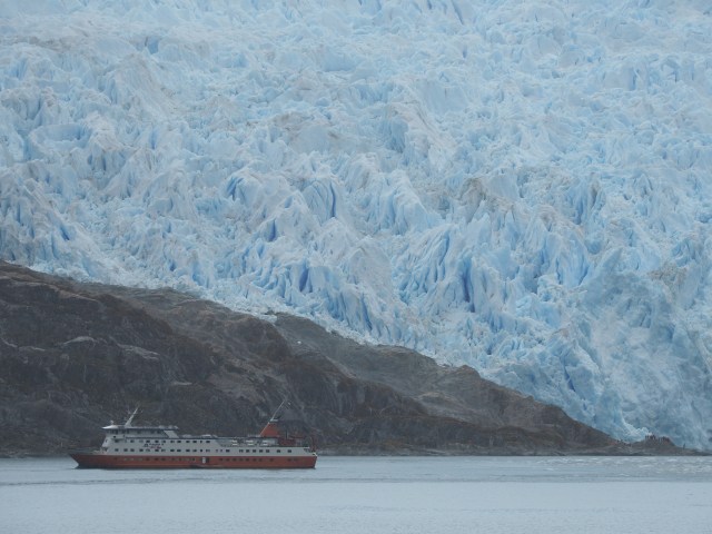
Along the Chilean Fjords
The fjords were somewhat interesting environments, but the weather was often overcast and with some drizzle so the landscapes were not too impressive. We deviated to see the Brujo Glacier, but shared the view with an expedition ship that could get closer. They used small boats to put people ashore to get an even closer view.