Baja California’s climate is controlled by its position relative to the large-scale aspects of the global circulation. It sits in an area of generally subsiding air, which at the surface appear as subtropical high pressure areas. Then the coastline’s orientation relative to the prevailing winds results in upwelling of colder ocean water along the coastline, with the result that there are strong onshore winds much of the year – especially during the afternoon when the sea-breeze enhances the mean northwesterly winds around the North Pacific subtropical high.
Baja California displays a strong contrast of climatic conditions – both along and across the peninsula. There are three main factors that determine a location’s climate in Baja California. These are 1) the latitude 2) the proximity to the Pacific Ocean and 3) the altitude and proximity to major mountain masses.
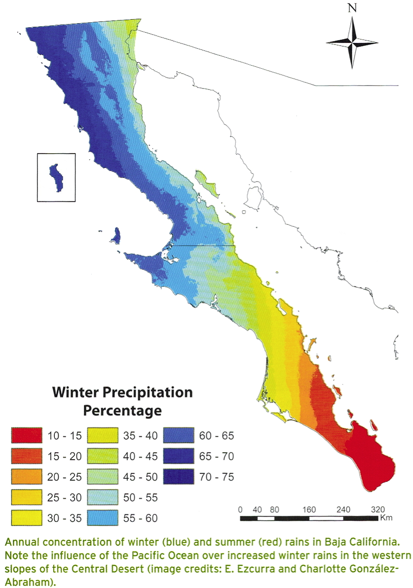
The latitude. The position in the subtropical belt and the relative influence of winter and summer storms. Winter rains associated with mid-latitude cyclones (e.g. cold fronts) decrease as one proceeds southward. Summer rains associated with tropical storms or afternoon thunderstorms increase in frequency as one proceeds south.
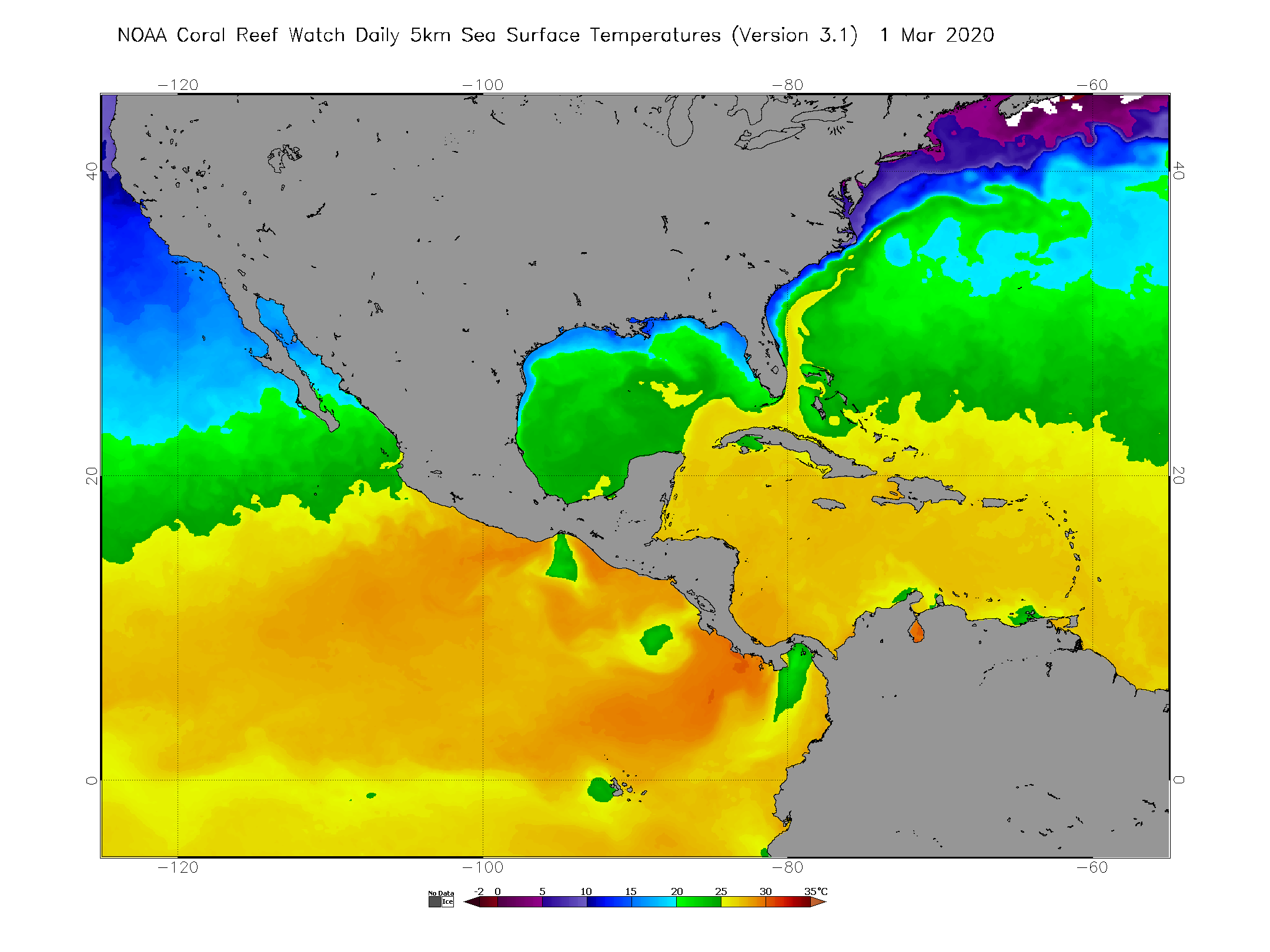
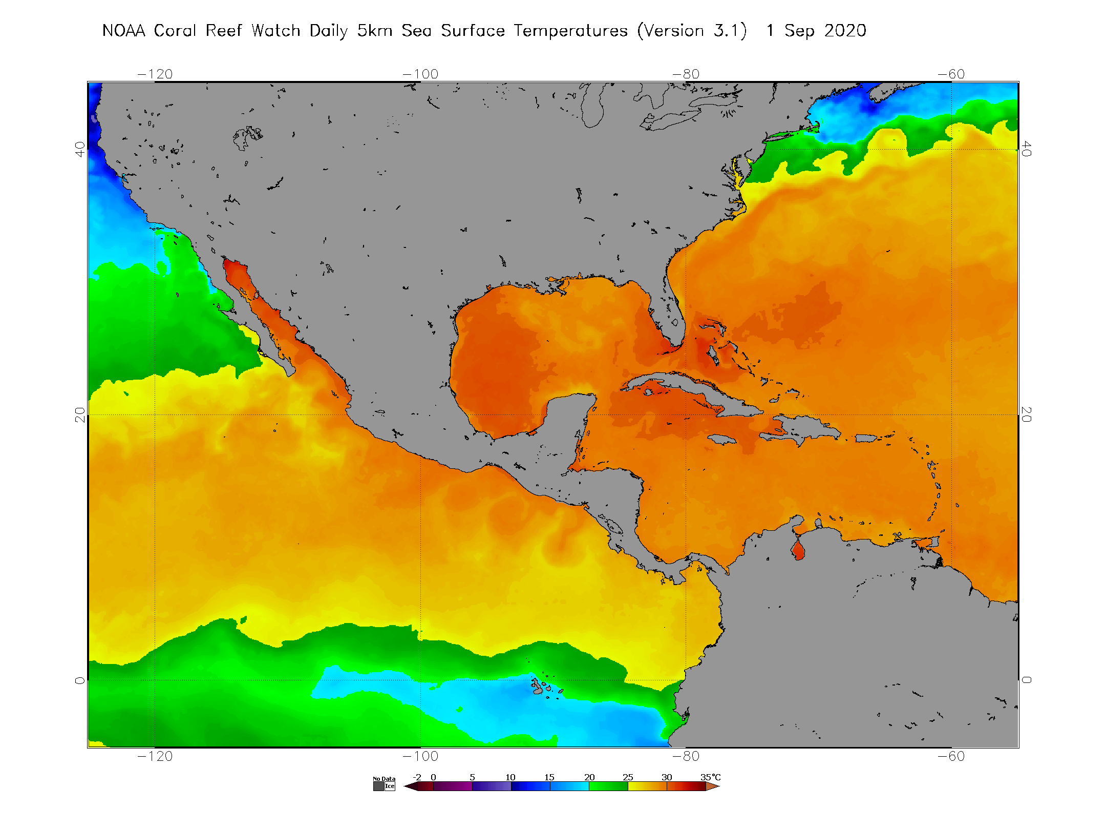
The proximity to the Pacific Ocean. The Pacific Ocean is quite cold compared with the water in the Gulf of California (except in late winter when the northern Gulf can cool to temperatures comparable to coastal Baja California). Air flowing off the Pacific will cool the coastal areas close to the coast. Daytime high temperatures are moderate for this reason – until well inland.
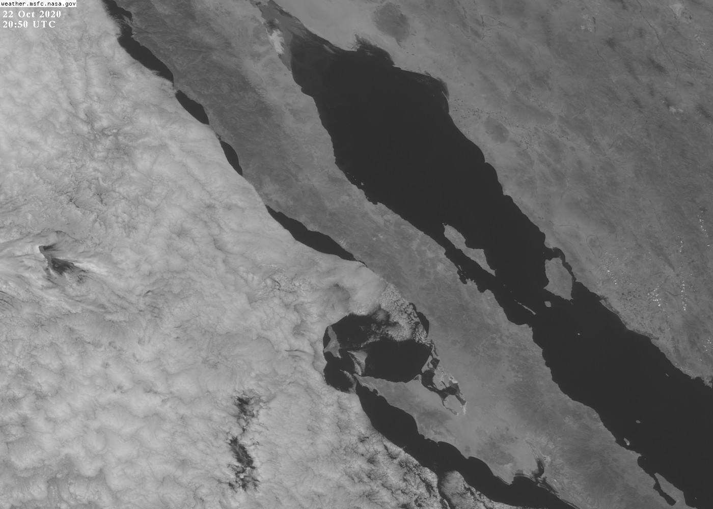
The importance of coastal low clouds and their diurnal variation can be seen in this video or this video (you must download and open in Quicktime for a full resolution view). The clouds usually “burn off” in the late morning, depending on the day. (“Burning off” isn’t exactly a correct explanation for why the clouds dissipate – the “mixed layer” deepens due to daytime heating over the land and at some point the relative humidity at the top of this mixed layer drops below saturation and the clouds dissipate. There is much more to this subject but it’s not appropriate to digress too much here.)

In the lee of the higher mountains of northern Baja California there is a strong rain shadow. During cool-season storms, moist southwesterly winds ascend and precipitate on the upwind/Pacific side of these mountains and descending air on the downwind/desert side results in cloud-free or at least much reduced rainfall. The “Lower Colorado Desert” appearing on most maps of the subdivisions of the Sonoran Desert is for the most part an especially dry desert associated with the lack of much winter rain and even less summer rain. The winter dryness (relative to the Pacific slopes of California and northern Baja California) is due to this rain shadow effect.
Since rainfall from winter storms diminishes southward in Baja California and the mountain height also diminishes on average the rain shadow effect is less apparent in southern Baja California.

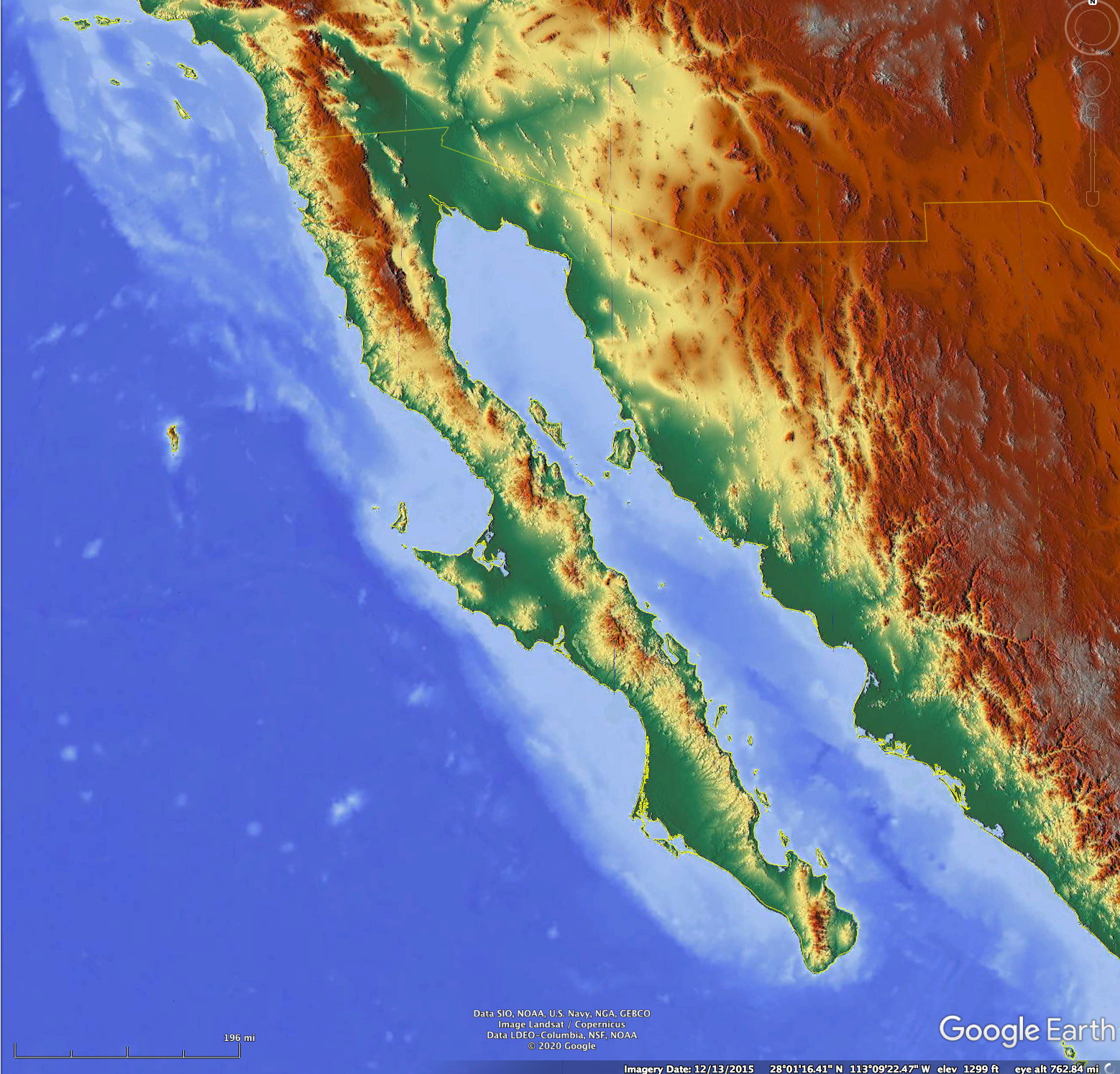
The altitude and location relative to the major mountain masses. Although most of the easily accessible parts of the Baja California peninsula are of relatively low altitude (less than about 2000 ft), there are some areas, especially in northern Baja California, where one can drive to 5000 – 9000 ft. Here altitude does have a strong impact on temperature. However, it isn’t always what one might expect. During the summer months as one climbs from the Pacific coastal region towards the mountains one passes through a strong temperature inversion and the daytime temperatures at 5000-6000 ft elevation in the mountains are usually warmer than at the coast. It is certainly much drier. So, in Southern California and northern Baja California, to cool down in summer you head to the coast, not to the mountains.
Mean cloud cover
Cloud cover, especially low stratus, has a large impact on the underlying vegetation in Baja California. Clouds have multiple effects. In the daytime they reflect sunlight and reduce the surface temperature, When low clouds impinge on the underlying terrain the cloud droplets (“fog”) wet the surface. Areas where this is common favor the presence of lichens, an epiphytic bromeliad (Tillandsia recurvata) and a variety of plants that can best survive in such relatively cool and moist environments.
There are no really reliable maps of cloud cover over the peninsula, but satellite imagery can be used to show daytime cloudiness. In this section we will show some of these.

The dramatic difference between meteorological conditions on the Pacific and Gulf sides of the Baja California peninsula is seen most clearly on summer days.

The figure above shows air near the surface moving northward towards the Arizona desert where the surface pressure is lowest. Air over the Pacific Ocean is moving outwards from the high pressure region over the northeastern Pacific. The Baja California topography is high enough that much of this near-surface Pacific air doesn’t flow over the peninsula directly, but mixes vertically and recirculates aloft. There is enhanced flow through gaps in the peninsular topography on some days.
The Summer “monsoon”
There is a seasonal reversal of winds over the Gulf of California, akin to the much larger monsoon over southern and eastern Asia. During the summer months the air near the surface flows into the low pressure area over southern Arizona from the south, bringing moisture into the southwestern US at very low levels (like in the figure/animation above). The wind direction can be different on any given day, although winds from the north are quite rare over the northern Gulf of California during the summer months. In the winter months the flow is reversed, with air flowing down the Gulf of California – on average. This seasonal variation is known locally in Arizona and some other parts of the southwestern US as “the monsoon”. Much research has been done into it (see here and here for some older summaries) – though much less than the Asian monsoon that affects far more people and is more pronounced.

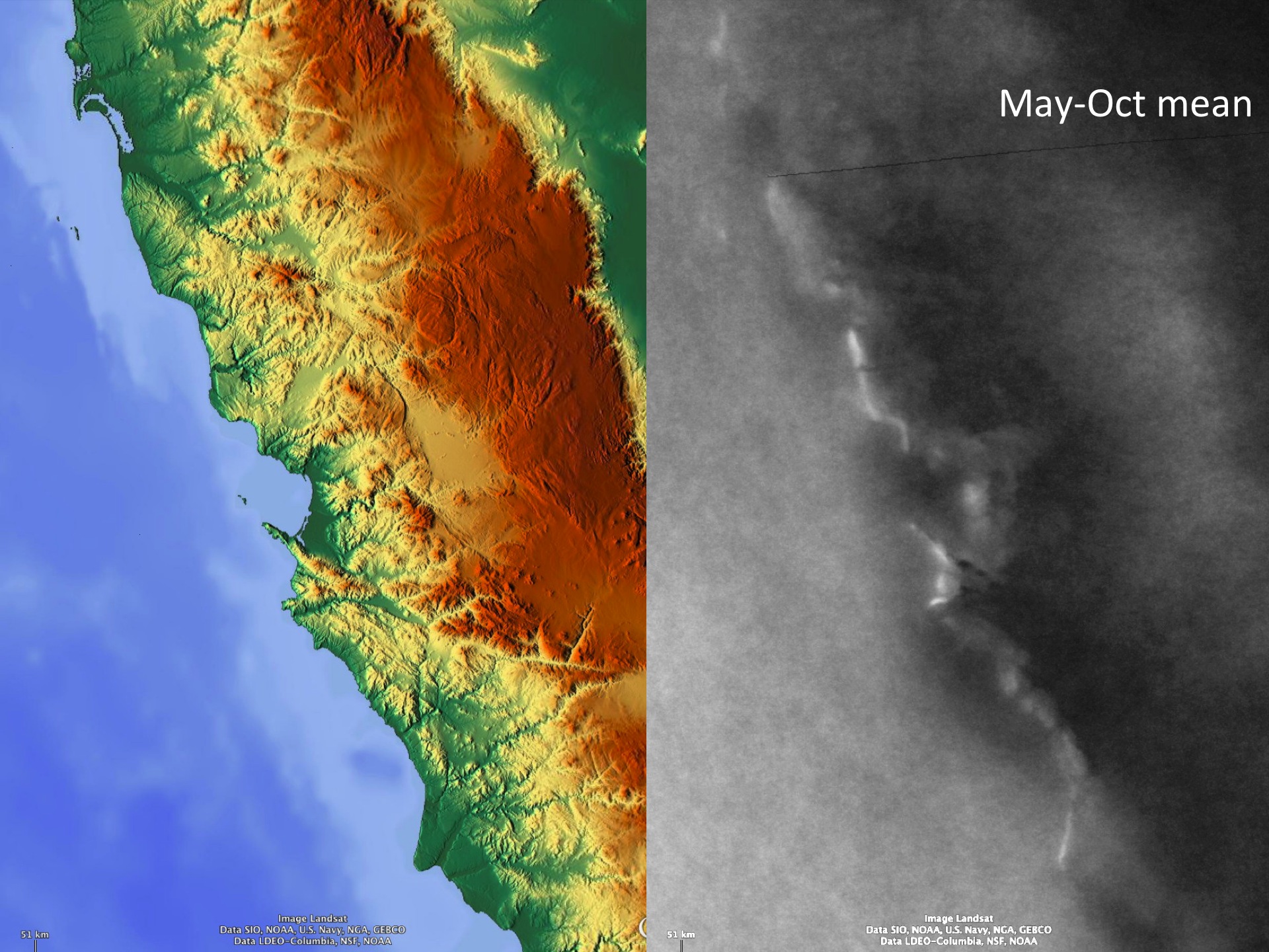
Difference between winter (Nov-Apr) and summer (May-Oct) mid-day cloudiness. Red areas are where summer cloudiness exceeds winter cloudiness and blue areas are where winter cloudiness is larger. The quantity is normalized (divided by the total cloudiness amount) so desert areas with little cloudiness can appear very prominent colors (misleading). The important point here is that summer cloudiness is max over high areas of the peninsula – especially in the southern part.
During the summer months there can be showers and thunderstorms over the higher terrain of the Baja California peninsula, especially in the southern part.
A cloud climatology of the summer period shows the distribution of cloudiness around 1330 local time (1:30PM).


Summer early afternoon cloudiness around 1:30 PM over northwestern Mexico during the May-Oct period for a 7 year period. White indicates least cloudiness while red is the highest cloudiness amount. Details of the procedure used to generate these climatologies can be found here.
Finally, but not least, is the effect of hurricanes on the Baja California peninsula. Hurricanes hit the southern part of the peninsula every few years and virtually every year several more pass by to the south or southwest and bring enhanced rainfall to the peninsula. These events can even bring a majority of the rainfall to areas away from the higher mountains, where daily showers are more frequent. Hurricanes cross the peninsula mostly in September and October, when their path is recurving towards the north and northeast.
