(This page is very incomplete… just a placeholder to motivate myself to fill in the remaining huge gaps)
I have been interested in maps, geography and travel for almost as long as I can remember. In recent years my interests with satellite imagery, Google Earth imagery, and an increasing interest in biogeography have overlapped. This page is designed to motivate biogeographers and conservation biologists – though hopefully it will interest a much wider audience of naturalists.
We have been working with developing satellite-based cloud climatologies since before 2000, though their use was often for practical applications like helping to decide the best locations for pilot balloon observations. But their value for understanding the distribution of plants and animals quickly became obvious (to me at least) and this motivated further work. A summary article of the procedures and observations used is here.
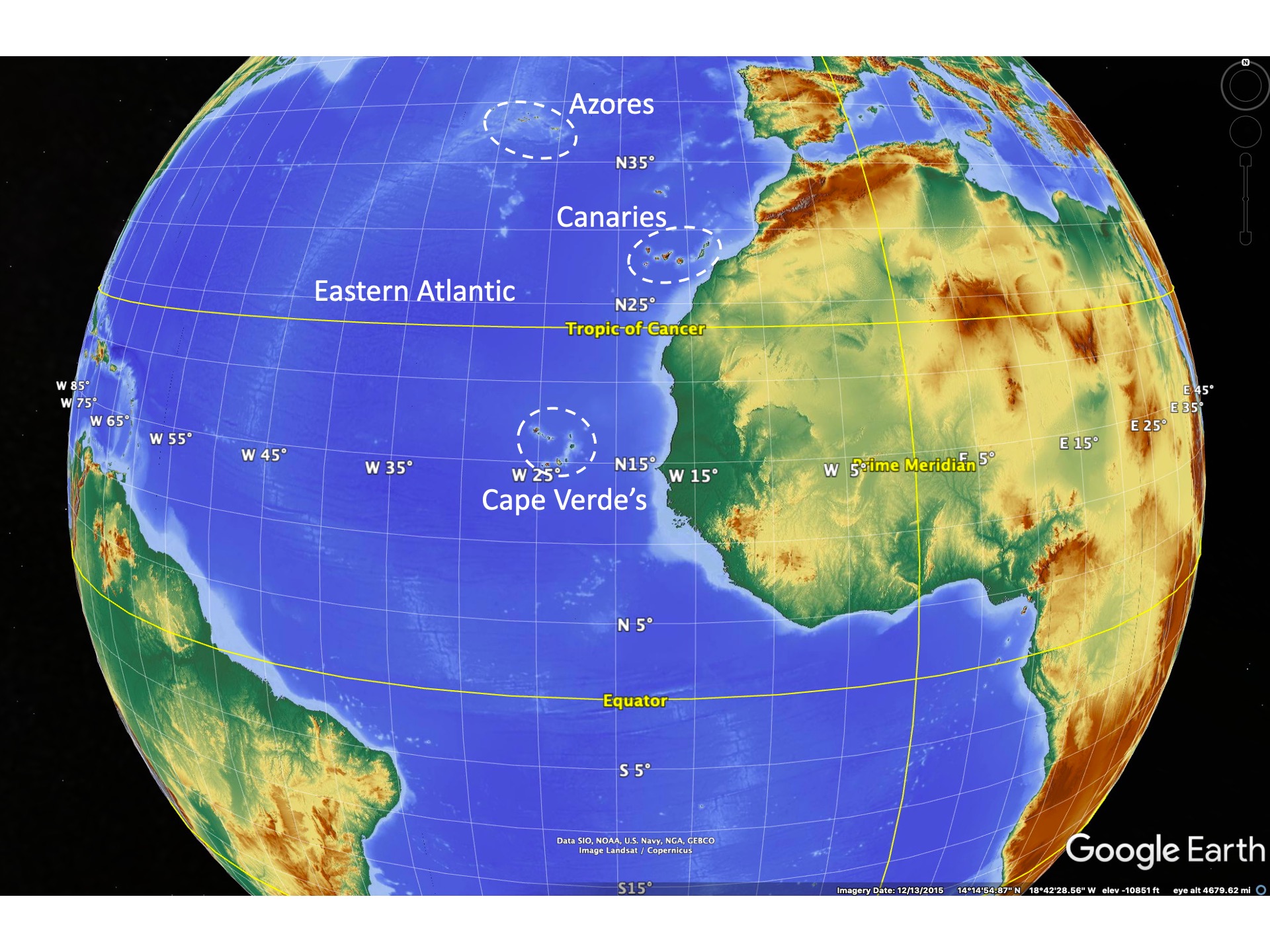
The current page was partly motivated by a recent IBS talk presented online by José María Fernández-Palacios where he described the general nature of islands and their importance to biogeography. While islands have been the subject of much study in biogeography the number of archipelagos and their islands that have been studied are relatively few. The Galapagos, the Canaries, Madagascar, and the Hawaiian Islands dominate the published work related to islands. There are of course many, many studies that cover lesser-known islands but the proximity to Europe and the US have strongly affected the study of island biogeography.
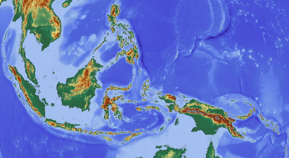
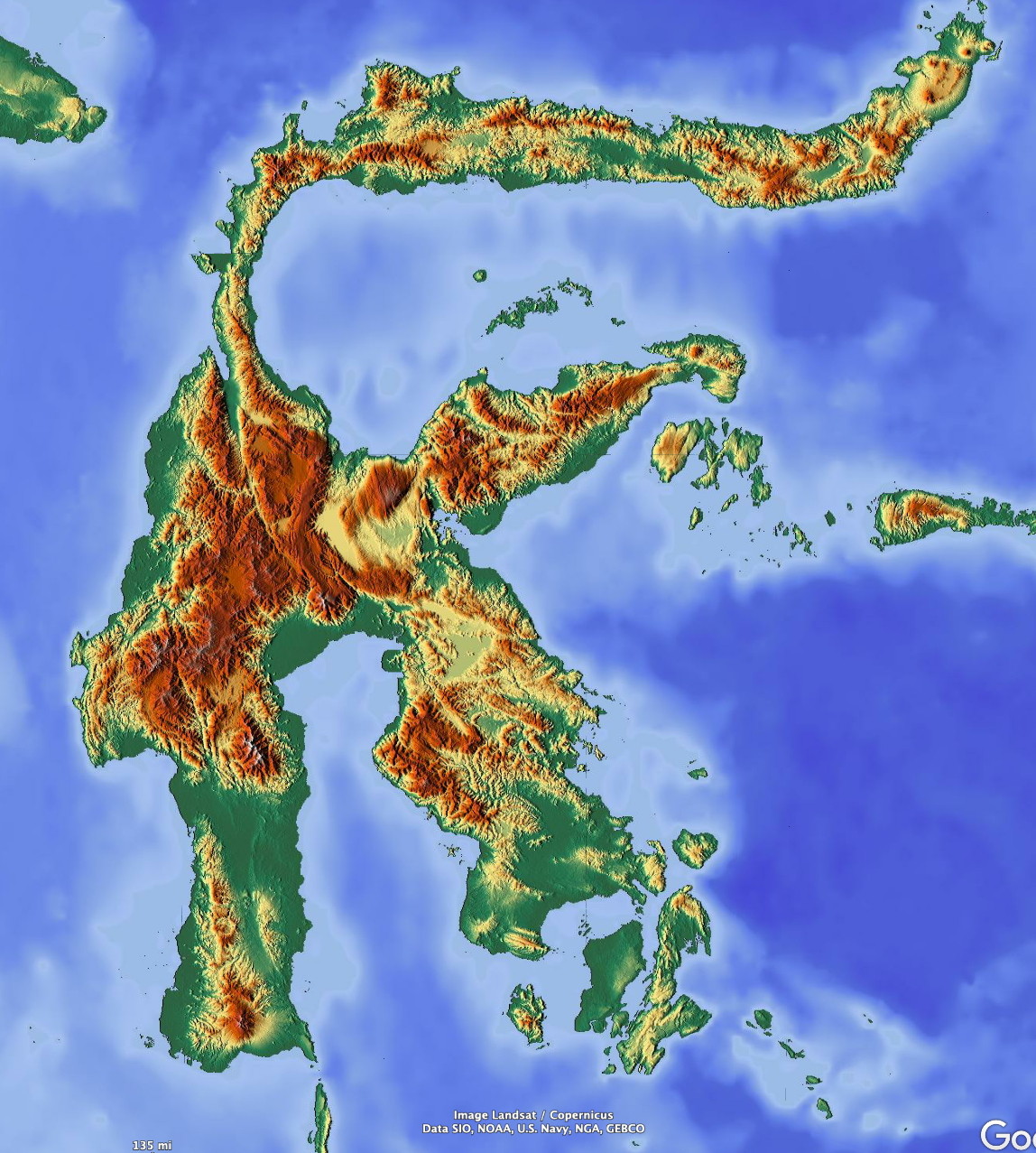
Here we will show some basic aspects of the cloud climatologies of some of the main island complexes, with a focus on those less-well described. Most are in the tropics and most, by accident of global geography, are in the western Pacific and are often grouped together under the term “oceania”.
The global distribution of islands
There are many thousands (probably hundreds of thousands) of islands inhabited with plants and animals. Some are only a few meters across, while others are large continental fragments like Madagascar. A detailed treatment of the climate of each is impossible. Here we describe some of the better-known islands that have biota that the biological community has recognized for some time. The focus is on tropical and subtropical islands in lesser-known parts of the world. Also, islands that don’t reflect a different climate from the surrounding oceans are not discussed. The latter would include small atolls of the western Pacific, or low and small islands almost anywhere. Just what constitutes “small” will be covered soon.
The islands we discuss here are shown schematically in the following figures. We don’t attempt to explain their distribution via plate tectonic theory; such explanations can be found in many places elsewhere. The focus here is on showing that islands modify their climatic environment to varying degrees, based on their size, relief and other features. The focus will be on using specific islands as examples of concepts that can be applied to generalized islands almost anywhere on Earth.


Oceanic islands and their mean cloudiness
Islands have an important role in the theory of biogeography. “Island biogeography” is the subject of how islands are colonized by new species and how speciation occurs on islands. Eventually there is a balance between new colonizing species and the available niches on an island. These niches are occupied both by speciation of organisms already on the island and those that are arriving. The number of niches is thought to be related to the diversity of habitats on an island. The larger and more topographically diverse the island the greater the diversity of organisms – provided comparable island ages. But the topographic diversity of an island affects the climatic diversity of the island. So it may be that the climatic diversity of an island is as important as the topographic diversity of an island. Here I am trying to describe the climatic diversity of many biogeographically-important islands that lack dense climatic data via a partial surrogate of cloudiness.


Consider an idealized volcanic island, having formed via an extended eruption from the oceanic crust near a mid-ocean ridge or a mantle “hotspot”. The initial island will grow rapidly from successive eruptions and for the sake of discussion will form a symmetrical cone of substantial height. Examples might be Mauna Loa on Hawaii or a number of the shield volcanoes in the Galapagos Islands.
Recent symmetrical volcanic cones don’t have as many available climatic niches for organisms as do more highly eroded cones. There are a number of reasons for this. A smooth symmetrical cone will have no areas of extreme shade or water concentration, whereas an eroded cone will have deep ravines that will concentrate rainwater. Likewise steep ridges provide a very dry, windy environment compared with a uniform gentle slope; such dryness may favor certain organisms. The greater the topographic relief the more variations in shade and the greater the microclimates that can exist.
Some recent relatively symmetric volcanic edifices in the tropics
Ambae in Vanuatu
Gamalama, Makian in North Maluku
Ulawun and Bamus, New Britain
Elevational differences are the best known aspect of major islands and their continental relatives – sky islands. Altitudinal changes are associated with temperature changes. This is, on average, about 6.˚C per km in tropical regions but this can vary widely and from day-to-day. For well-mixed air, such as results from a daytime convecting boundary layer, the air temperature on Earth decreases at a rate of 9.8˚C per km. (It cannot decrease at a faster rate with altitude as it will spontaneously overturn as density must decrease with height.). But the temperature can increase with height, and often does in temperature “inversions” – so-called because the temperature increases, rather than decreases, with height.
For a tall island, the mountain top temperature will generally be lower than that at sea level. But in many subtropical locations, a strong temperature inversion associated with subsiding air can result in warm, dry air above a cooler layer near the ocean surface. The Canary Islands shown this very clearly on most days. If islands extend above the base of the temperature inversion on most days there will be a strong decrease in humidity as elevation increases and a very different, arid environment may exist near the top of the islands. Tenerife and La Palma Islands in the Canary Islands are excellent examples of this situation, though there are other complications affecting the aridity in the Canary islands as well.
The cloud fields associated with islands can be produced by a number of processes. These include:
orographic ascent. This is forced uplift by air impinging on a barrier. This is strongly dependent on the atmospheric stability and under stable conditions most air flows around obstacles.
lee-side convergence. air flowing around an island obstacle will converge on the backside of the island and there can be a secondary region of weak ascent on the lee slopes. This i s observed in the Canary Islands, but precipitation associated with this cloudiness is usually much less.
diurnal ascent up slopes. Daytime heating of an island’s slopes results in air rising along the slope. With sufficient moisture this air eventually saturates and cloud formation occurs. This is the most common process associated with daytime cloud formation over an island.
sea-land breeze circulations. A sea-breeze (air flowing from sea towards the land) is generated on any island since the land heats more rapidly than the surrounding water resulting in a low pressure forming over the land relative to the water. On most islands the sea-breeze cannot be easily distinguised from slope circulations, since both occur together. On near flat islands, like the those in the Bahamas, the sea breeze is the dominant breeze and its signal depends on the size of the island and the strength of the prevailing wind.
heating of the surface during daytime to initiate convective clouds. On small islands a detectable sea-breeze may not develop but the land surface still heats in sunlight. This changes the depth of the mixed layer by convection. If there is enough mixing and the temperature cools sufficiently at the top of the mixed layer a cloud will form. Cumulus clouds frequently form in this manner over tropical islands. Since the tropical atmosphere is usually conditionally unstable (enough lifting of an air parcel at the surface leads to saturation, then the parcel becoming warmer than its environment and it continues to rise further) this process leads to cumulus clouds. The size/depth of such clouds depends on the scale of the lifting, since entrainment of dry surrounding air cools the ascending cloud via evaporation. Deep cumulonimbus clouds develop where lifting is over a fairly large area and sustained to moisten a larger area.
Sky Islands
Sky island is a term used for mountains on larger landmasses like continents or large islands (e.g. Java or Borneo) that are isolated from surrounding mountains by intervening lower-altitude areas. The term is widely used in the southwestern US to describe mountains with pine forest on their peaks while they are surrounded by desert vegetation. However, the term is applicable to any mountain or mountain range that is effectively isolated with respect to the movement of some of its biota. Sky island regions are favorable for speciation because of their isolation in both time and space from their immediate surroundings. Movement between sky islands must be through lower elevation areas that may not be suitable for many organisms or for non wind-borne plant seeds.
There is almost no limit to how many sky islands can be defined. To a certain degree every topographic bump – however small – might be termed a sky island relative to its surroundings. However, to make a measurable impact on the climate, such topographic features need to have substantial scales – both horizontal and elevational.
There are some differences between the climates of oceanic islands and sky islands. Some of these include:
difference in the moisture availability
stability of the surrounding temperature field
depth of the mixed layer and higher cloud bases for most sky islands
greater range of seasonality for sky islands because of their distance from large water bodies
We describe these differences after we discuss oceanic islands in more detail.
Oceanic islands
Biogeographers generally consider two types of islands; continental fragments and those resulting from oceanic volcanism. The evolution and biota of these two types of islands tend to be very different.
Continental “islands”
Continents, made up of a core of less-dense material like granite, come in all sizes. Most of the larger islands are actually continental fragments that were at some point in the past attached to larger continents. Madagascar is such a fragment, but there are many others. New Guinea, New Caledonia, Fiji, Socotra, Hispanola, Puerto Rico, Cuba, Jamaica etc. Their geology tends to be complex, a product of continental collisions, accretion of oceanic crust and sediments in subduction zones, and related metamorphism. While the geological structure of islands is very important in determining the types of vegetation that evolve on these islands I won’t discuss this here, since one has to be an expert of the particular island to say much about this. Although my undergraduate degree in geophysics allows me to broadly understand plate tectonics and most geological concepts, I don’t pretend to be even vaguely authoritative about any of this.


Continents are made up of less-dense rocks like granite, which solidified deep underground. Continents tend to float on the denser mantle material, much like an ice cube in a glass of water. The taller the continent, the deeper its “root” (isostatic equilibrium; isostasy).

Erosion will reduce a continental island towards sea-level eventually, but because the core is less dense than the mantle, the granite will float, much like an ice cube will continue to site above the water line in a glass even while it melts. Also, collisions of continents can raise mountain ranges (like the Himalayas) and this process actively opposes erosion.
Volcanic islands
Oceanic volcanism tends to occur on mid-ocean ridges, or above what are considered upper mantle “hot spots” . Mid-ocean ridge volcanism tend to be eruptions of fluid basaltic magma. Hot-spot volcanism usually is the same (like Hawaii) but occasionally cones are built from more viscous magma (Tenerife in the Canary Islands). The evolution of mid-ocean ridge volcanoes that grow above sea-level follows a somewhat well-known sequence….
Once volcanism ends as the volcano moves away from the ridge crest erosion starts to reduce the height of the volcano. Also, the oceanic crust contracts as it undergoing cooling as it moves away from the oceanic ridge crest. This contraction reduces the elevation of the island above sea level. Eventually, the processes of erosion and contraction of the oceanic crust combine to reduce the island to near sea-level. Once the island is at sea-level rivers cannot erode the island further – and wave action eventually brings the island to sea-level. But if the oceanic crust is still contracting the island will then sink below the ocean surface, and crustal contraction due to cooling is then the only process to cause the island to continue sinking beneath the ocean surface.
In regions with warm ocean temperatures coral reefs form around volcanic islands. If the island eventually sinks beneath the sea surface the coral can continue to survive if the upward growth of the coral exceeds the rate of island sinking. This is usually the case in the warm tropics. The fringing reefs of the island then become rings of coral surrounding a shallow lagoon which is collectively called an atoll.
In areas with colder waters where corals cannot grow the island may sink far beneath the ocean surface and often beyond the photic zone. The submarine flat-topped mountain is then usually termed a guyot.
Biodiversity differences between volcanic and continental islands
There are major difference between the biodiversity of the the two island types. Volcanic islands start without any life at all – every species must migrate to the newly formed volcanic island. The rate of colonization is a function of distance to the nearest landmass and also of the prevailing winds and currents.
Continental islands begin with a well-established flora and fauna. As they separate from a major continent they gradually lose species and evolve new ones as conditions on the island change. But because they start with an established biota they are never as impoverished as volcanic islands.
A second important factor is the rock (and thus soil) types present on continental islands. There is usually a wide diversity of parent rock, including limestone, shales, plutonic rocks like granite and volcanic rocks. Thus, floras may exist suited to each geological substrate before separation from the continent and these distinctive floras continue to exist after separation. Volcanic islands usually only have volcanic rock substrates of basaltic composition, so there is little opportunity for development of such specialized floras.
Because colonization of remote islands is a matter of chance and occurs slowly, the initial colonizers of volcanic islands often radiate into different species to fill different climatic niches on the island. Relatively few genera but many species for each genera. Thus the Galapagos have many finches, many Scalesia trees and shrubs. The Hawaiian Islands have many Lobelias, many spiders of a few genera, and such.
Colonizers of continental islands face competition from biota already established and adapted to the island’s conditions. They may be less likely to successfully establish themselves on a continental island than on a volcanic island.


Some speculation about the relative diversity on volcanic islands
It has been speculated that older volcanic islands have greater biodiversity than younger islands. This is due to the more varied relief due to erosion and greater number of niches for biota to specialize into. Of course, an active erupting volcano will tend to wipe clean the landscape frequently, reducing the number of successful colonizers that might have arrived.
The climate of islands
There are some important differences between the climates of oceanic islands and sky islands. We discuss the aspects of sky island climates here.
One of the more obvious differences between sky islands and their oceanic counterparts is the availability of moisture for cloud formation.
stability of the surrounding temperature field
depth of the mixed layer and higher cloud bases for most sky islands
greater range of seasonality for sky islands because of their distance from large water bodies
We describe these differences after we discuss oceanic islands in more detail.
mid- and higher latitude islands
subtropical islands
steady trade wind regimes. (Fiji, N Caledonia, Vanatu, Hawaii)


coastal stratus regimes
tropical islands
monsoonal regimes
socotra, Comoros, Cameroon
weak flow regimes
near large landmass regimes
The climate of “Sky Islands”
The term “sky island” is not universally used, but was invoked to describe the conditions on isolated mountains in the southwestern US. Many mountains are relatively isolated by low-elevation drylands, especially in the SW US. As such, the higher-altitude floras and faunas can be effectively isolated from those on similar higher elevation regions on similar mountaintops only a relatively short distance away. Organisms that are not very mobile or intolerant of much warmer conditions will not be able to easily migrate between such sky-island mountains.
Sky islands may be found at any latitude, though those in the tropics will usually show the largest changes in vegetation with changes in elevation. There are some key differences between tropical and mid-latitude climates, the most important being the difference in seasonality of temperature. Higher latitude locations have large swings in temperature between the cool and warm season and these changes affect all elevations on a mountain. Temperature mountain biota must be adapted to these extreme seasonal changes and strong gradients in flora and fauna with elevation tend to be smoothed out because biota must be adapted to these large seasonal changes. While a species at low altitudes in a mid-latitude mountain range might never experience freezing conditions during the warm season, such freezing conditions may be guaranteed in the cool season. Some organisms can migrate vertically, but most cannot so must be adapted to freezing conditions.
Tropical mountain ranges, like mid-latitude mountains, may experience large precipitation seasonality. However, they experience very small seasonality in temperature. This leads to some major differences in vegetation patterns on tropical mountains. Because there are small seasonal differences in temperature the elevational distance between places that experience freezing and those that never freeze can be very small. And those that freeze may do so every morning, but rise above freezing every day. They rarely, if ever, experience long periods of freezing conditions.
Latitude affects the height of the snow line and tree line on mountains since the atmospheric mean temperature is a strong function of latitude. A good figure showing the relationship between snow line and latitude for the various continents is here. Such figures are obviously a bit ragged since they depend on measurements on mountains – and tall mountains aren’t everywhere. The snow line can actually be highest in the dry subtropics since there is too little snow to balance the loss due to melting and sublimation. On wet equatorial mountains the snow line is near where melting balances snow accumulation.
Slopes and their exposure (orientation like north-facing or east facing) also lead to different effects on temperate and tropical mountains. Depending on the time of year the sun can shine from either the north or south on near-equatorial mountains and the daylight is approximately 12 hrs. Temperate mountains have extremes in sunlight and temperature even within a day, depending on the exposure of the slope. North-facing slopes have less direct sunlight than south-facing slopes in the Northern Hemisphere at any time of the year. This results in cooler surface temperatures and more mesic conditions on north-facing slopes compared with south facing slopes. The opposite is true in southern hemisphere mountain slopes (mesic south-facing slopes).
Schematically, the figure below indicates the difference in vegetation patterns between mid-latitude mountains and low-latitude mountains under the same precipitation regime.
There are some differences between the climates of oceanic islands and sky islands. Some of these include:
difference in the moisture availability
Atmospheric moisture, along with how frequently air ascends along a mountain slope, determines how much precipitation will fall along a mountain slope. If the air is very dry air rising along a slope may not saturate and hence no clouds (or rain) will form. If air is very moist, only a small lifting of air is required for saturation. With sufficient lifting and thick enough clouds rain will then form.
Mountains away from major moisture sources- like those in Nevada, central Asia or the central Sahara are far from sources of atmospheric moisture compared with tropical islands. In addition, air is usually sinking in such regions and the air has low relative humidity dry to begin with. Air needs to ascend considerably for saturation and cloud formation and this may be above the mountain tops. Cloud formation and precipitation in such regions depends on uncommon atmospheric conditions that are favorable for precipitation. This is usually sufficient moisture in lower parts of the atmosphere.
Oceanic islands, being surrounded by high relatively humidity air, only require lifting to saturate the air. This doesn’t always happen.
stability of the surrounding temperature field
depth of the mixed layer and higher cloud bases for most sky islands
greater range of seasonality for sky islands because of their distance from large water bodies
