If you have been diligently reading the previous sections you know the best locations to see the eclipse based on climatology and the expected physical processes that are likely to be occurring (sea-breeze etc). However, we all know that weather is not the same as climatology, and it might be cloudy on some days in even the sunniest locations. So how do we plan for the “unpredictable”?
Of course, the weather isn’t exactly “unpredictable” in this day in age, thanks to modern weather forecasting procedures. Here I describe what I might do if I were planning to see an eclipse (anywhere in the world).
1) I would use climatology and information on the road networks to identify the best place to be situated several days before the eclipse. (I would do this research at least a month ahead of time – if I were really serious I would do it several years ahead of time).
2) I would use a 2 or 3 day forecast, valid for the time of the eclipse, to estimate the likelihood of cloudiness at eclipse time. There are many weather prediction models that will provide this information. It is not 100% reliable, but at 2 days lead time most model forecasts can predict the major atmospheric features that will control the “large-scale” cloudiness, say on the scale of several states. Cloudiness forecasts for different models can be found at http://weather.cod.edu/forecast/ HOWEVER spend some time, days before the eclipse, exploring this (or a similar) website to be sure you can find the forecasts you are looking for. There isn’t a specific link to these products… For example if you select the NAM model tab, then open the “Precipitation Products” side tab, and then select the “Average Cloud Cover” you will get something like the image below:
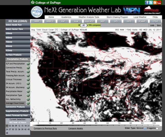
This is the cloudiness forecast valid at 18Z (GMT), 2 PM eastern time, on July 12th. It is a 42 hour forecast – by moving the time slider you can see the forecasts at different times… It isn’t too detailed, but can give a general idea if there will be widespread cloudiness. Cloud forecasting is not all that accurate compared with forecasts of other meteorological quantities. It requires predicting accurately both the atmospheric humidity field and the vertical motion field.
3) Using the 1-2 day forecast of cloudiness from a variety of models I would fine-tune my travel plans. Should I drive 500 or 1000 miles along the track of the eclipse – based on the forecast cloudiness? I probably wouldn’t – unless the forecast was convincingly for extensive cloud cover over the location I had planned to be at.
4) On the morning of the eclipse (assuming it was near noon, so you would have a few hours to work with before eclipse time) I would examine the latest cloud cover from real-time satellite imagery (not forecasts), then examine the winds at different levels (to estimate drift of any low clouds), and any other factors that might affect cloudiness at my observing site. Using this information I might drive 50 miles, more or less, but only if it had a good chance of improving observing conditions. (Note added August 4th – the traffic in many areas may not permit you to move much in response to cloudiness conditions. Don’t get stuck in traffic and miss much of the eclipse!)
You should ideally be situated and ready to observe at the time of the first contact.
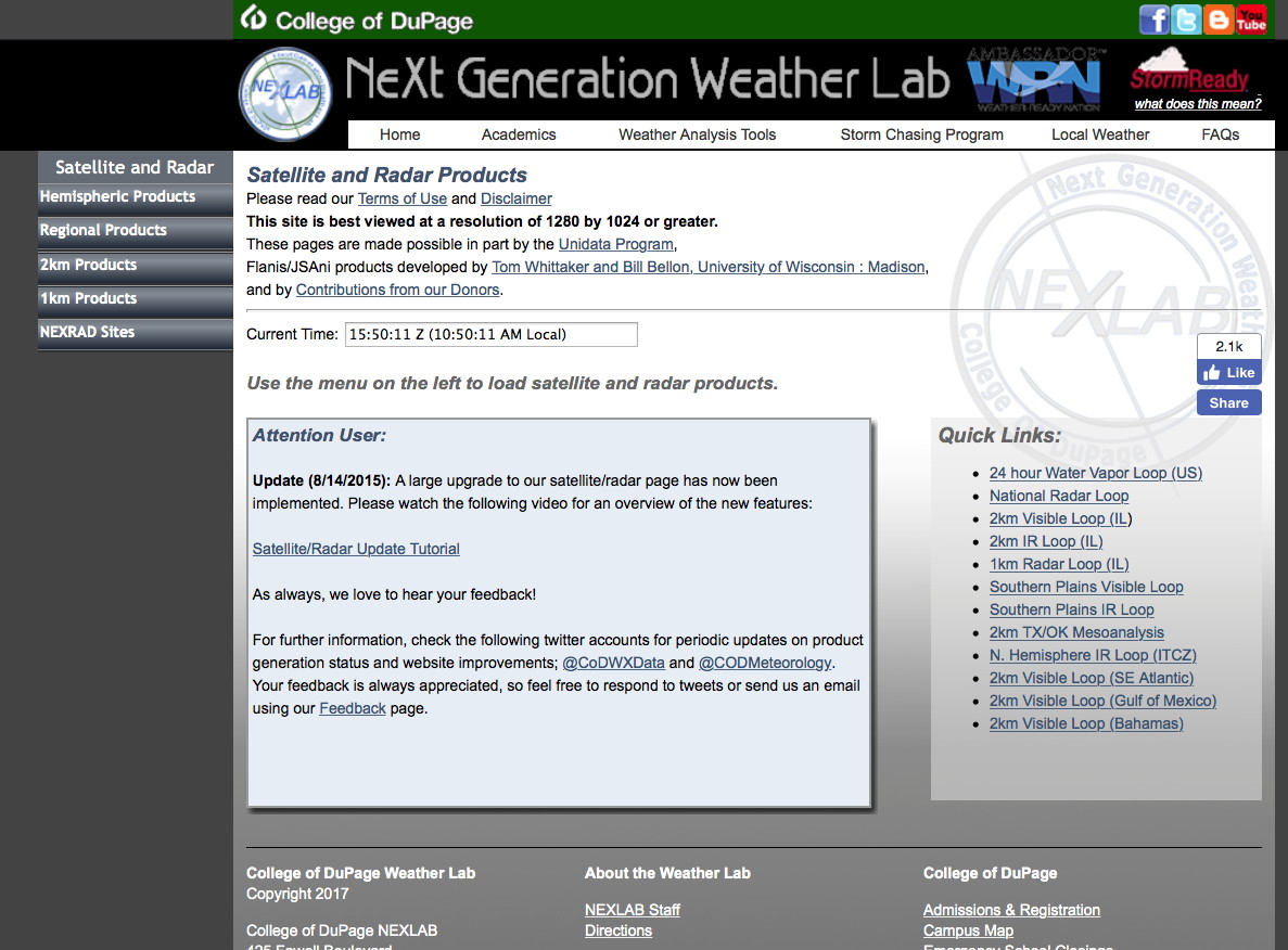
This is the website I use most frequently to see satellite imagery. It is at http://weather.cod.edu/satrad/ Click on the “1km Products” tab on the left to get the following screen:
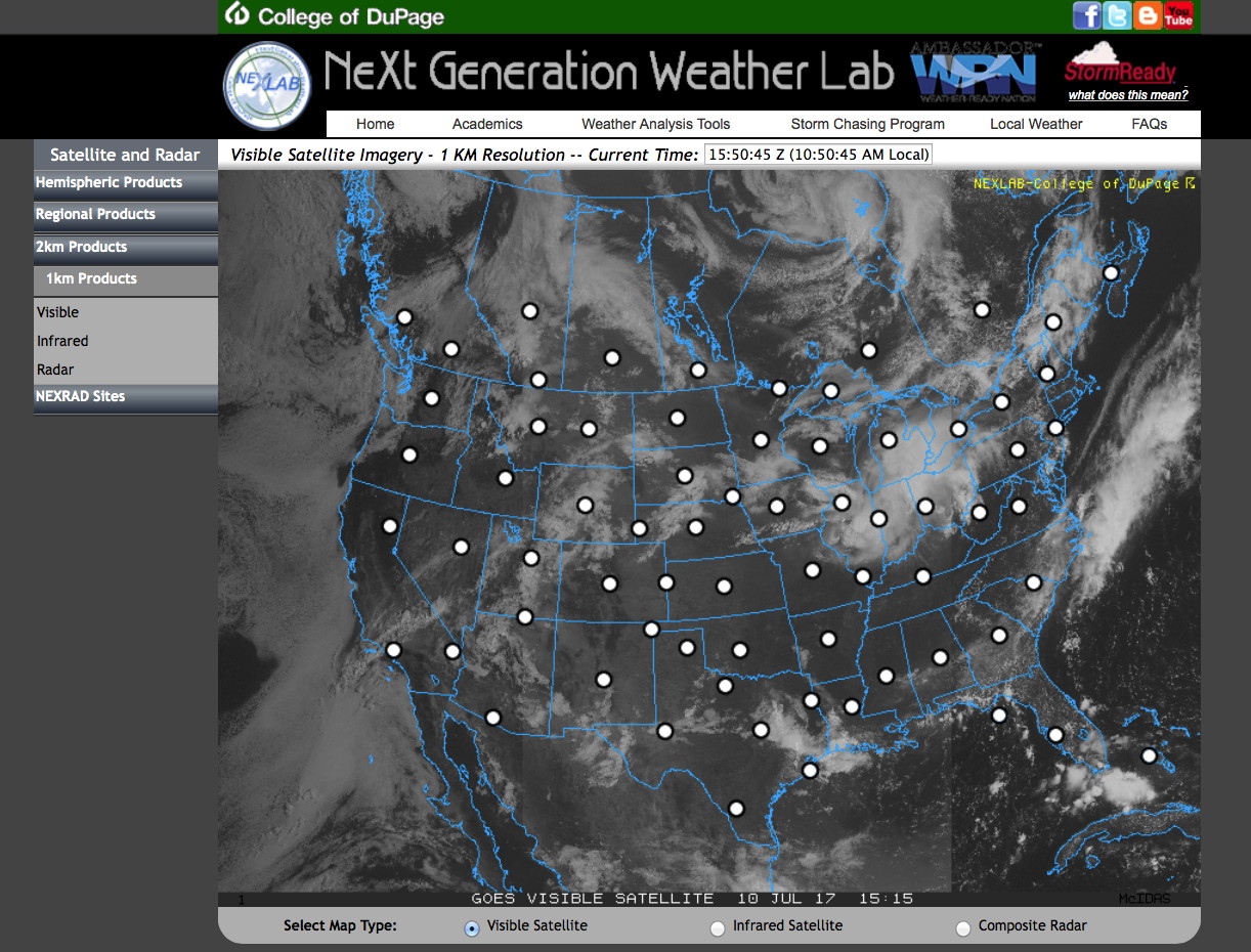
Next, select the dot nearest your location to see the 1 km pixel imagery (and animation) for visible imagery. If you click on the dot in Georgia you will get the following screen…

This will be the “latest” visible image – and you can click the “loop” to loop it. These images are updates roughly every 15 minutes.
IMPORTANT
There is an important factor that didn’t fall under “local conditions” but will affect daytime cloudiness. As the moon covers more and more of the sun, the solar radiation reaching the earth’s surface continually decreases – and this leads to a cooling of the earth’s surface. This cooling of the surface reduces the intensity of convection in the atmospheric boundary layer, which is associated with cumulus cloud formation. Thus, the shallow cumulus clouds, if they are present before the eclipse starts, should tend to diminish as the moon’s obscuration of the sun increases, leading to more cloud-free skies at total eclipse time.
MY “BEST SITES” BASED ON THE MODIS SATELLITE CLIMATOLOGIES
Most people will not have the luxury of traveling great distances to be at the best site for seeing the eclipse (from a climatological perspective). However, here are my suggestions:
For all recommendations below – try to be moderately close to the centerline of the eclipse – duration will be longest on this line (blue line in the kmz files). However, read this astronomical document to better appreciate the advantages and disadvantages of being off the centerline. The figure below (from the document) shows the dropoff in totality time as you move away from the eclipse centerline (the brownish curve labeled totality). For the approximately 2.5 minute maximum eclipse duration on August 21, you loose only about 20 seconds if you are half way (about 17 miles) from the centerline to the eclipse edge. So don’t pack yourself in with thousands of other people clustered about the centerline on a busy road! You can afford to be off the centerline by 5 to 15 miles – or more – with losing very much time of totality.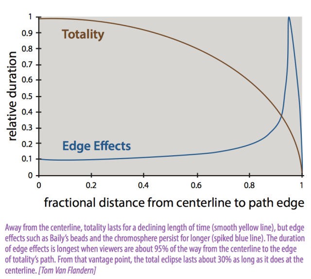
Here they are, my “best sites” based on the satellite climatology and other considerations:
For people living in the southeast US: Be at the seashore of South Carolina – near the centerline of the eclipse. Otherwise be along the shore of one of the lakes discussed in the previous section (side of lake depends on the wind direction). Alternatively, people living near the Great Smoky Mountains should be in a broad valley away from peaks to the extent possible.
For people in the central US: Unfortunately, in the central US there are few topographic features or large lakes to modulate cloudiness so most cloudiness will be associated with features that “come and go” somewhat randomly. No specific location has a clear advantage in less cloudiness (though pay attention to even small lakes (and apply what you learned in the previous section) – if the winds are weak). Pay attention to the latest cloudiness forecasts and the satellite-observed distribution of clouds a few hours before totality. You may have to drive only a little bit – or alot if you are really unlucky. If you are very lucky you can see it from home without going anywhere.
For people in Wyoming and surrounding areas: The best spot is near Ocean Lake, about 15 miles northwest of Riverton. But stay close to the centerline as with other locations. The entire valley around Riverton is approximately equal in climatological cloudiness – but again, pay attention to the centerline. Don’t make the mistake of driving to escape cloudiness – and leave the totality path by accident!
For Idaho and surrounding areas: about 20 miles north of Idaho Falls (near Rexburg) or on I-84 near the small town of Lime (close to centerline).
For Oregon: Anywhere around the town of Madras – but stay along the centerline. You must go east of Mt Jefferson to find (climatologically) minimum cloudiness.
