The Magdalena Plain is perhaps the flattest part of the Baja California peninsula. Examination of the topography shows that it is a tombolo – a sand spit that extends from the mainland to the “offshore” islands that are now connected to the mainland except for a barrier lagoon. Normally tombolos are associated with small features, but here the sand deposition must have been taking place for a much longer time.
Because the Magdalena Plain is mostly flat or gently undulating, it has been developed for agriculture in many places. However, the groundwater has limited development and fortunately, from environmental perspectives, it has not greatly changed in Google Earth imagery over the past 30 years.
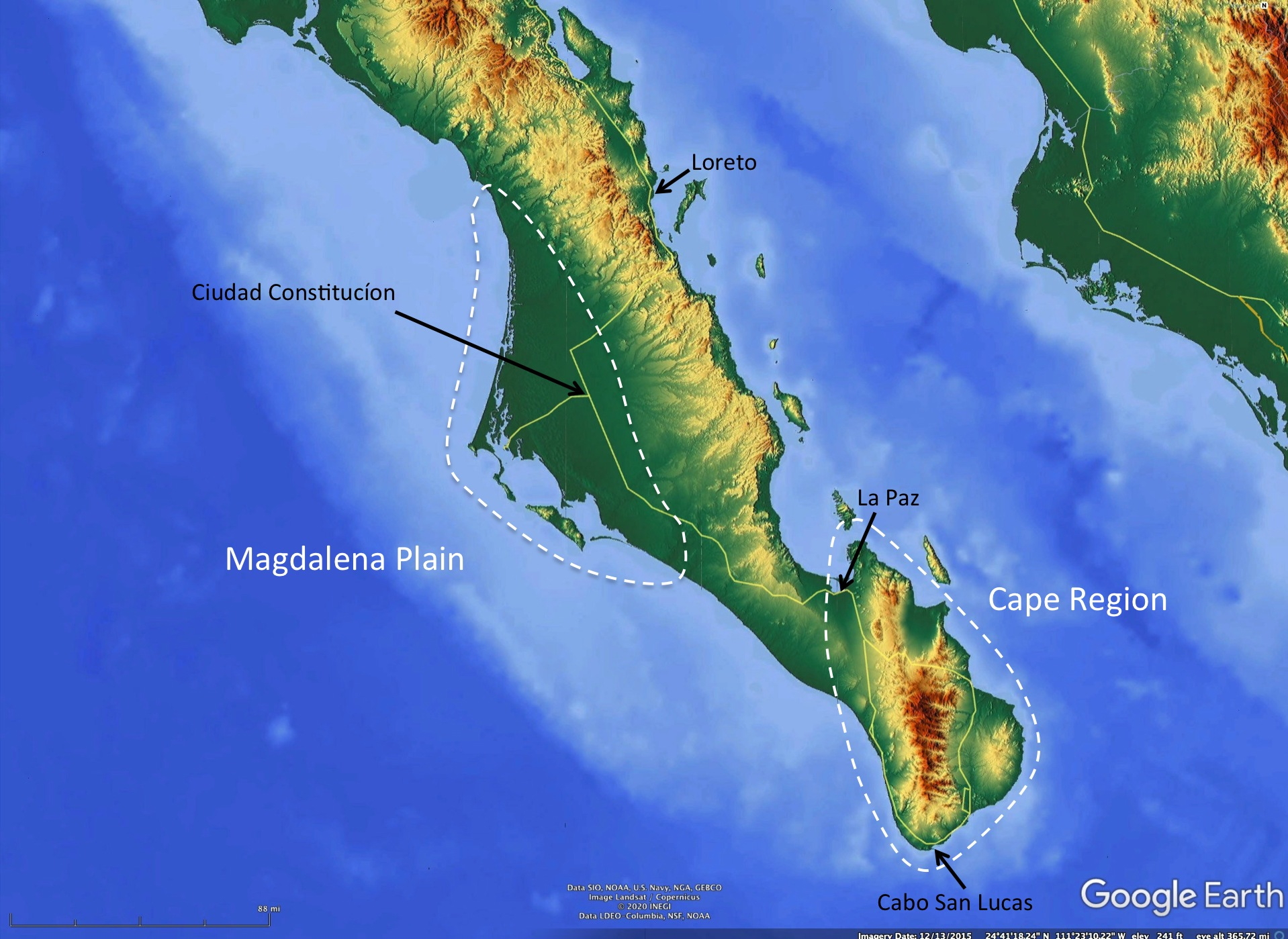
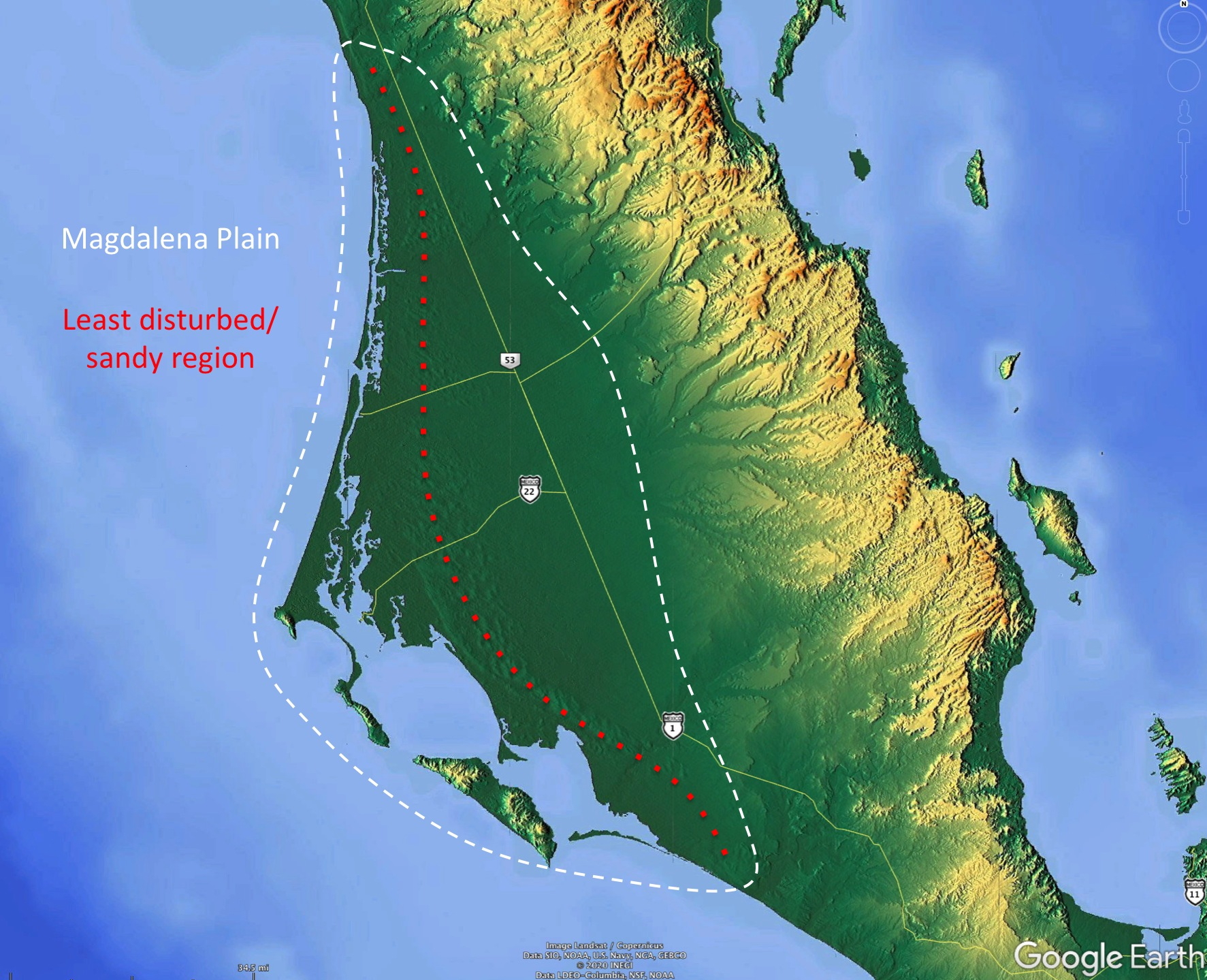
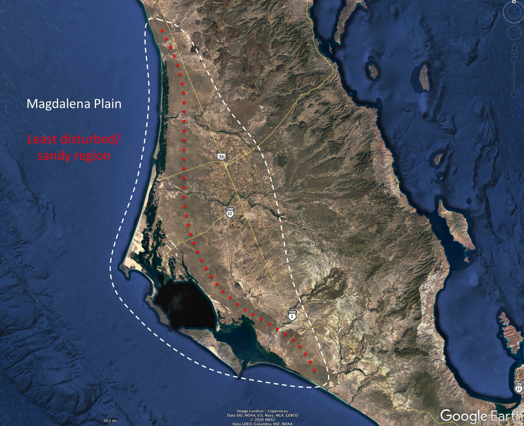
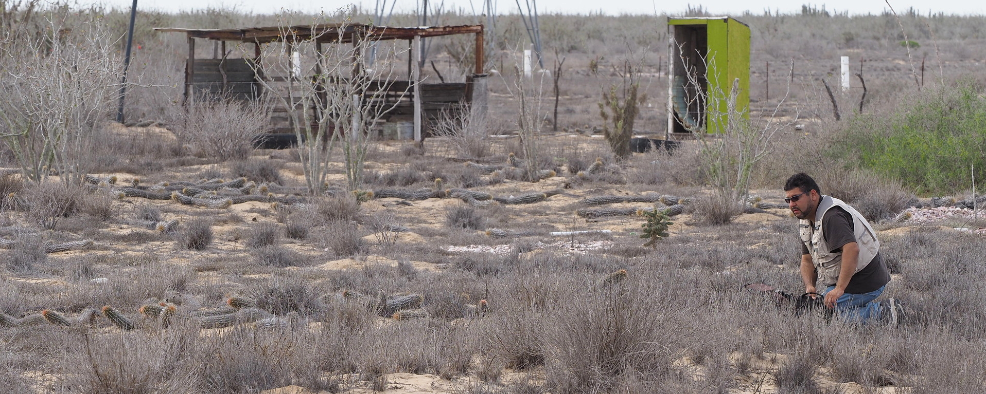
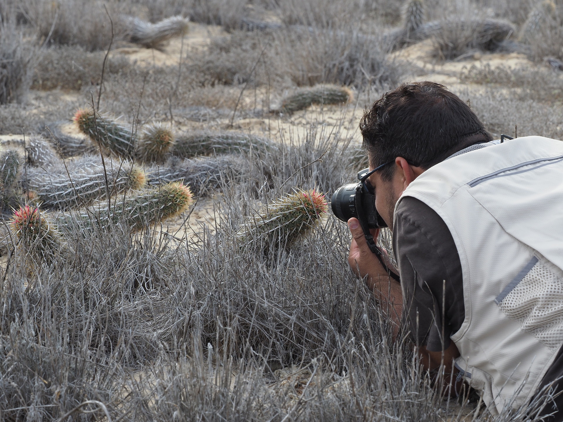
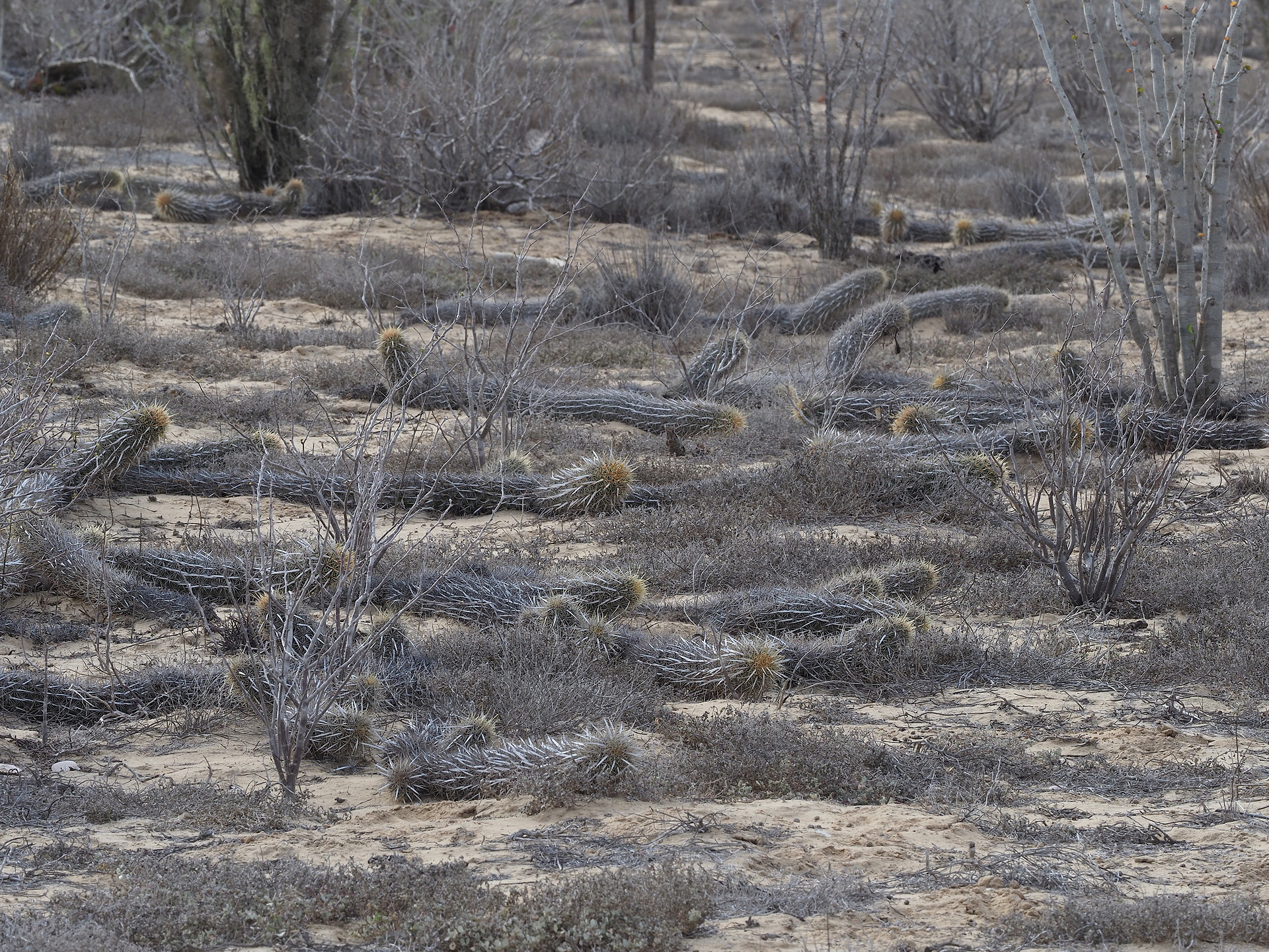
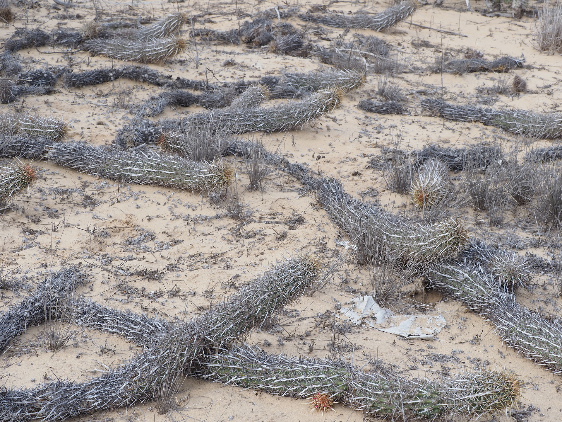
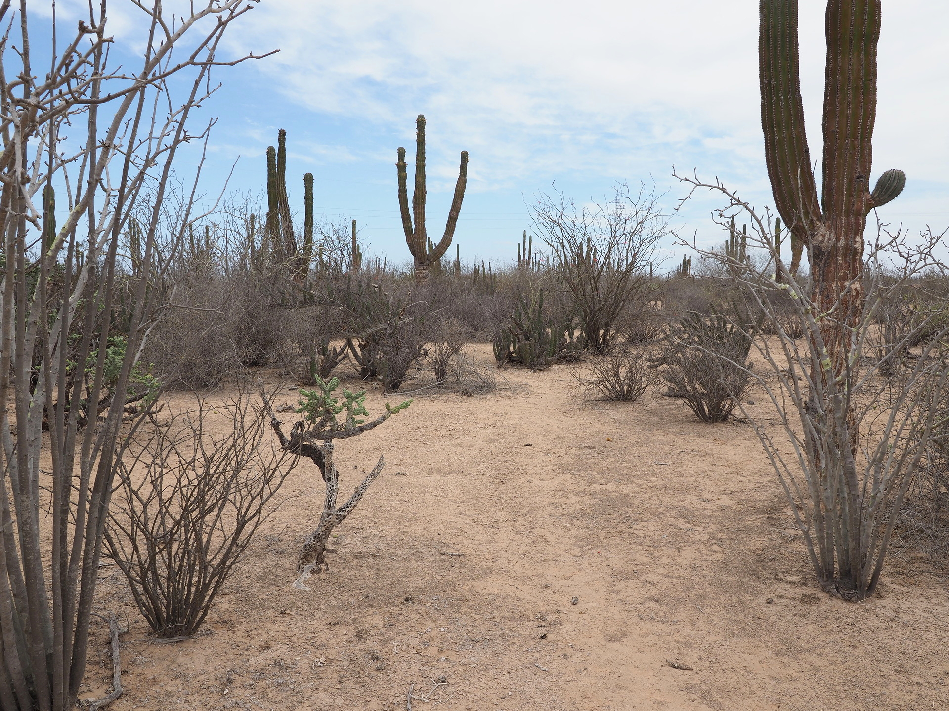
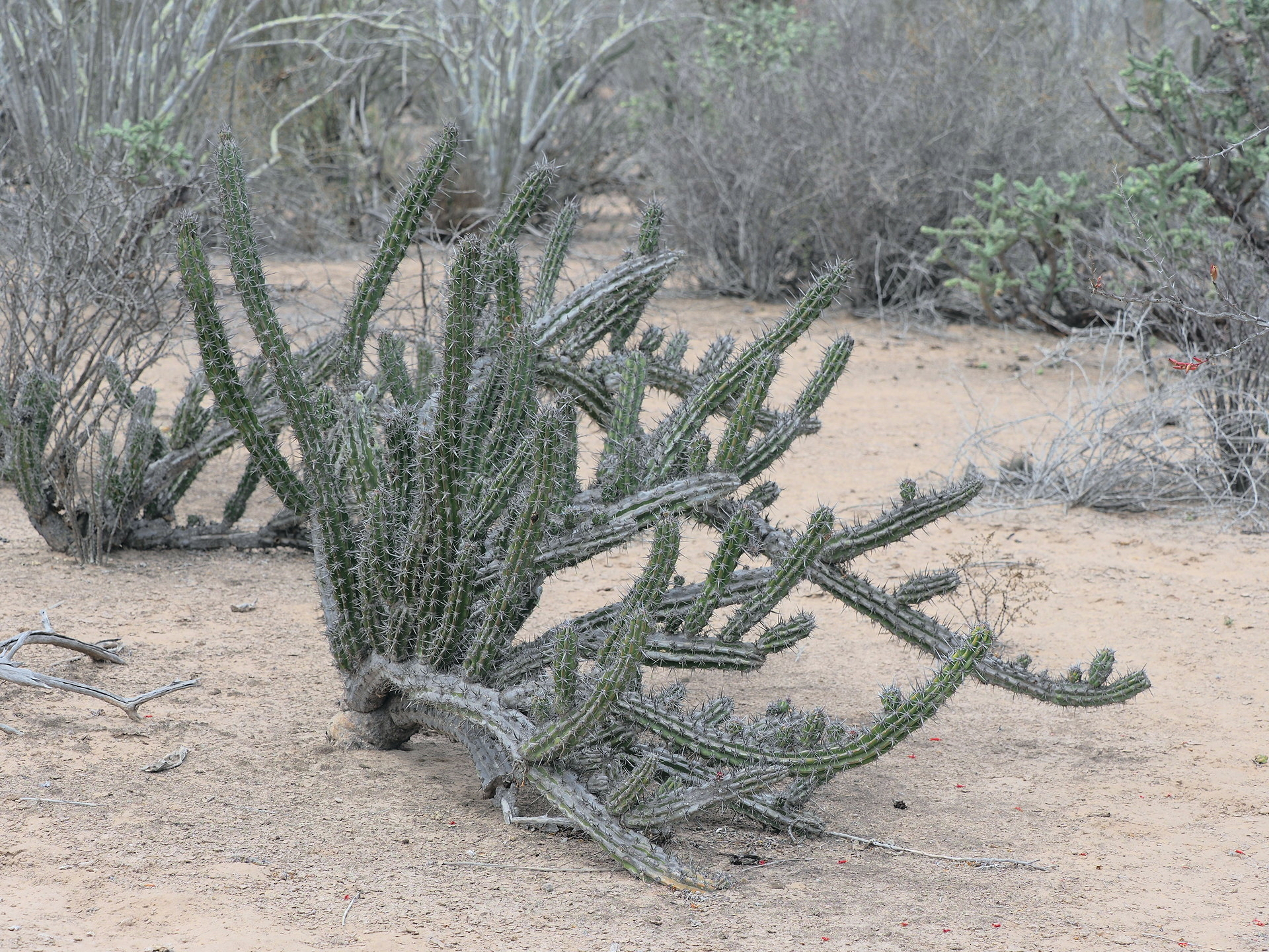
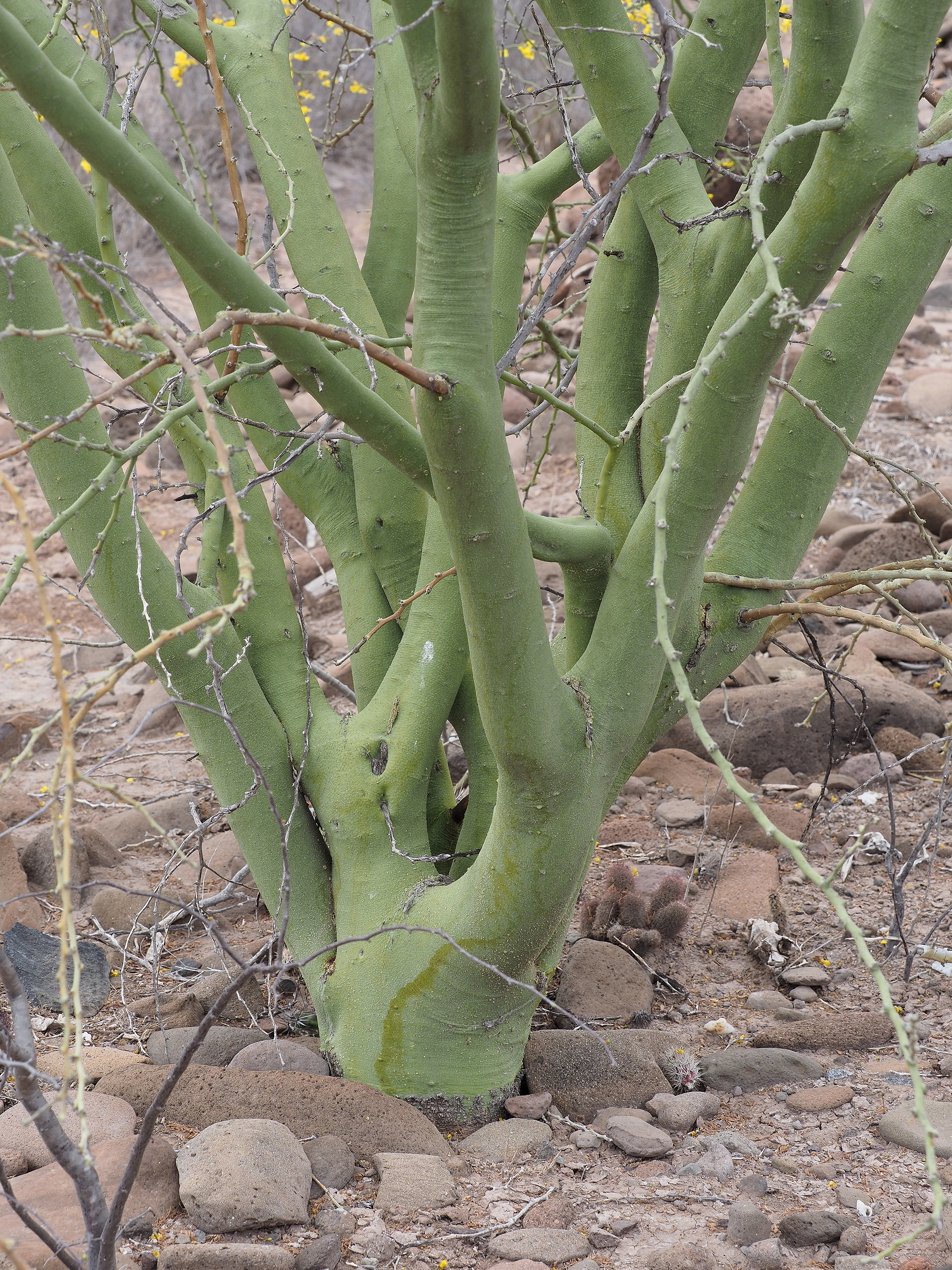
Finding undisturbed vegetation on the plain is another matter. Much of arid Mexico is open range land or poorly-fenced, and evidence of cattle is nearly ubiquitous. The side road to the small port of San Carlos crosses gently undulating vegetation-covered dunes with some salt lakes. Approaching San Carlos one of the more unique cacti in Baja California is found the Creeping Devil (Stenocereus eruca). Most visitors to Baja California never see this cactus because of its limited range on the Magdalena Plain- well off the main North-South Highway and the fact that it grows along the ground rather than upward.
Because low clouds and fog extend some distance inward on the Magdalena Plain lichens are seen densely festooning plants in many locations.
The islands just offshore the Magdalena Plain – the ones in part responsible for forming the plain along with wave action – require special efforts to visit by boat from San Carlos. We have not done so, but there are a handful of endemic cacti and other plants found on the islands, which rise to about 1500 ft elevation in places.
Click on any image below to start stepping through the images – text accompanies each image.