This section has been developed to support the Trip log related to our recent trip to Madagascar in later 2015. There is enough material related to climate, geology and other aspects of the country to have another location to refer to it. This material has been prepared by Mike Douglas.
Madagascar climate, topographic relief, land cover, and geology
The vegetation of any location depends of the climate and the underlying type of rock. Together, these two factors determine the resulting breakdown of the rock into finer pieces that, when combined with plant matter, yield soil. The character of the soil depends on the slope (water runs off faster off steep slopes) and the orientation of the slope (e.g. poleward-facing slopes are cooler than those facing the equator).
The following slides give the reader an idea of the basic physical geography of Madagascar.
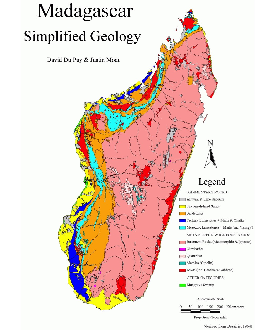
Click on this map to get a larger version – and read the legend. The original citation can be found here. The large pink area on the eastern side of Madagascar is granite or similar rock forming the core of the mini-continent of Madagascar. Red is volcanic rock – though nothing is really recent. The orange is sandstone – Isalo National Park is basically all eroded sandstone formations. And the light and dark blues are limestone – the tsingy formations are the light blue areas. Alluvium (eroded material like sandy flats and sand dunes) are yellow. Note that the sedimentary rocks (sandstone and limestone) are on the westrn side of the island while the igneous rocks that cooled from molten magma (mostly deep underground as with granite) are on the eastern side of the island.


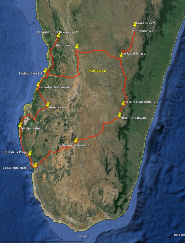
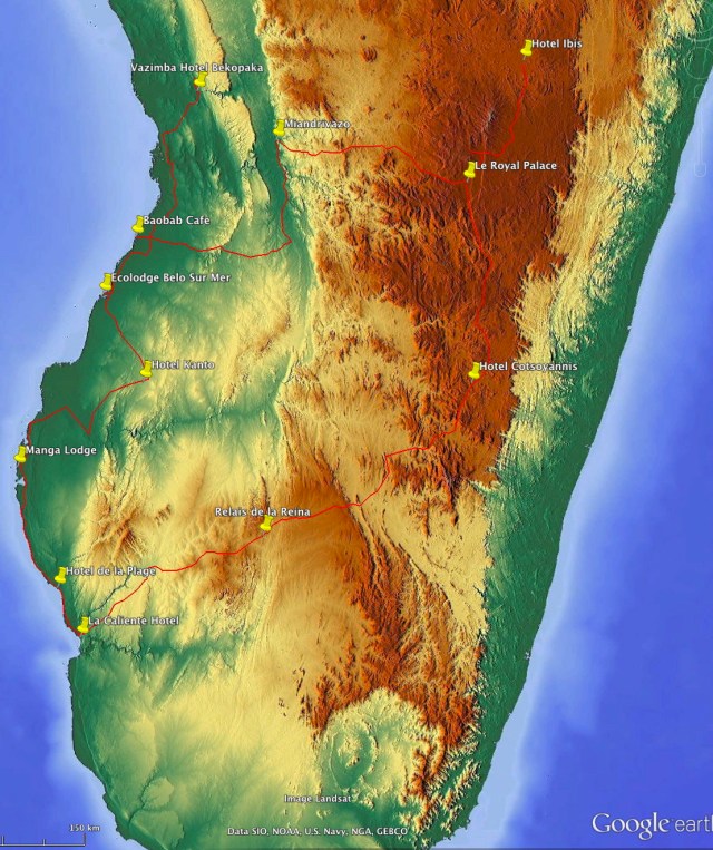
Google Earth view, dark areas are forested, light are grasslands or less vegetation. Our route and the nightly stops are indicated.

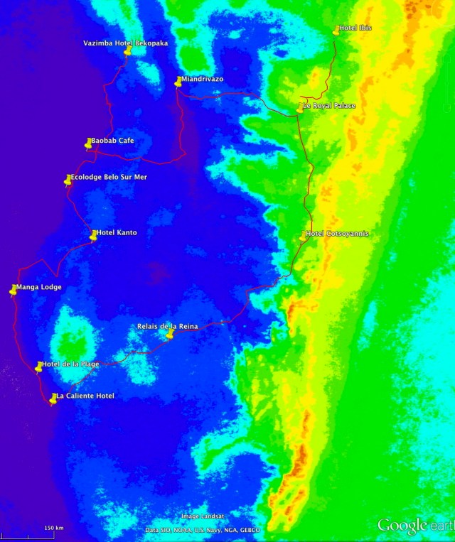
Mean annual cloudiness – redder is more cloudiness, deep blue is least (white is less than 2% cloud frequency)

May-October mean cloudiness – note west coast has almost no cloudiness (white pixels).
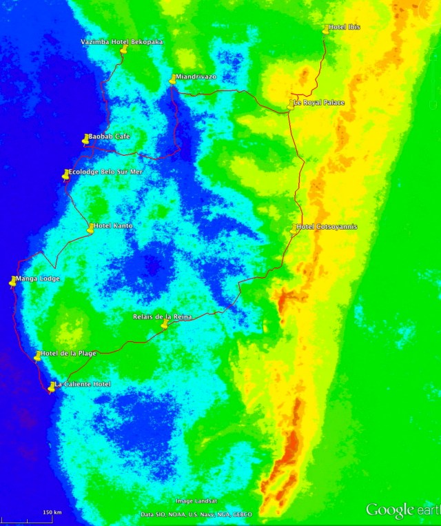
Oct-April mean cloudiness (warm season). Red max cloudiness, blue is minimum. Note that west coastal region is still a minimum in daytime cloudiness – associated with sea breeze subsidence.
A link that shows (if you play with the slider at the bottom) the separation of Madagascar from Africa and India at different times is here:
https://ees.as.uky.edu/sites/default/files/elearning/module04swf.swf
