A section is needed on aspects of Nature Conservation in Argentina, based in part on our recent trip. The same comments apply to a handful (probably most) of Latin American countries.
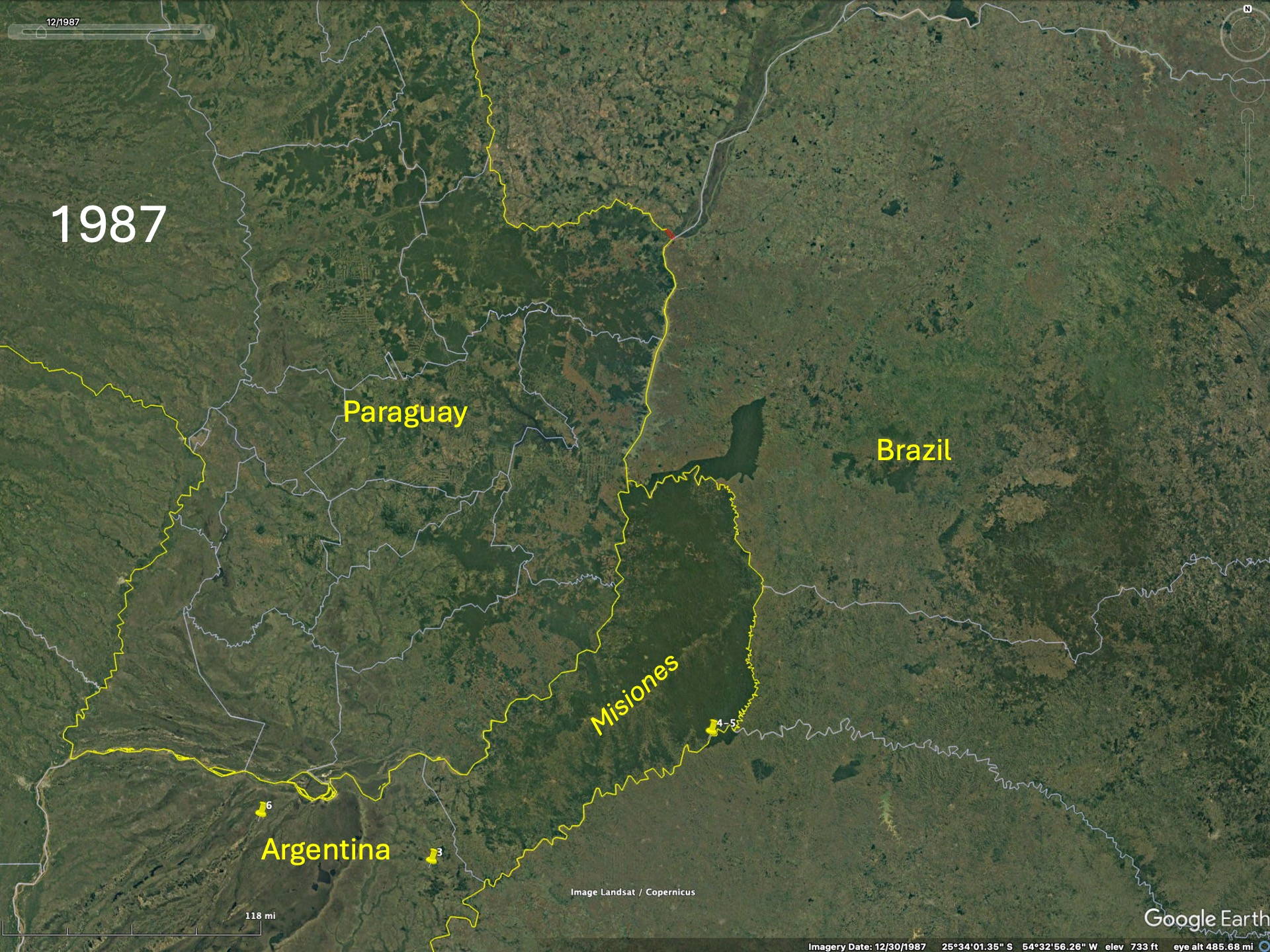
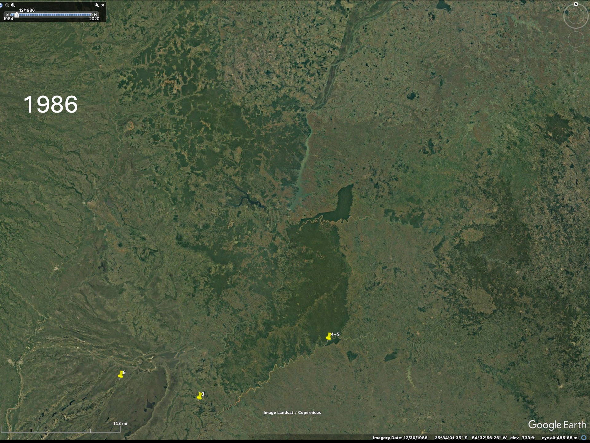
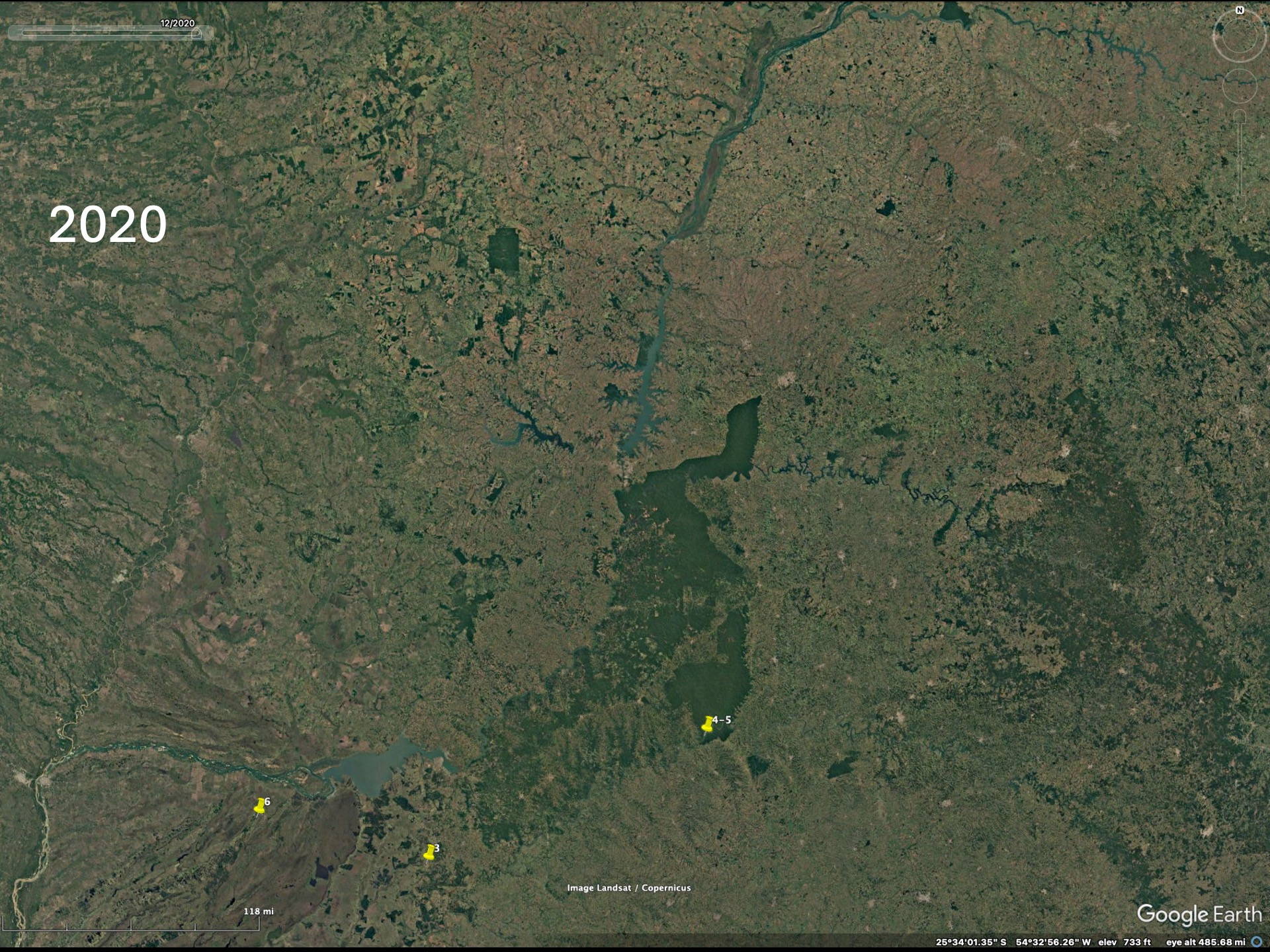
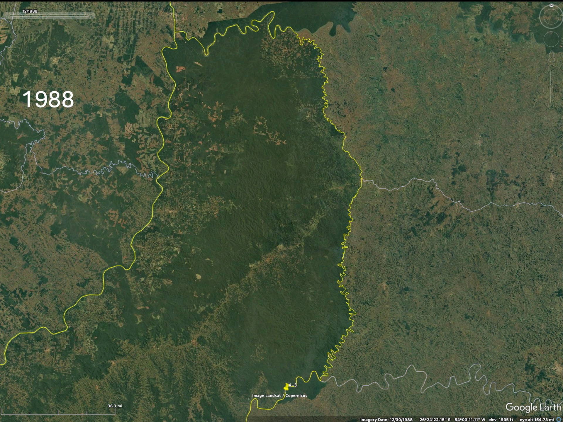
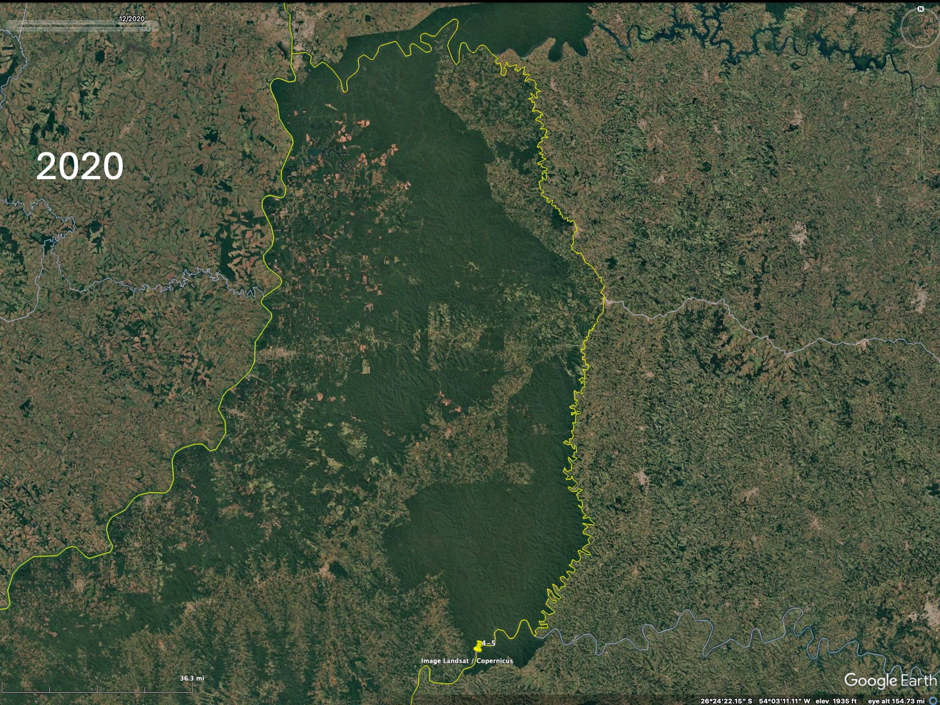
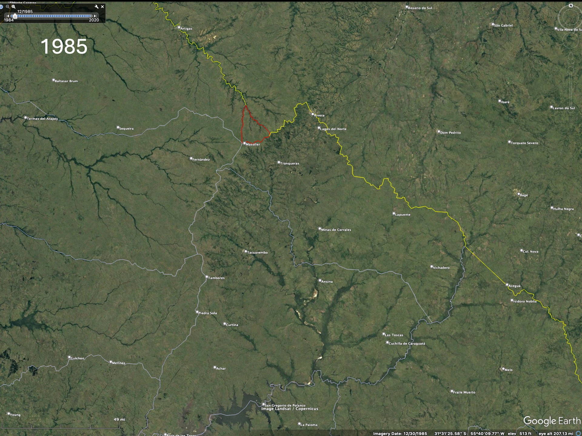
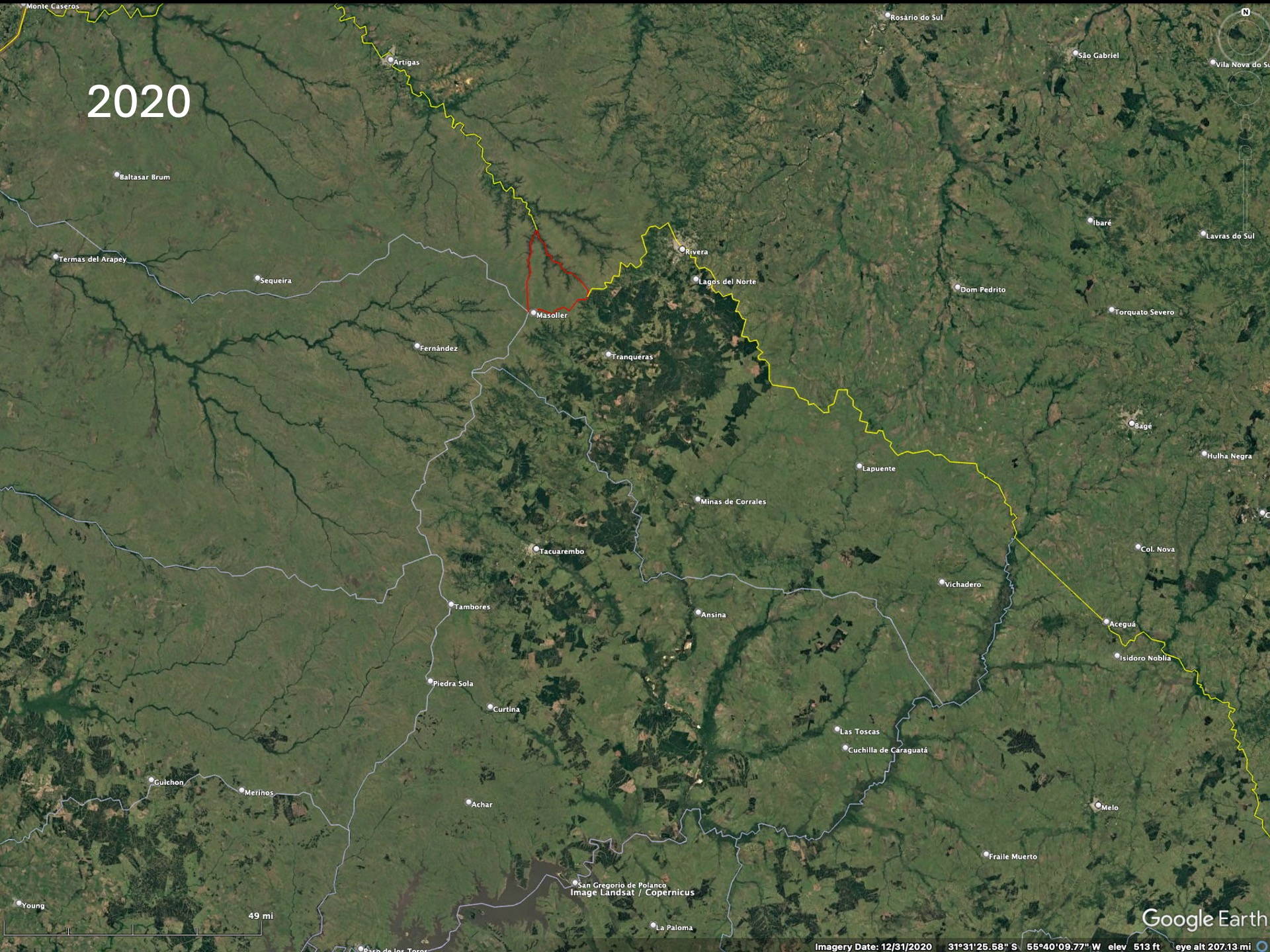
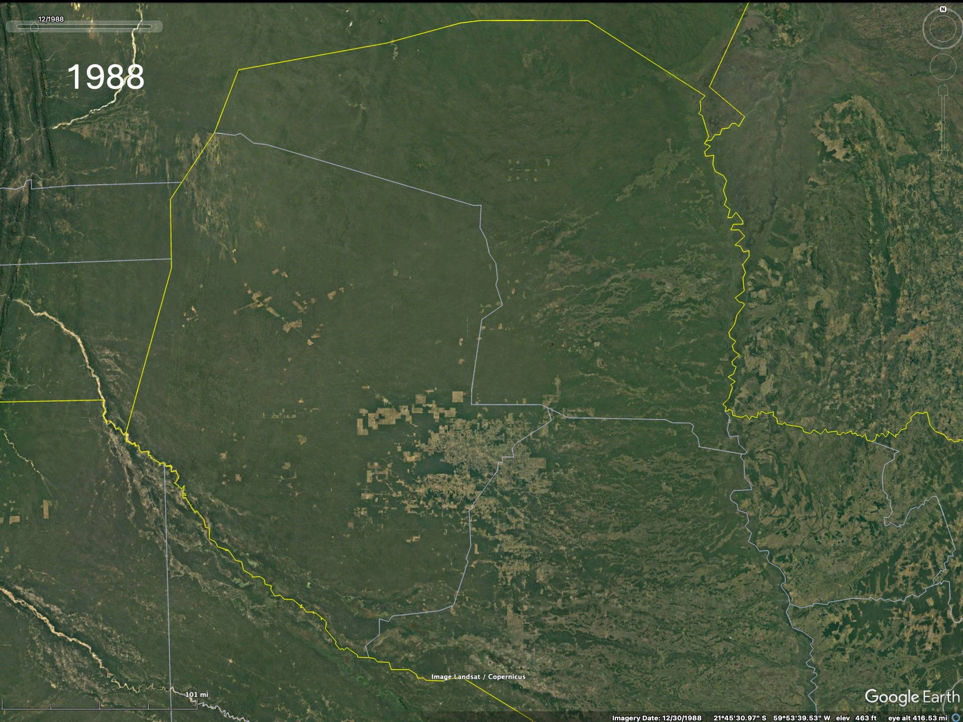
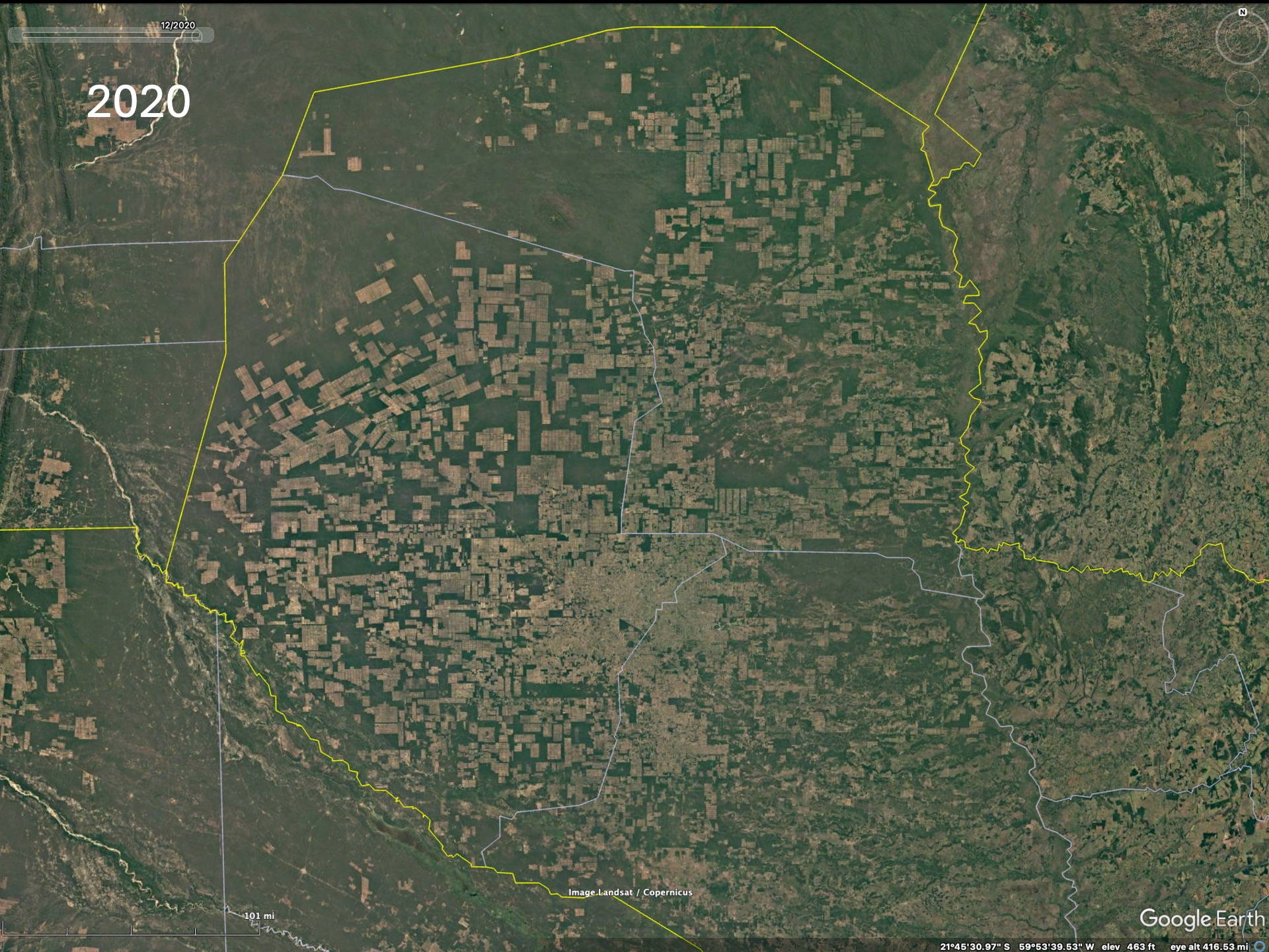
If one looks at satellite imagery (usually from Google Maps or Google Earth – they use the same data) over a larger area, say northeast Argentina, one might believe that there are large forested areas in this region. A few images are shown below to suggest this. In fact, many areas are undergoing reforestation – suggesting that there is an increasing awareness and interest in conserving the original forests of the region. The truth is nearly the opposite.
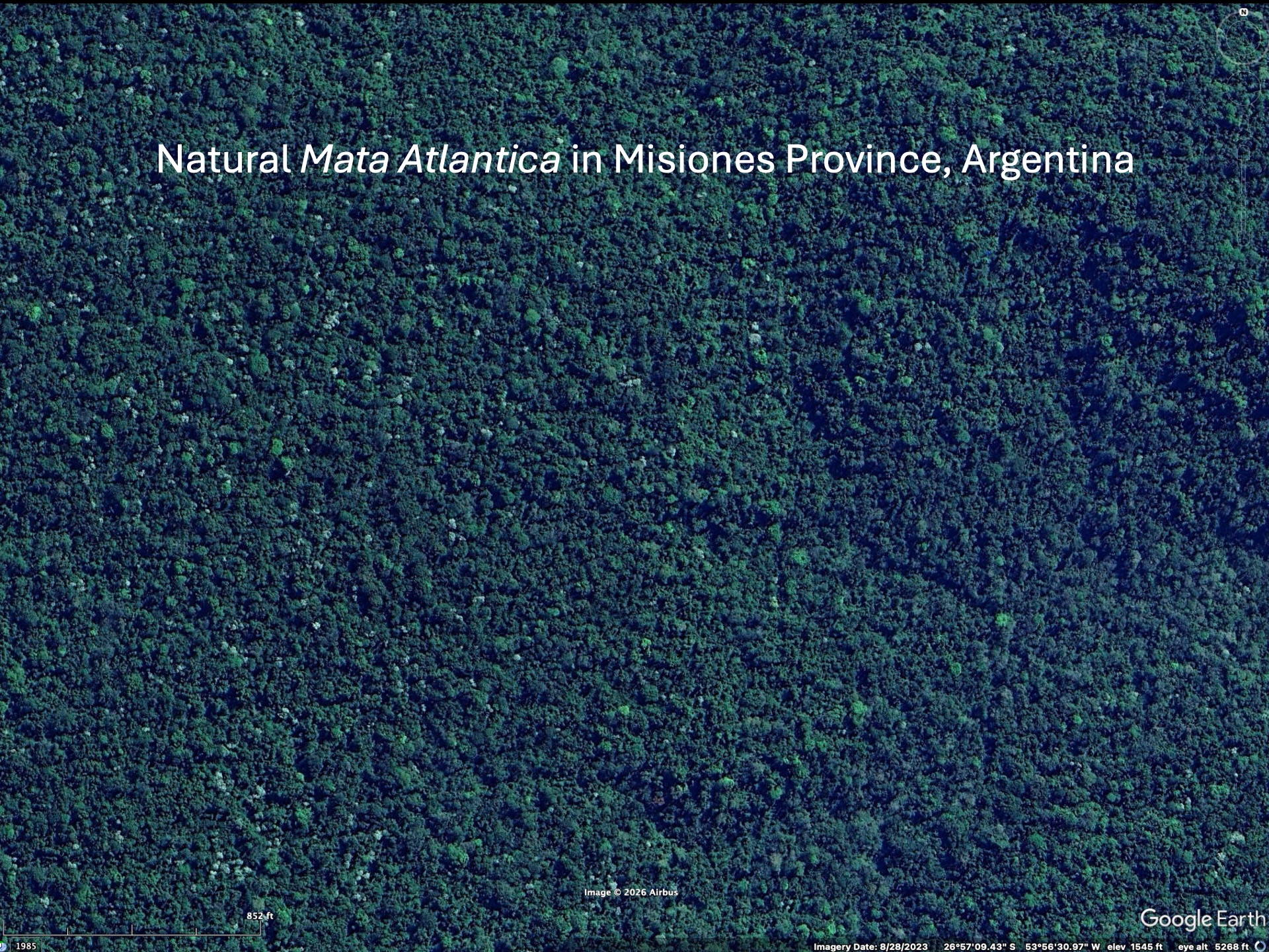
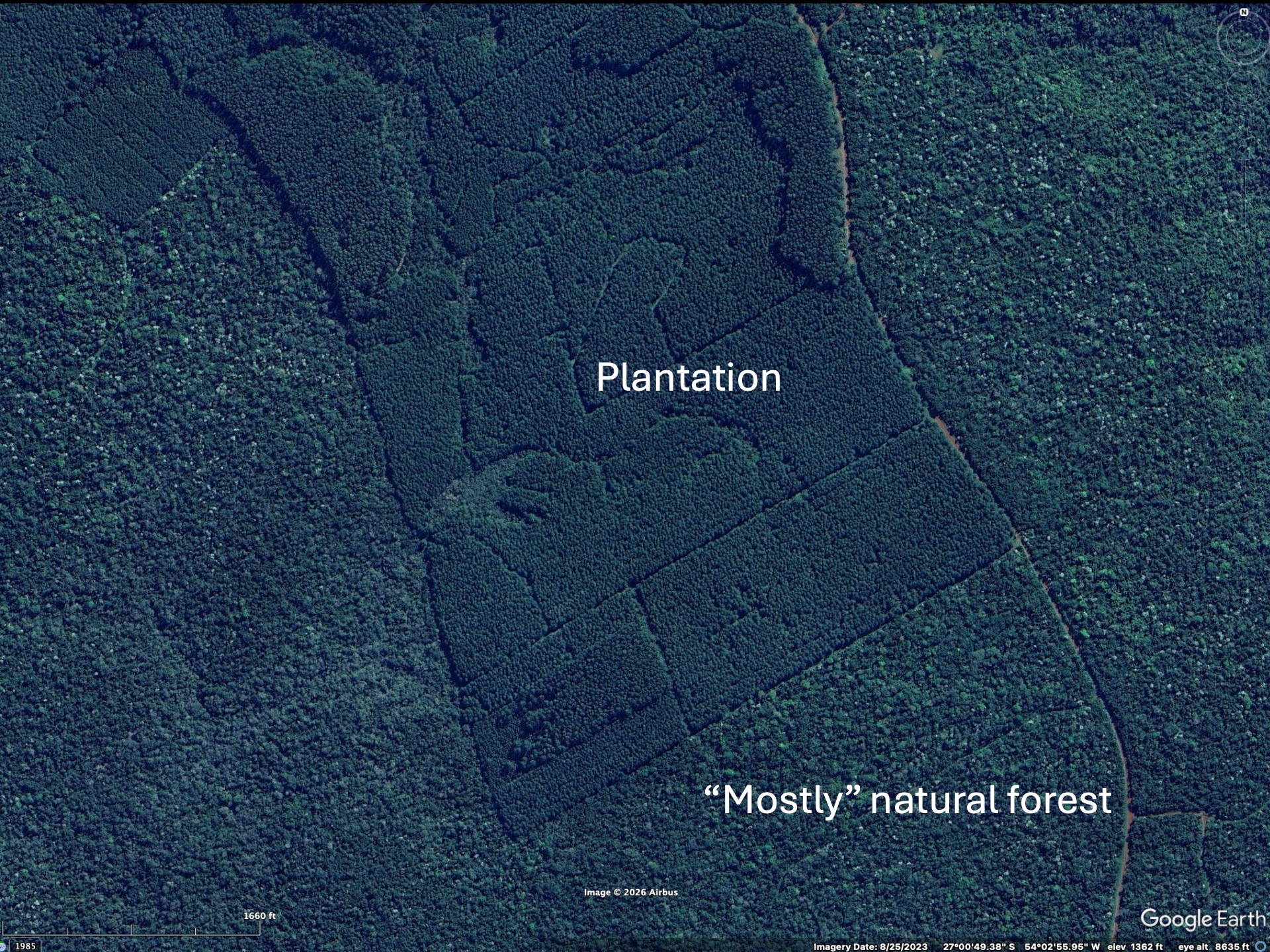
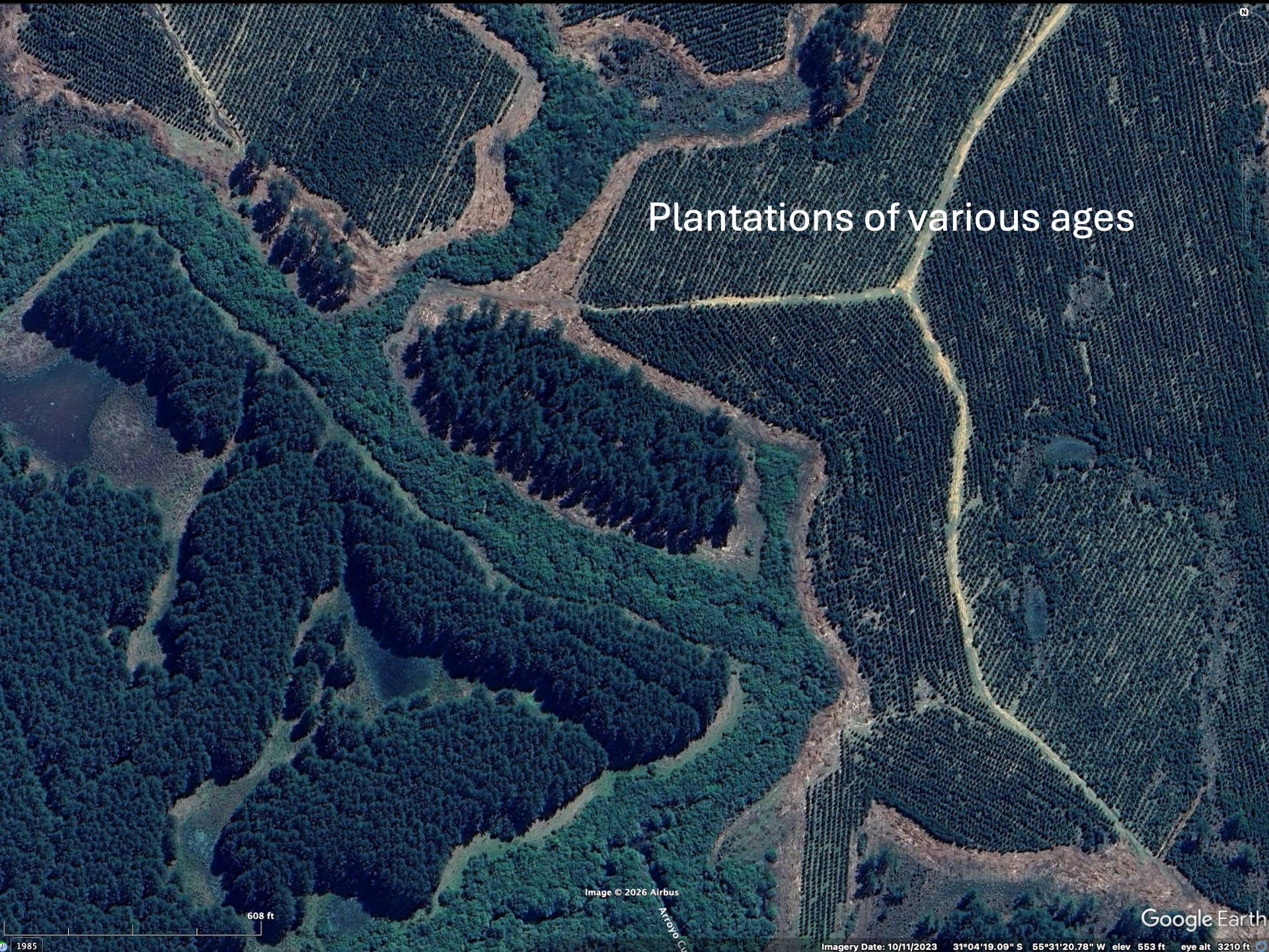
Most reforestation in northeastern Argentina (the Mata Atlantica region) is actually done with species of fast-growing pine or eucalyptus (neither native to South America). These are used for wood, either for construction or paper pulp. These trees are planted very close together and appear darker on satellite imagery. There are essentially monocultures with minimal biodiversity. Like corn or wheat fields, only taller.
To realize the “forests” are actually plantations one needs to zoom in to higher resolution on the Google imagery to see that the trees are planted in rows. Then the difference between native forests and plantations becomes obvious. The native forest patches, especially in eastern Paraguay but also Argentina and Brazil, have decreased since the availability of the LANDSAT imagery in the early 1970’s (imagery from 1984 on Google).
Much like in the central US, the vast majority of land in northern Argentina is under cultivation, especially in moister areas. Fully protected lands are very small in percentage; the concept of “Biosphere Reserve” occasionally seen in the region does not imply full protection, and private land holding can be widespread in such areas.