A summary of our 27 day trip to Madagascar in October of 2015
Introduction
During October 9-26, 2015, my husband (Mike) and I (Rosario) participated in a succulent plant tour in Madagascar. This trip log is intended to provide both visual and written information about our experiences during this trip. We have also added comments, conclusions, recommendations and a reference list that may be of use to travellers planning a visit to Madagascar.
All comments in this log reflect our personal opinions. All comments in this log where the word “I “or “my” are used refer to myself (Rosario). Although I did most of the writing, the text has been revised extensively by both of us.

1. Mike and Rosario south of Morondava, Madagascar 2015
Our Trip
Because of the long distance required to travel to Madagascar and the possibility of visiting western South Africa during the springtime (a good time to see the succulents before they dry out too much and to see some flowers) we decided to combine our trip to Madagascar with a visit to South Africa. This was aided by the fact that the lowest-cost flights from our location (and most direct route) to Madagascar was via Johannesburg, from which there were daily South African Airways flights. We both enjoy traveling and exploring in South Africa and this was to be our 6th visit since 2002 and our second visit of 2015. Thus we flew to South Africa in early September and spent about a month visiting Namaqualand, the Little Karoo, the Cape area and interior fynbos, as well as farther into the interior (Augrabies and Mokala National Parks). Then we flew to Madagascar and at the end of our Madagascar tours we flew back to Johannesburg. We then spent another 16 days visiting Kruger National Park and its vicinity where, aside from the numerous mammals, we were hoping to see a good variety of birds, including recent arrivals from Europe. It was our third visit to Kruger.

2. The big picture… our trip route in red, Madagascar and its relation to southern Africa and the various latitude and longitudes lines. Most of Madagascar is in the tropics, but not all.
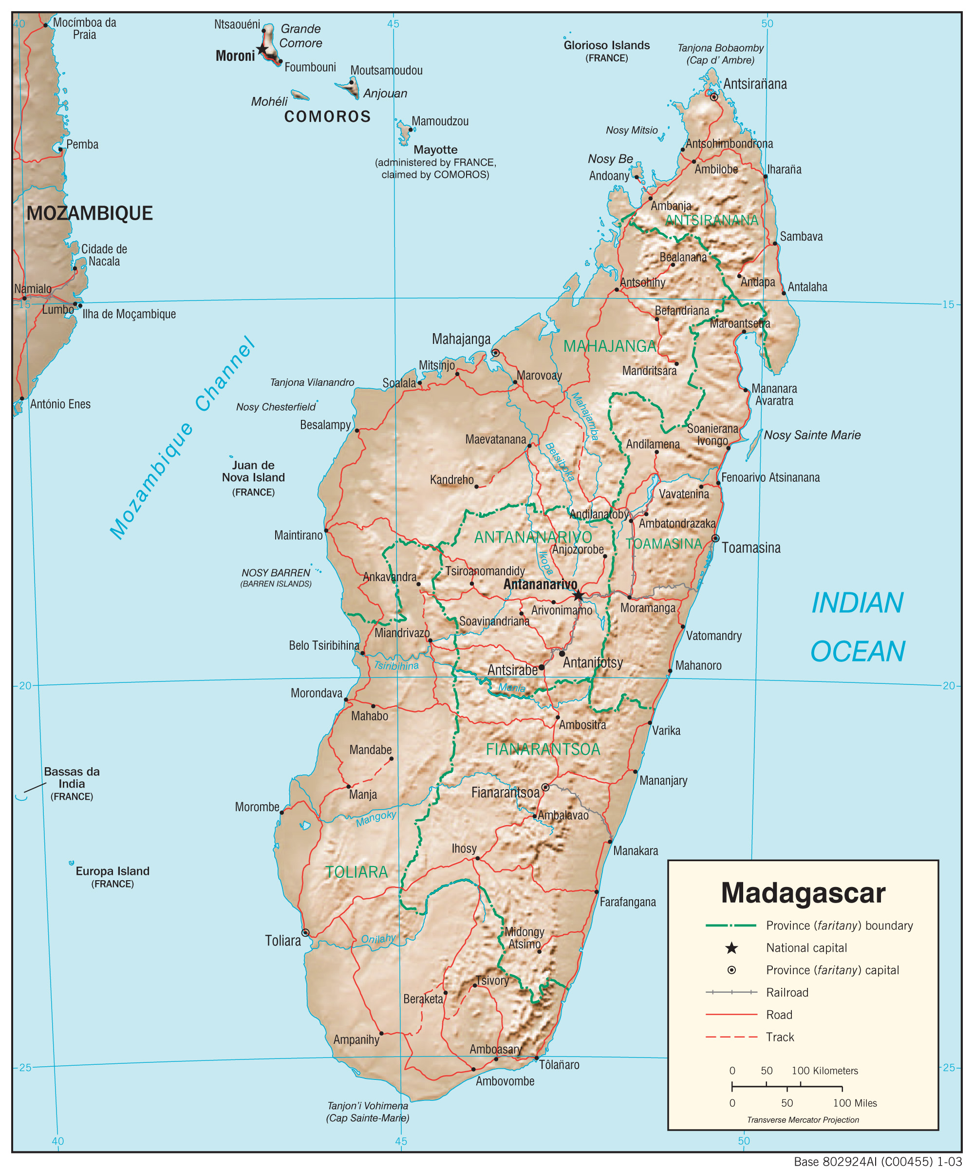
3. Shaded relief map of Madagascar.
Although it is under construction you can read a bit about our South Africa travels at this webpage.
In Madagascar, because the SANT itinerary was focused exclusively on the dry forest environments, we decided to also schedule a shorter tour to moist habitats in eastern Madagascar primarily the Andasibe-Mantadia National Park area. The main objective of this second tour was to see moist forest environments. In the end we spent 27 days in Madagascar between the two tours. Included in this trip log is a section called Private tour where you can read about our second tour in Madagascar.
Photography comments by Mike
We traveled from South Africa with 4 cameras – seeming overkill for the two of us. And that excludes one camera we left in South Africa! However, experience had taught us that some redundancy is useful. Two cameras were “mirrorless” Olympus OMD EM1’s; by the end of the trip one had mostly failed in an important regard; hence the value of the back-up. These Olympus cameras have the advantage of a tilting rear viewfinder allowing composition of subjects when the camera is on the ground or over your head. However, they do not have GPS location capability, hence the need for another camera, a Nikon D7100 with a newly purchased 18-300mm zoom lens. It turned out this lens, despite my dislike of all-in-one lenses, was critical during our many short stops where frequent lens changing would have taken too much time and allowed dust to land on the camera’s sensor. For example, I would need to shoot a wide-angle shot of a tree, then zoom to shoot a bird on the tree. Then a lizard on the ground… The zoom gives you flexibility to do this. (You can see I am trying to justify to myself the $1000 we spent on the lense.) The Nikon D7100 is also compatible with a GPS unit I have, so we could obtain locations for later comparison with Google Earth imagery. Finally, we brought along a new Olympus TG-4 point-and-shoot camera for quick and candid photos of people and places where our larger cameras might attract unwanted attention. It was also waterproof and had a build-in GPS capability so we could also get positions from this camera. The quality of the images is not very good, but many times any photo was better than none at all. Many of the roadside photos and “people pictures” were taken with this camera – there were few opportunities for “controlled” photos of such scenes.
We put all our images in Aperture (we work with Apple computers) and modified as required. Many are still not great, even after modification, but are used here because they provide important documentation of key events. Finally, to put the images into this website we scaled the images to 1280 pixels across and exported them from Aperture as jpeg files. Thus, some images might be 6000 pixels across in the original, but are reduced to 1280 pixels for display here. As WordPress limits the size of images to 600 pixels across in the basic website display, you need to click on the images to see the 1280 pixel version. We could have put full-resolution versions online in this manner – but the space allotment for our WordPress account would have been quickly used up. Such are the compromises of website displays.
Finally, in addition to the cameras, we brought a hand-held ETREX GPS unit where we recorded positions from time-to-time. This served as a back-up and allowed us to mark our daily route, even if we were not taking many photos.

Example of the GPS positions from the two GPS equipped cameras. Except for the first two days, the route is well-depicted. Our 5-day private tour is also shown (upper right).
Collectively, the positions from the two digital cameras and the Garmin ETREX gave us enough points to produce fairly detailed route maps, especially in the maze of dirt roads that crisscross the west coast of Madagascar. More comments about photography are given in the recommendations section.
Why go to Madagascar?
As succulent plant enthusiasts we have been aware for a long time of the remarkable diversity of succulent plants found in Madagascar. Many iconic succulents such as Adansonia grandidieri or giant baobab are found nowhere else. A visit to Madagascar was in the back of our minds for a long time.
We have generally been independent travelers, preferring the freedom to design our own itineraries and the flexibility that such type of travel provides. However, not being perfectly fluent in French, not speaking Malagasy and not knowing where to see the best succulent plant habitats, we decided that a succulent plant tour would be the best option for visiting Madagascar for the first time. Our experience with tours had been limited to a couple of week-long private tours in Ghana, and a trip to eastern Brazil in 2009 with South America Nature Tours (SANT hereafter) a one-person company run by Guillermo Rivera.
Our online searches yielded a fair amount of information about Madagascar tours offered by both local and international tour operators. Few nature tours to Madagascar focus on the plants, with birds and lemurs tending to be the main subjects. Other tours concentrate on either adventure tourism, or time at beach resorts. In the end, given that specialized succulent plant tours to Madagascar are infrequent and not routinely offered by tour companies, we decided to take a tour being offered by SANT in October 2015. This despite the fact that SANT had only run its first tour to Madagascar the previous year.
Prior to the Madagascar trip we were aware that conditions related to environmental protection and habitat degradation in Madagascar were not ideal. We had read books about Madagascar (see our reference list at the end), some of which clearly mentioned the problem of overpopulation, poverty and the environmental consequences. These two elements combine to exert a heavy toll on natural habitats throughout the country. However, nothing we read or heard prior to this trip prepared us for the levels of habitat degradation and the ever-present poverty we observed in Madagascar. Trip logs, traveller’s reviews, reports, travel books, National Geographic or BBC specials, articles about Madagascar often fail to convey the less ideal aspects of what travellers will see during their visit to Madagascar. Travel books and articles tend to emphasize the novel and more pleasant aspects of the country and many travellers don’t really want to admit to a less than “awesome” experience to their friends when they return home. We are aware that some tours are better than others and that the experience and customer satisfaction level can vary greatly depending on the tour you take. In our log we are trying to provide an objective narrative of what we saw and our experience with our particular tour.
MADAGASCAR TRIP LOG
Pre-tour activities
October 7
After a 3-hour flight we arrived in Antananarivo (usually referred to as “Tana” by locals) the capital of Madagascar at 2:15 pm. On this flight from Johannesburg, South Africa we were joined by Guillermo Rivera, the tour operator and owner of South America Nature Tours. After changing money at the airport (we changed $300 dollars and got back a mountain of Ariary, the local currency), we took a taxi to the Ibis hotel. Time that afternoon was spent resting, repacking our luggage and enjoying a good swim at the hotel’s pool. At dinner in the hotel that night we were joined by two other tour members and our tour operator.

4. View of the Ibis Hotel’s pool from our room.
October 8
After a very nice breakfast at the hotel we took a taxi to go to Vahatra, a non-profit Conservation organization where Mike was giving a talk that afternoon. Prior to our trip Mike had been communicating with Dr. Steve Goodman, a key researcher at Vahatra and who is actually an employee of the Field Museum, the large Natural History Museum in Chicago. Steve was interested in some of the cloud climatology research Mike has been working on and Mike offered to give a talk when we were in Madagascar. We spent a couple of hours talking to Steve about Madagascar and the various problems related to conservation in the country. Later that afternoon Mike gave his talk. We had a good group of local researchers and students attending. The talk was followed by a lavish icebreaker. After this Steve drove us to the hotel. On our drive back to the hotel we experienced the very active Tana at rush hour and also began to appreciate the hilly nature of the city.
By now all tour participants had arrived and after an introduction to the group and a short talk by Steve we all enjoyed a welcome dinner at the hotel.
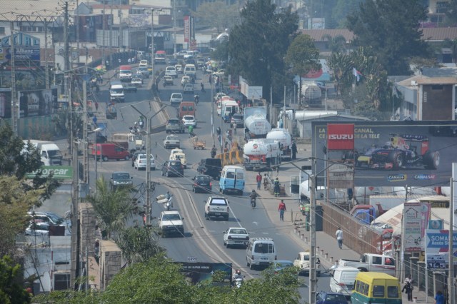
5. Traffic in Antananrivo, or Tana, can be problematic. This is light traffic.

6. Hilly Tana
Our tour route
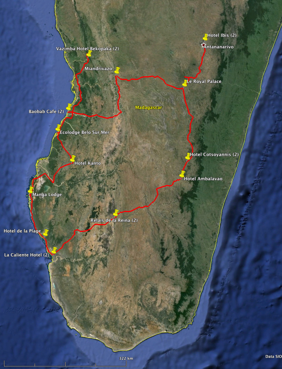
7. This was our route during the 18-day succulent plant tour. There are some small errors in my red route – but they are almost undetectable at this scale. Our hotel locations for the different nights are also shown. Dark green are the evergreen forests.

8. Color shaded relief map showing the topography of our route. The map is the same area as in the previous image. By comparing the two maps it is evident that the forested areas are mainly along the eastern escarpment where the prevailing southeast trade winds ascend.

9. Our route from one camera’s GPS positions. Arrows indicate our travel direction. I added a few points (red dots, not pins) on the route where we didn’t have GPS data from the cameras. Personal travel north and east of Tana is also shown (not part of our succulent tour)

10. Same as map above except showing Google Earth (or Bing) landscape view, dark green is eastern forests.
Our tour begins Tana-Tsingy-Morondava
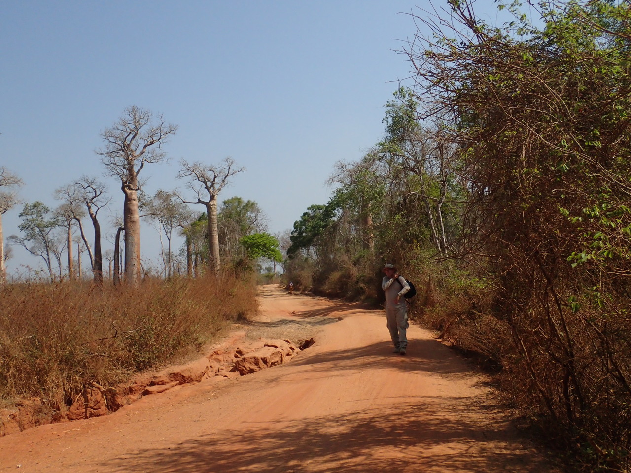
Day 1 10/9th The early days and the wonders of pavement
Our succulent plant tour began on a nice sunny day. All 3 cars and drivers were waiting for us at the parking lot of the Ibis hotel in Antananarivo. Luggage was loaded and people settled in the car of their choice and then we were off. It was exciting to be starting this tour and expectations of things to come were high. The first day was not too difficult and I should note that we were driving on a paved road, a luxury in Madagascar where many roads are not paved. Due to the lack of many succulent plant habitats between Tana and Mandrivazo, our destination for the night, this first day was not very productive and did not include many stops. The simple lunch (sandwiches, fruits) was next to the road.
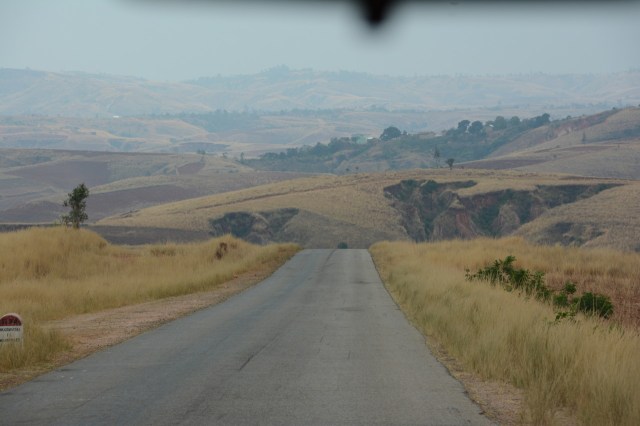
10.1 A good road in Madagascar
There was a stop at a good-sized town and we did not know why we had stopped. The group wandered around a bit and we checked out a shop or two. While at one of the shops we noticed the driver of our car was changing a tire. He was very quick about it, but my first thought was: is not this a bit early to start changing tires? Then Mike commented on the bad condition of the tires in all 3 vehicles. Little did we know that this would not be the last time car troubles/maintenance were part of the conversation.
As we drove on we started to appreciate the common elements that form part of daily life here in Madagascar. Examples include small shops next to the road, colorful butcher shops, people going about their daily business some carrying heavy loads, some heading for church, while others did laundry in rivers near the road.
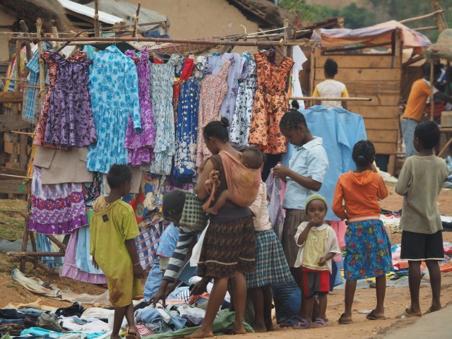
10.2 Colorful clothes for sale at a small road-side shop
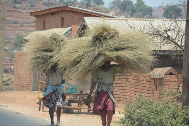
10.3 Carrying loads of stuff, a common sight in Madagascar.
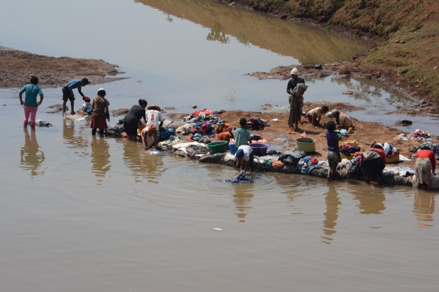
10.4 Laundry day

10.5 A wedding party? I like her serene demeanor and impeccably clean clothes. A bit out of place walking next to the road.
Common sights along the route were the rice paddies and fires, both important elements that have shaped the landscapes in many parts of Madagascar.

10.6 The omnipresent rice paddy.

10.7 Important modifiers of the landscape, fires are common during the dry season. The fires provide green grass for the cattle in the wet season. These fires are the main factor in preventing the regrowth of trees in many parts of Madagascar.
That afternoon we arrived at our hotel at 5:30 pm. Our hotel was a pleasant place, out of town, with nice views of the surrounding terrain and a swimming pool. The rooms were a bit warm but we managed. Dinner that night at the hotel was OK, although our food was a bit heavy with garlic. All inconveniences appeared minor since this was, after all, only the first day and we were finally on the road in Madagascar!

10.8 The restaurant at our hotel Pricesse Tsiribihina.
Day 2 10/10 A visit to an iconic place
Our breakfast was at 7 AM and this became the norm for most of the trip. Early this day we crossed the scenic Tsiribihina River, which was teaming with people doing laundry and cattlemen crossing with their cattle.

10.9

10.10 Laundry day at the Tsiribihina River
During one of the few stops that day we spotted an Adenia growing near the road, its thick trunk helped us spot it among the dry tangled vegetation. At this stop we also encountered local kids for the first time and they seemed curious and followed us while we looked around. This would become commonplace, as we were never very far from people during this trip.

10.11 Adenia olaboensis?

10.12 Closer view of the Adenia olaboensis trunk.
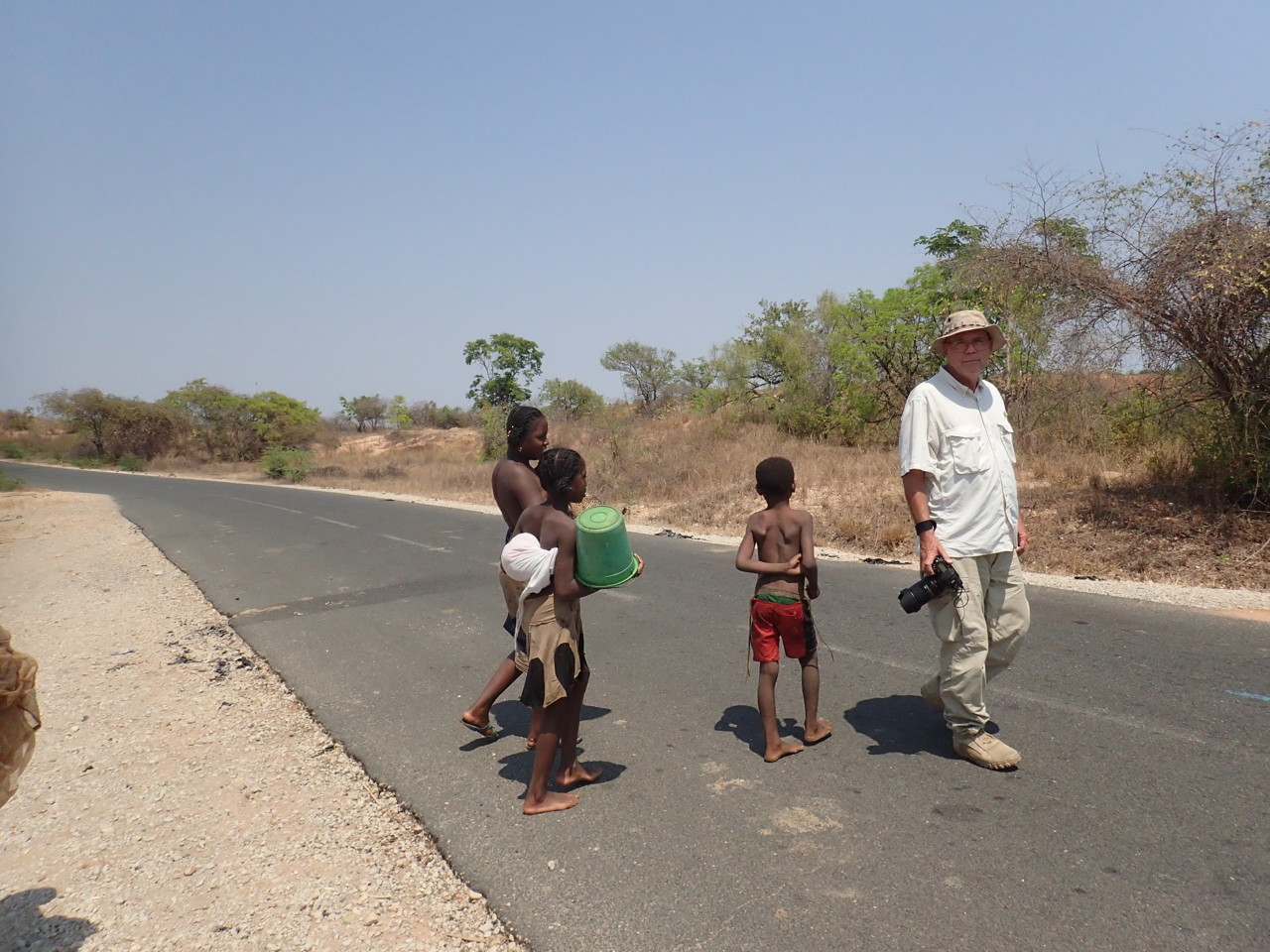
10.13 Mike and local kids.
As we headed for the Avenue of the Baobabs we ran into a cattle market next to the road. Cattle owners bring their cattle to be sold on certain days at these markets and there is plenty of activity to observe at these events.

10.14 Cattle market. I did not notice the lady when I took the picture, but it is unusual to have her in the picture given that everybody else in this photo is a man.
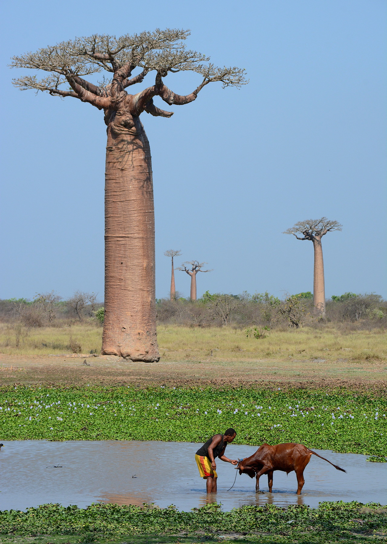
After some hours of travel on the paved road through uninteresting terrain (mostly burned or deforested) we eventually arrived near the coast and turned off the main road to visit the “Avenue of the Baobabs” near Morondava. A well-known landmark, the “Avenue of the Baobabs” appears in most travel guides and books about Madagascar. Most pictures do not show the people and human disturbance that is taking place very close to the trees.
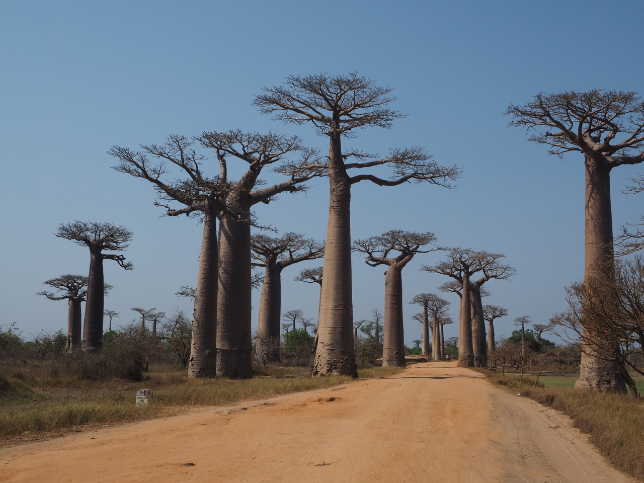
10.15 The Avenue of the Baboabs (Adansonia grandidieri) near Morondava.

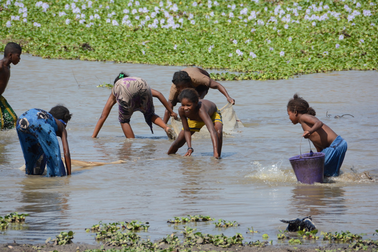
10.16 Local children fishing for frogs.
10.17 A closer view.
10.18 Unlike a protected park or reserve, the area surrounding this famous tourist attraction show many signs of human activity and disturbance.

10.19 The trees are old, note their size compared to people.
To be fair the trees were impressive, yet the whole experience was less enjoyable than expected due to the noticeable human disturbance around the site. There were people fishing for frogs, others were selling wooden baobabs while still others were just passing through with their cattle. People and cattle were abundant in the area and the tourists were there too although in a minority. Unfortunately our visit was not timed to experience this site with the best light for photography, but we were told we would come back through here and there would be another chance for photography.

10.20 Google Earth imagery centered on the Avenue of the Baobabs (small white arrow near center), Click for larger image. Note the pivot-irrigation fields and other rice paddies across the landscape.

10.21 Closer view of Google Earth imagery where you can see the individual baobabs. White arrow points out the small visitor hut where we took many pictures from. Seasonal ponds are greenish ovals.
Then it was time to head to Morondava and the Baobab Cafe, our hotel for the night. This hotel was in an interesting location next to a mangrove-lined channel with fishing boats steadily passing by. After a swim we joined the group for dinner at the hotel.
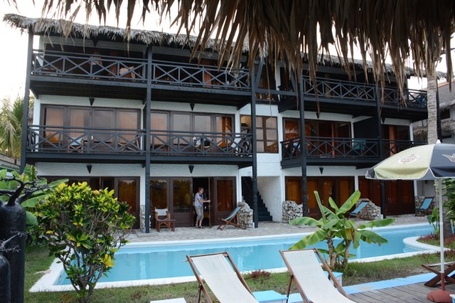
10.22 The Baobab Cafe, our hotel in Morondava.
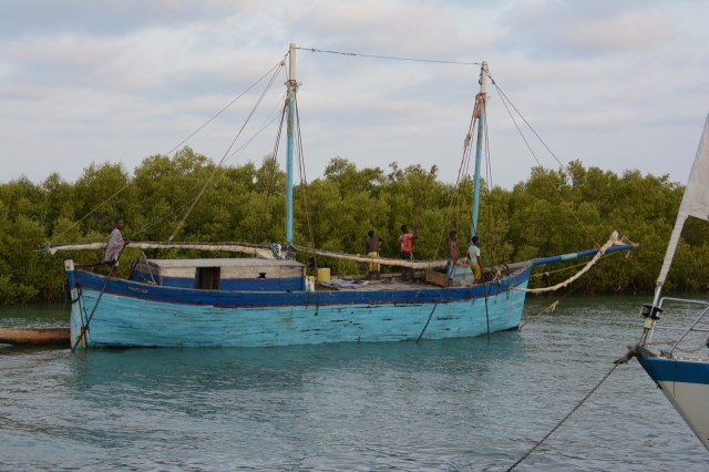
10.23 Many boats passed by the back of the hotel on the canal that led to the ocean.
Day 3 10/11 Our introduction to dusty Malagasy country roads
This was to be a long day on dirt roads with few stops. Two ferry crossings added to the novelty of the trip with the waiting, boarding, getting the cars in and out, getting off, local vendors, local people and other tourists. Ferry crossings were very busy places and this was a confluence point for locals and tourists alike.
10.24 Everybody waited at the ferry crossings.
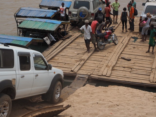
10.25 Cars, people, motorcycles, were all loaded on the ferry.

10.26 Passing another ferry heading in the opposite direction.
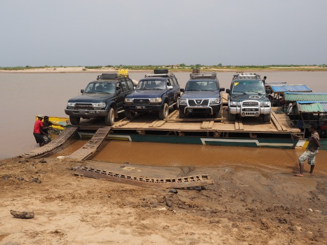
10.27 Our vehicles starting to leave the ferry on the other side
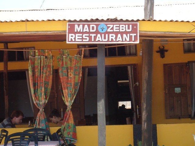
At the largest town on the route, Belo Tsiribihina, we enjoyed a very good lunch at a restaurant called Mad Zebu (Zebu are cattle in Madagascar and other tropical areas with a large hump – Brahman cattle).

10.28 Excellent smoked shrimp and vegetables at the Mad Zebu restaurant.
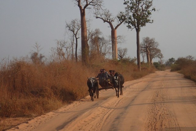
After lunch we continued on the dirt road passing near the Kirindy Reserve, a nice area where the trees were still standing. Along the way we saw interesting lizards a Cynanchum? and Aloe vaombe. As we continued on we encountered locals either on foot or on their zebu-drawn carriages. In spite of my stubborn migraine headache the sights and landscapes observed up to this point were novel and interesting.

10.29 Even on these roads we ran into people and their carriages.

10.30 Rosario on a side road near the Kirindy Reserve. This is probably relatively undisturbed dry forest at the end of the dry season.
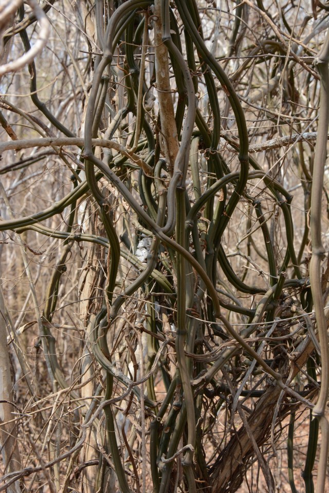
10.31 A Cynanchum? growing near the road.
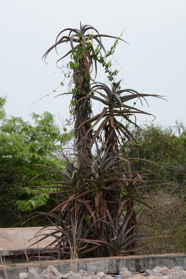
10.32 Aloe vaombe growing near a tumb next to the road.

10.33 Madagascar spiny-tailed iguanid (Genus Oplurus) resting on the tomb.
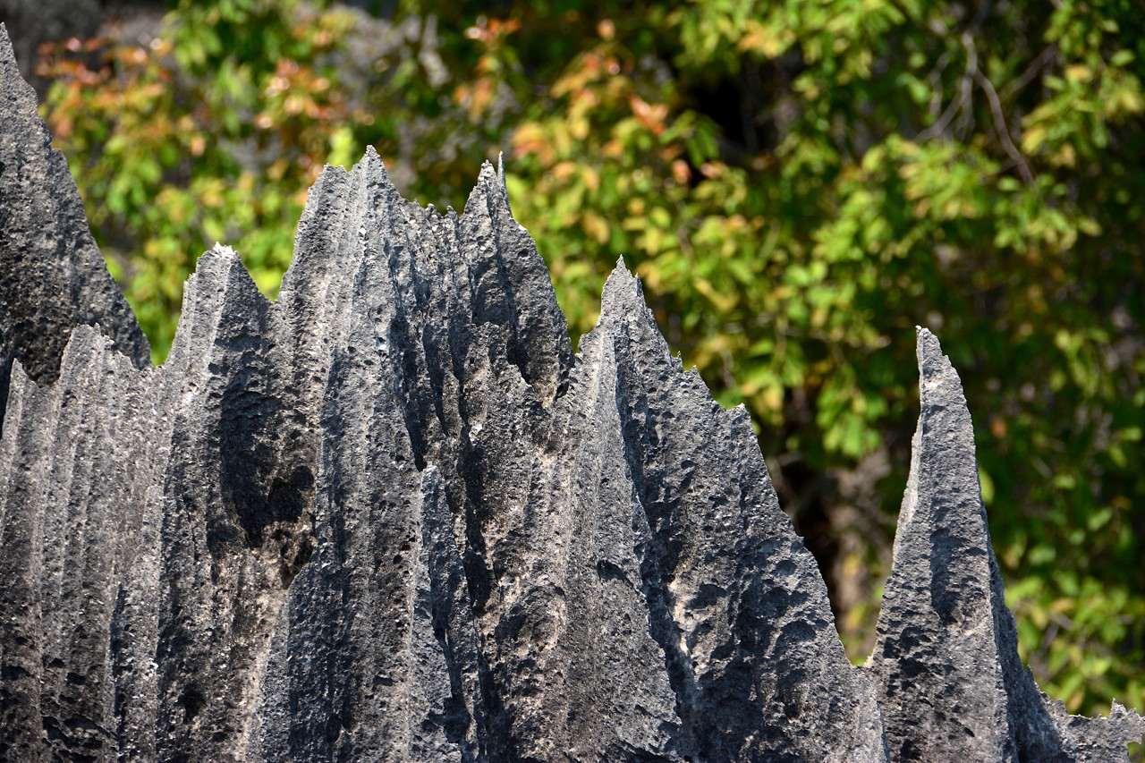
By the time we arrived at our hotel we were all fairly dusty and ready for a break. The hotel consisted on individual bungalows and there was a swimming pool and a restaurant. After a swim we joined the group for dinner. On the way to our rooms after dinner Mike spotted a chameleon on a shrub near the restaurant. They appear white in a flashlight’s beam. It had a been a long day but anticipation was in the air for the next day we would visit another landmark, the Tsingy de Bemaraha Strict Nature Reserve.
Day 4 10/12 A silver lining day
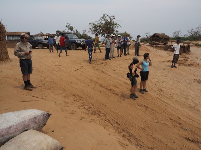
By early morning, the stomach pain that had started the previous night before dinner, had evolved into a very bad case of diarrhea and vomiting. In spite of this, I decided to go with the group in the hope that I would make it. I did not know that we were an hour away (about 8 miles as the crow flies) from the park entrance at the Tsingy. If the road the day before was bad, the road from our hotel to the Tsingy of Bemaraha park entrance was even worse. Upon arrival to the park we met our guide TV (we would later learn that he was to be our botanical guide and would travel with us for the rest of our Madagascar tour) and he proceeded to explain the “circuit” as guides in Madagascar like to refer to the various routes/trails one can walk in Madagascar national parks.

10.34 The circuit or trail at the Tsingy.
By then, I realized that I had made a mistake in coming to the park and I asked our tour operator if our driver could take me back to the hotel. His response was a loud and short “out of the question”. I tried to start the trail but very soon it became clear that I was too sick to go on so I returned to the car and resigned myself to wait for the rest of the group to return. Before turning around I convinced Mike to go on with the group. After about an hour waiting in the car I must have looked pretty awful because at this point our driver spoke to me for the first time. He said to me in French that he felt sorry for me and could not let me wait for hours in the car given my condition. He offered to take me back to the hotel, but I hesitated at first – remembering the “out of the question” comment. He persisted, and in the end I accepted so we started the long way back.
I survived the ride back, but as soon as I got out of the car I experienced a violent bout of vomiting. After getting to my room with the kind help of the driver I was able to get some badly needed rest while waiting to get better. Other members had issues with food related health problems through out the trip, yet I am not sure if anyone else got sick enough to have to skip an outing as was my case.
Sometime by mid-afternoon Michael came back from the Tsingy and he appeared exhausted. His first words were: “you are lucky you were sick and did not go on the hike to the Tsingy”. Thus even though I regretted missing the Tsingy, there may have been a silver lining to my story since the hike turned out to be no picnic for people with short legs and or knee problems like me. Due to a congenital condition, steep angles and excessive bending of my knees while hiking or sitting can lead to sharp and long-lasting pain.
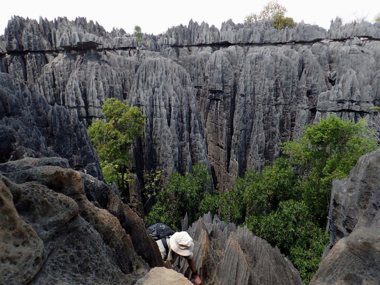
Mike’s comments: The hike through the Tsingy, though only something like 4 km total distance, took 4 hours and involved climbs up and down limestone cliffs via wire ropes where the participants wore their harnesses. In fairness, the harnesses probably weren’t necessary for many people – just a safety precaution in case you slipped (and then fell and died).

10.35 Google Earth imagery of area of our Tsingy hike. White arrow shows parking area/start of hike, with red pins being some GPS photo locations. Black areas are the Tsingy limestone formations, dark green are forested areas in Tsingy canyons. This appears to be only easily accessible Tsingy – despite the formation extending for many miles north and south of this location. Most of the succulents were seen near the two pins closest to the parking area.

10.36 TV explaining about the limestone rocks.

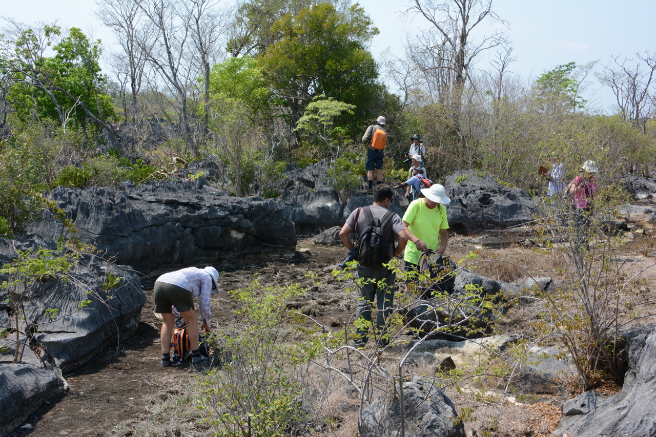
10.38 Our group looking around before the hike got a bit tougher.
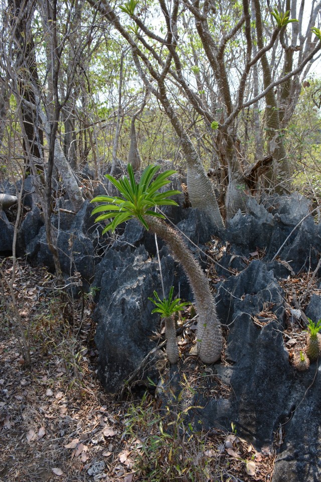
10.39 Pachypodium lamerei growing on the limestone.
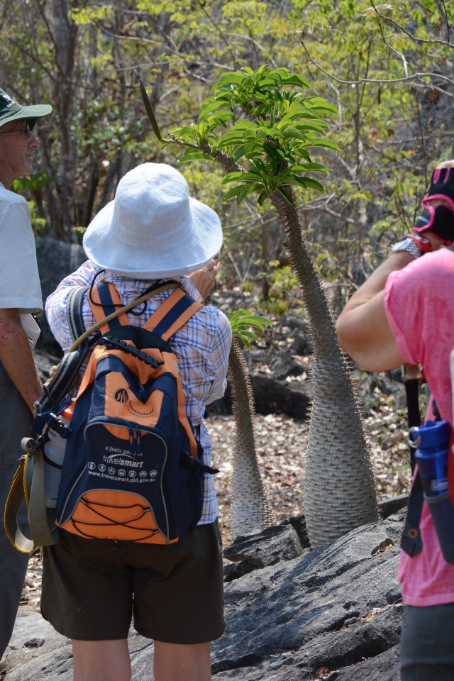
10.40 Photographing Pachypodium lamerei.
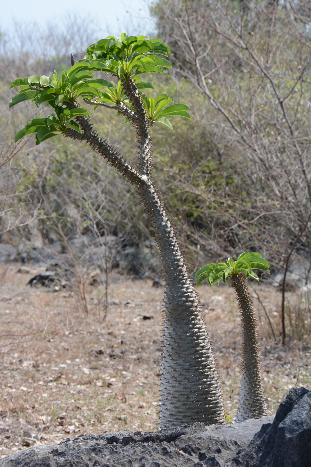
10.41 Pachypodium lamerei
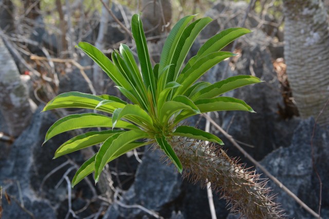
10.42 Closer view of the Pachypodium leaves.
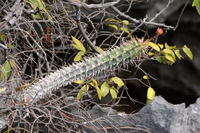
Some of the other succulents we saw before the trail became more difficult were: Euphorbia opuntioides, Adenia sp. Euphorbia milii and another Euphorbia and an orchid.

10.43 Impressive rocky landscapes.

10.44 Euphorbia opuntioides

10.45 Adenia sp.
10.46 Euphorbia milii.

10.47 Euphorbia sp.

10.48 Terrestrial orchids
Some of the animals encountered during the hike included Decken’s Sifaka, Brown Lemur, Madagascar Iguanas, a chameleon and a mongoose.

10.49 Madagascar iguana (Oplurus cyclurus)
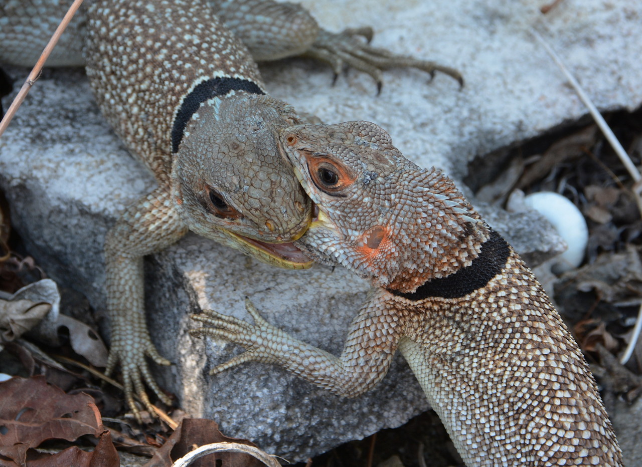
10.50 Two fighting Oplurus. They were oblivious to me (Mike) while I photographed them.
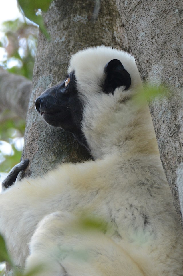
10.51 Decken’s Sifaka.

10.52 A Brown Lemur.
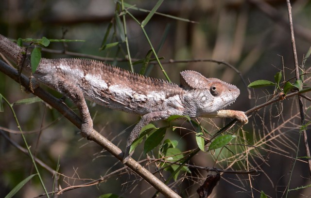
10.53 A chameleon.

10.54 Closer view.
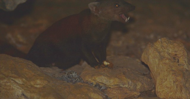
10.55 A Ring-Tailed Mongoose The photo is terrible, but my flash didn’t work well and I couldn’t compose well in the darkness. This image has been greatly brightened – the only interesting thing is the Mongoose’s canines!
After about an hour and a half our guide mentioned that we were at a point where the trail would get steep and people fearing heights or the steep hike could wait. Two people decided to wait. The rest of the group then proceeded and eventually, after considerable scrambling, we climbed up steep steps, perhaps 50-100 ft, with the aid of the harnesses. Here we reached a wooden platform where we had a panoramic view of the Tsingy. From this platform we could take photos safely and with “slightly less rush” than during the hike. I say slightly less rush because the platform was not large enough to hold more than 4 or 5 people and as other groups were coming there was not unlimited time.

10.57 Ladders were necessary.

10.58 Heading up.
10.59 The hike continues.

10.60 More ladders.
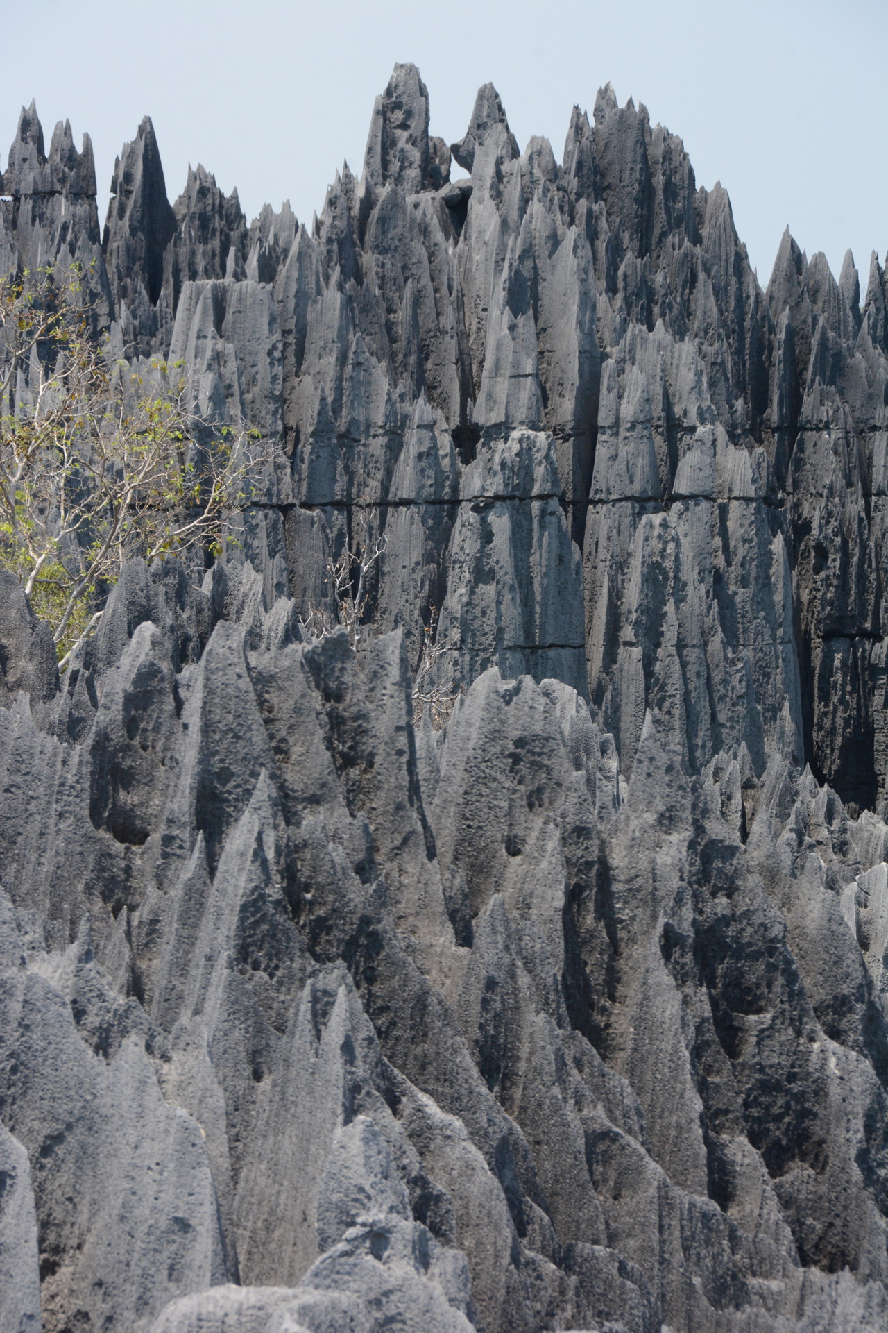
10.61 Nice limestone formations.

10.62 Pachypodium lamerei.

10.63 This was a small platform.

10.64 The bridge you see in many books about Madagascar.

10.65 The rocks can be sharp.


10.67 The group making slow but steady progress.
Then we descended to the bottom of a Tsingy “canyon” where we had lunch. It was much cooler (about 75F in the canyon bottom, where sunlight barely reached. However, some of us had run out of water by that time. Then there was scrambling on all 4’s to go through short cave passages to continue on the trail. The final stretch was through fairly uninteresting grassland/deciduous forest devoid of many succulents.

10.68 Now it is time to head down.

10.69 A narrow trail.

10.70 The canyon provide a cooler shadier area.
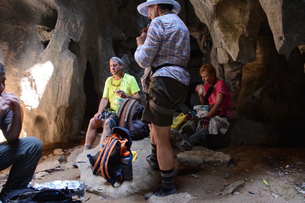
10.71 Lunch was eaten in near silence – we were all quite tired by this point
By the time we were well into the Tsingy the temperature was about 90˚F (32˚C) at the top of the limestone, so we ended up being quite thirsty, despite us all carrying 1 liter water bottles. The real disappointment of this hike was that the interesting succulents (Pachypodium lamerei being the main one) were seen before getting to the difficult part of the hike, and that they were not seen on the return part of the trail.
In other words, most of the difficult hike wasn’t necessary – if you just wanted to see the succulents. We weren’t given a choice or informed of this possibility. Of course, most tourists come to the Tsingy not to see the succulents, but to experience the steep climbs and rough limestone landscapes. Thus, our tour guide (TV) did what he thought most tourists expected to do – rather than what our group was supposed to focus on.

10.72 Our exit from the difficult part of the Tsingy trail was through a nice forest patch surrounded by Tsingy
We all assembled for dinner that evening. Most likely everyone was looking forward to getting some rest that evening.

10.73 A colorful Madagascar gecko emerges near our dinner table, back at the hotel.
Day 5 10/13 Gear shifting problems
On this day we returned to Morondava. So we were very quickly back on the dusty road, repeated the ferry crossings, the good lunch at Mad Zebu and again experienced a fresh set of car problems.

10.74 Ferry crossing on the way back to Morondava
Except for our lunch stop at Mad Zebu, most stops were short. Some of these stops included a 23 minute stop near the Kirindy Reserve when our car’s problems became too serious to ignore. Another stop was in an area where Baobabs began appearing.
10.75 A very good restaurant in an out of the way location.
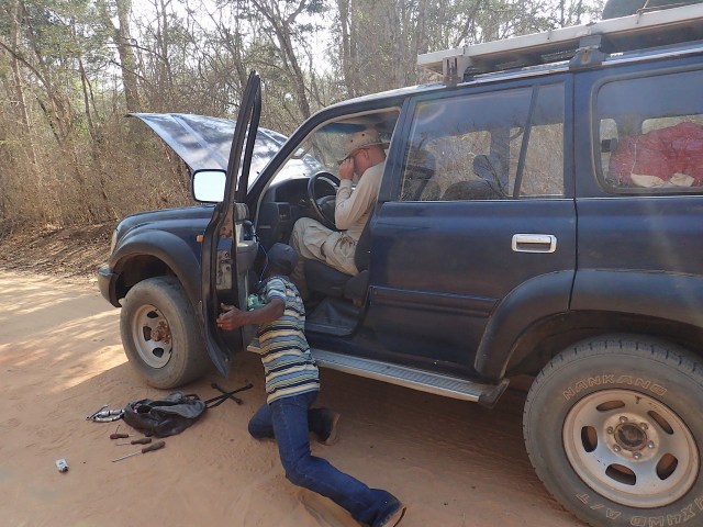
10.76 Our driver trying to get the clutch to work-despite leaking clutch fluid. It eventually failed – the driver could not shift.

10.77 Car trouble stop near the Kirindy Reserve.
10.78 The road and young baobabs. Note that these baobabs are only visible because the surrounding forest has been cut down.
Along the way we saw locals traveling in zebu- drawn carriages and in some areas we ran into small fires.
10.79 Children riding a zebu-drawn cart. Also, more baobabs standing exposed.

10.80 Fire. There were many birds attracted presumably to insects escaping the flames.
Nice examples of baobabs appeared as we got closer to the Avenue of Baobabs, but at this point our vehicle had developed a leaking clutch fluid line and the clutch stopped working – making stops very undesirable.

10.81 Adansonia grandidieri on the road as we get closer to the Avenue of the baobabs.
Eventually our driver could not change gears without stalling the car so not only did we miss a stop that the other two cars made to see the two embracing baobabs just off our route, but we were also unable to stop when we drove through the Avenue of the Baobabs at a time in the afternoon when the light was better for photography. We could not communicate with the other two vehicles to let them know we were not stopping since cell phones did not work in that area and we did not have walkie-talkies.
We returned to the same Baobab Café Hotel in Morondava and dinner was again a slow 2-hour affair.
