Summary: This page describes a trip to various state parks and preserves from Texas to the Florida panhandle, thence northwards to northern Alabama and westward again back to Norman. As always on this website, we will try to make the material less of a “personal vacation” summary and more a description of aspects of the parks that we visited that would be of general interest to any natural history traveler.
The places we visited and the reasons for visiting them are given below. The numbers in parentheses are the number of nights we stayed at each location.
Meridian State Park, TX (1)
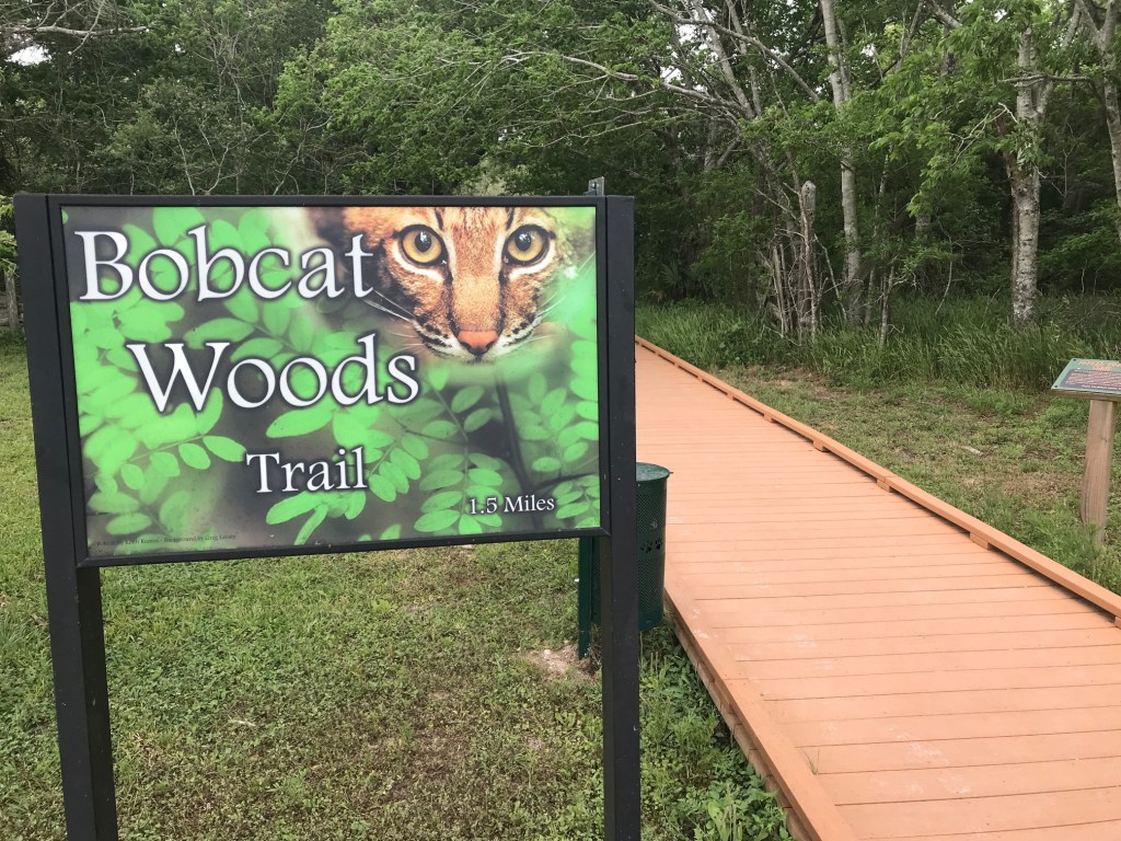
Brazos Bend State Park, TX (3)
Bolivar Flats Audubon Sanctuary, TX
High Island Audubon Sanctuaries, TX (3)
Pevito Woods, LA:
Palmetto Island State Park, LA (2)
Chicot State Park, LA (2)
Buttercup Flats, Desoto National Forest, MS.
Big Biloxi Campground, Desoto National Forest, MS (2)
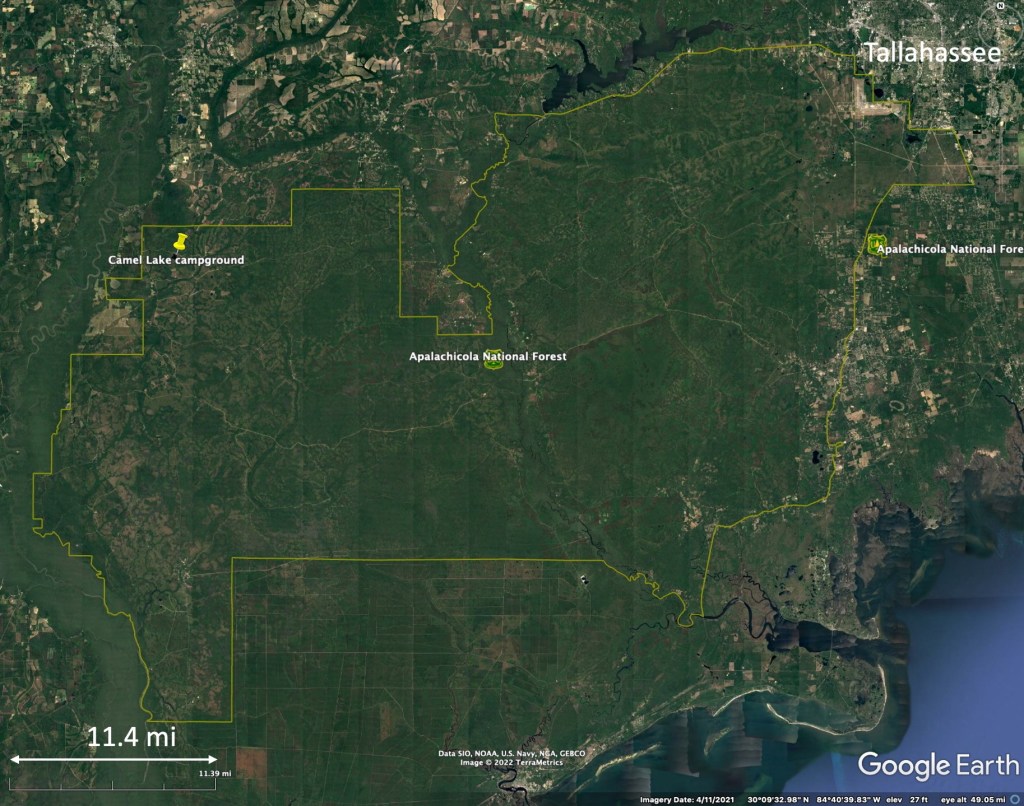
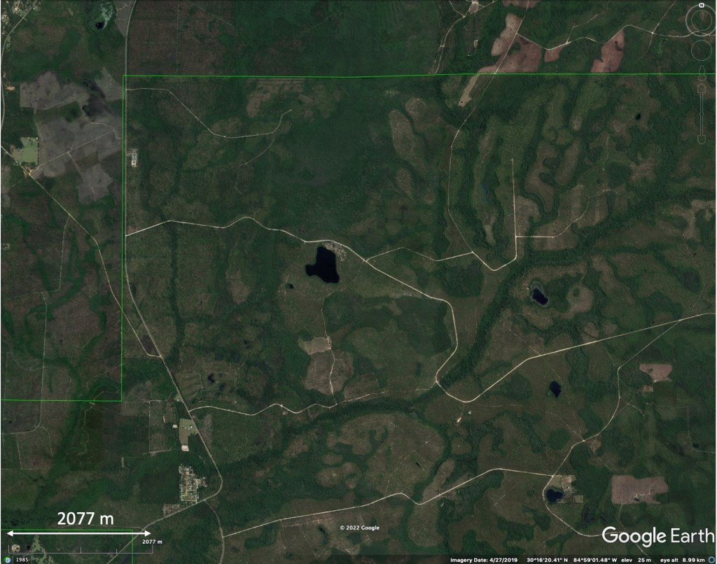
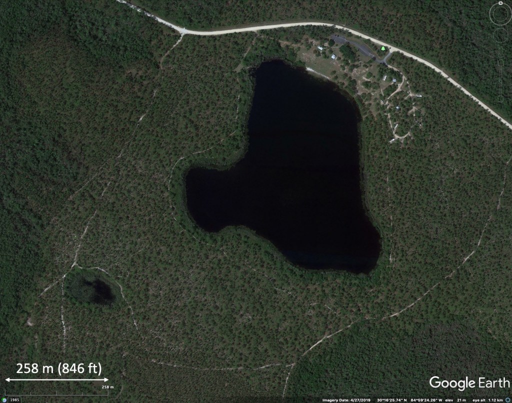
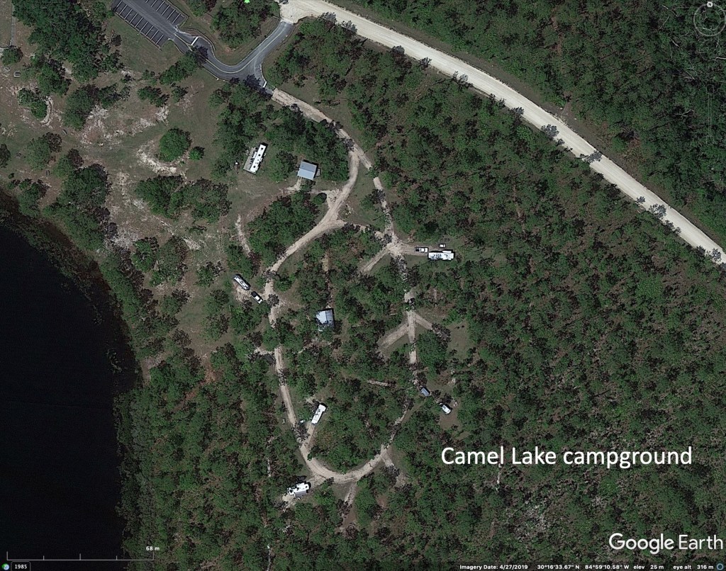
Camel Lake Recreation Area, Apalachicola National Forest, FL (3)
Cheaha State Park, AL (2)
Meeman-Shelby Forest State Park, TN (2)
Lake Sylvia, AR (1)
Beavers Bend State Park, OK (1)
Purpose of the trip
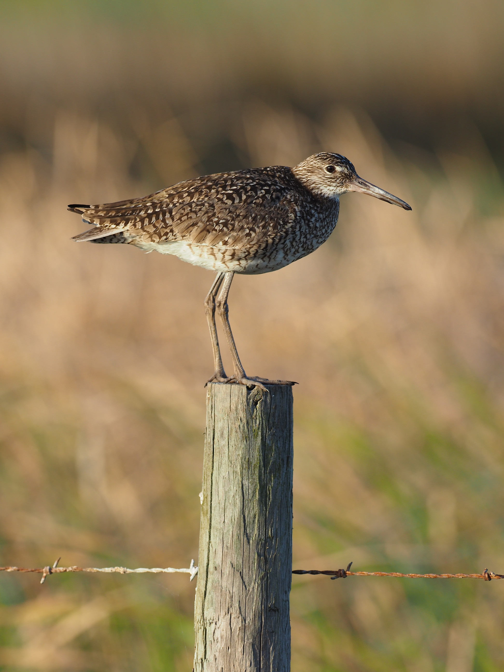
The rationale for the trip was to see birds arriving into the southern US during their spring migration. This is well-known along the Texas coast at High Island, where suitable weather conditions sometimes favor “fallouts” with huge numbers of northward migrating birds stopping after crossing the Gulf of Mexico. We did not experience a “fallout” during our trip, but did see, in various locations, many of the birds we had been hoping to see.
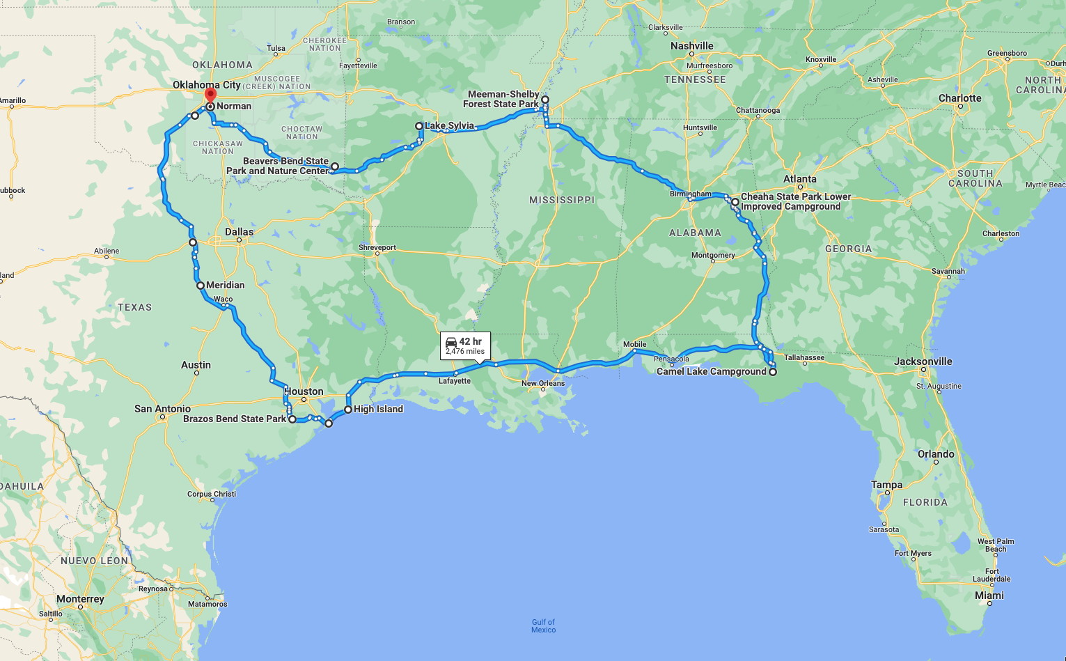
The details of our route are probably unimportant for most readers of this site – they depended on our departure point of Norman, Oklahoma. But the material we mention about specific state parks or other locations may be of value to the general nature-oriented traveler who finds themselves passing through the southeastern US. More details of any of these locations can be found in any Google search, but some of our perspectives will be unique to our interests, and unlikely to be found in online searches.
Some notes on the logistics of our travel
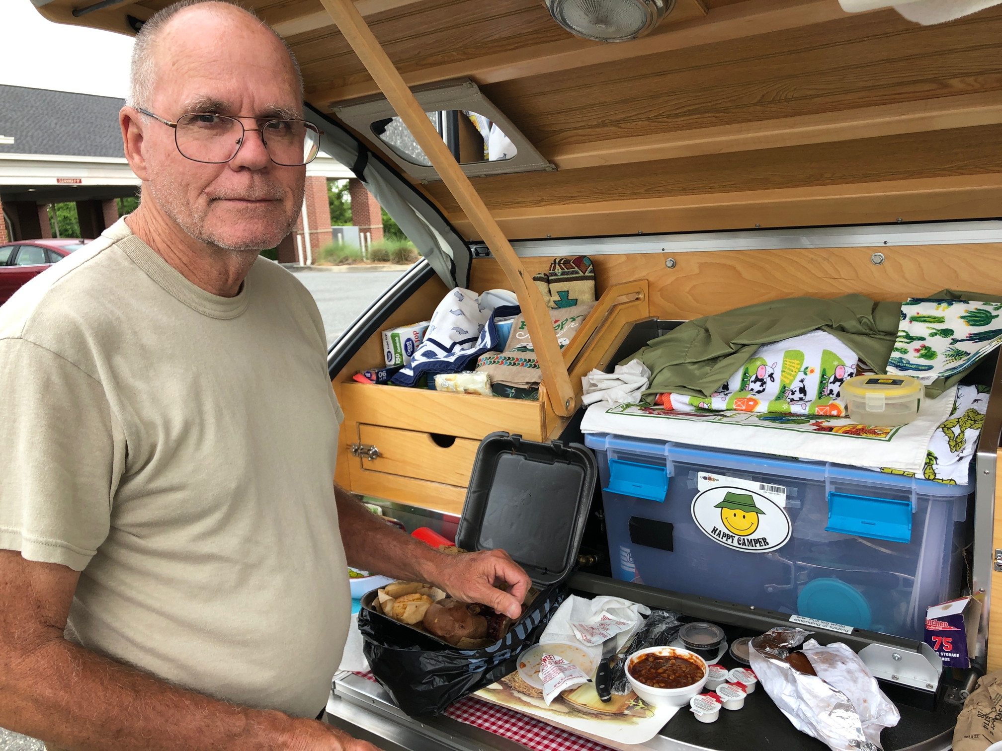
We generally camped in State Parks wherever possible, or in developed campgrounds in national forests. Compared with years ago, we have noticed an increase in the number of large recreational vehicles (RV’s) (large towed trailers or buses) that are populating developed campgrounds. This is unfortunate for the natural history traveler, since the large RV’s generally are associated with more campground noise (dogs, radios, TV’s, large air conditioning units etc). We try to select more isolated sites in such campgrounds (reservations are normally made online) but one cannot really predict who will show up at the last moment and occupy the site next to yours. We dislike campground fire smoke and this seems impossible to avoid in forest parks – it seems that many people camp primarily to have a fire.
Our route
Norman, Oklahoma, is claimed to be “centrally located”. Some might say that this means you have to drive 500 miles to see anything interesting! We won’t be quite that harsh on the central US, but it is a long way from interesting destinations in either the eastern or western US. A trip in either direction necessitates a long drive, often through less-the-interesting landscape dominated by ranch land or agricultural fields.
The challenge of any driving trip is to identify desirable places to visit while managing the daily driving distances so that such a trip doesn’t become a marathon. Some people, in suitable vehicles capable of traveling the freeway speed limits, feel comfortable driving 500 miles a day. Others drivers, either towing large trailers, or driving vehicles that are not as comfortable at freeway speed limits, may want to drive no more than 300 miles a day. A relaxed trip requires either having short driving distances each day or fewer long drive days, with more time at each stop.
An all-to-common situation for naturalists on a driving vacation is to discover, en-route, a great location that you cannot stay near because you’ve already made reservations somewhere else for the night. This happens on virtually every trip we take. No matter how carefully one plans stops and nightly reservations, weather, or some other factor, may force you to make modifications. While weather, such as all-day rain, might have the greatest impact on outdoor activities, other events also can force travel changes. Heavy traffic or road construction can add hours to some routes, while an unforeseen festival can fill every campground or hotel for many miles near your destination. Or your itinerary puts you on a weekend near a desirable park – where everyone from a nearby large metropolitan area is also heading. So much for peace and quiet under such conditions.
Our trip was designed to maximize time in locations suitable for nature observation. These are usually parks or campgrounds in national forests because you are surrounded by interesting features. Even a nearby town with hotels isn’t nearly as good because you can’t hear the nighttime sounds or early morning birds calling.

A summary of the main areas we visited and the rational for visiting them follows.
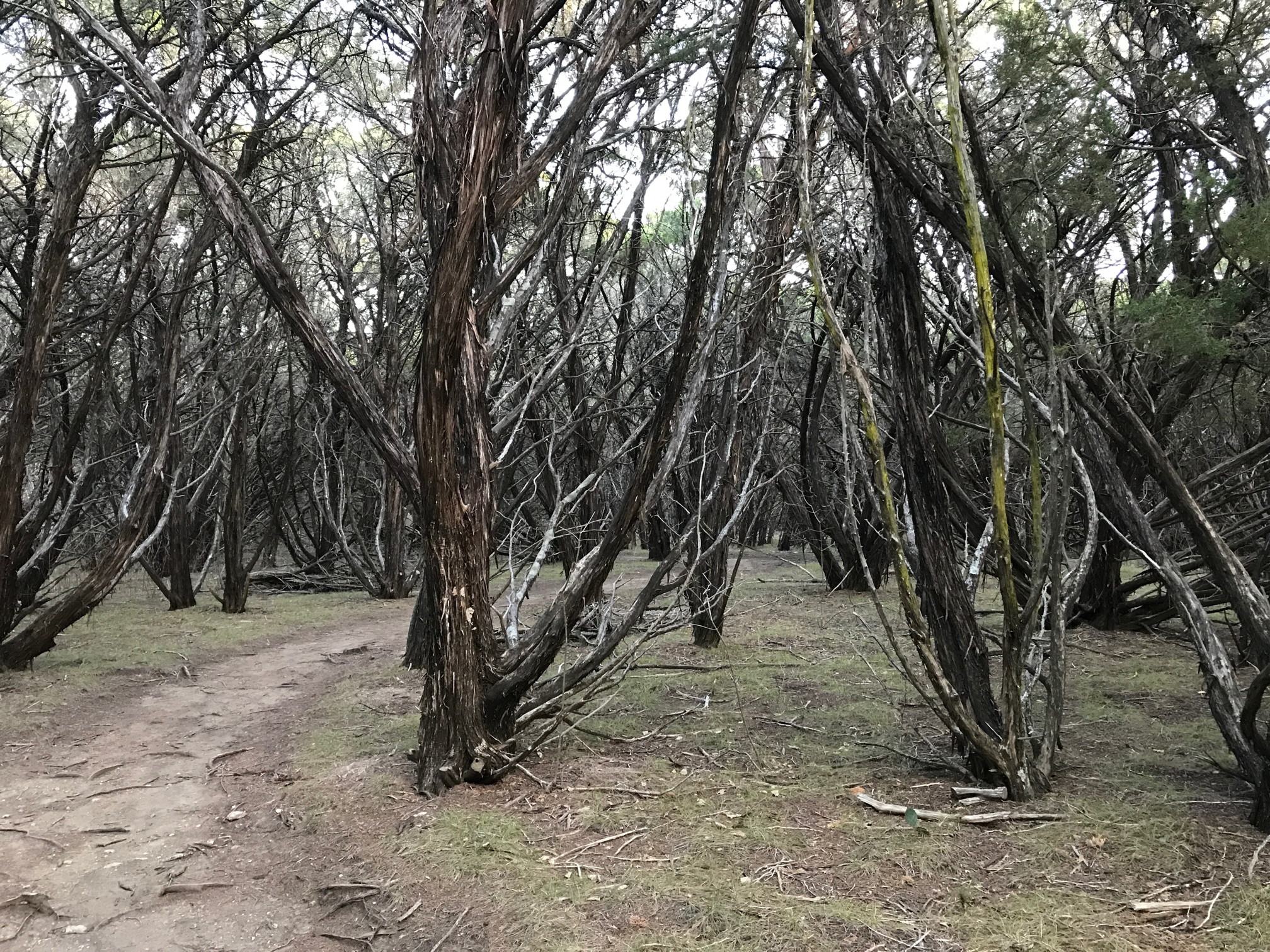
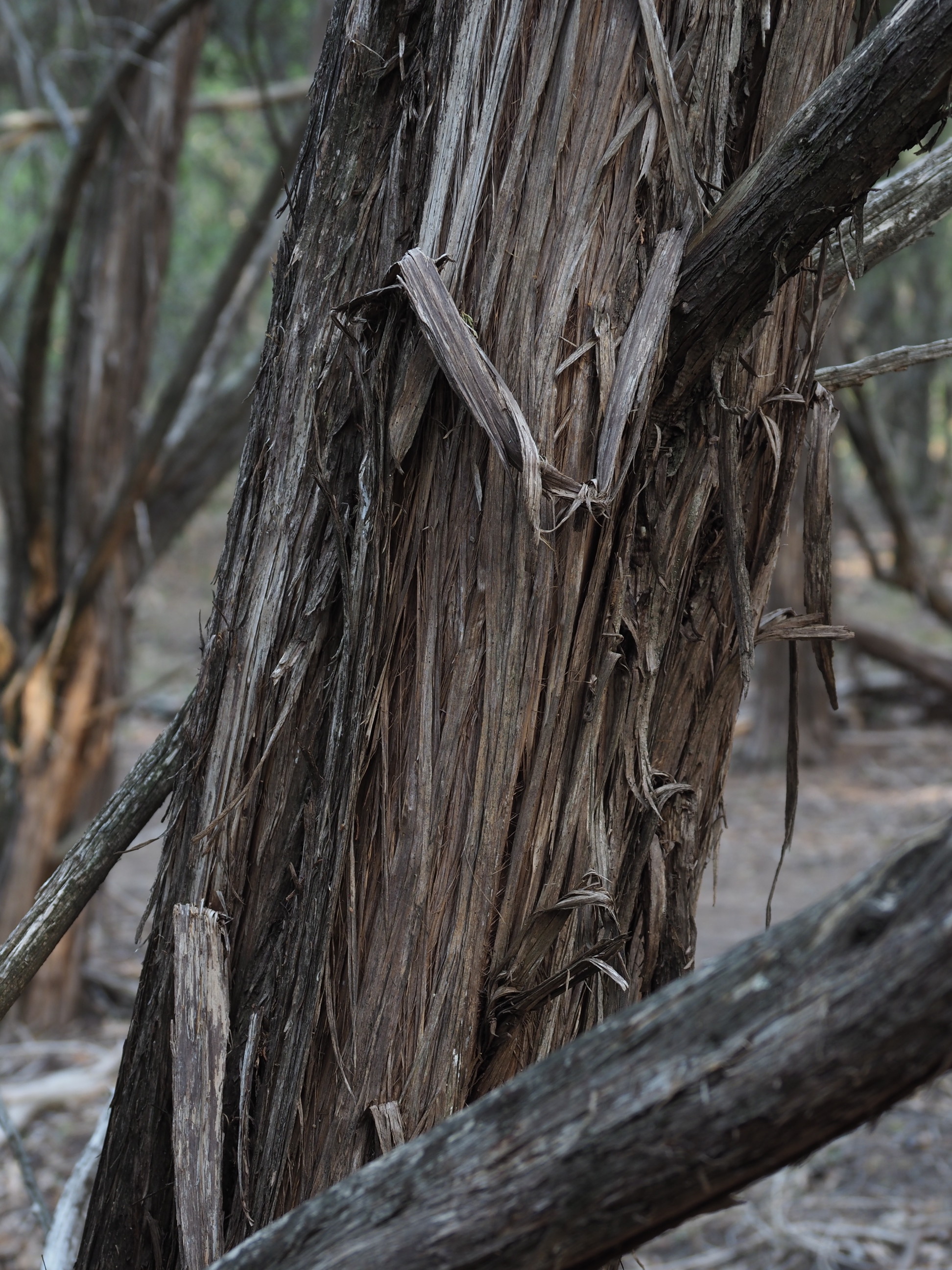
Meridian State Park
We visited this small Texas State Park because it was known to host nesting Golden Cheeked Warblers in specific Juniper-Oak woodlands at the northern end of the Texas Hill Country. We walked a several mile nature trail but saw no warblers. However, the park was interesting and the route to the park avoided the heavily traveled I-35 freeway and driving through the Ft Worth area. It also broke our journey into two shorter segments, rather than one long drive of 500 miles to the Brazos Bend State Park, south of Houston.


Above are images from Meridian State Park. Click on the images for corresponding text.
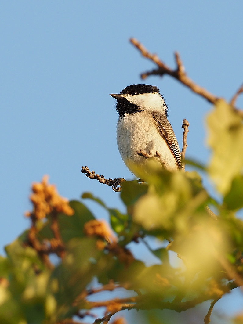
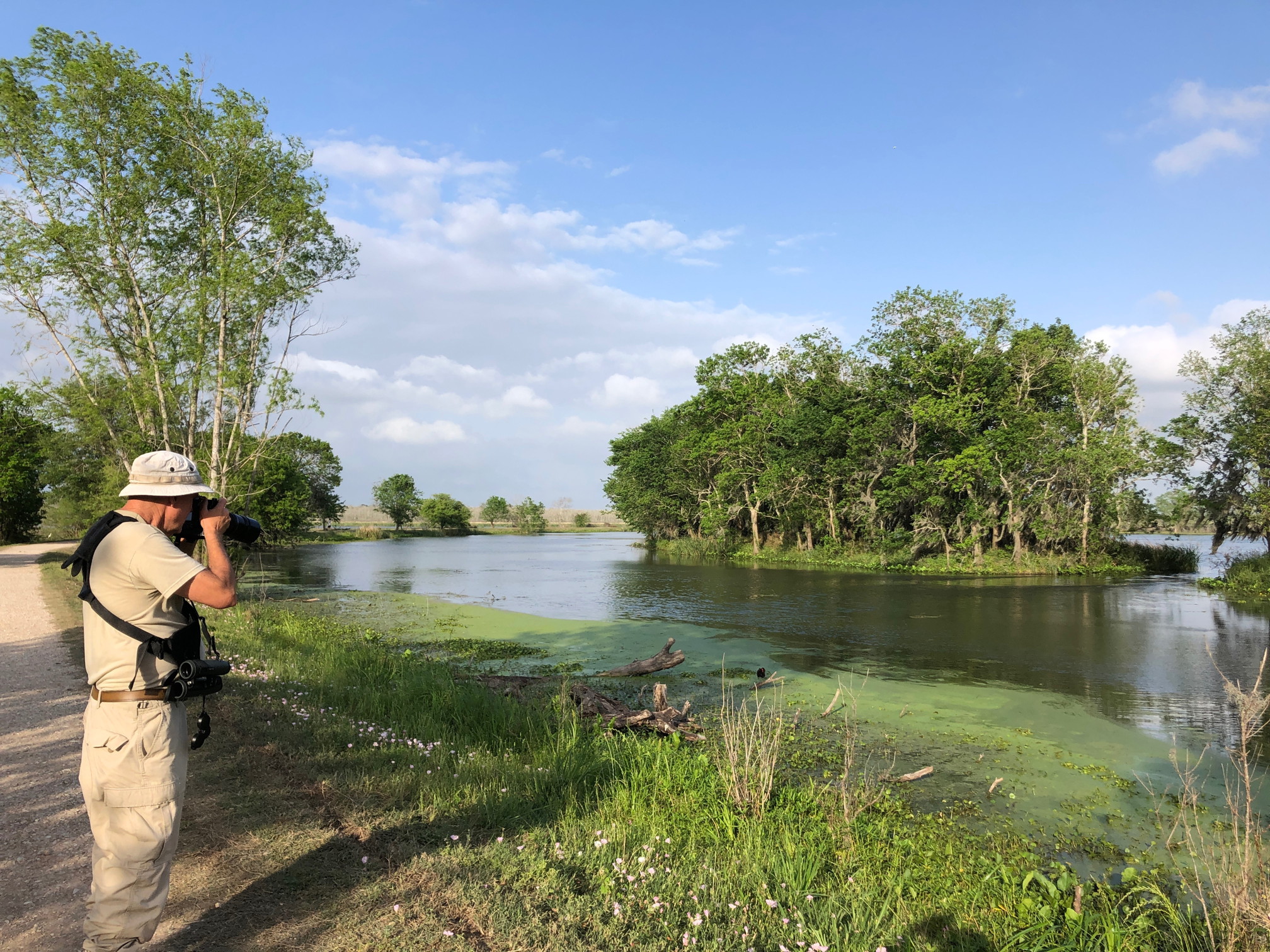
Brazos Bend State Park
Despite Texas having a reputation for everything large, its state parks tend to be small in area. Brazos Bend is a relatively large Texas state park – but it is only about 4 by 2 miles. It is only 30 miles southwest of downtown Houston as the crow flies and thus is full on most weekends. Knowing this, we timed our three-night stay for weekdays. We made a one day trip to visit two nearby national wildlife refuges – Brazoria and St Bernard.

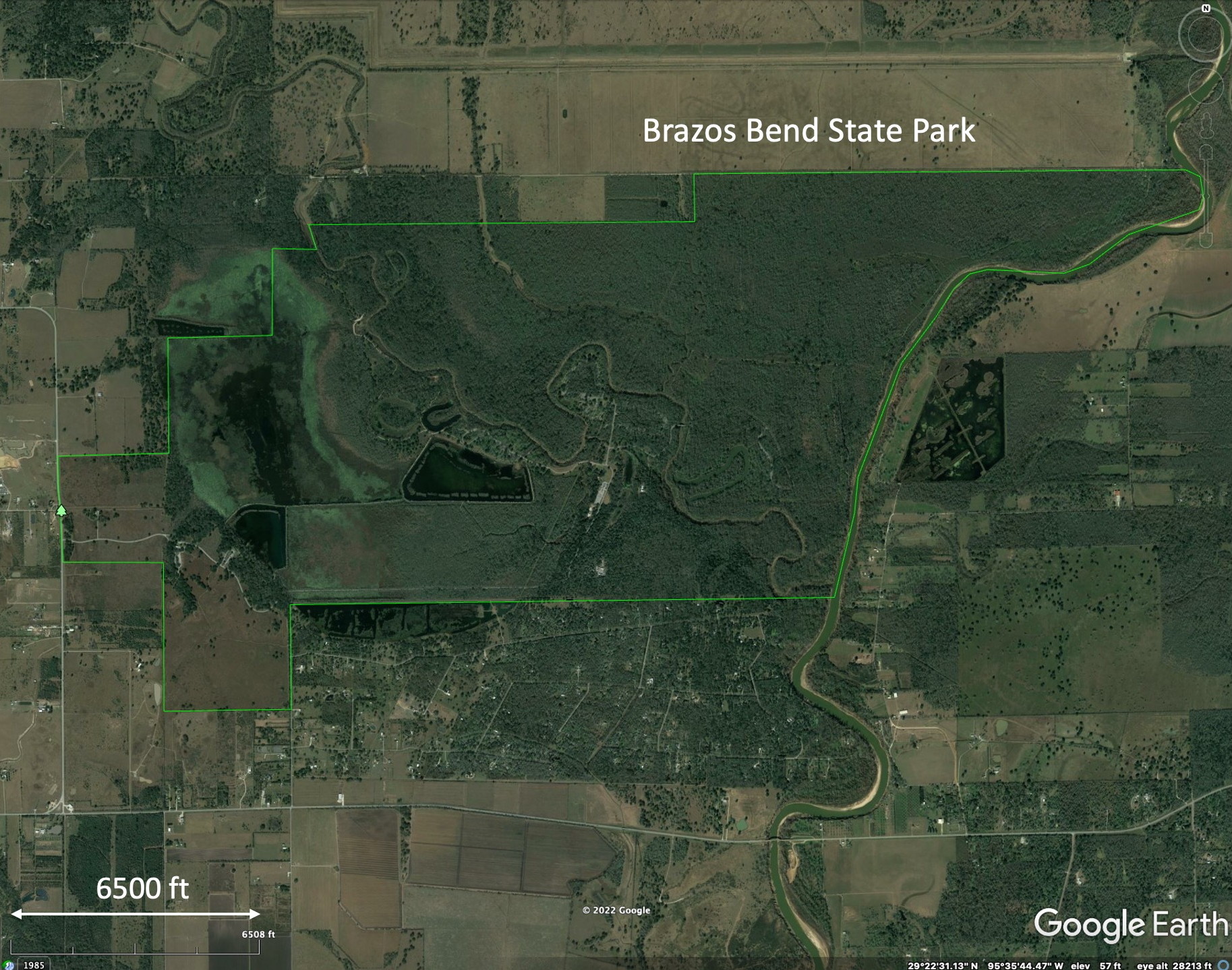
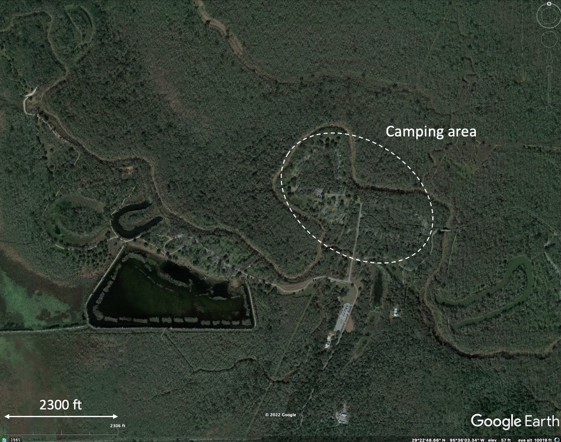
Above: Google Earth imagery showing the location of Brazos Bend State Park southwest of Houston and its setting surrounded by agricultural fields or ranch land. The last image shows the camping area immersed in the forest.
Below: Some photos from Brazos Bend. Click on any image to see text that explains the image. Then step through the images (with small arrow at right).


Bolivar Peninsula
The Bolivar Peninsula is a barrier island” that stands between the Gulf of Mexico and Houston. There are no state park campgrounds on this peninsula so an RV park was needed for three nights. Day trips were made to High Island to the east and to the Bolivar Flats coastal area to the west.
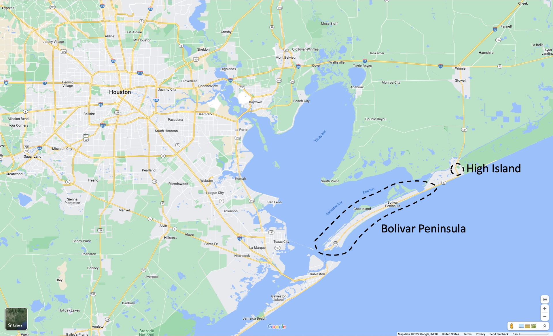

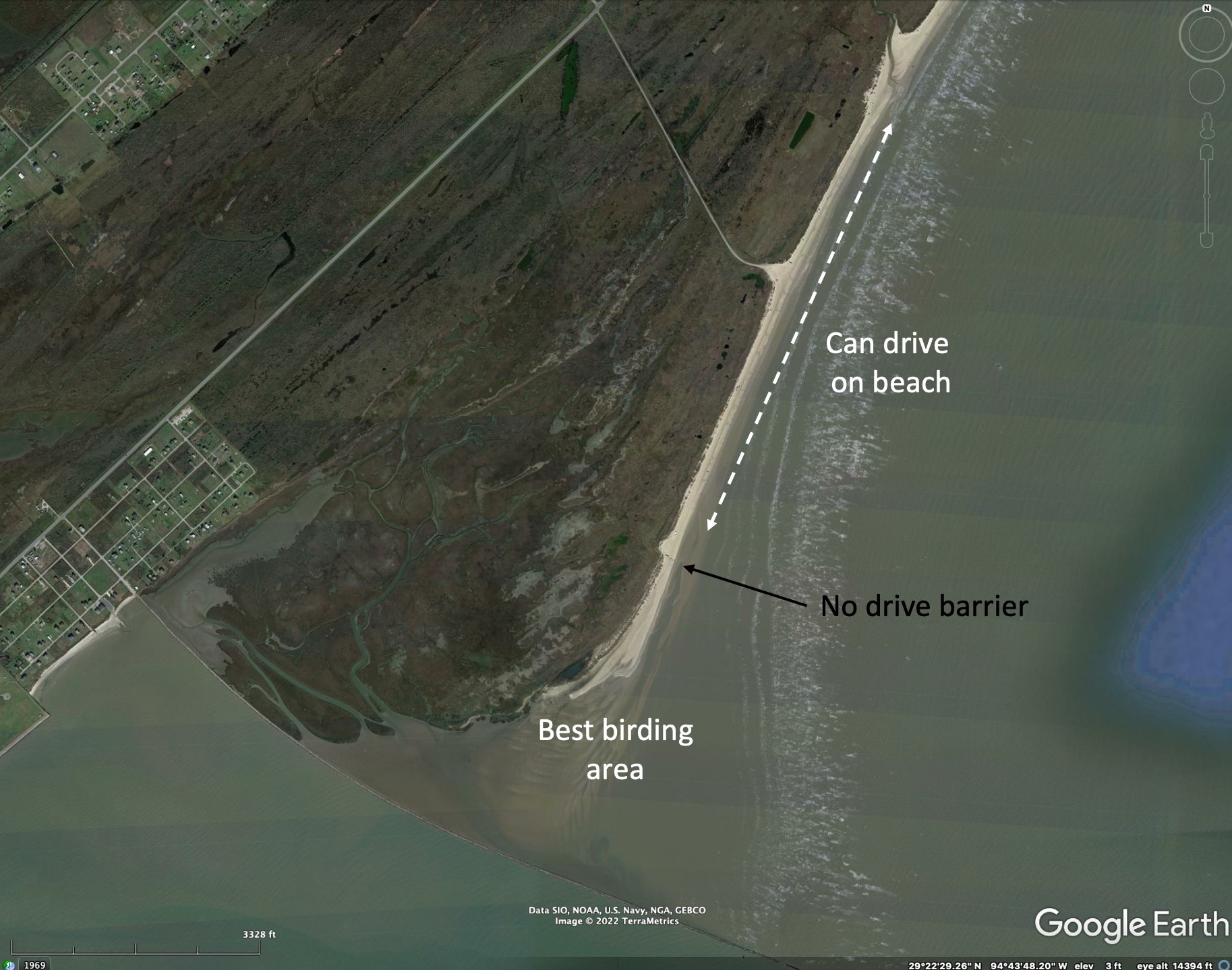
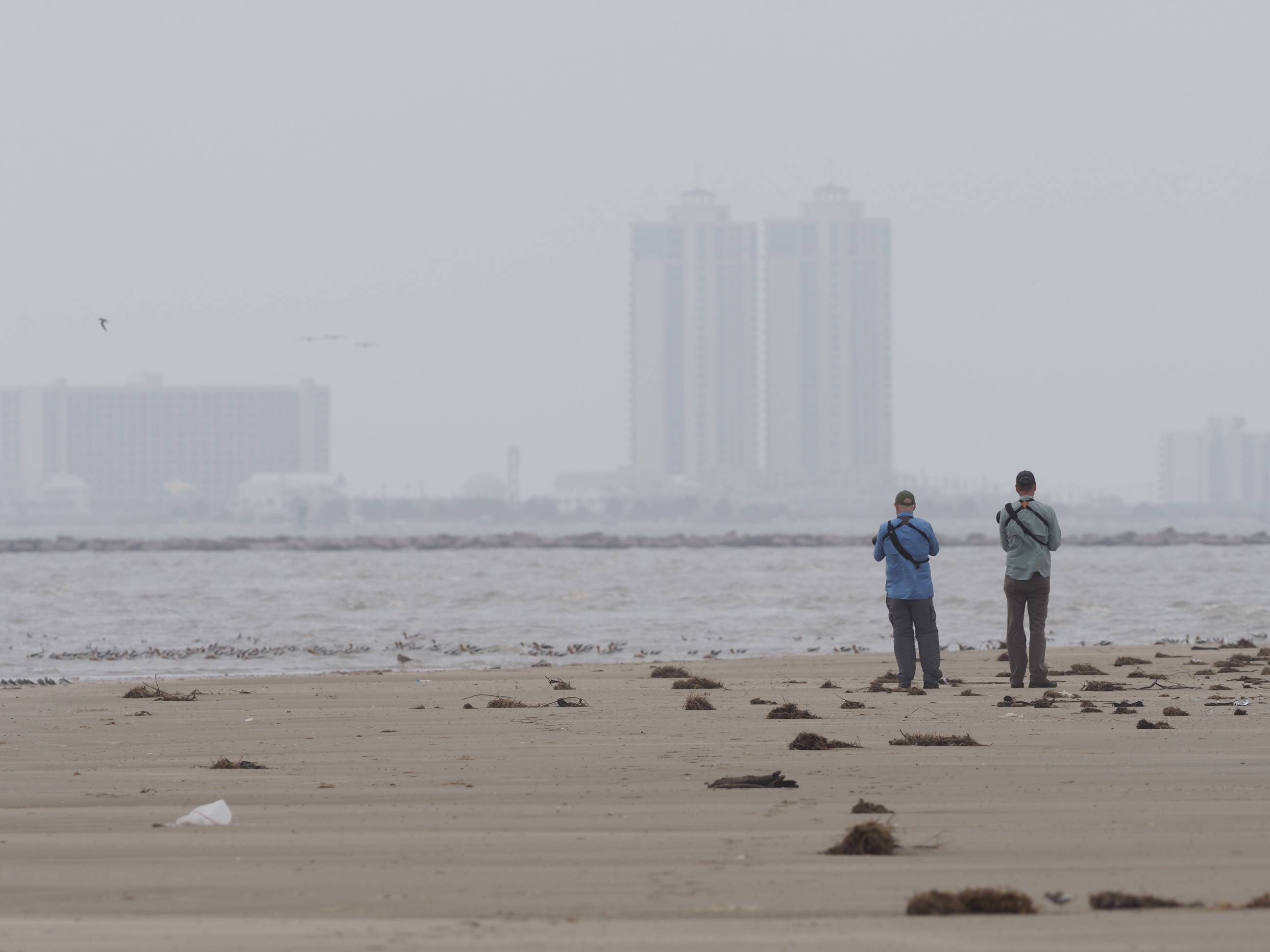
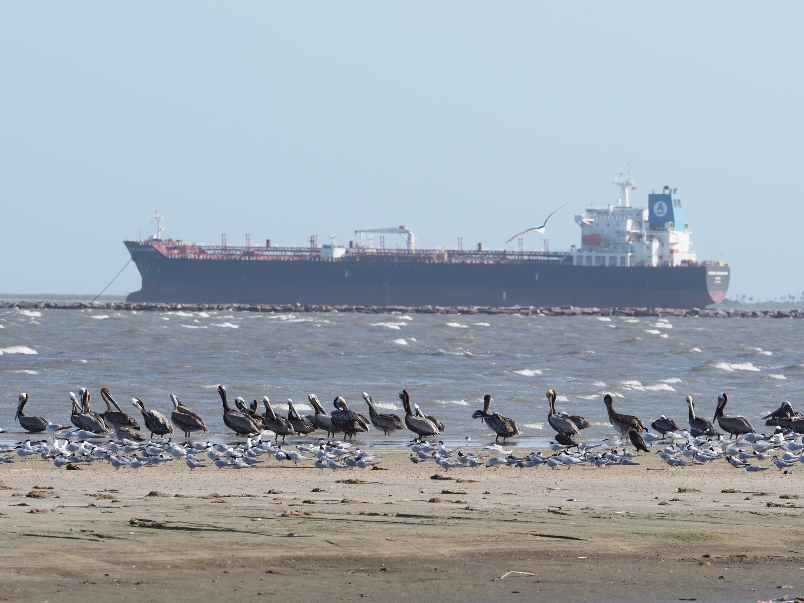
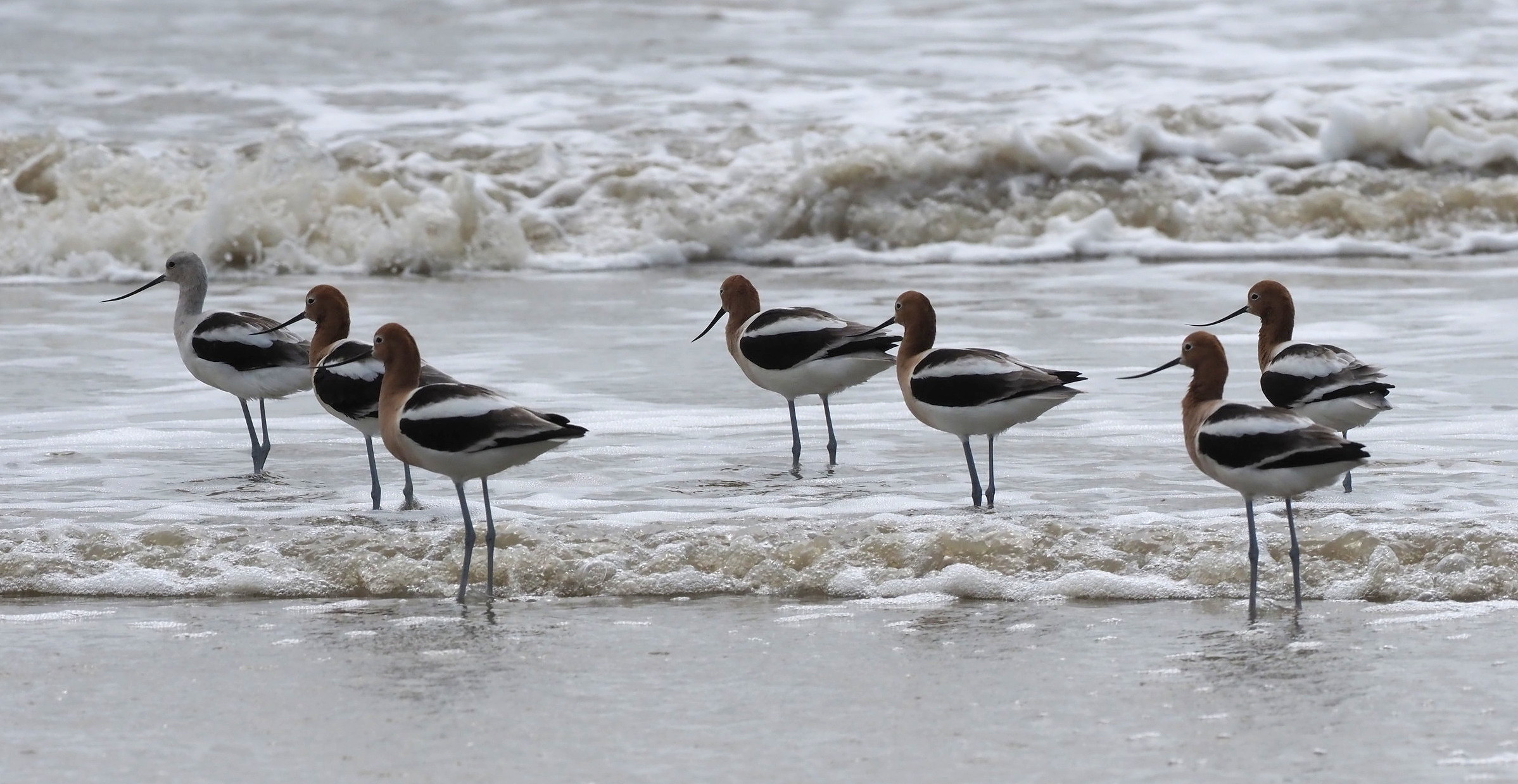
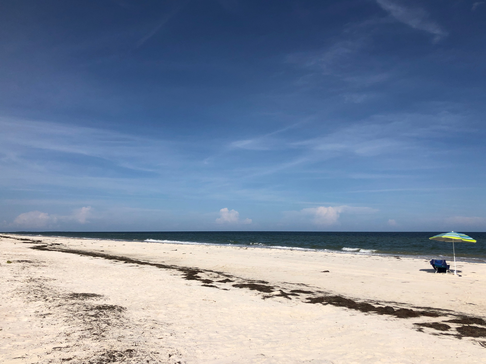
Bolivar Flats Audubon Sanctuary
This sanctuary is at the southernmost part of the Bolivar peninsula and a barrier prevents cars from driving is stretch of beach (otherwise you can drive on most Texas beaches with an annual permit). One needs to walk perhaps a half mile southward to reach sand and mudflats that host large numbers of shorebirds.


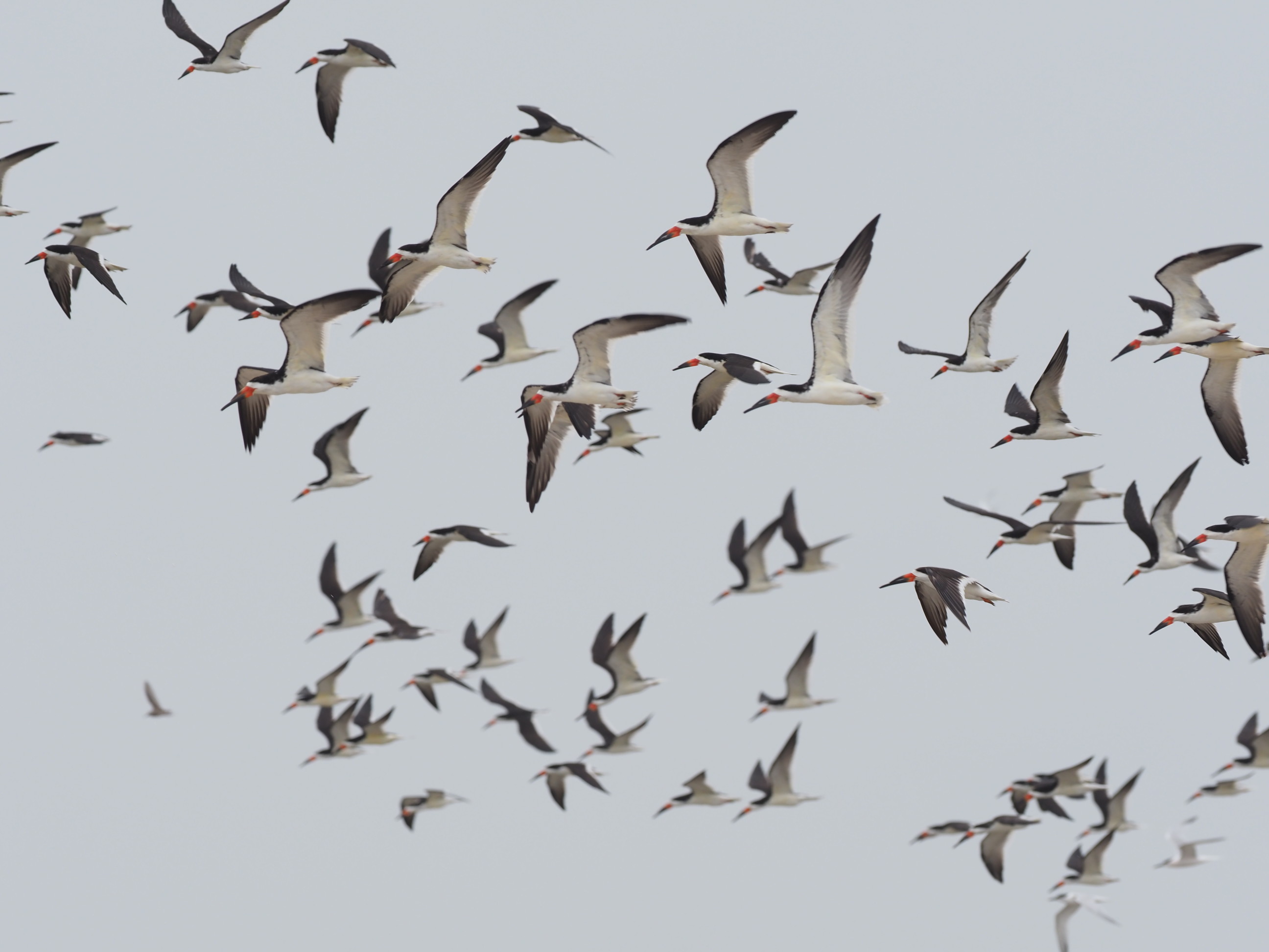


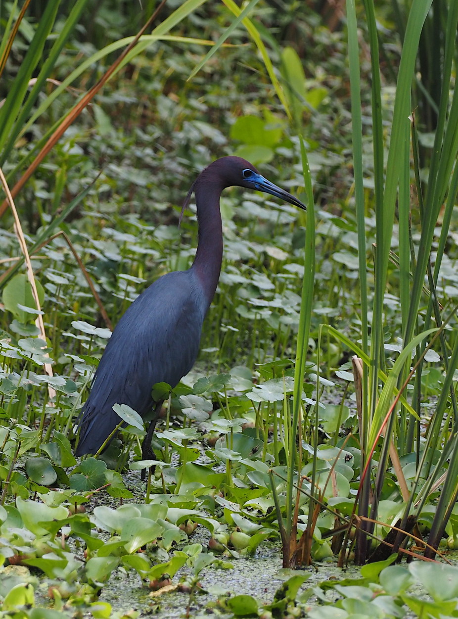
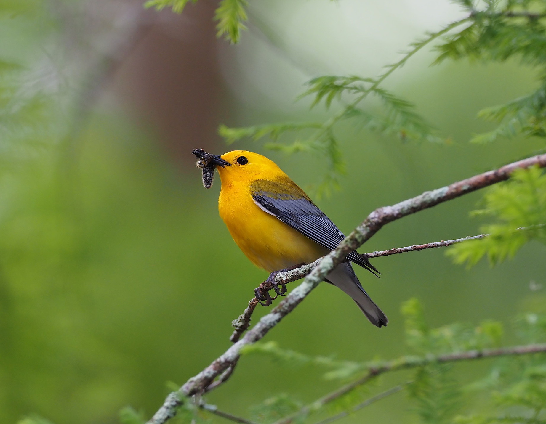
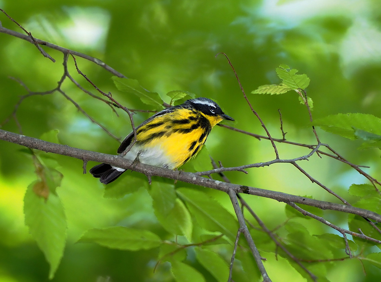
High Island Audubon Sanctuaries
High Island is the surface expression of a salt dome that extends downward thousands of feet. This part of the Texas and Louisiana coastal plain has many salt domes – in fact most are actually underwater on the coastal shelf. A thick layer of salt, deep underground, will rise towards the surface as “bubbles” since salt is less dense (2.15 gm/cc) than most rock (around 2.6 gm/cc or more). The upward motion is more controlled by the fact that rock salt deforms readily under pressure, unlike most rock. Thus a layer of sedimentary salt can migrate both laterally and upward under suitable conditions. More info on salt domes can be found here. But since salt dissolves rapidly in rainwater the actual salt remains below ground and the rock at the surface of High Island and other salt dome “islands” is other sedimentary rock that overlies the salt.
High Island, like many salt domes in the area, is a favorable geologic structure for oil drilling as the inclined strata around the salt dome favor the trapping of oil. As such, they have been widely exploited and drilling infrastructure is seen around most such domes. In addition, because the higher domes are above storm surge levels and not saturated by the surrounding marshes that are closer to sea level, they support very different flora than their surroundings. Oak and hardwood forests normally exist on domes like High Island and even higher ones in Louisiana like Avery Island, Weeks Island and Cote Blanche Island.
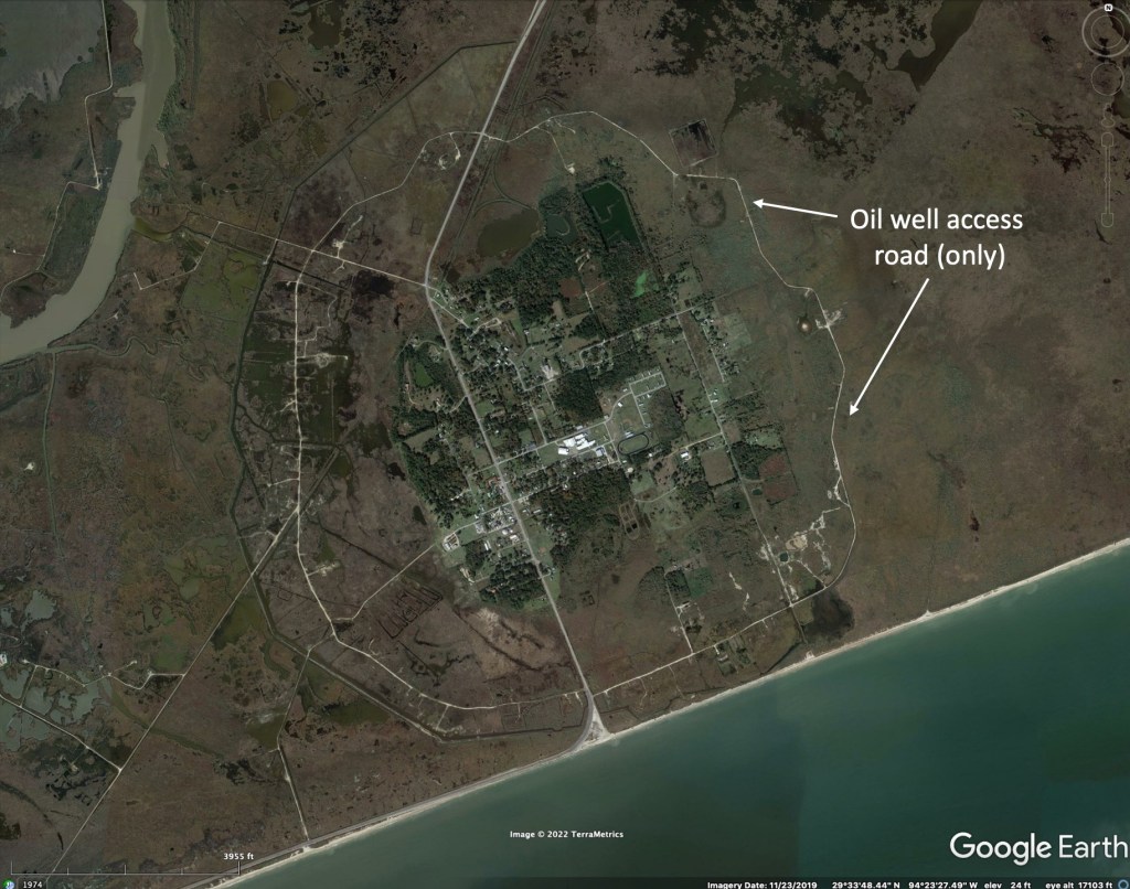
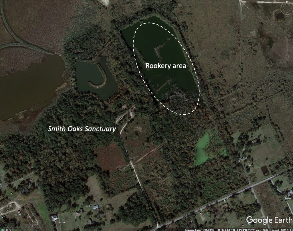

Because of the oil exploration activities and the suitability for limited agriculture and safety from storm surges, the salt domes have been seriously modified by human activities. High Island, being close to the Houston area with a large birding community, has been protected in places by land purchases over the years. The Houston Audubon Society runs five separate reserves on the island, each within a couple minutes drive from one another. These are extremely popular during the spring migration period, approximately early April through mid-May, and attract birders from around the World. A permanent rookery, with Roseate Spoonbills, along with various egrets and Cormorants is another attraction nearly year-round. A pdf map of the trails of the two main reserves is here. The Anahuac National Wildlife Refuge is nearby; a good place for seeing ducks in winter.


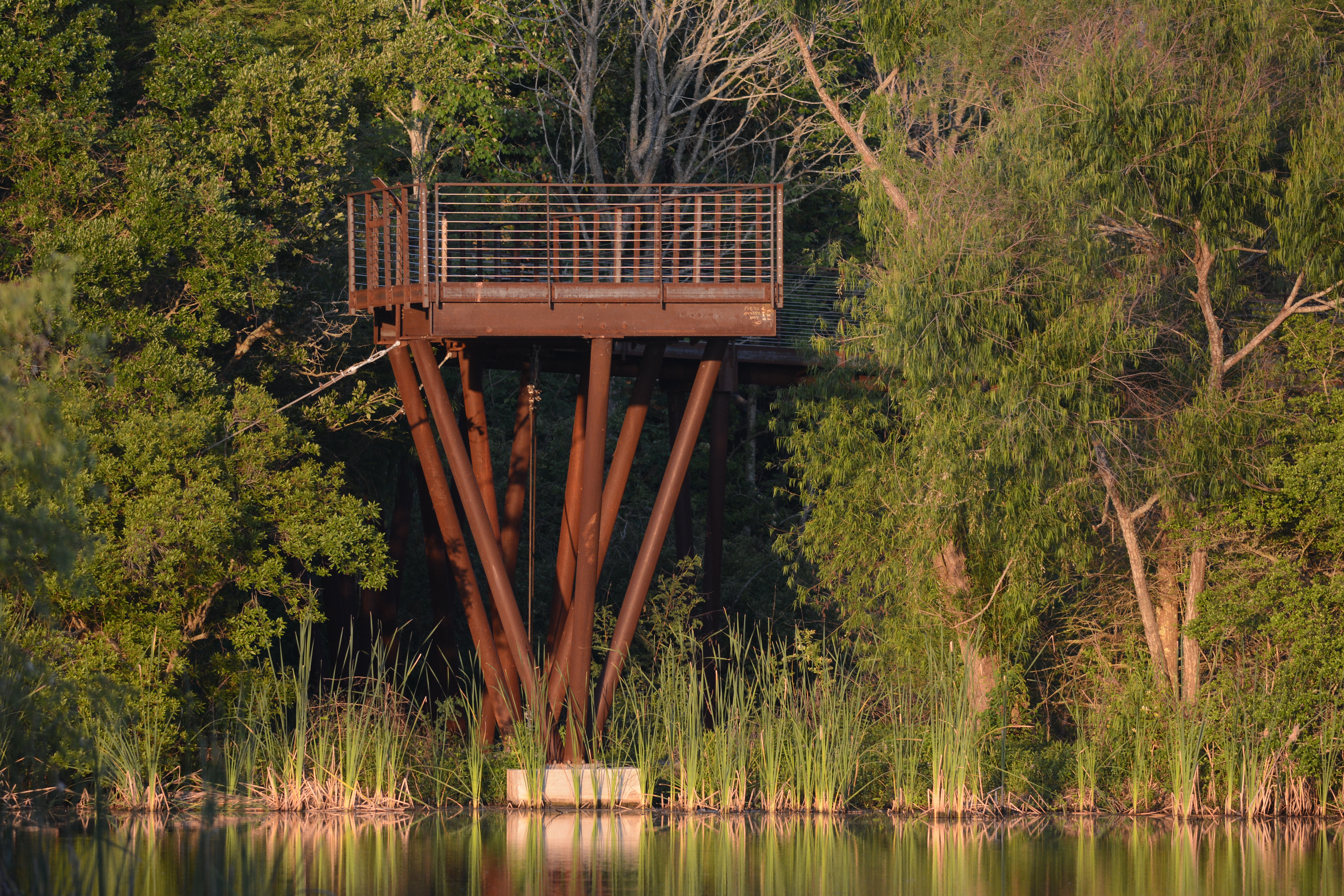


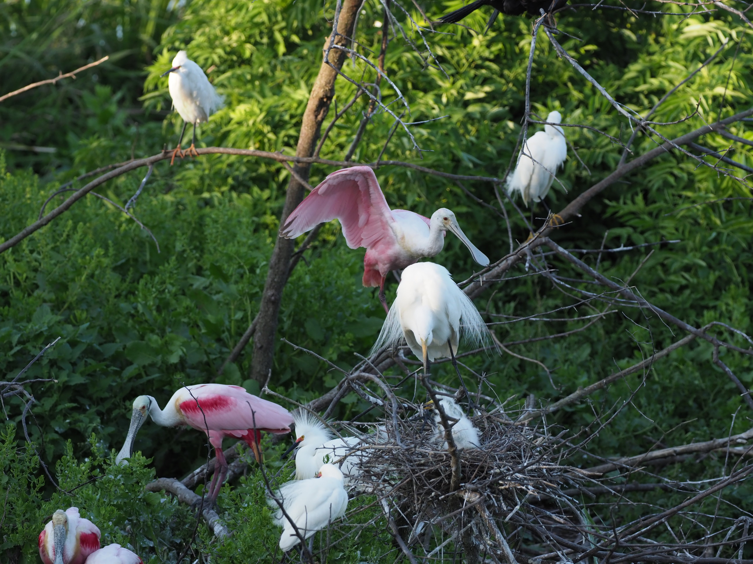

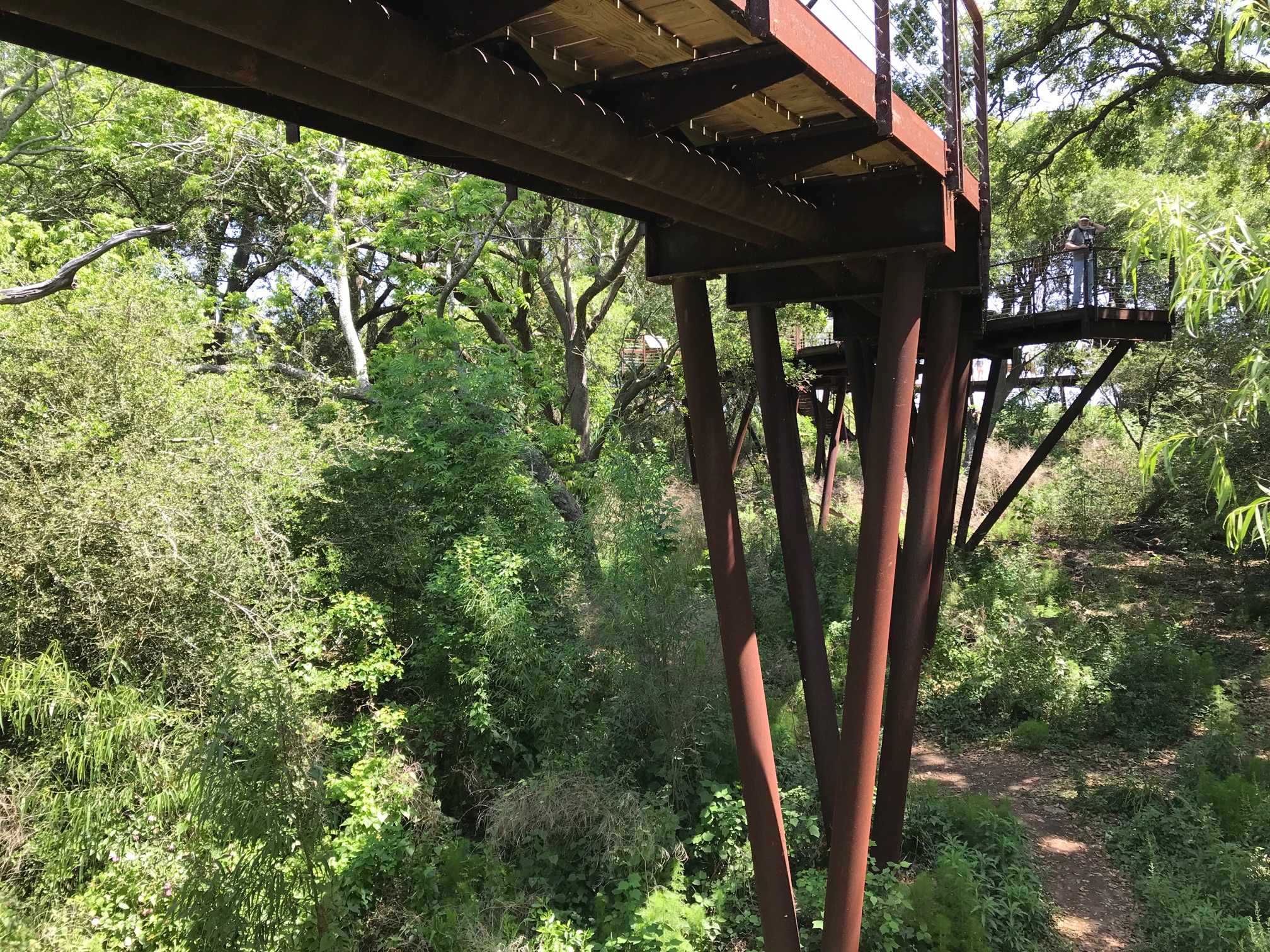

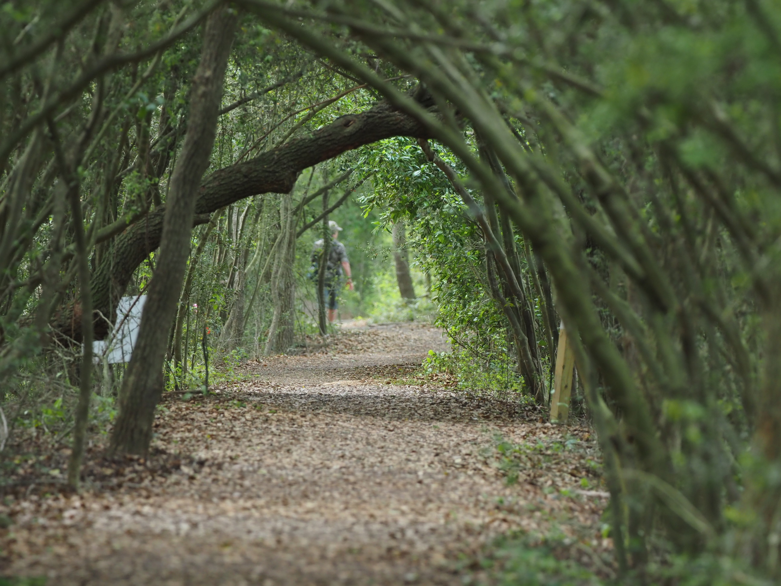


Above: Photos from the Audubon Sanctuaries on High Island.
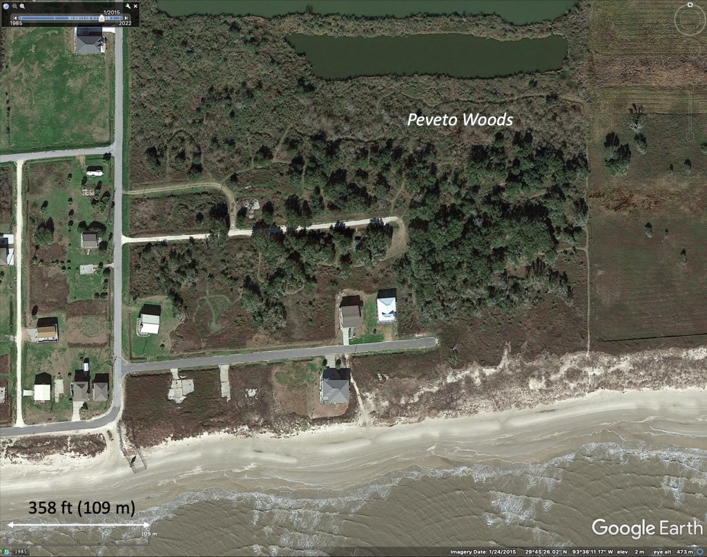
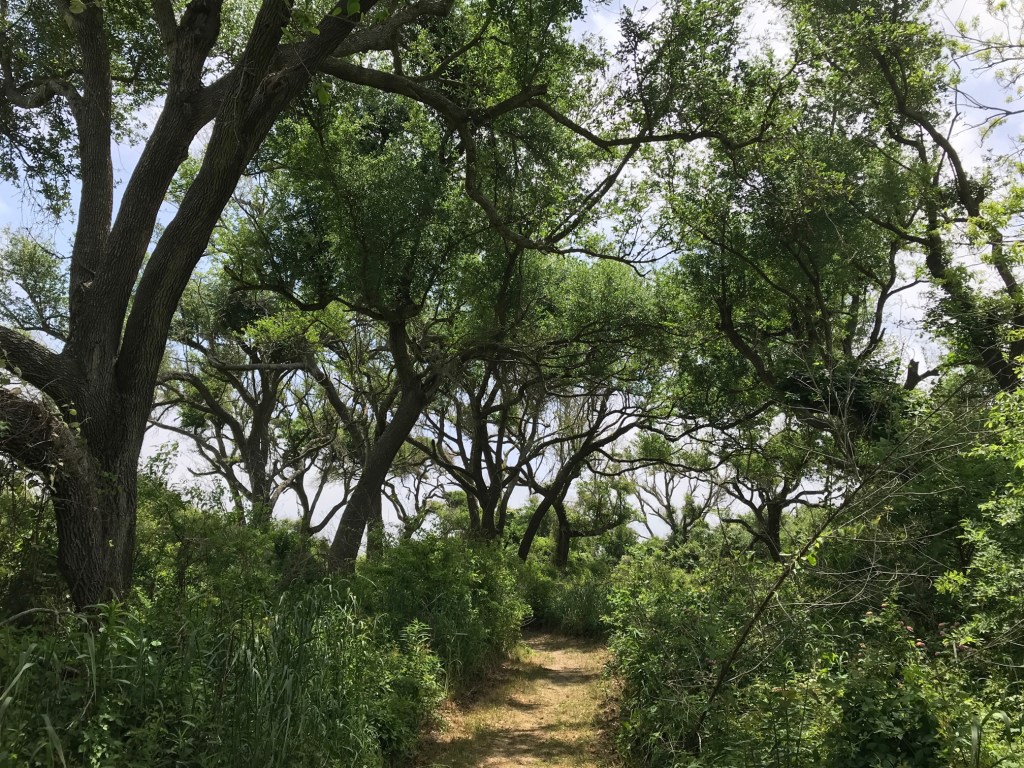
Peveto Woods Sanctuary
The coastline of northeast Texas and south Louisiana has in places barrier dunes that remain above storm surges most of the time. These areas support live oak communities, whereas the land immediately inland from the dunes is close to sea level, with brackish water conditions and lacks comparable forests. Some such coastline forests have been protected in Texas (Sabine Woods) and in southwest Louisiana (Peveto Woods). These sanctuaries of mostly live oak patches can be of major importance for birds crossing the Gulf of Mexico during spring migration. Birders visit these sites out of all proportions to the total area of these sites in comparison with the large National Wildlife Refuges just inland (that mostly support wintering waterfowl). Peveto Woods has many trails through the woods, some benches and several good water drips that attract birds. The isolated location of Peveto Woods means that relatively few people visit it. Despite this, we saw quite a few people there because a field excursion of the Louisiana Ornithological Society was in progress during our visit.

Palmetto Island State Park
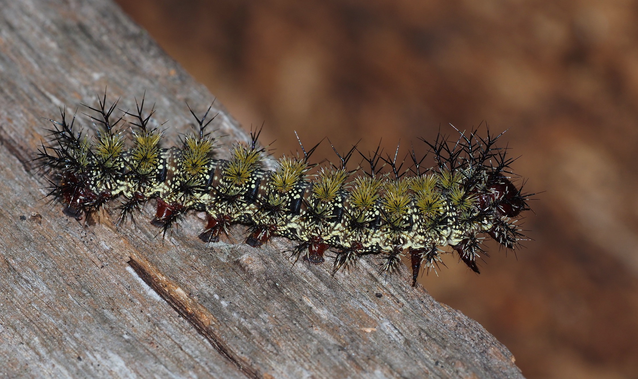
This state park protects an old oxbow lake area that is gradually filling in. There are several trails, including two short canoe trails, in the park and a visitor’s center (closed when we visited). A small boardwalk goes into a cypress swamp where native orchids are found. The park was undergoing a major caterpillar outbreak while we were there (as was Brazos Bend in Texas) with two species in abundance.

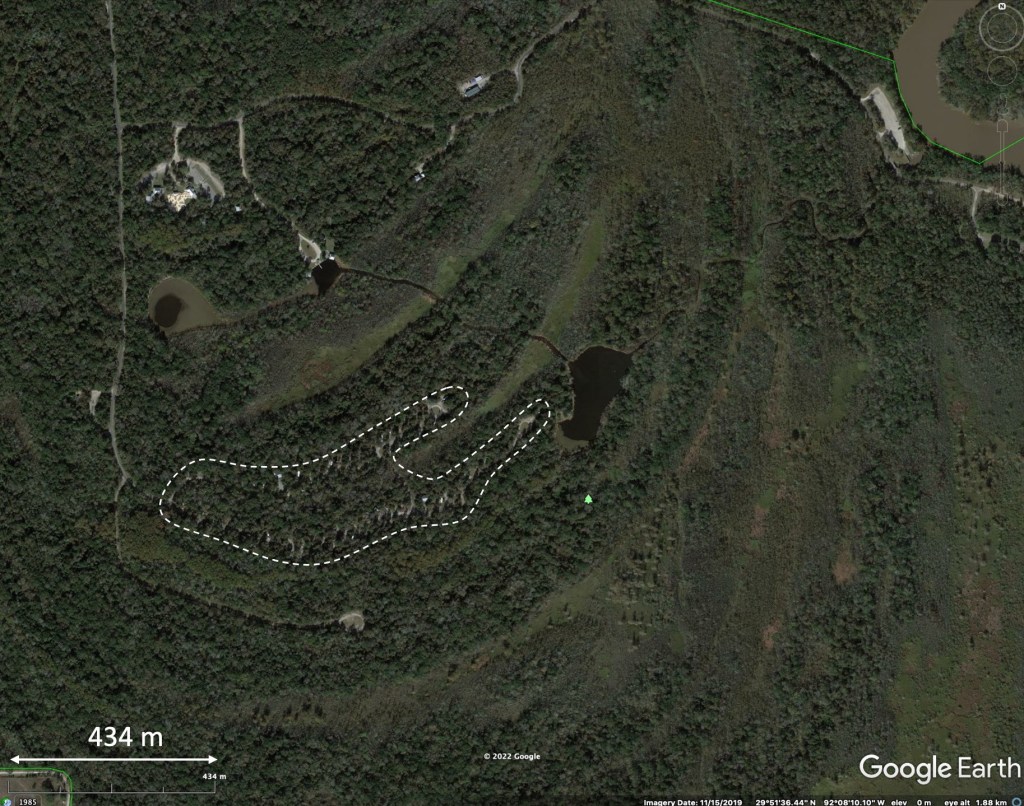

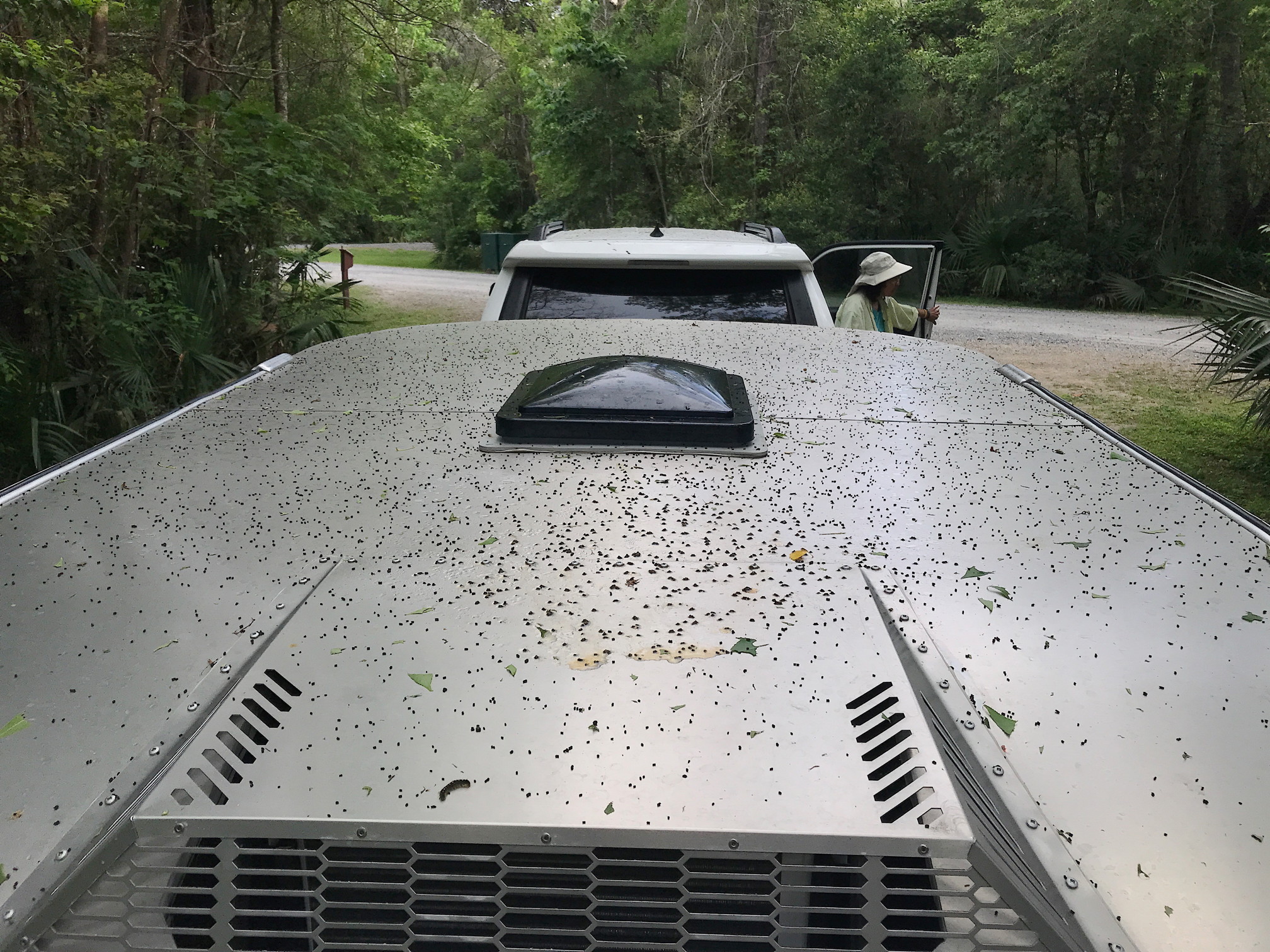
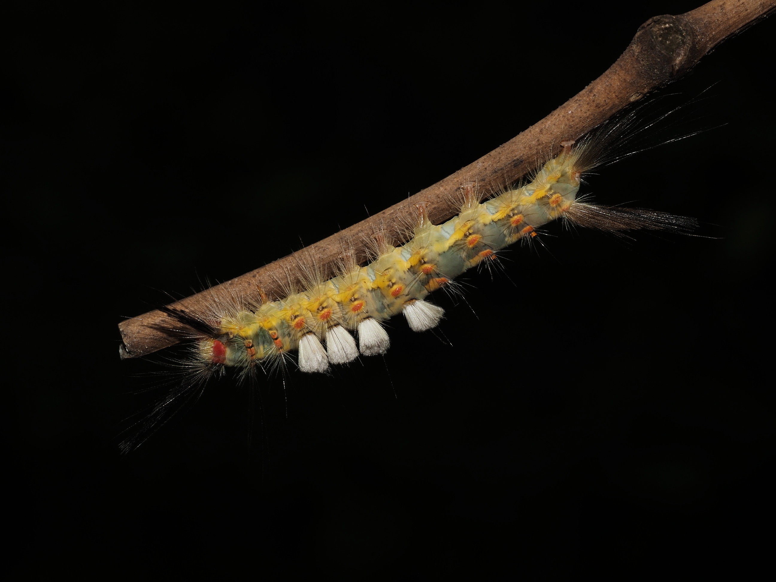


Above: Images from Palmetto Island State Park and surroundings.
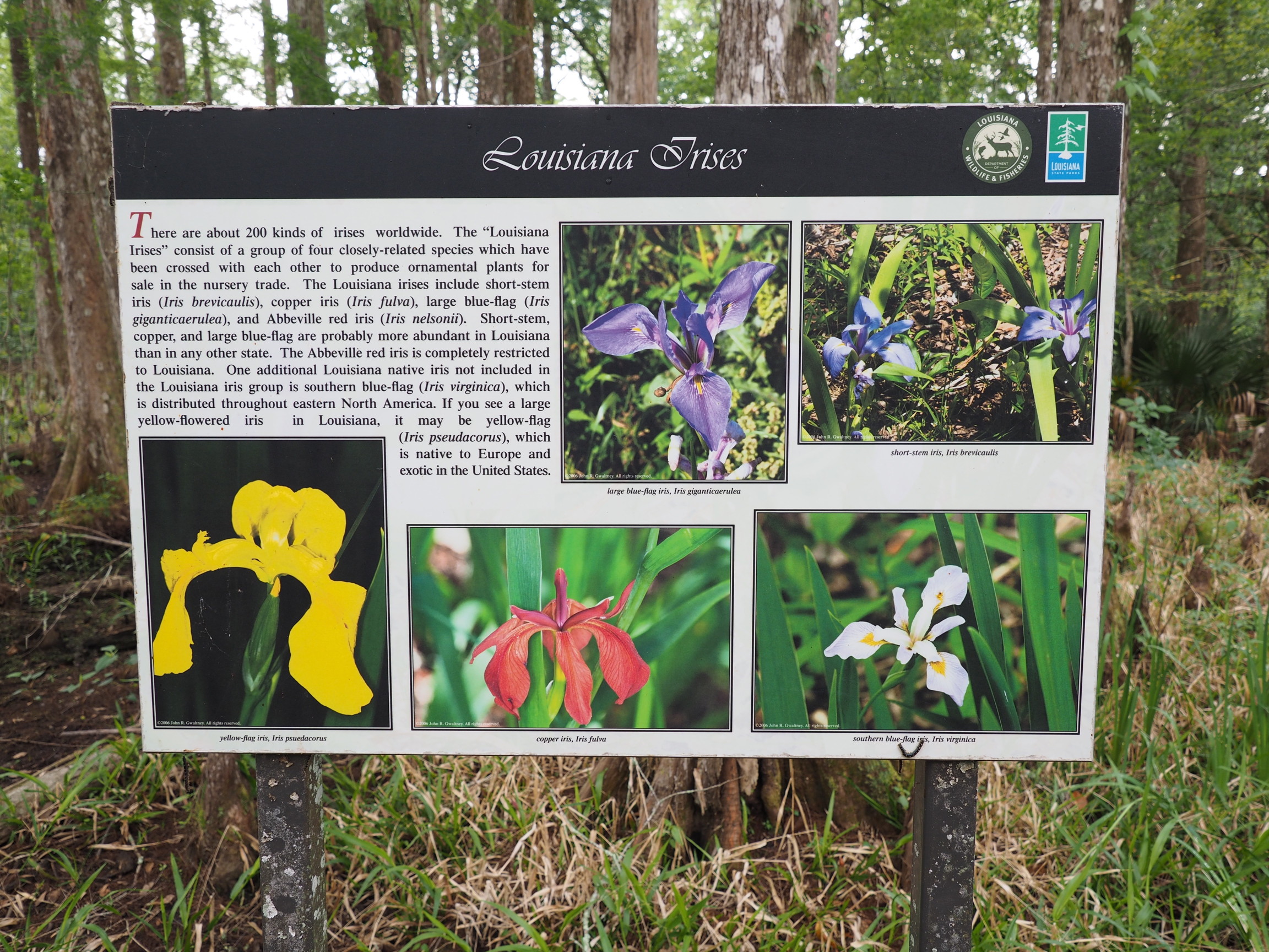
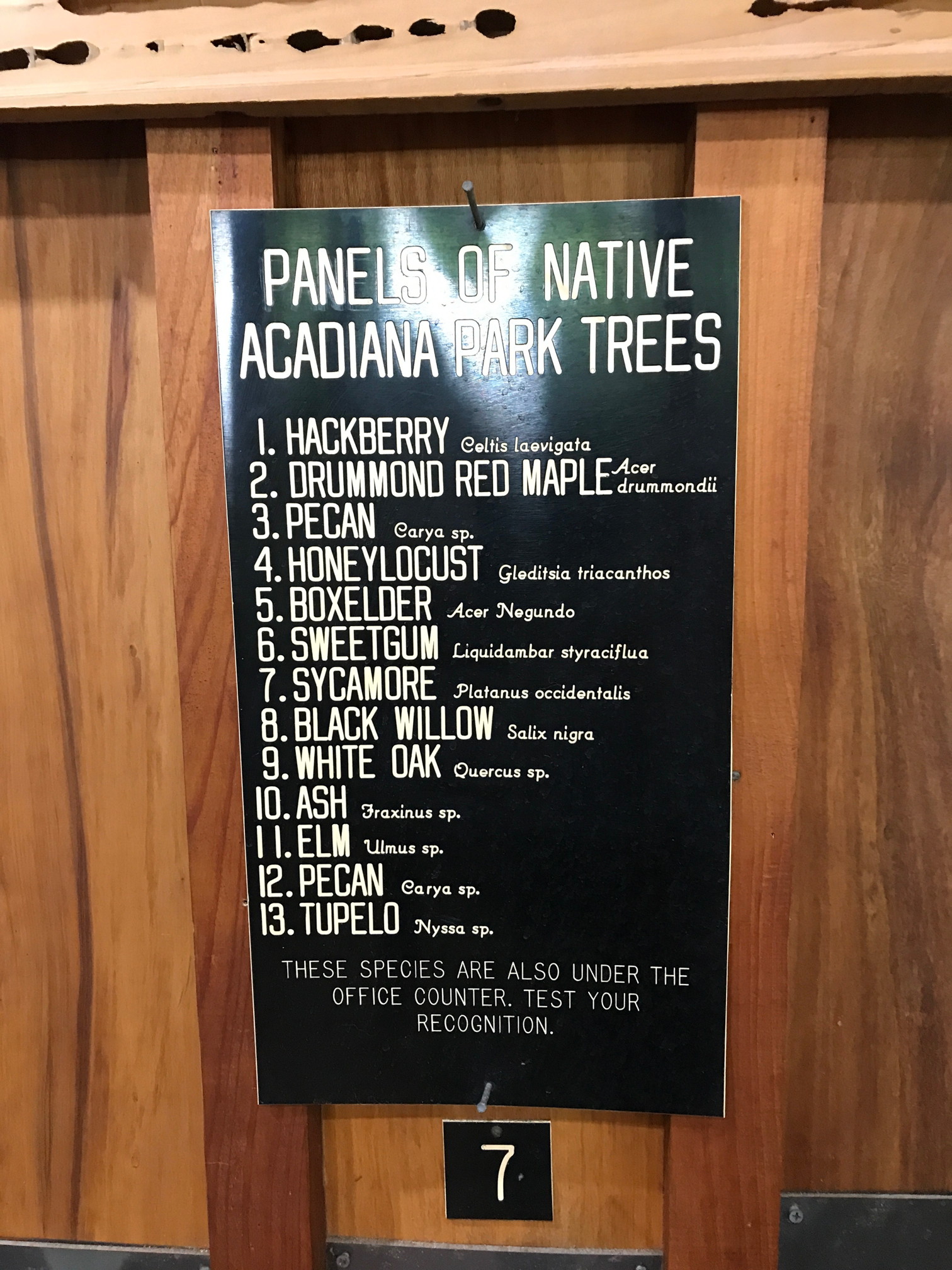
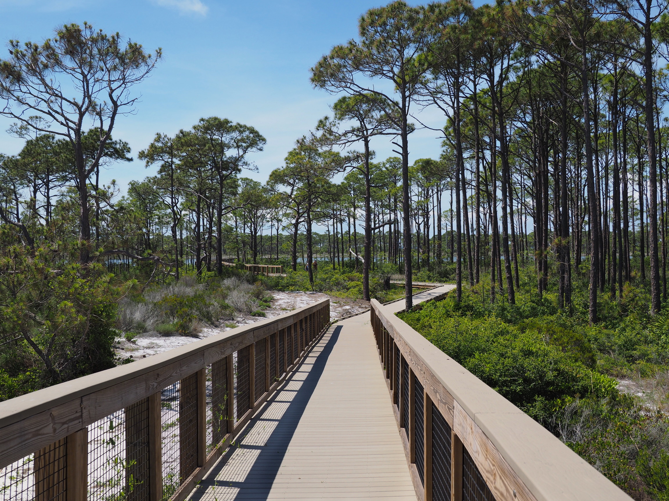
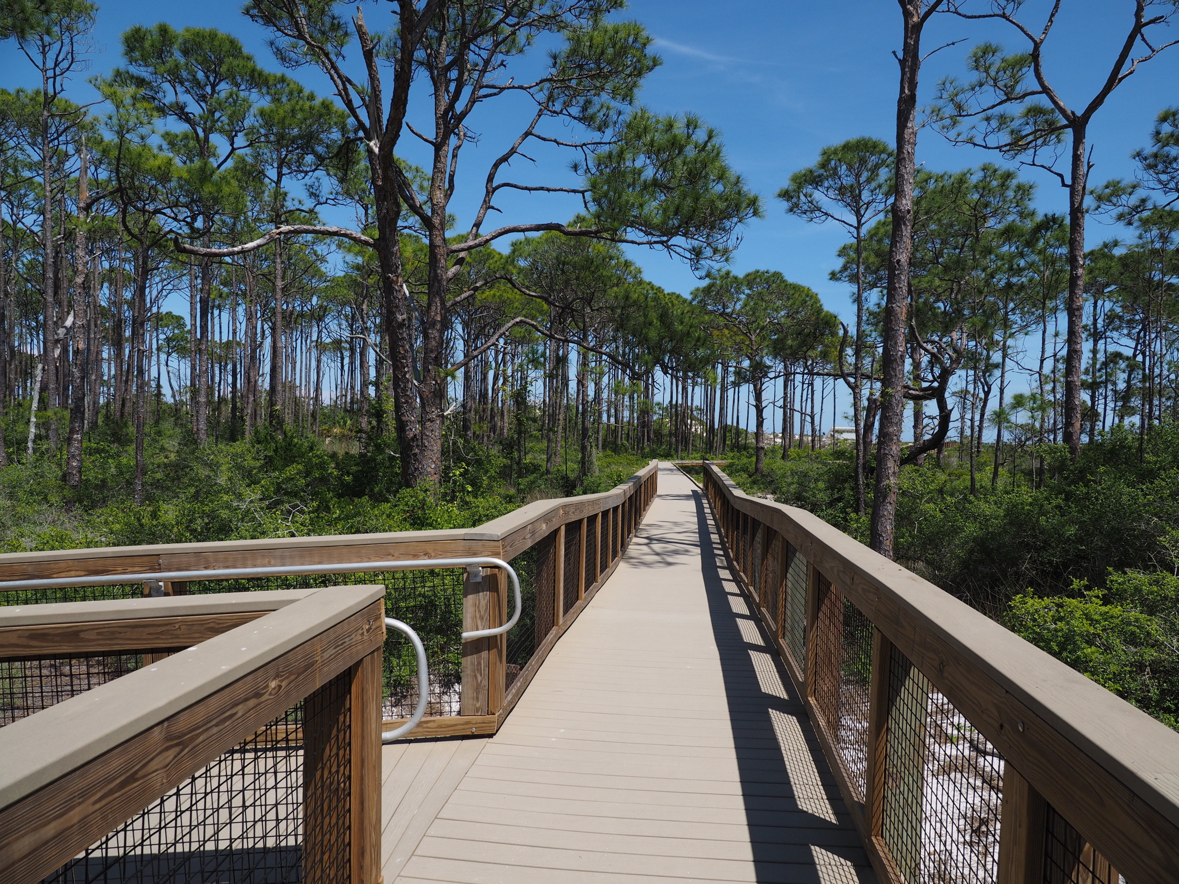
Acadiana Park Nature Station
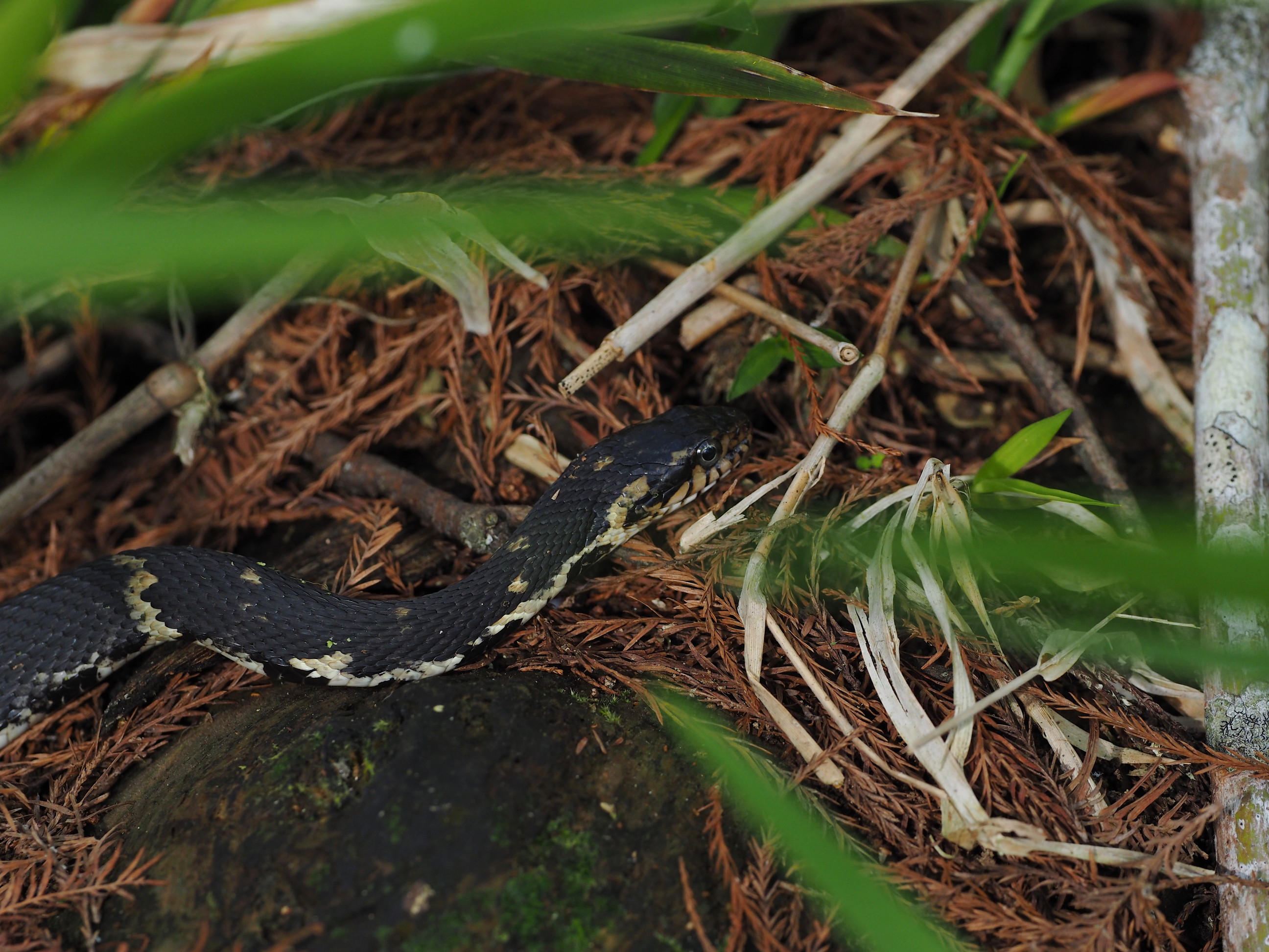
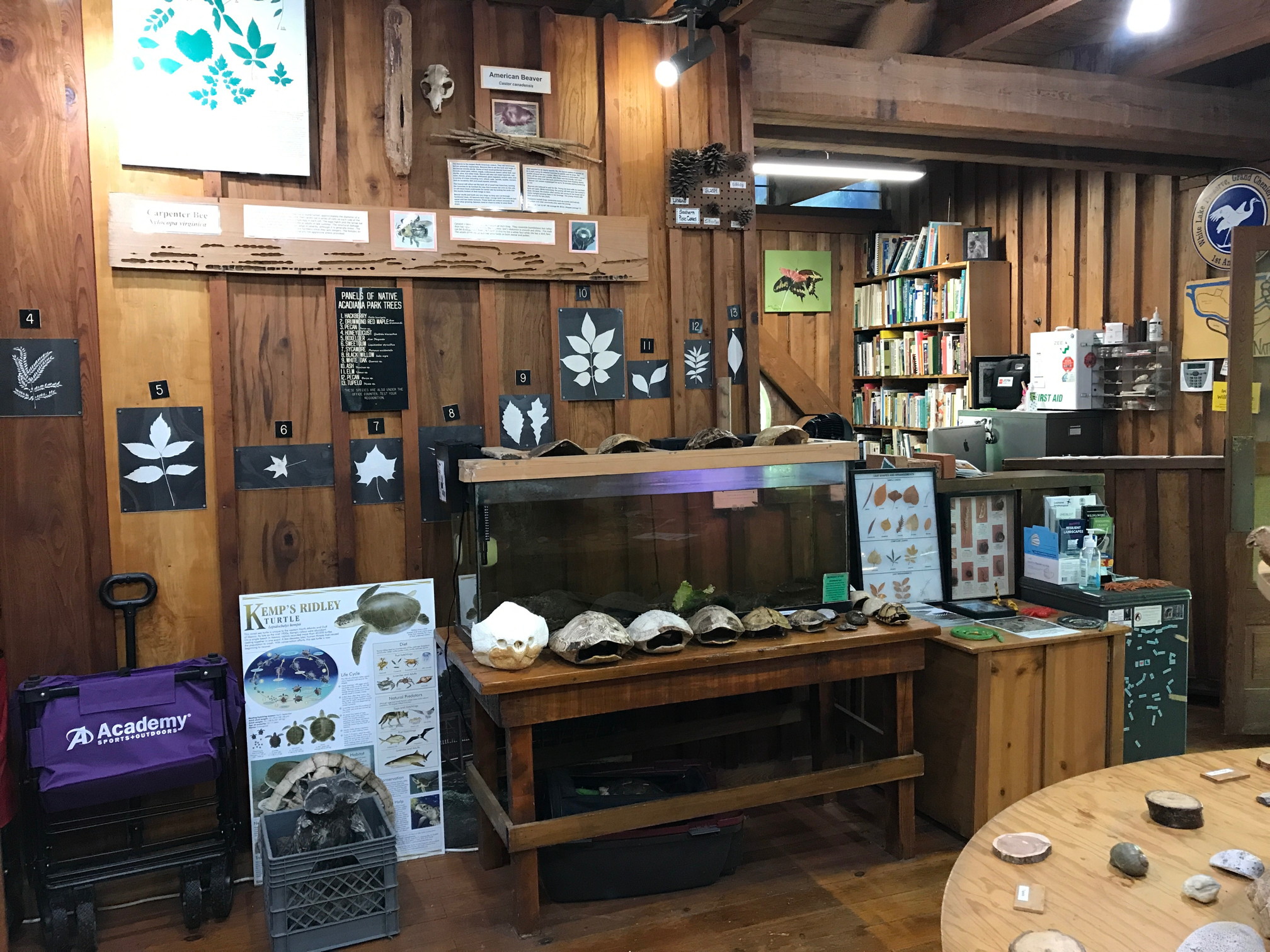
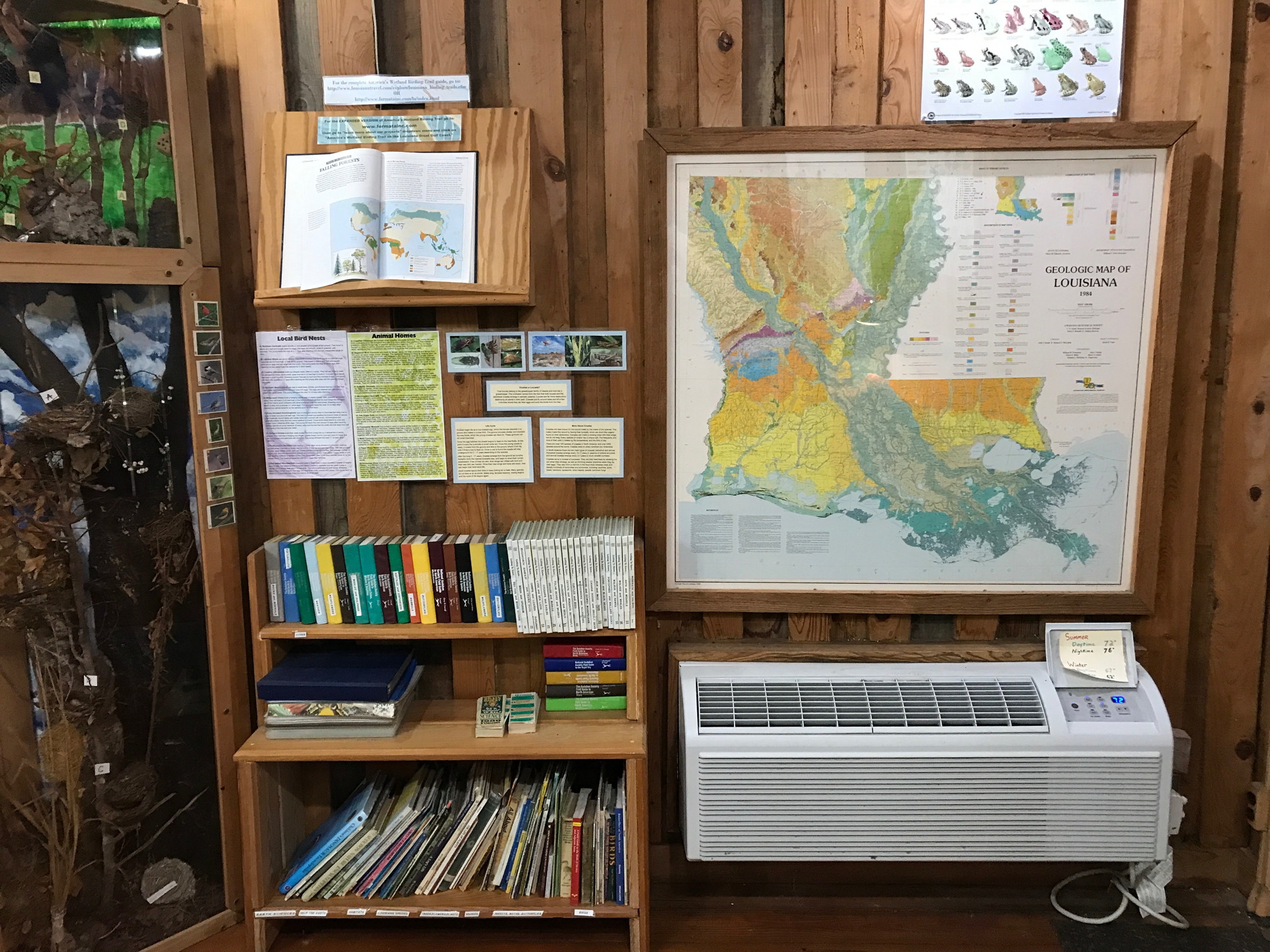
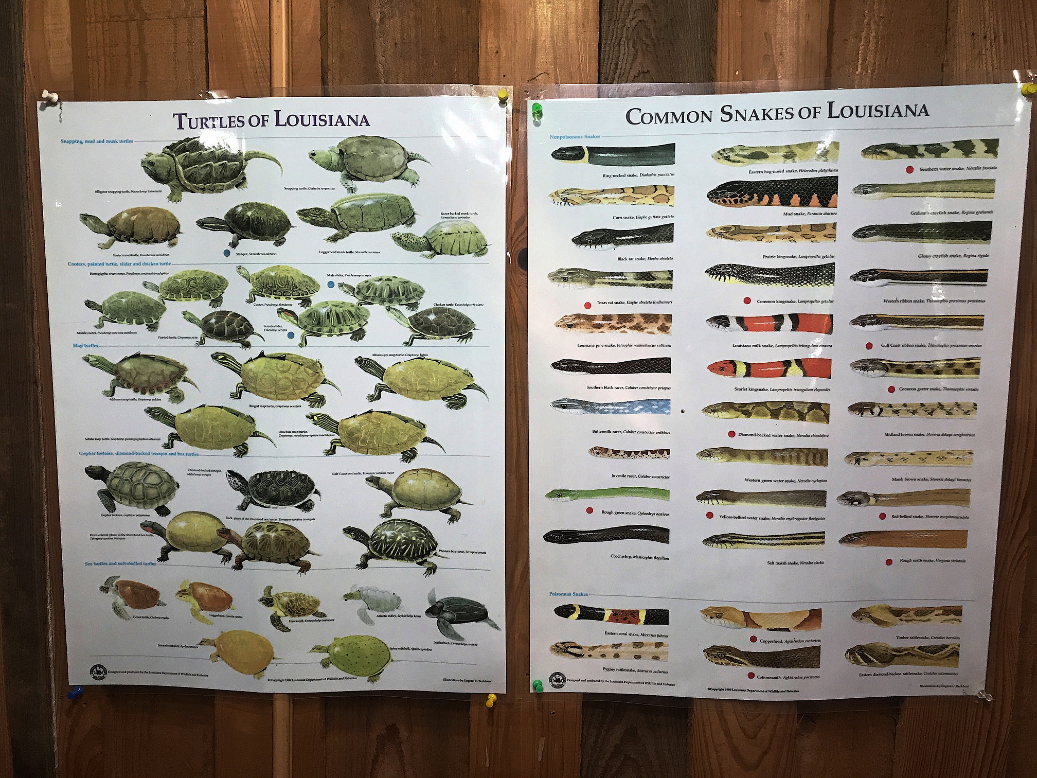
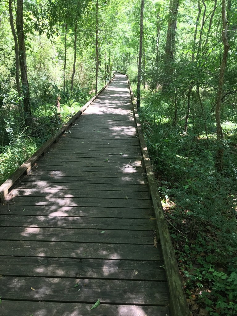
This small park lies on the northeastern outskirts of Lafayette, Louisiana and was a minor detour on our route from Palmetto to Chicot Lake State Park. It is the “nature center” for Lafayette and serves the school system with educational programs. The “station’s” main attraction is the three story visitor center embedded in the bottomland forest and a series of boardwalks that wind though the forest. Other trails radiate out from the boardwalk, but we didn’t have time to explore these and the conditions were muddy.
Though the visitor center exhibits were small, they had some posters we hadn’t seen elsewhere and were of interest. These are shown below.


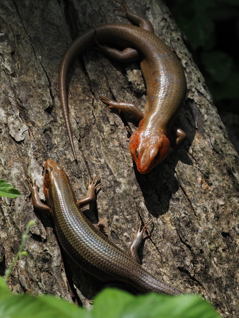
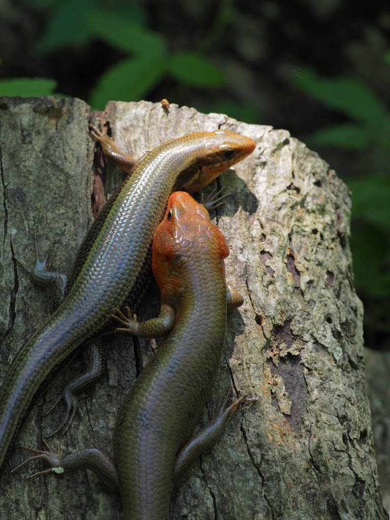
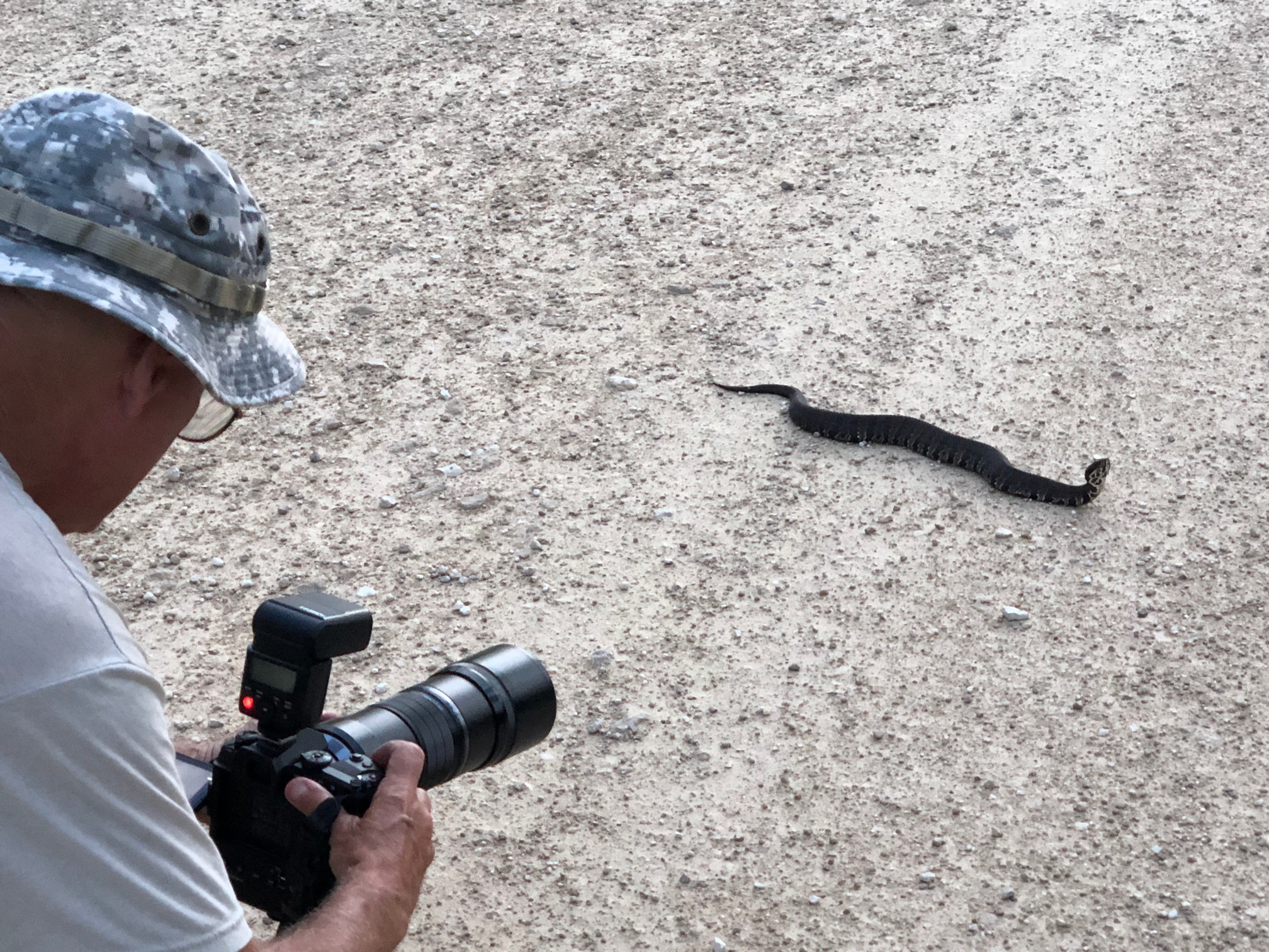
The boardwalk was surprisingly long and we were almost the only visitors on it. We got good views of some forest birds, a Copperhead basking on a fallen log, and some large Broad-Headed Skinks (Plestiodon laticeps).


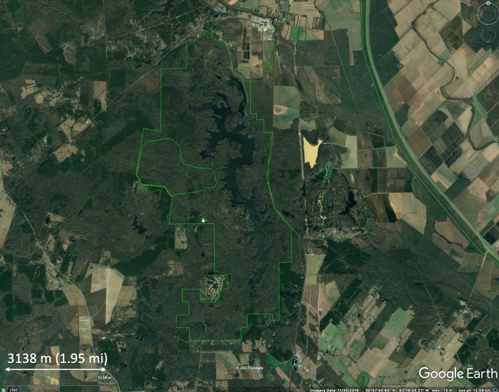
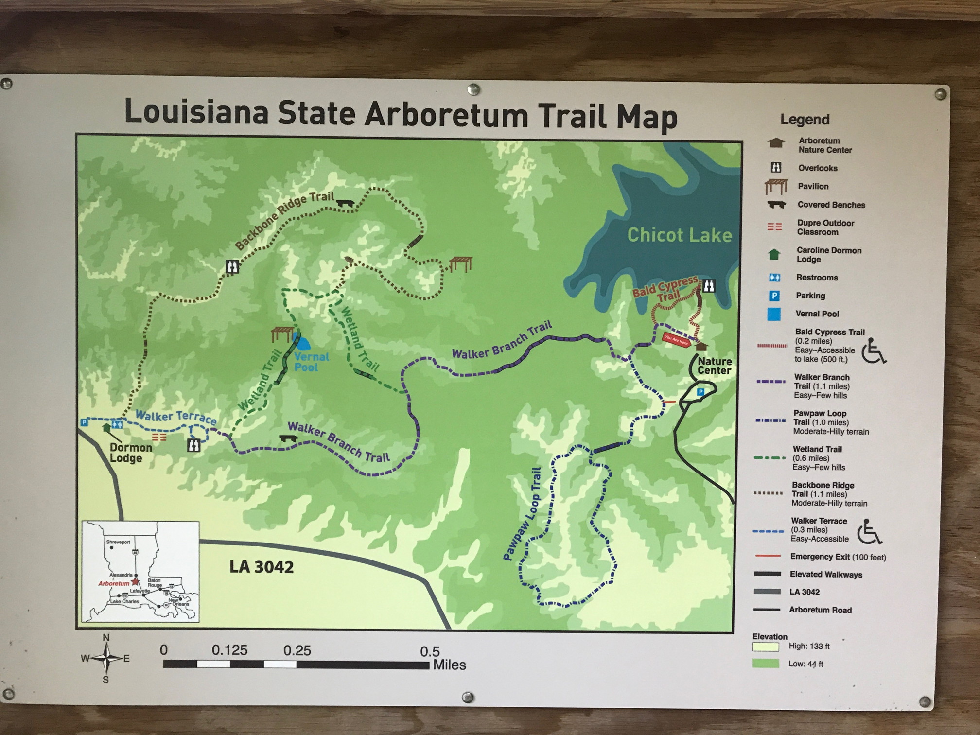
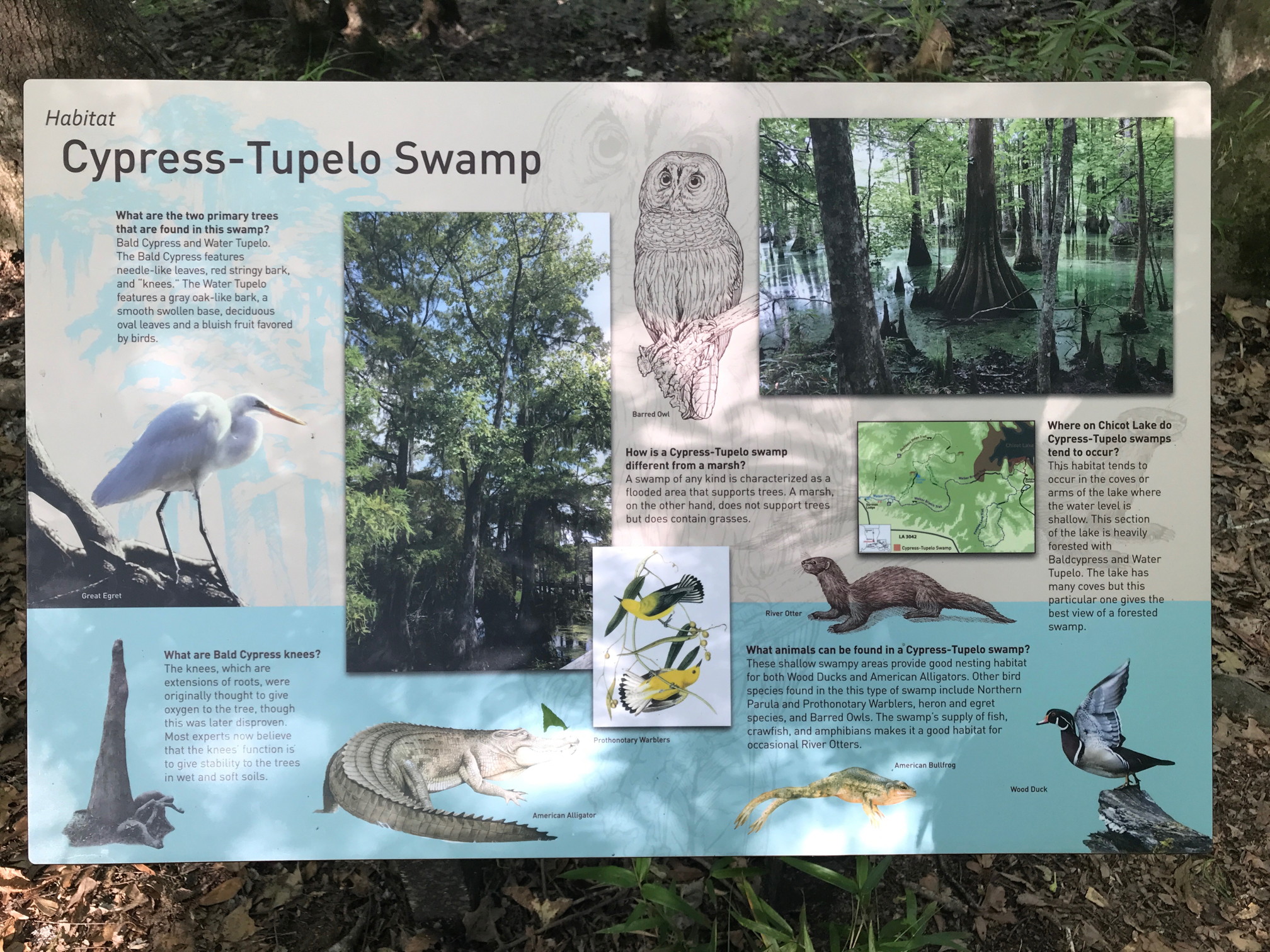
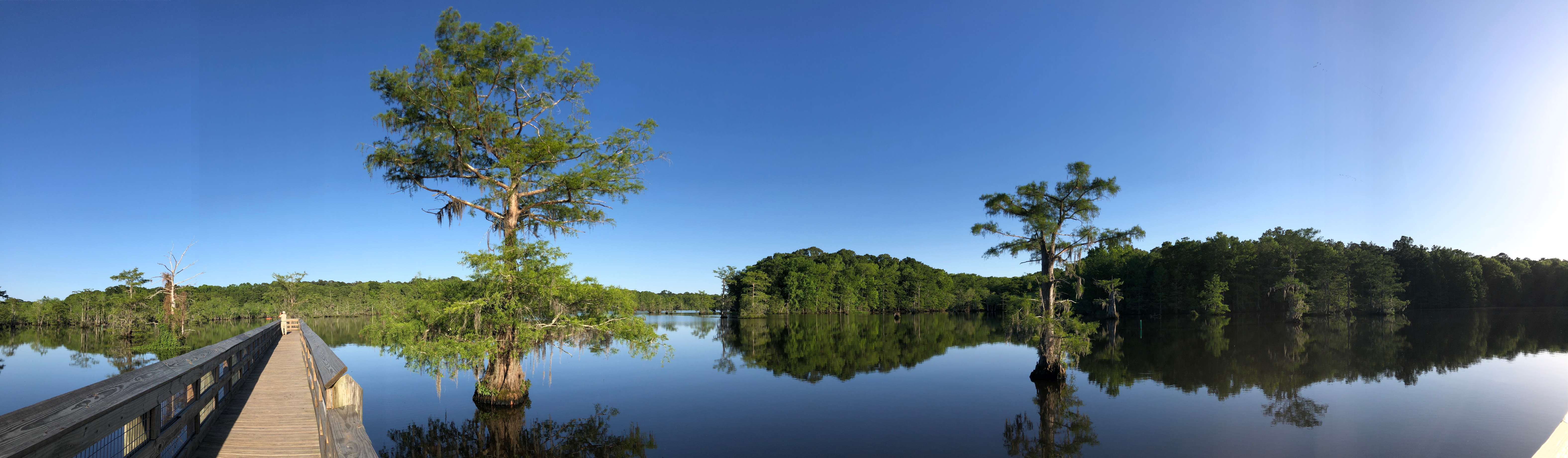
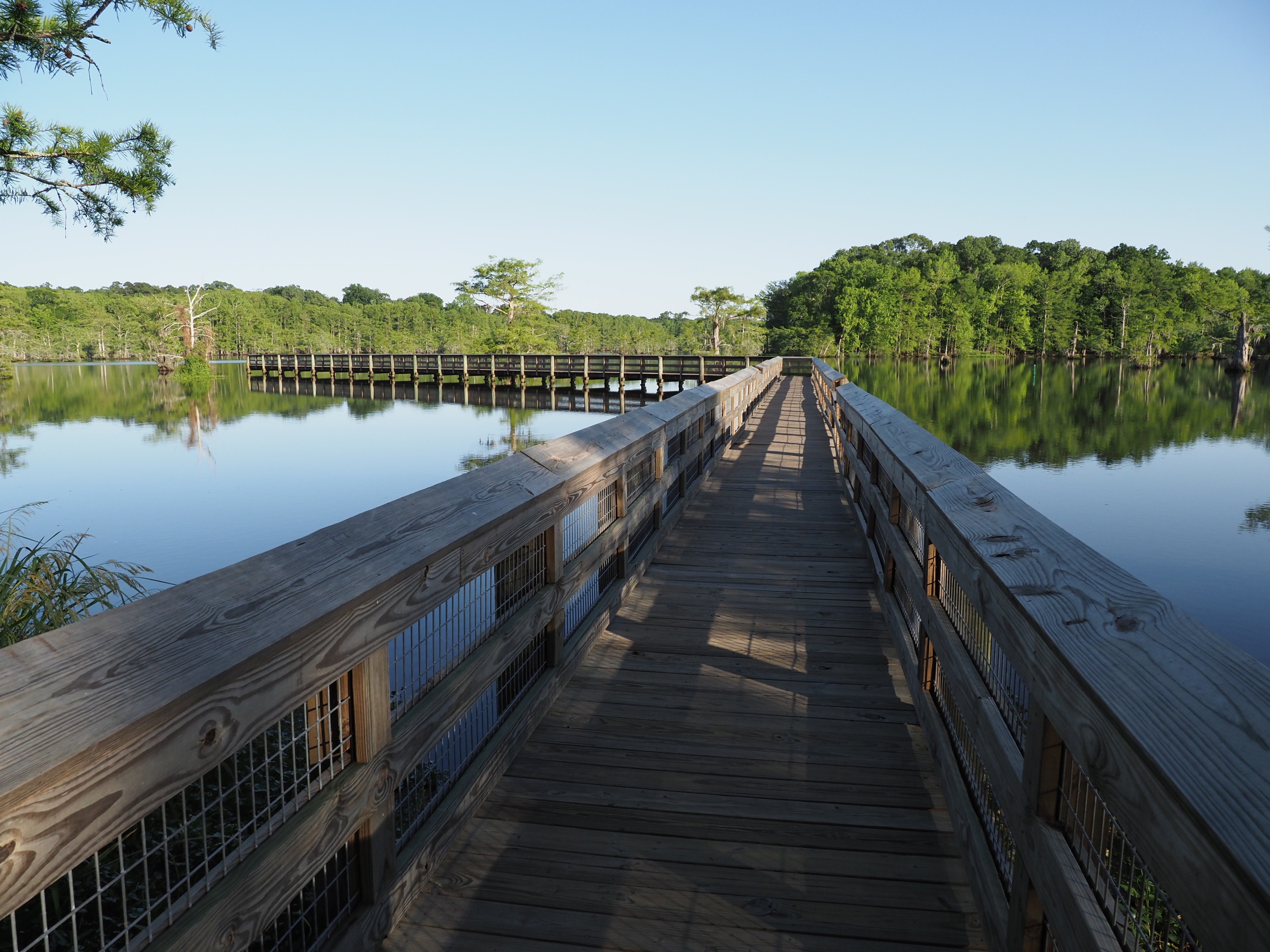
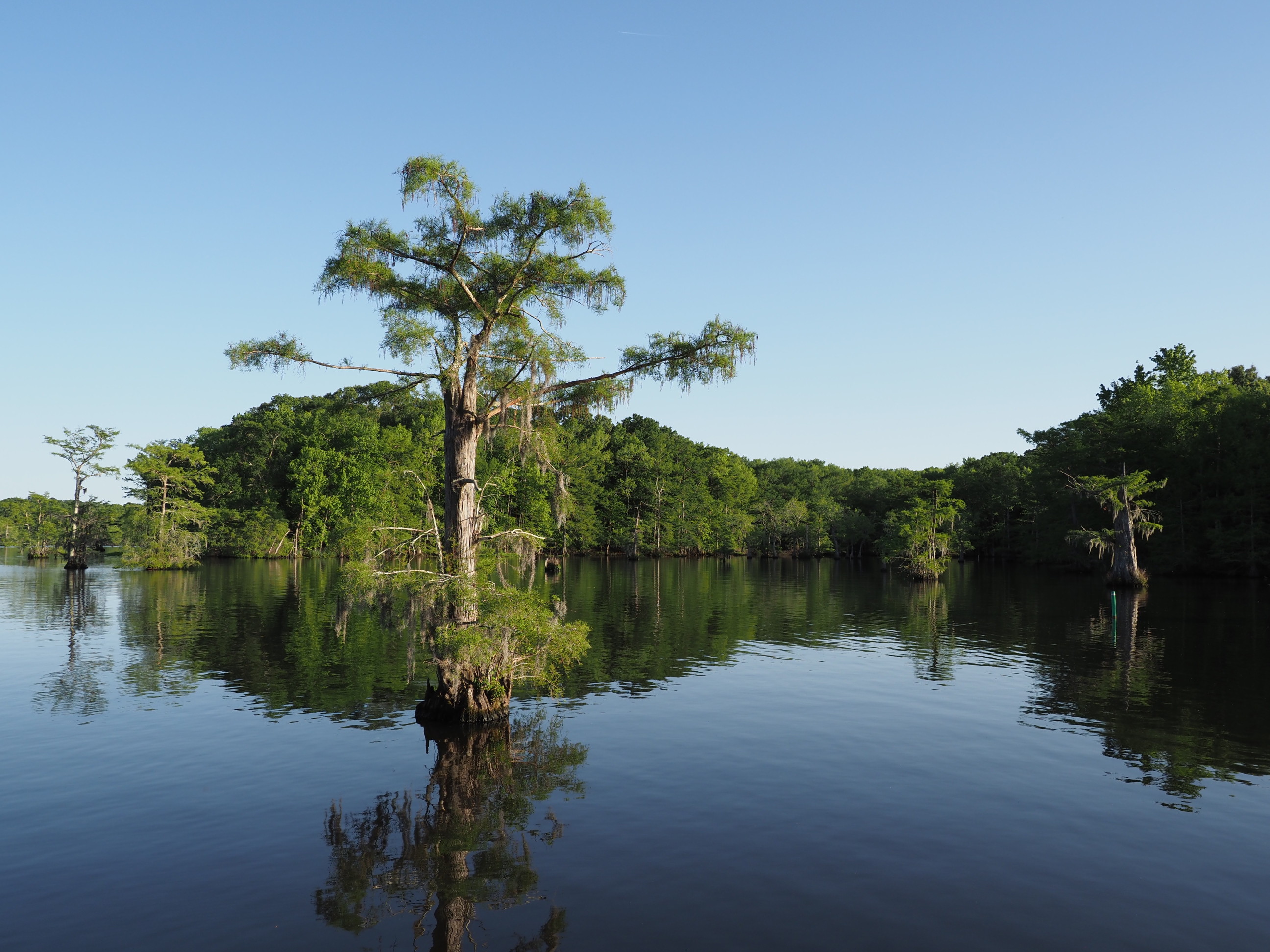
Chicot Lake State Park
This state park we had visited previously and within it lies the Louisiana State Arboretum. The Arboretum, about 600 acres, preserves an old-growth forest tract with trails and boardwalks winding through it. It is not a conventional arboretum dominated with planted trees – it is natural landscapes. A history of the Arboretum can be seen here; like with most natural places, it was motivated individuals who led to its protection.

Below are photos from Chicot State Park.


Desoto National Forest – Buttercup Flats
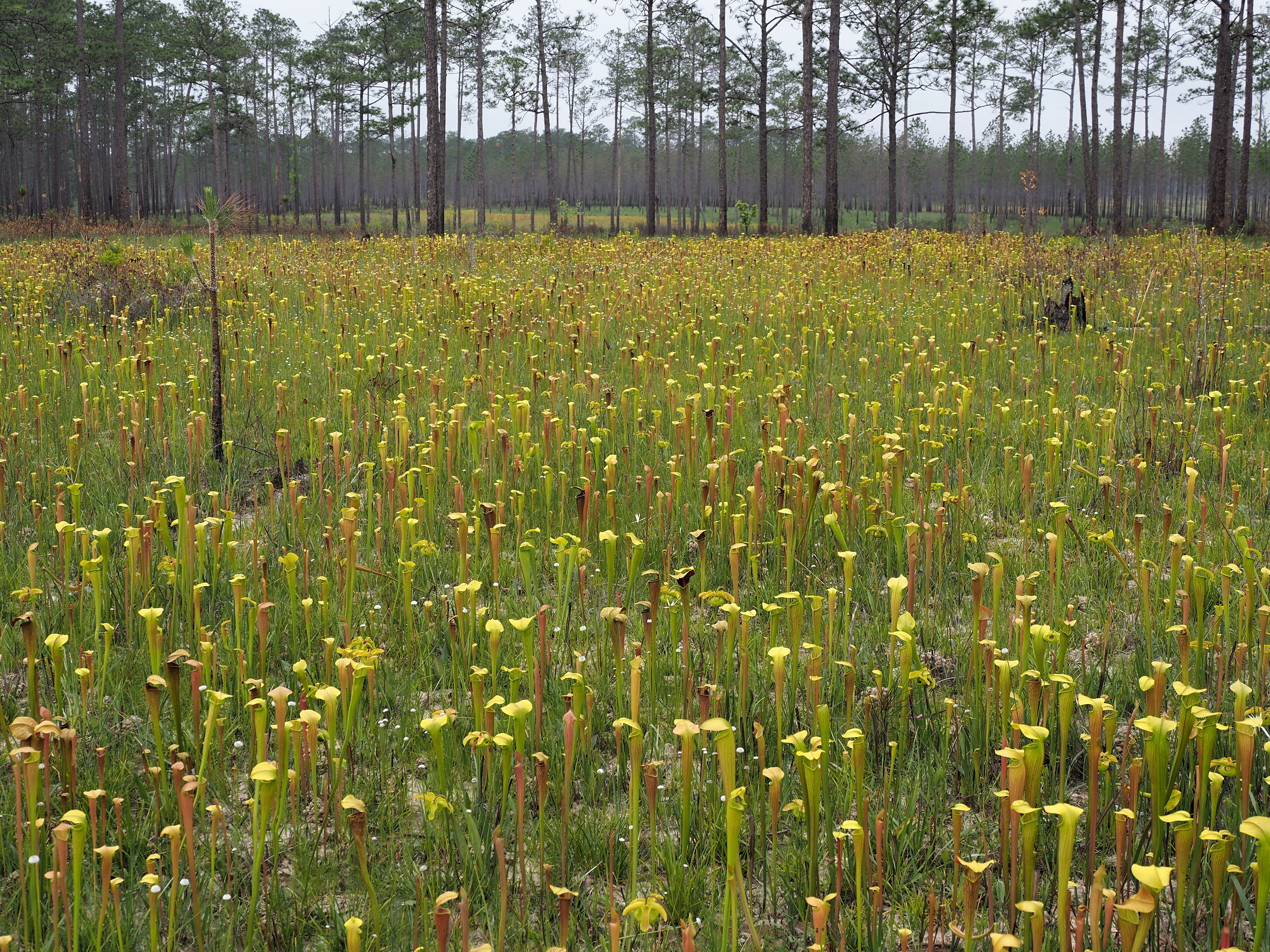
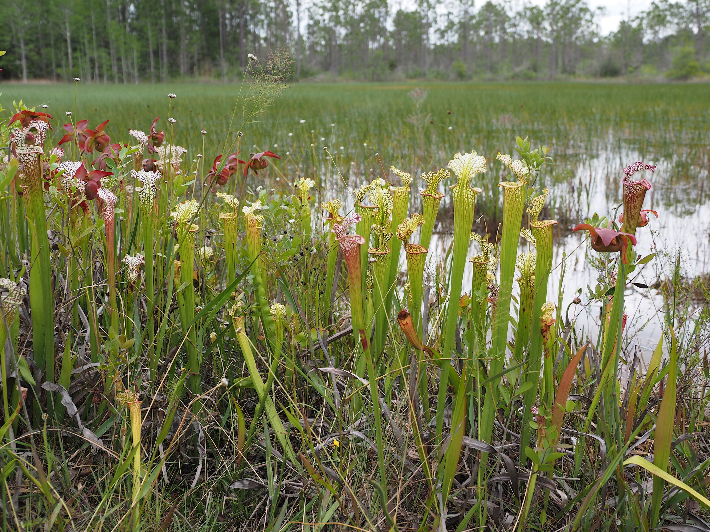
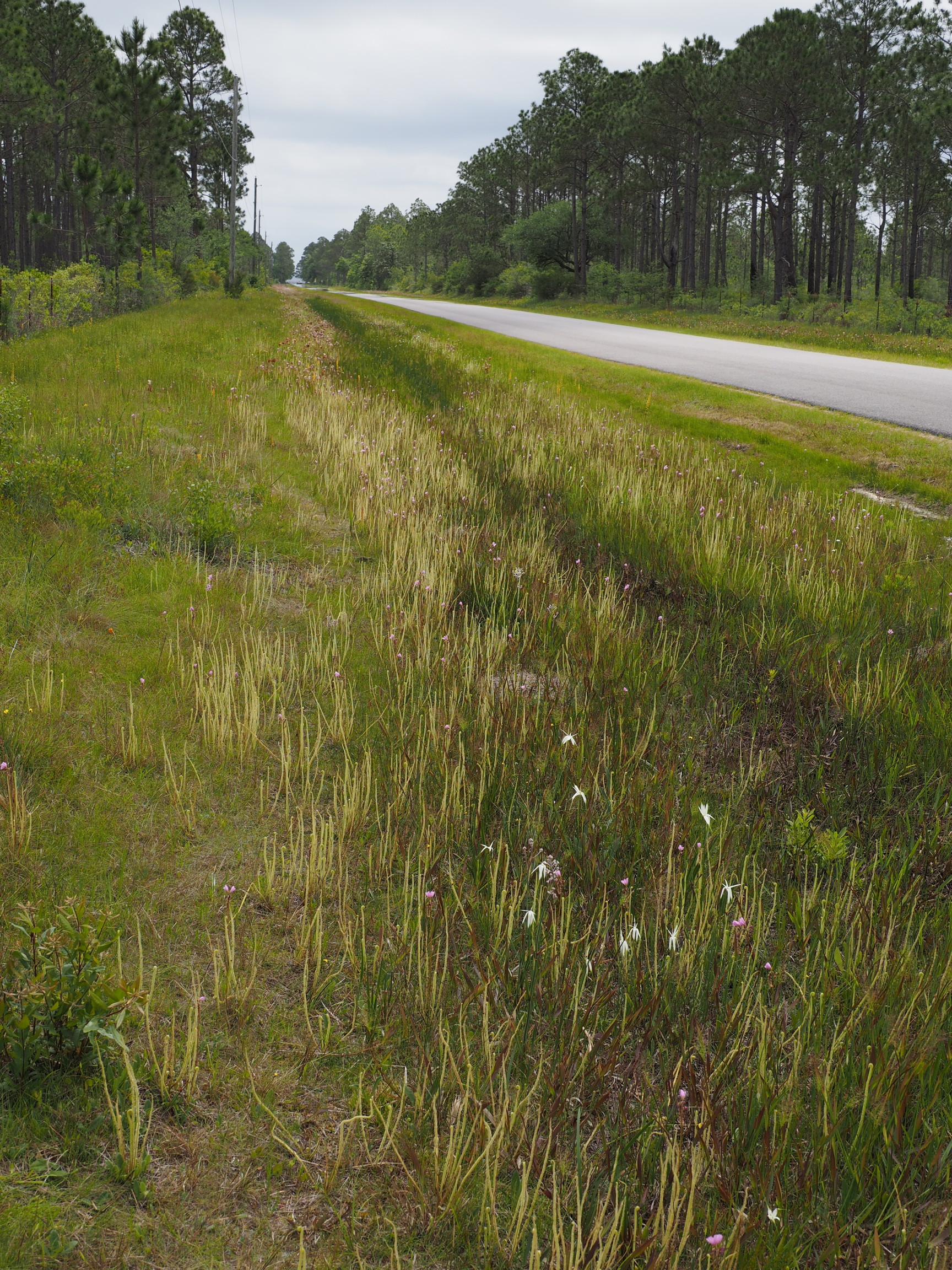
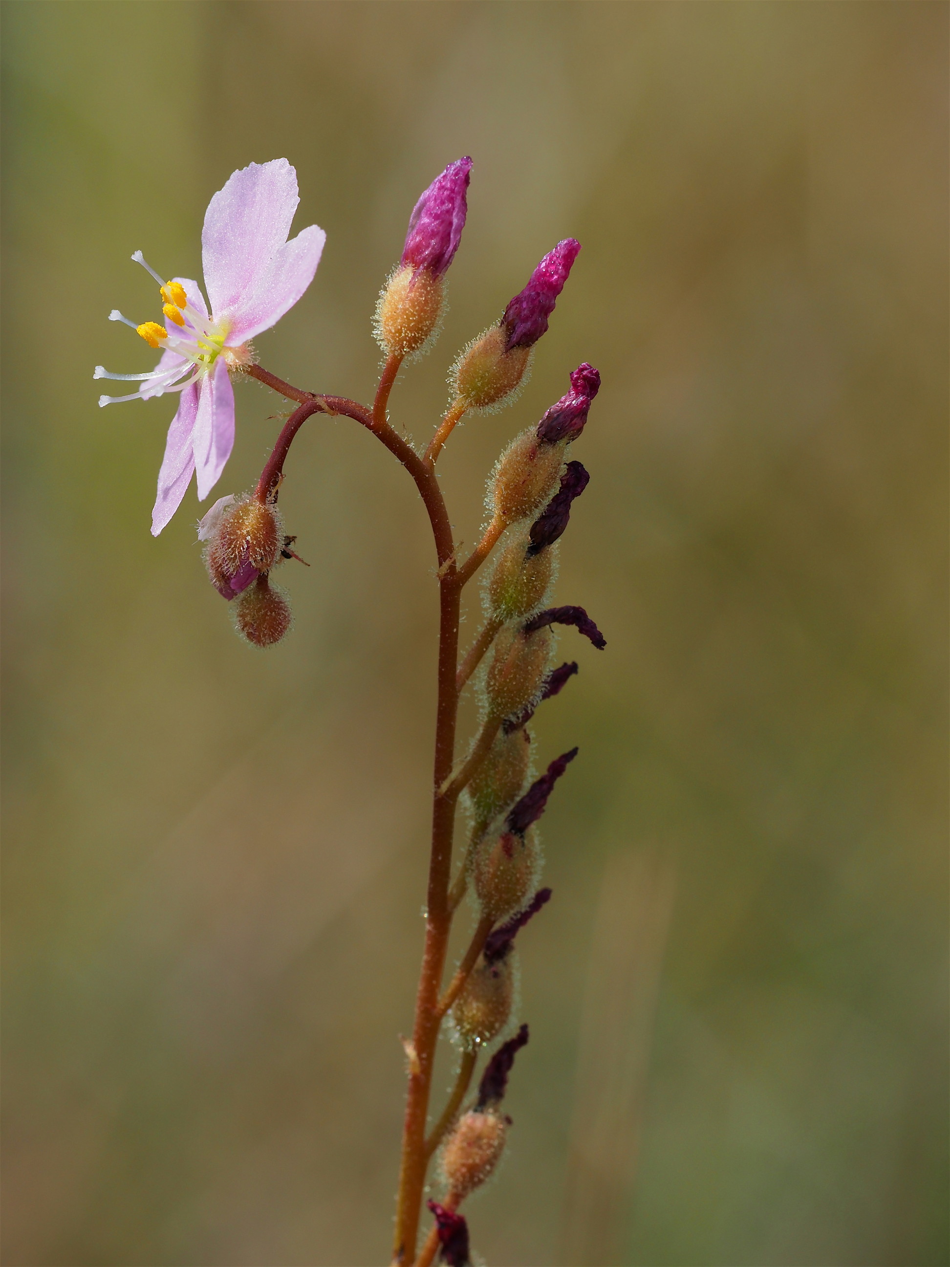
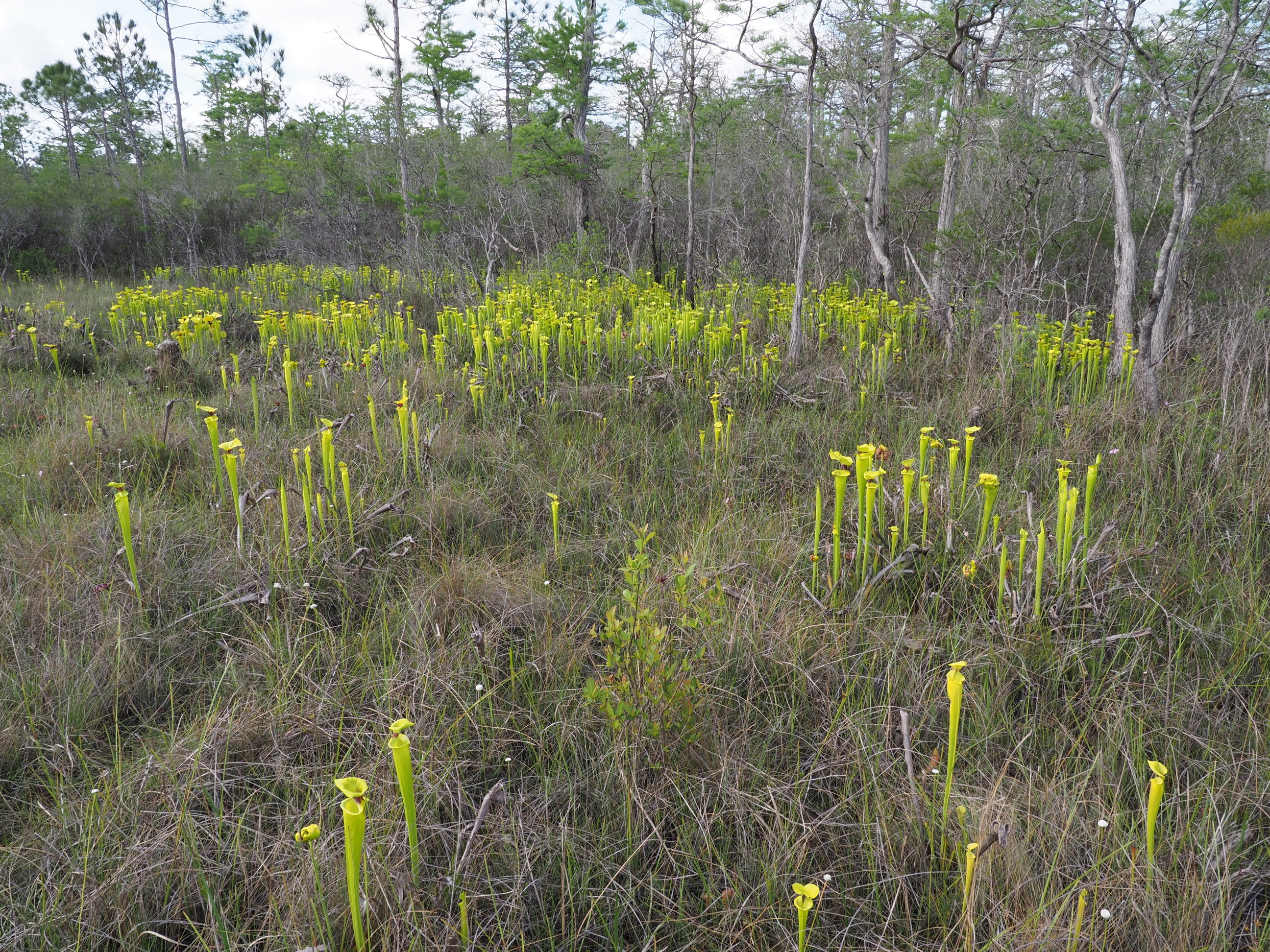
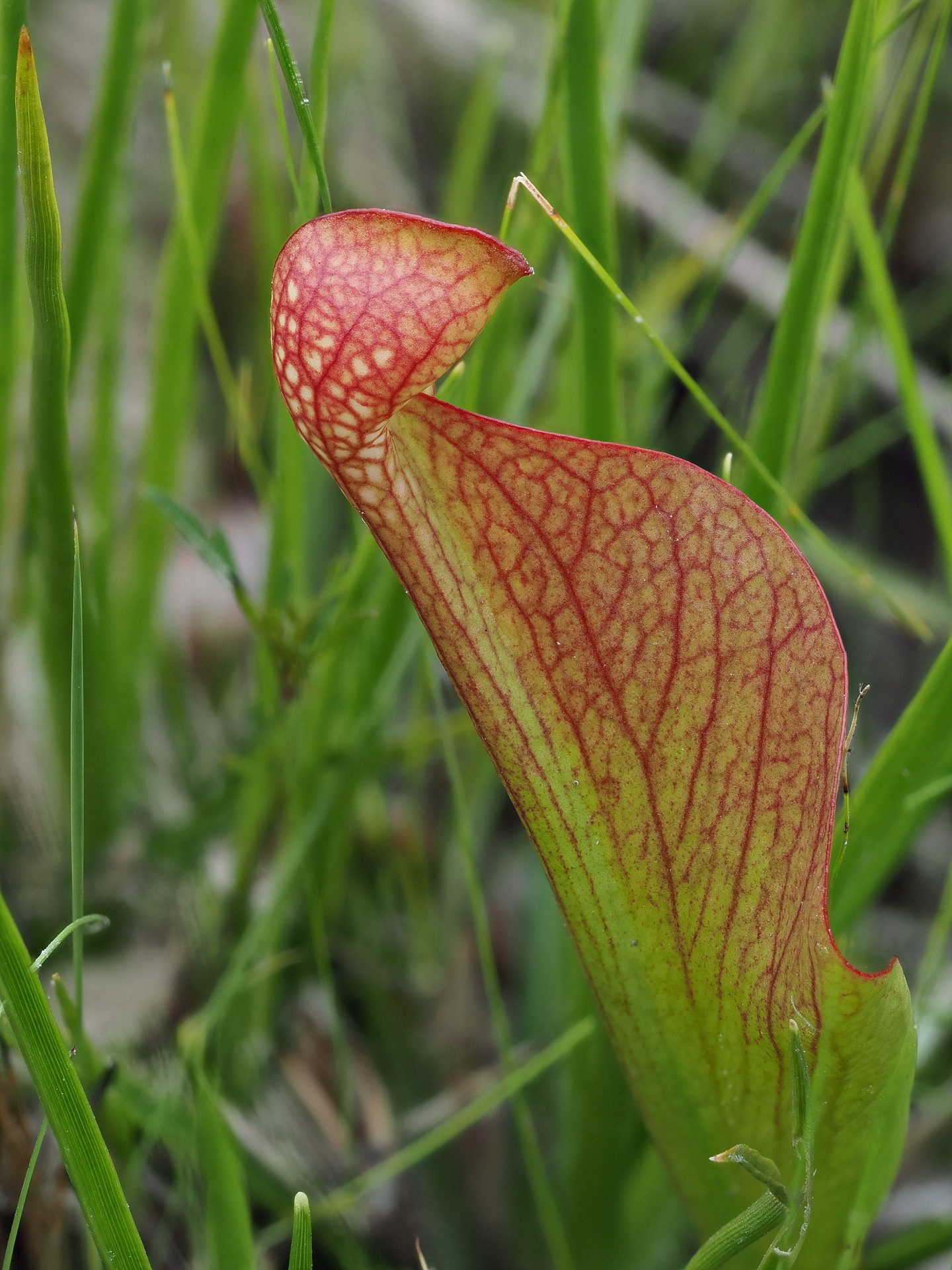
Although we had reservations at a coastal park we had previously visited (Davies Bayou campground of the Gulf Islands National Seashore) we wanted to pass through the Desoto National Forest on our way there to evaluate the Big Biloxi campground as an option. Though somewhat off our route, we wanted to see the following day the area known as Buttercup Flats. This small part of the Desoto National Forest (northwest of the intersection of Mississippi Highways 15 and 26 – east of the town of Wiggins) is maintained through controlled burns as a natural pine savannah. While such pine savannah is found in many parts of the southeast coastal plain, this particular area is known for its extraordinary abundance of pitcher plants (locally called “buttercups”). The particular species in great abundance is Sarracenia alata.
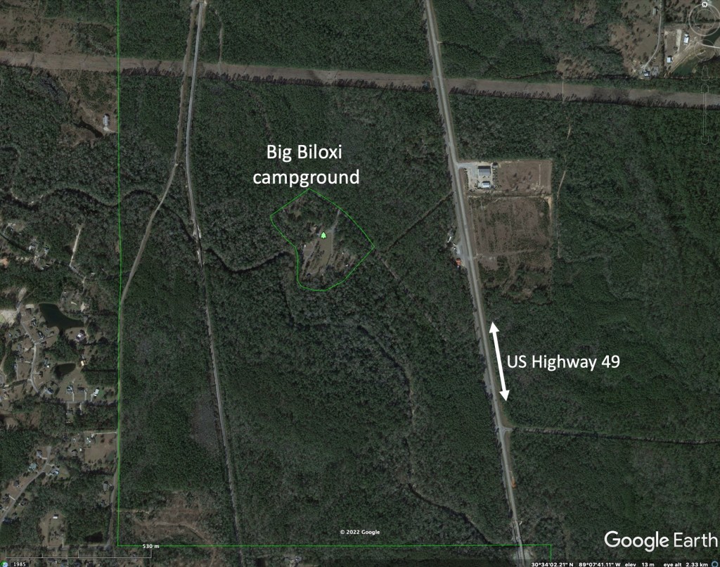
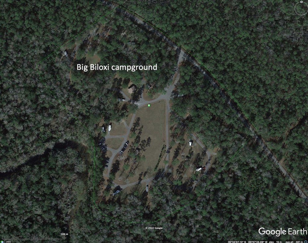
We chose to stay at Big Biloxi as the campground was less crowded that the coastal campground and this would save extra driving to Buttercup Flats the following day. Unfortunately, there was some highway noise at Big Biloxi – it lies only a half mile off a major north-south divided highway in Mississippi. The first night was noisy, but the second night much less so. We mention this to indicate that subtle details can affect your camping experience – the night of the week, the proximity to busy highways etc.
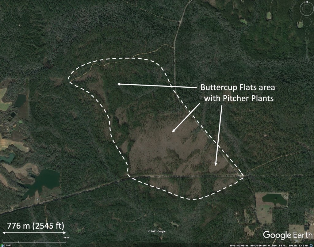

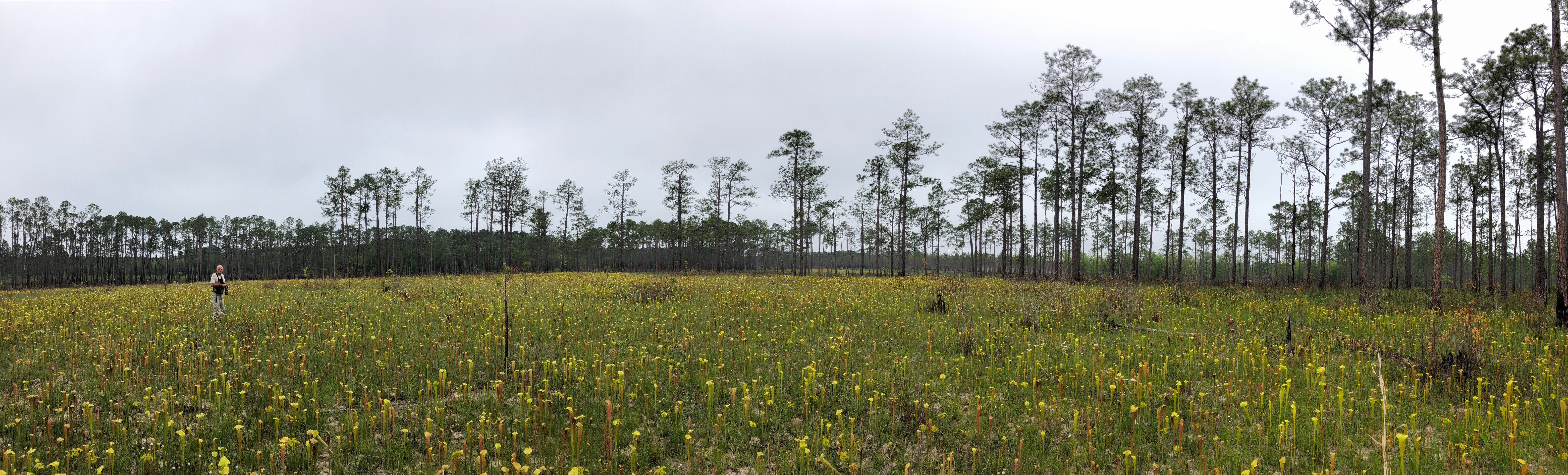
Buttercup Flats was worthwhile to visit. This was the largest field of pitcher plants we had ever seen in the southeastern US. Although many parts of the Florida panhandle have pitcher plants, they are not nearly as extensive or as dense as those at Buttercup Flats.
Curiously, our campground host, who had spent much of the winter at Big Biloxi and was from Mississippi, was not aware of Buttercup Flats, nor of the pitcher plants. This despite the Flats being only twenty seven miles from the campground. Declare it a national monument or state park and people would travel for hundreds of miles to see it…


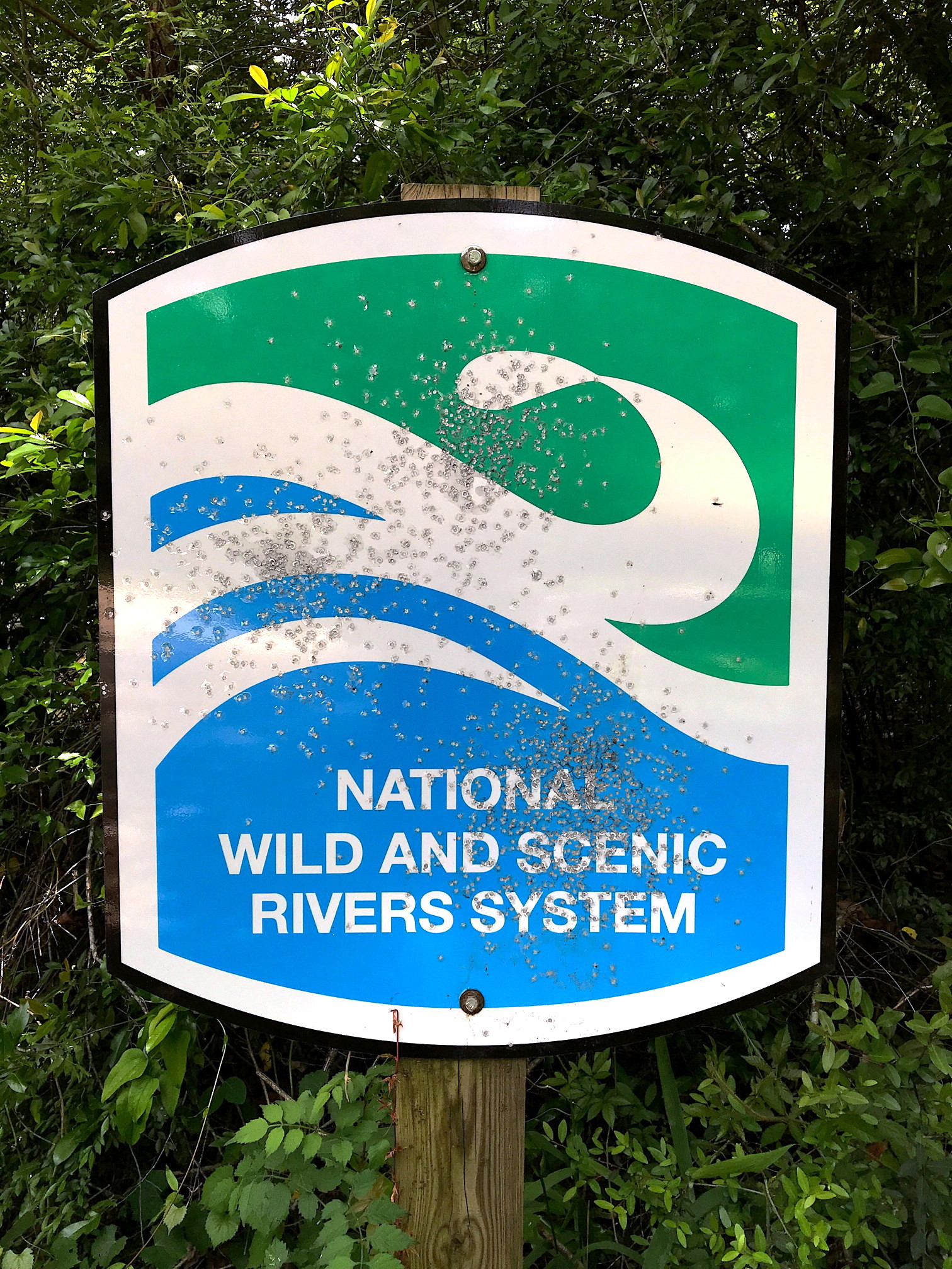

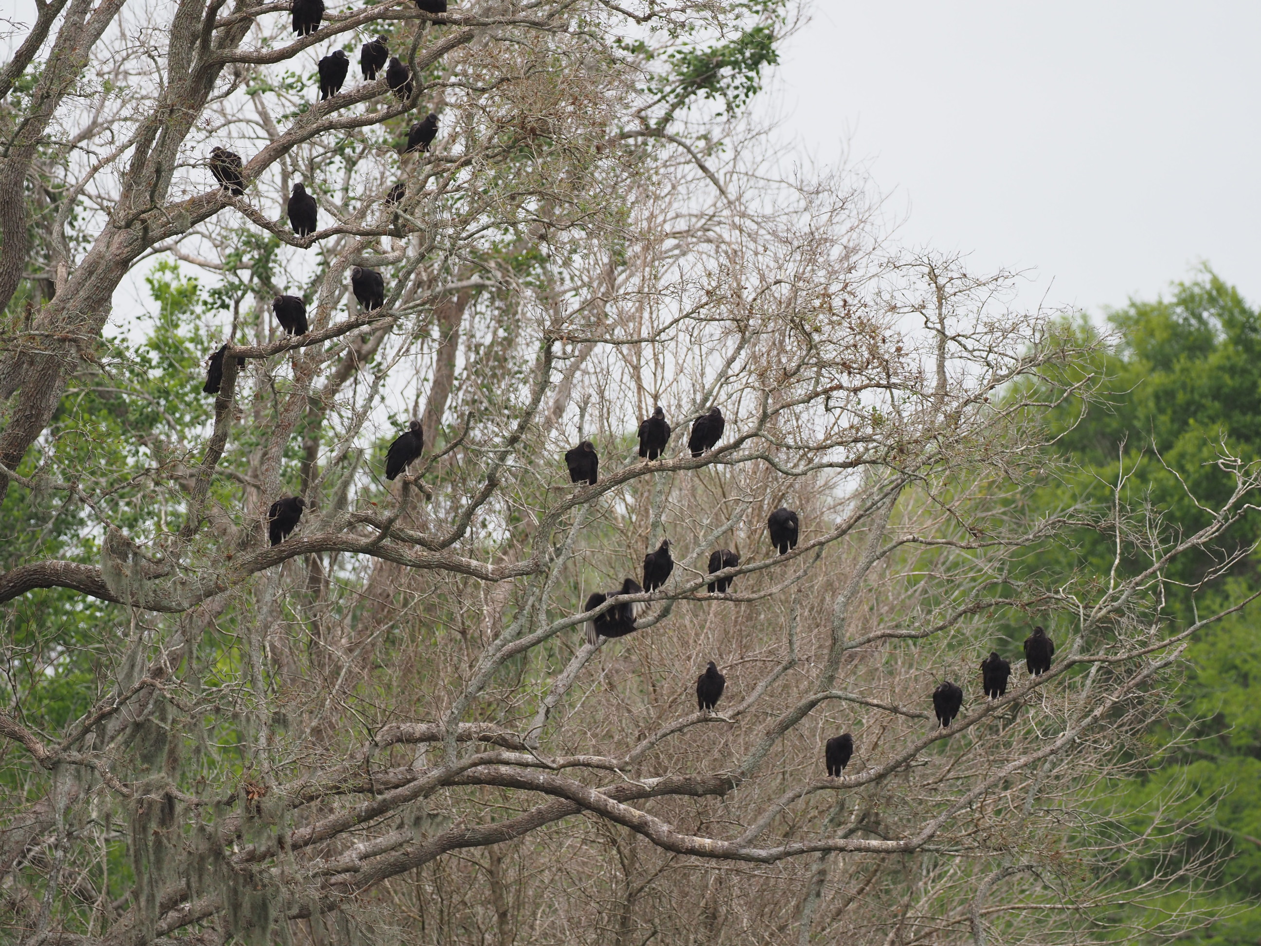
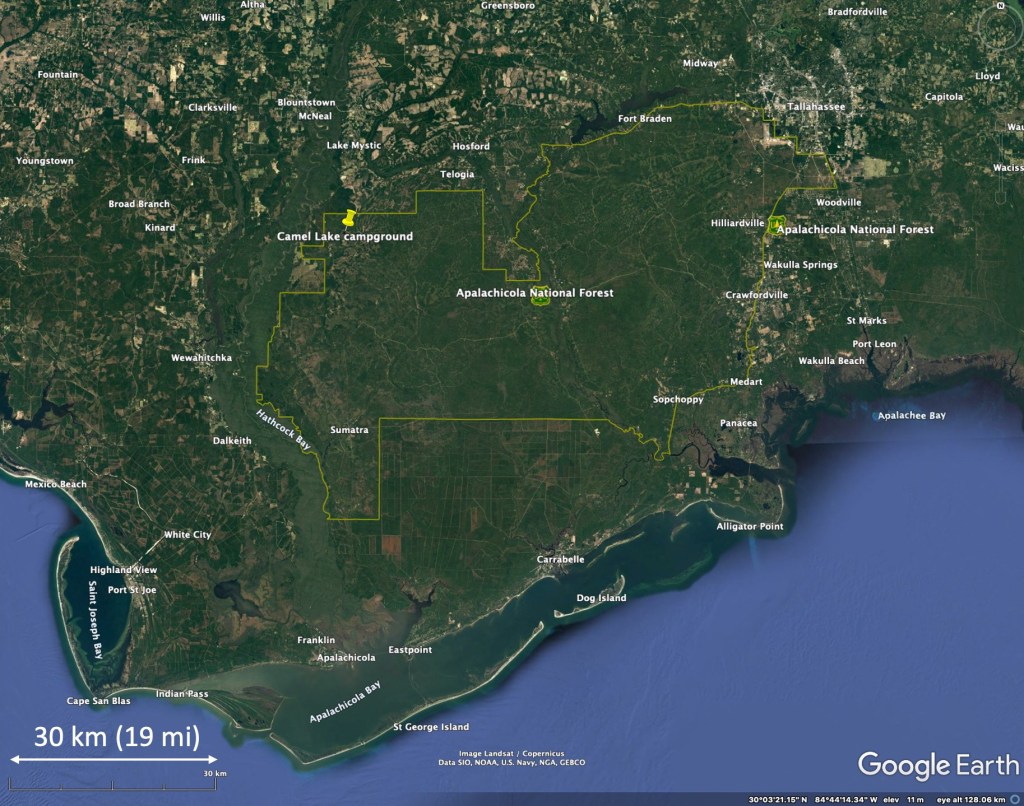
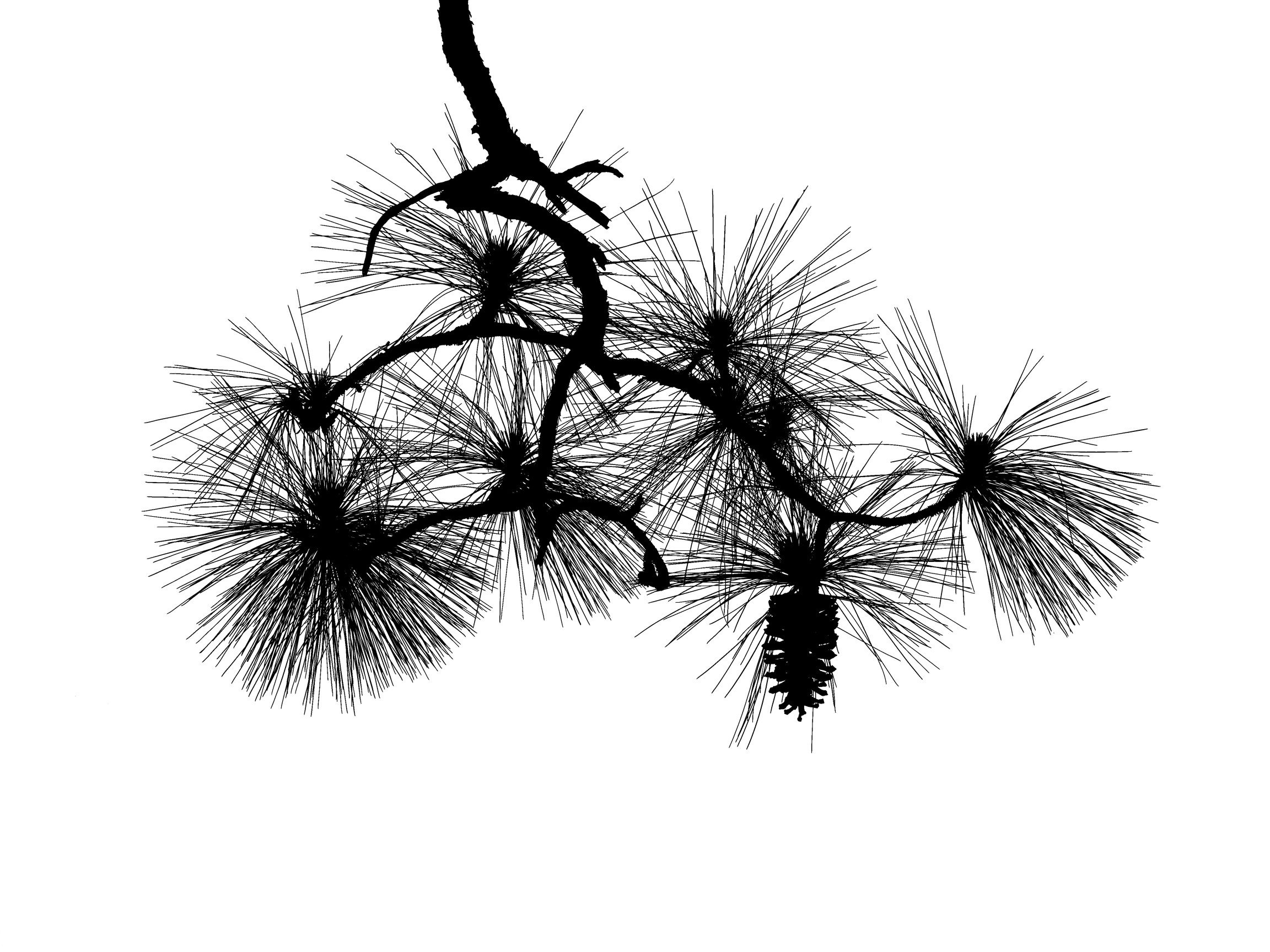
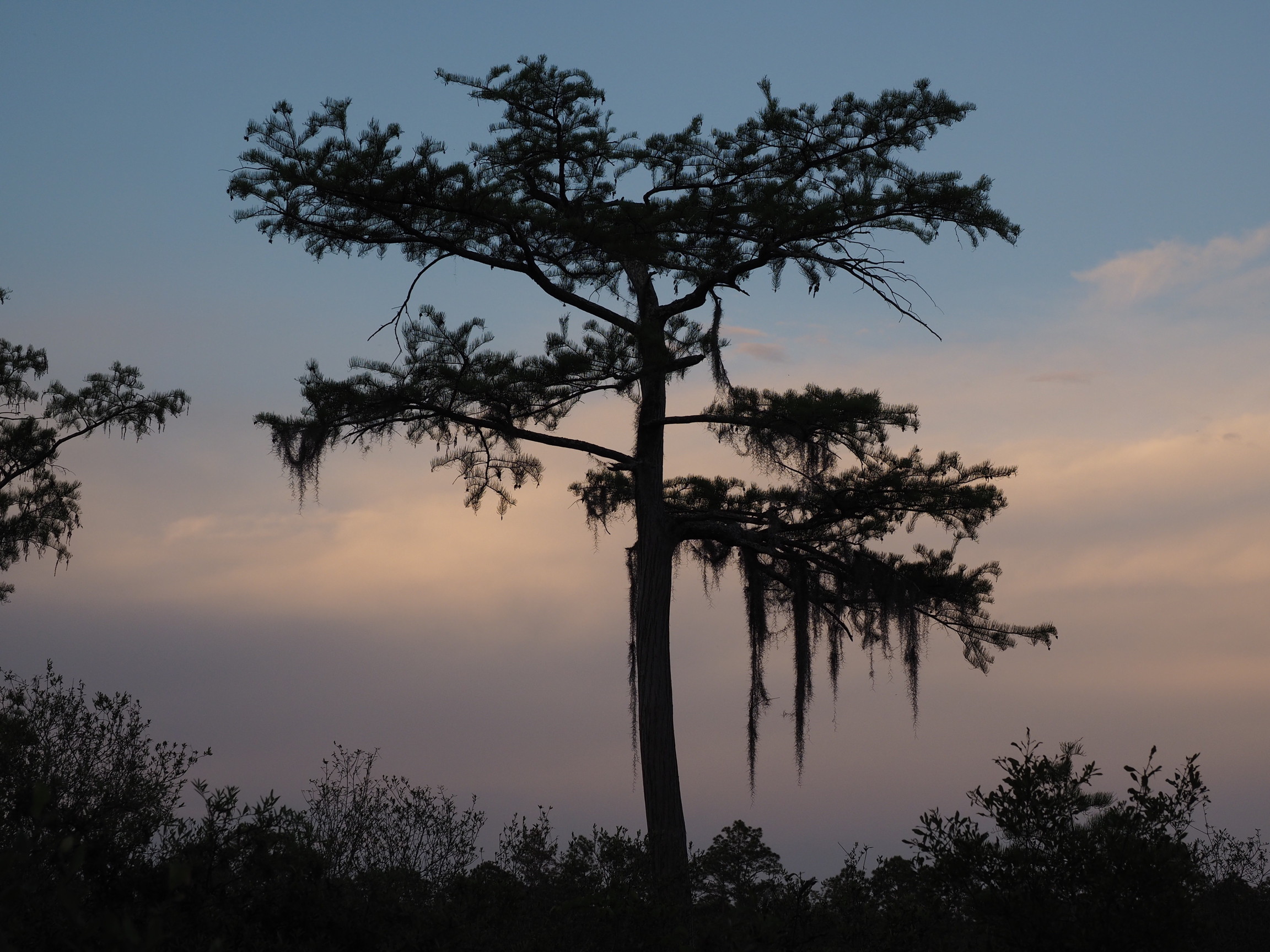
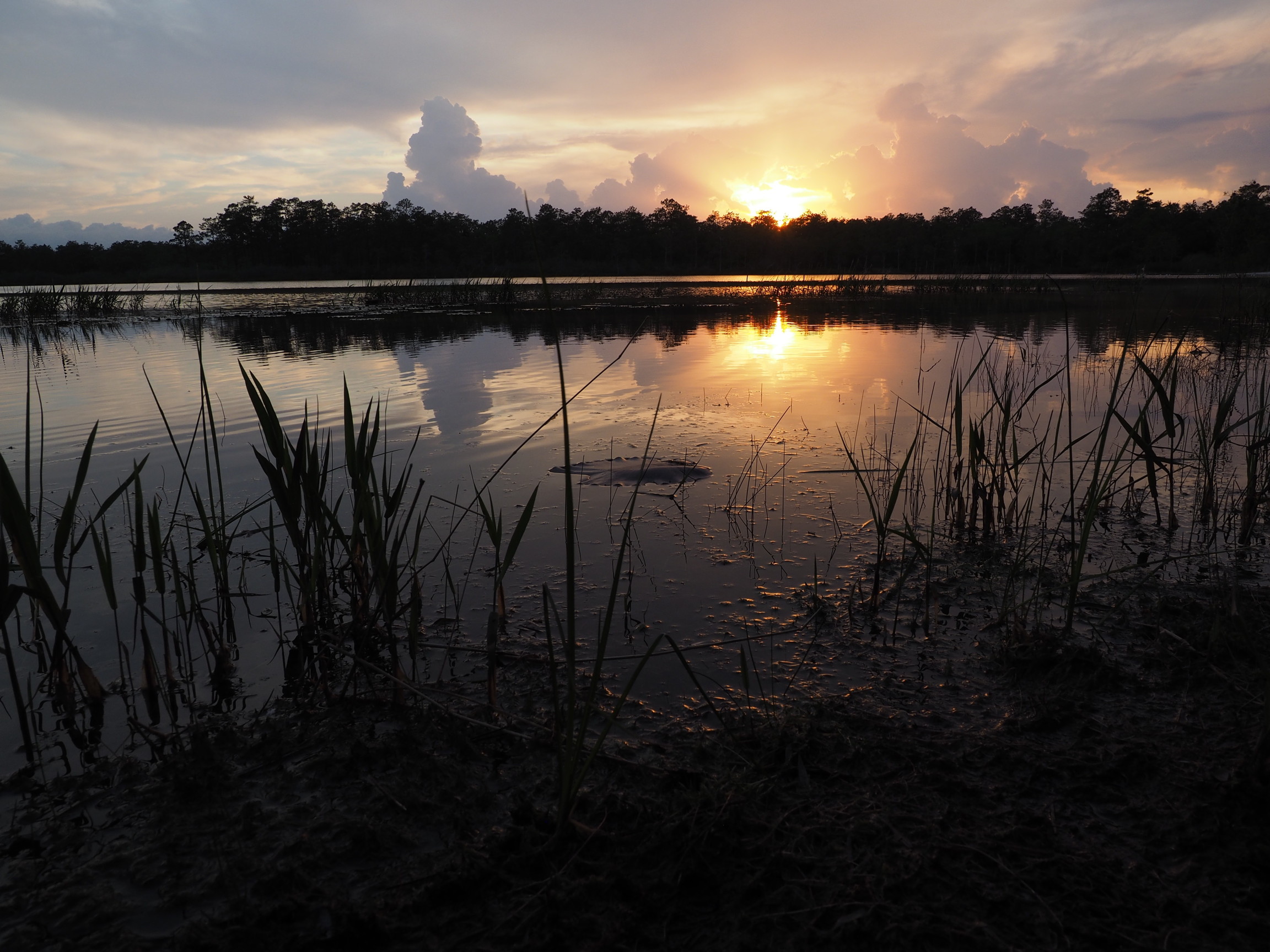
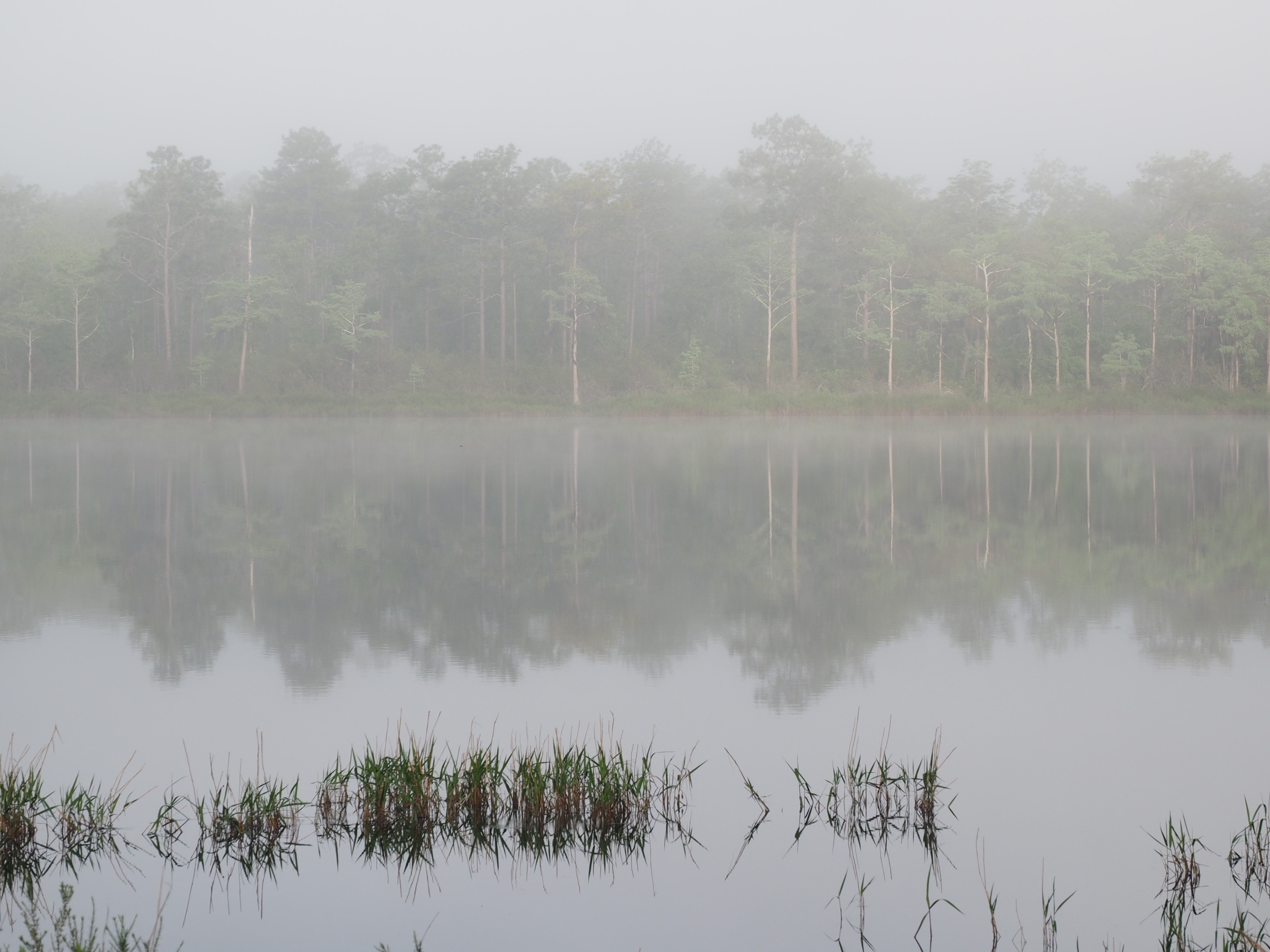
Apalachicola National Forest – Camel Lake
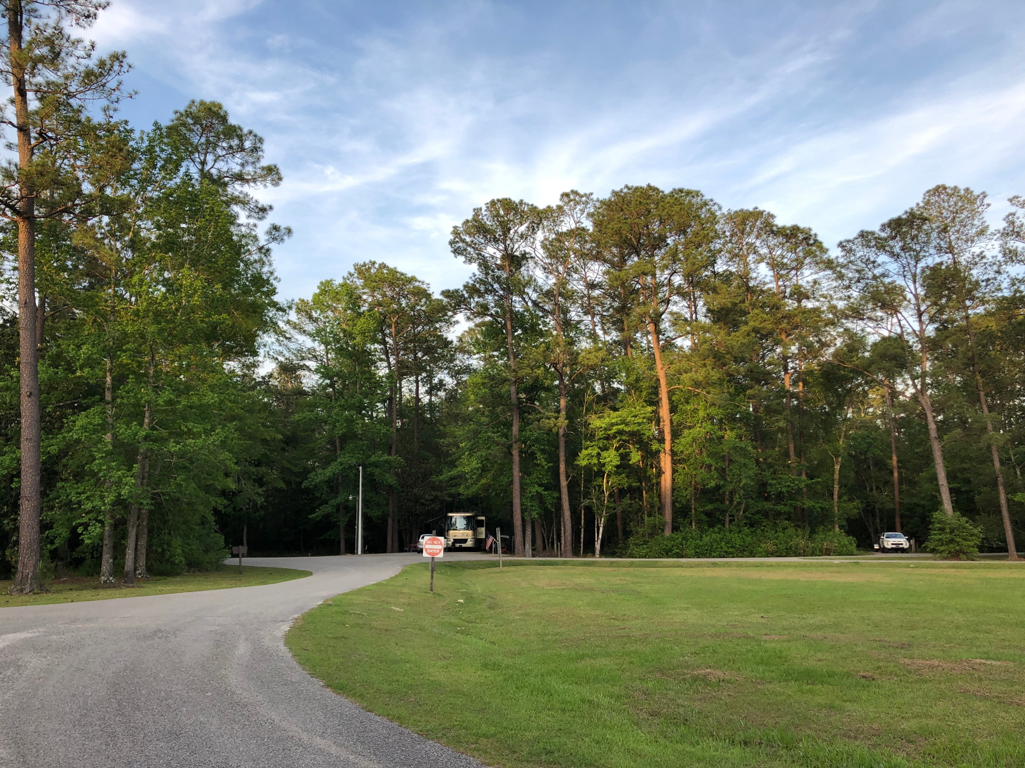
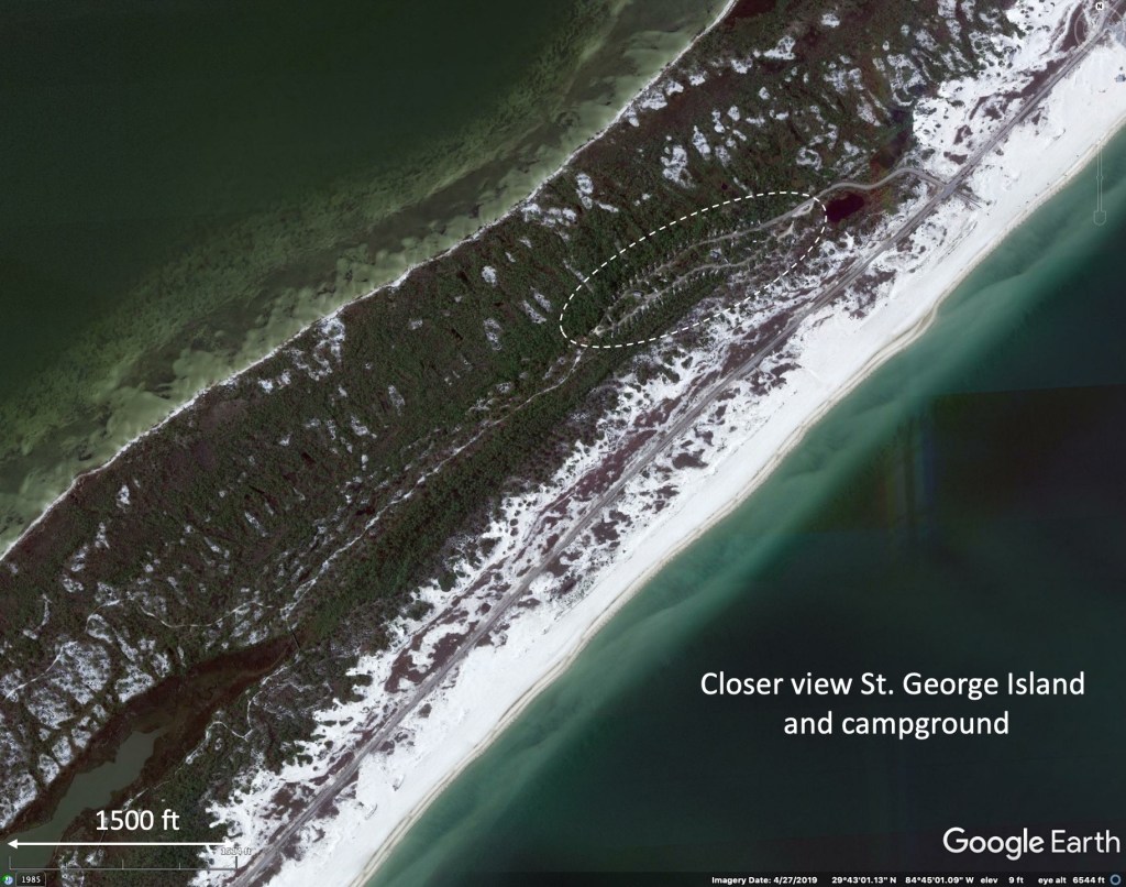
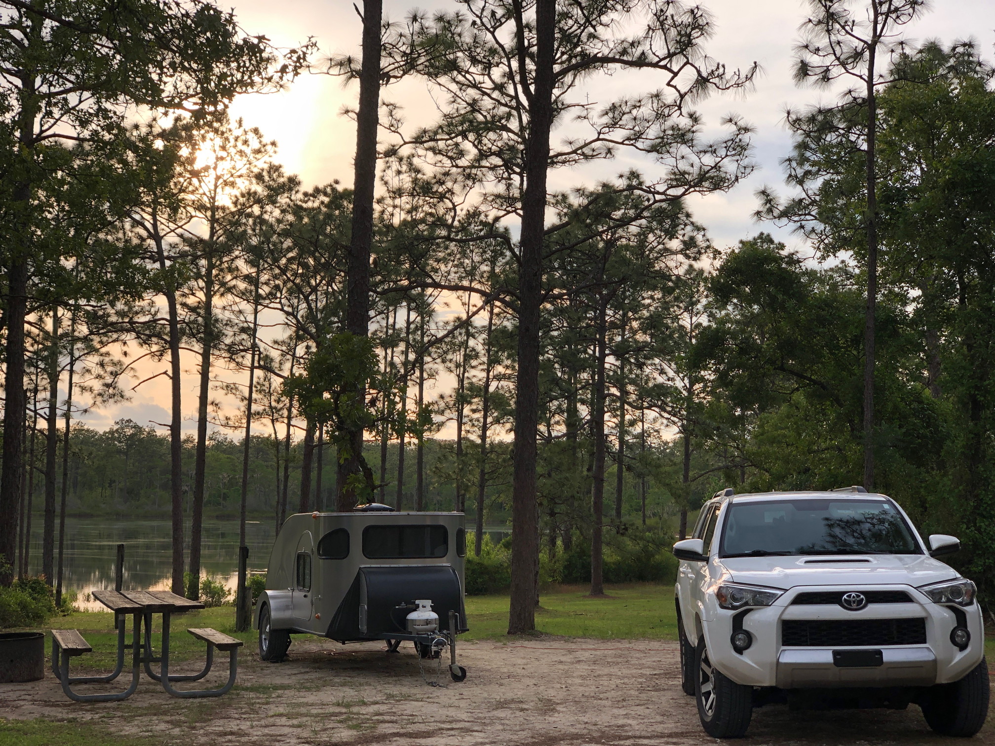
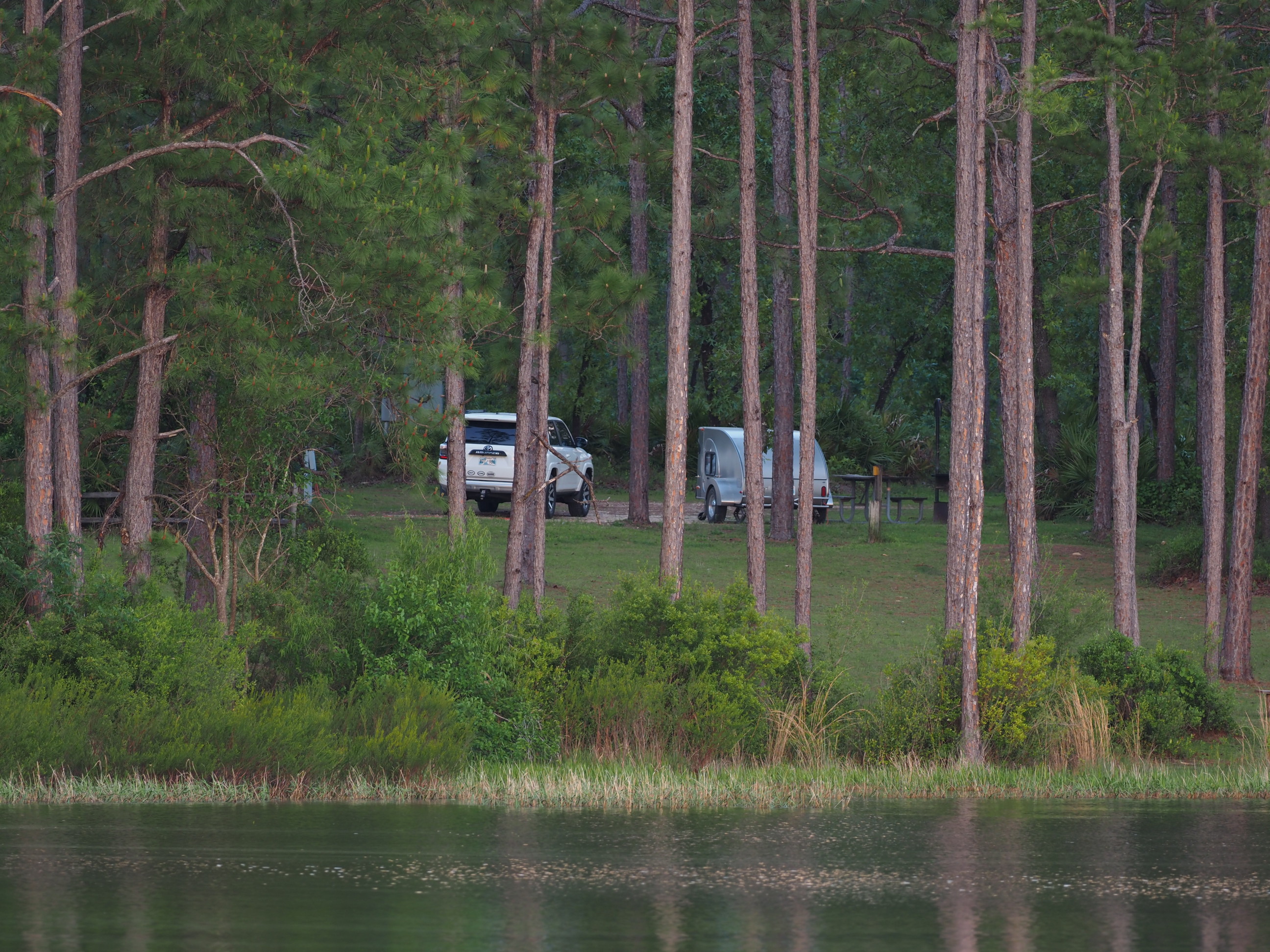
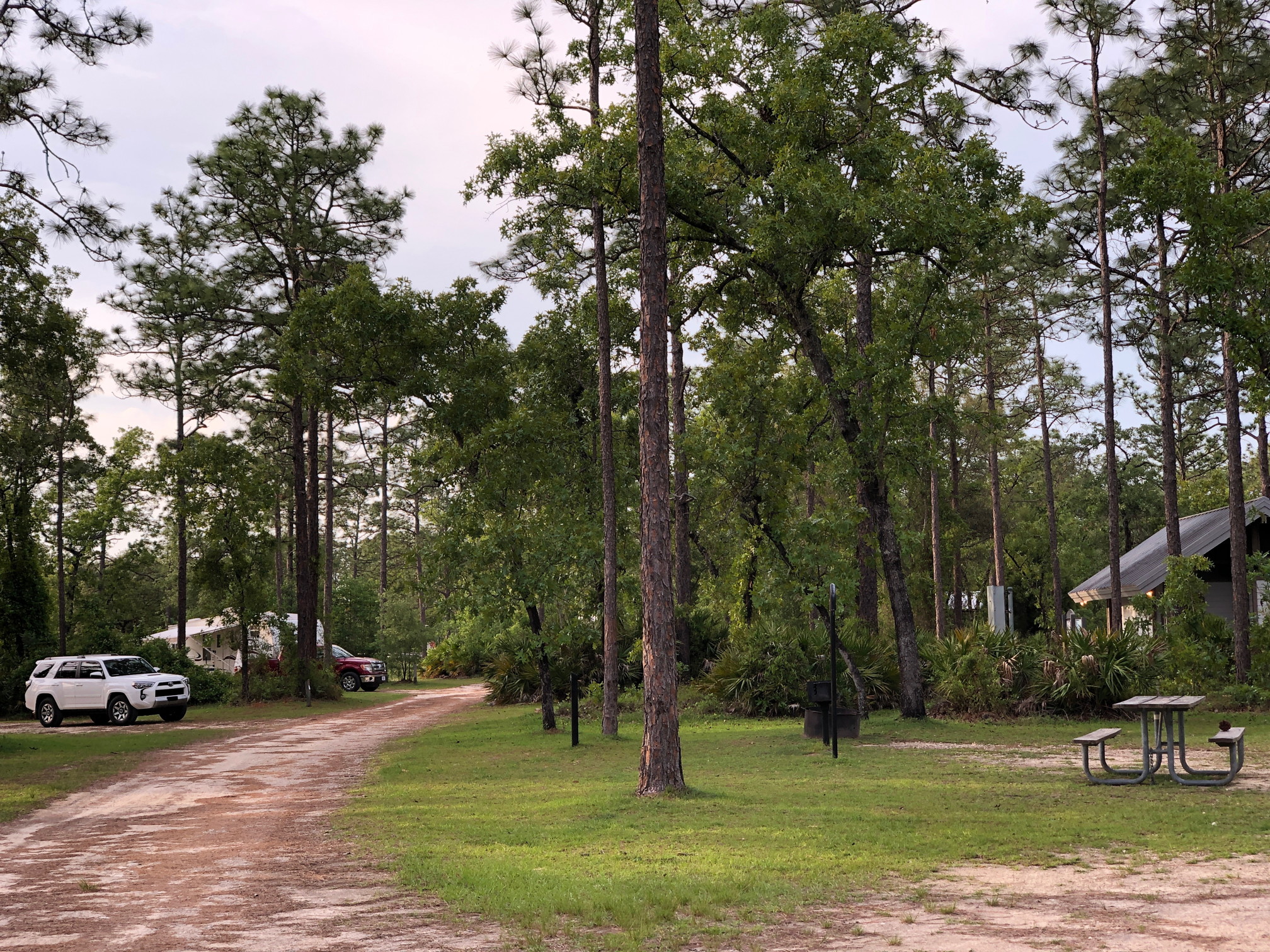
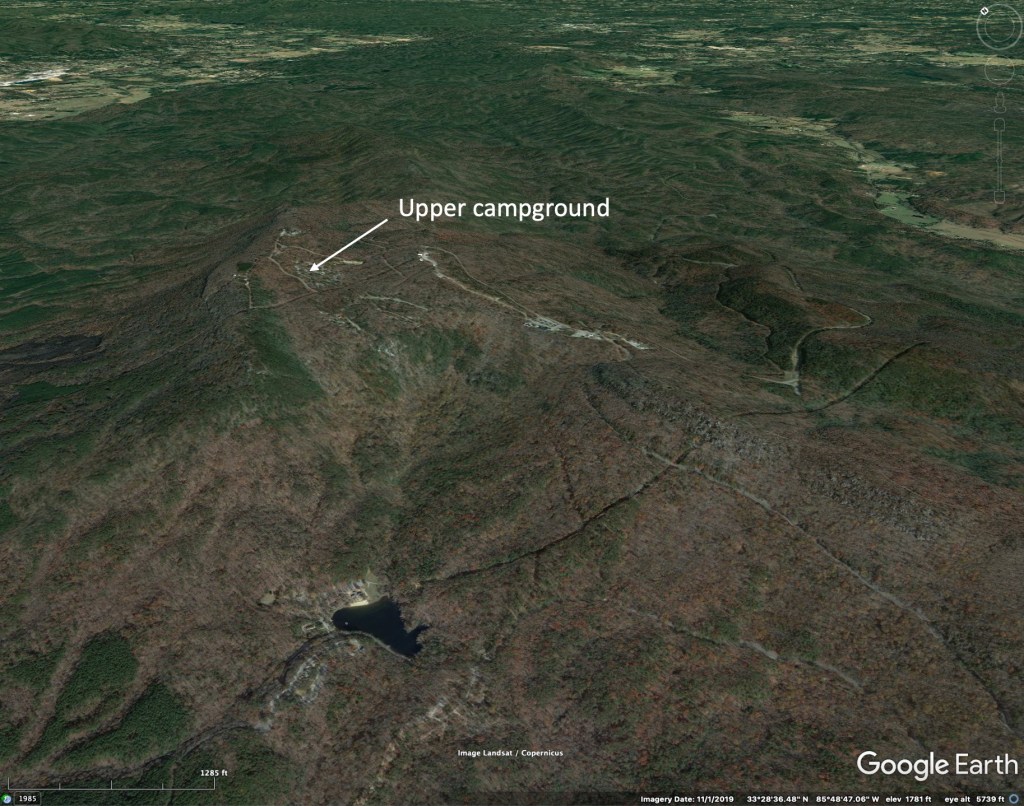
We are familiar with the back roads of the Apalachicola National Forest, since we spent years in Talahassee. These are lightly traveled during weekdays and we chose to camp at the Camel Lake Recreation Area. This has only twelve camping sites and only four electric sites, so it is not crowded with larger RV’s. It sits along the shore of a small natural sand pond that has a nice 1 mile nature trail that goes around it and that very few people use. Camel Lake, about 55 miles from downtown Tallahassee, is at the far western part of the Apalachicola NF and closer to the pitcher plant savannas than other camping areas nearer to Tallahassee. It is a convenient base for exploring the national forest or other attractions along the coast like St George Island or Torreya State Park.

Below: Photos from the Apalachicola National Forest and surroundings. Explanations are with each image.


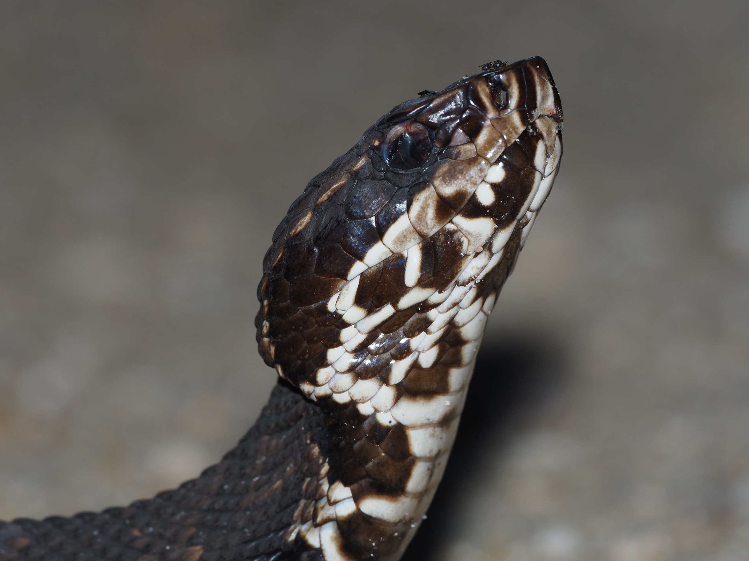


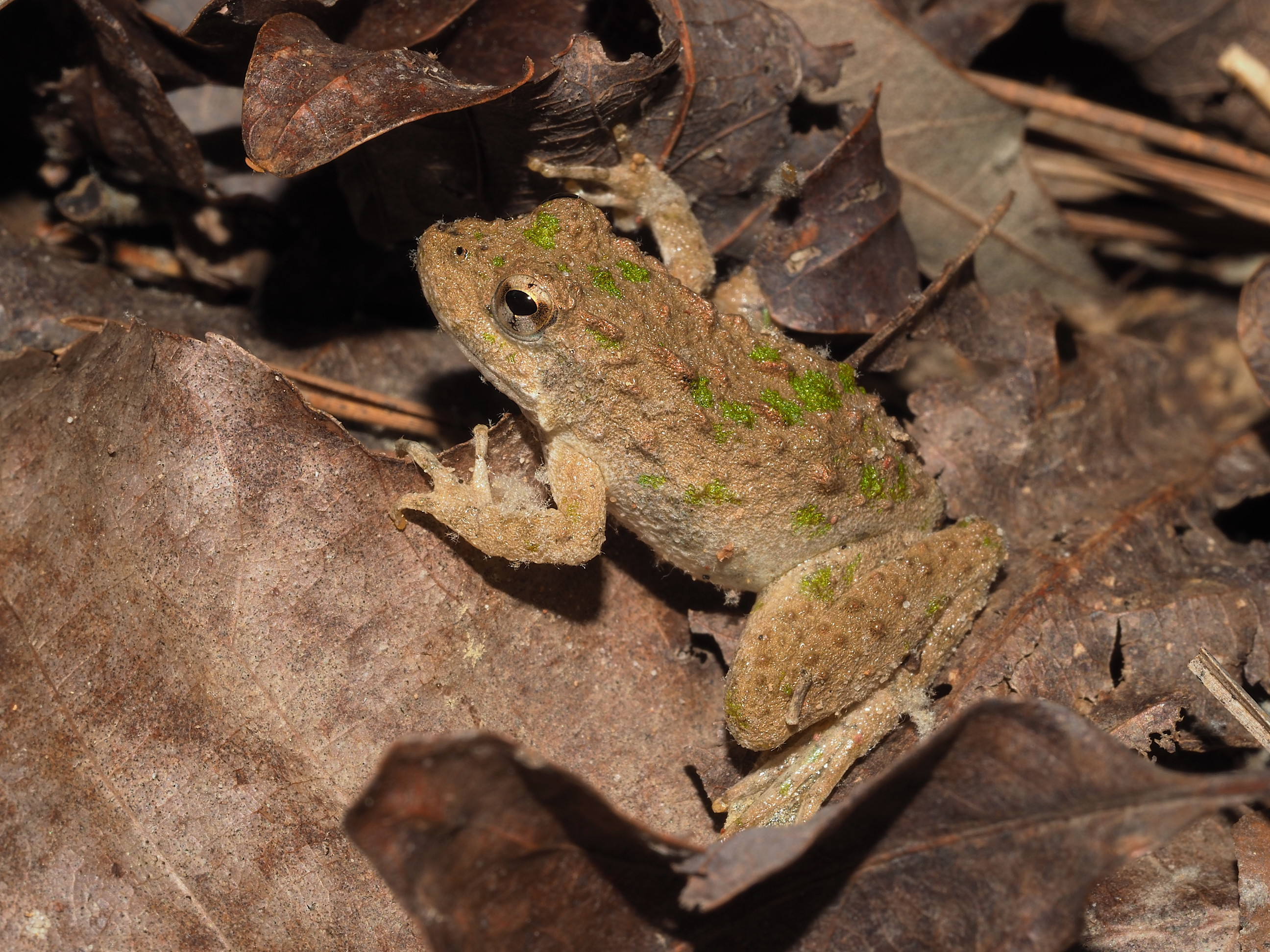
One objective of the visit to the Apalachicola was to revisit carnivorous plant localities that we have seen over the years. We had less time for this than anticipated, but did revisit the “Hosford Bog” just outside the hamlet of Hosford. While stopped to photograph the Venus Fly Traps found there (apparently introduced there many decades ago – before 1980) a car pulled up and a woman got out… We thought she was going to ask if we needed help. It turned out her last name was Hosford and she knew Bruce Means (from whom we learned of the bogs location in the 80’s), and she was a member of the Florida Native Plant Society. We talked for a while about the need to burn the bog to remove the shrubs that were encroaching. She knew of one other Fly Trap location as well (we had seen them elsewhere in the 80’s but had been unable to locate them).
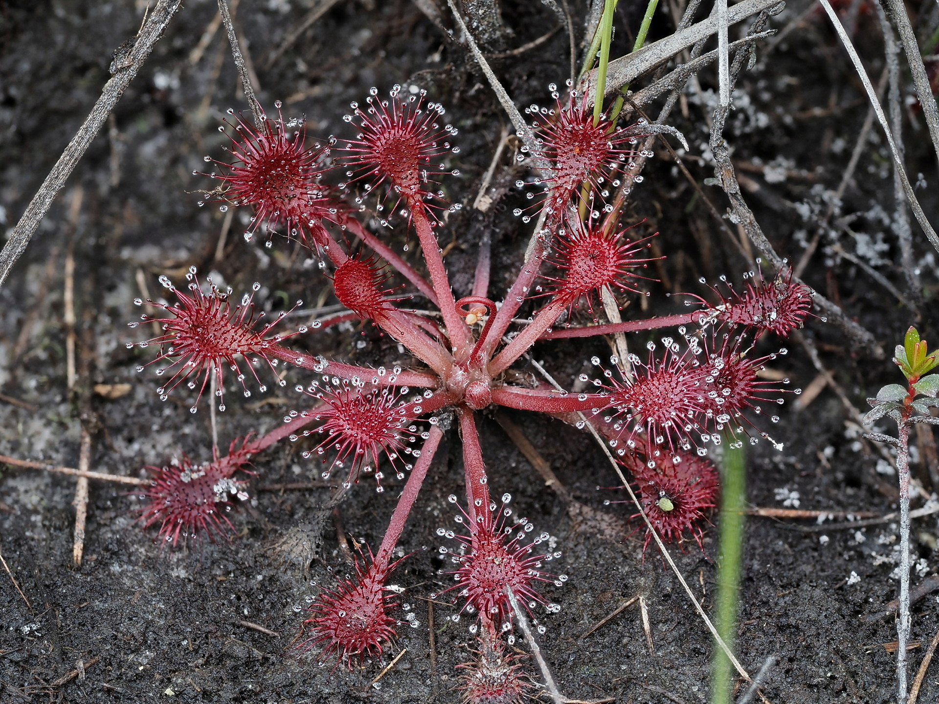
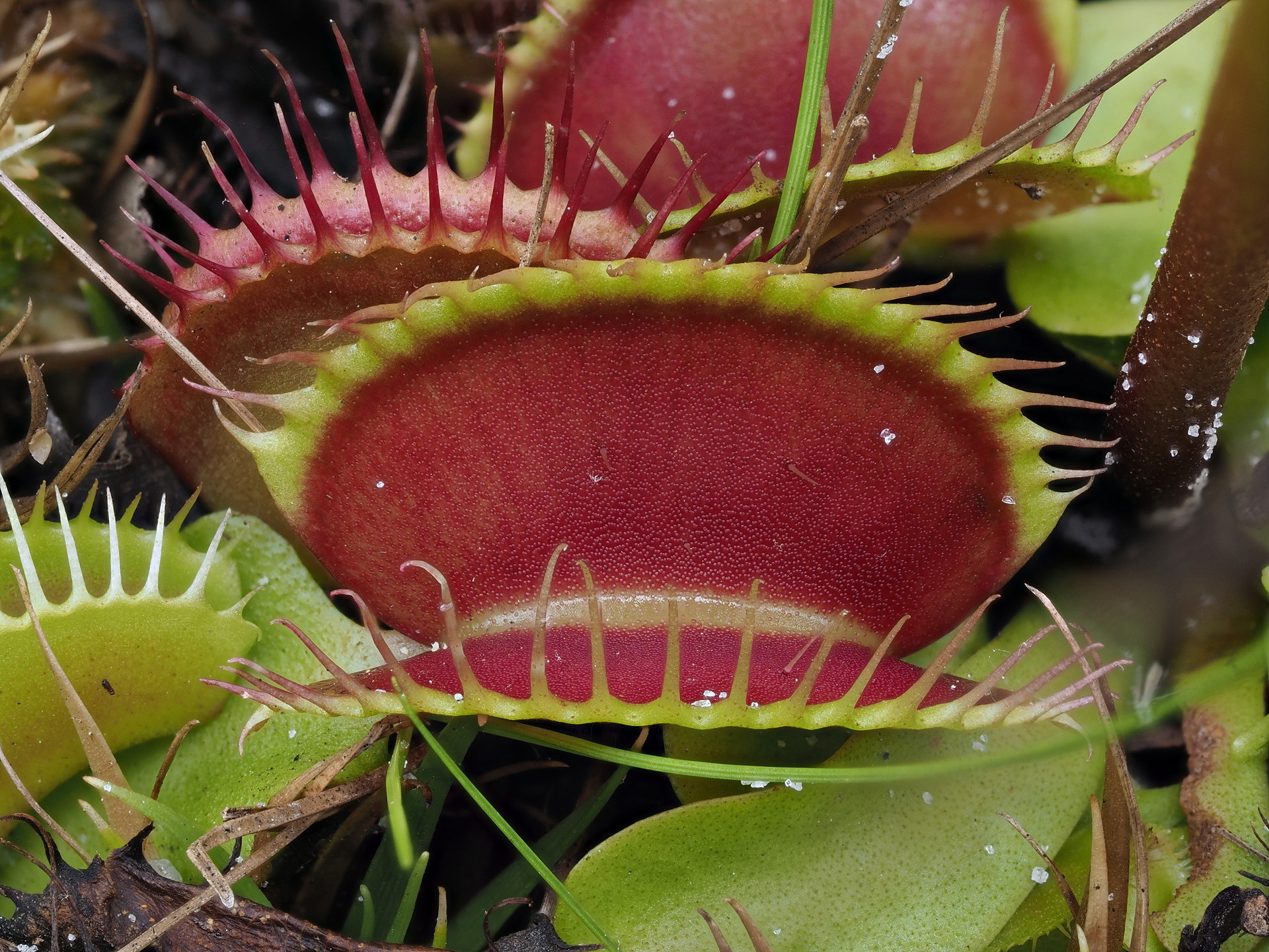
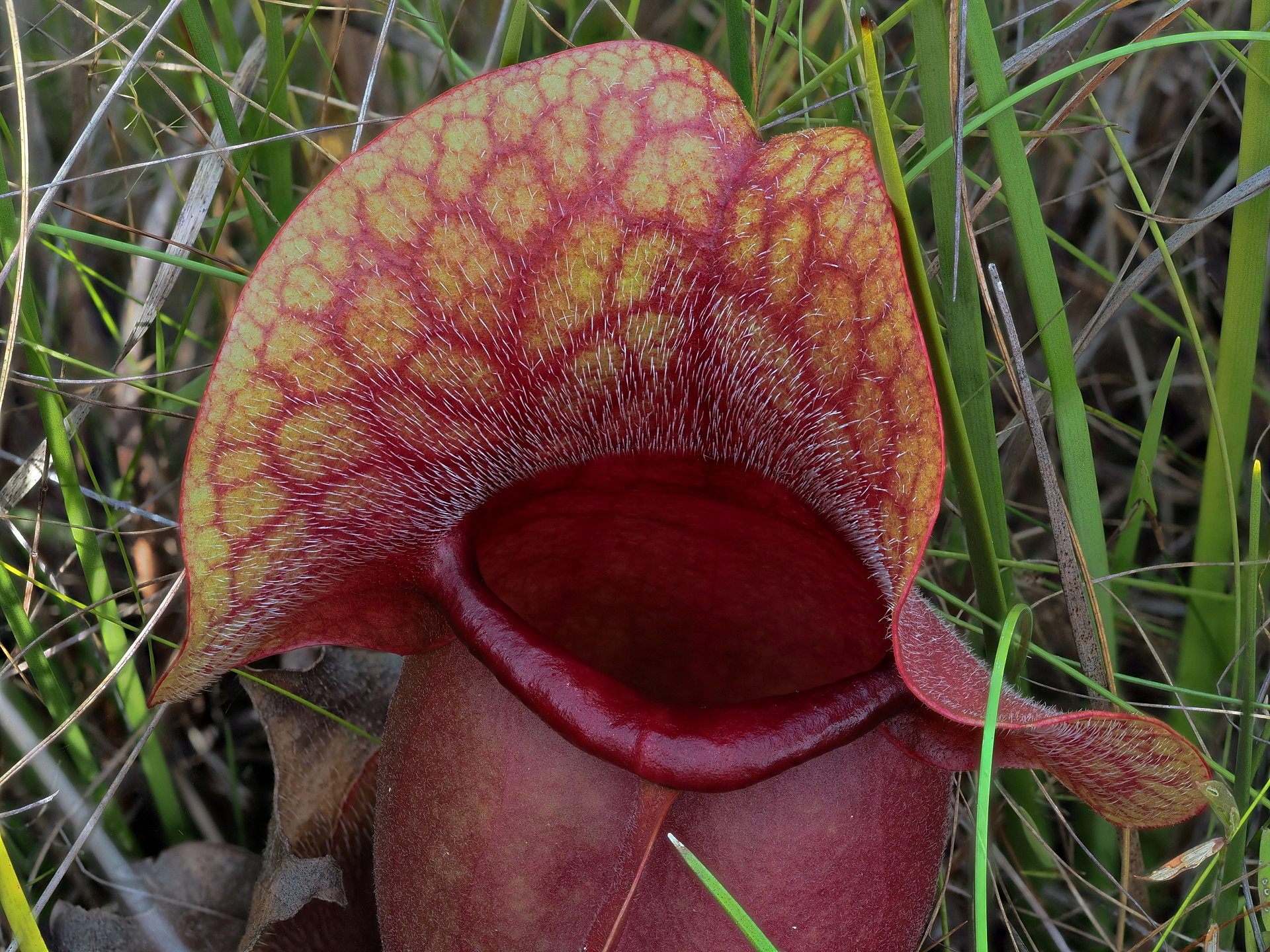
Below are some photos of various insectivorous plants we saw while in the Florida area. These aren’t individual photos – they are focus stacked images from many images focused at different positions. The Olympus camera we use has this capability – it changes the focus of the lens slightly with each shot and these can be processed to get much greater depth of field than with a single photo. The camera must be on a tripod to do this.


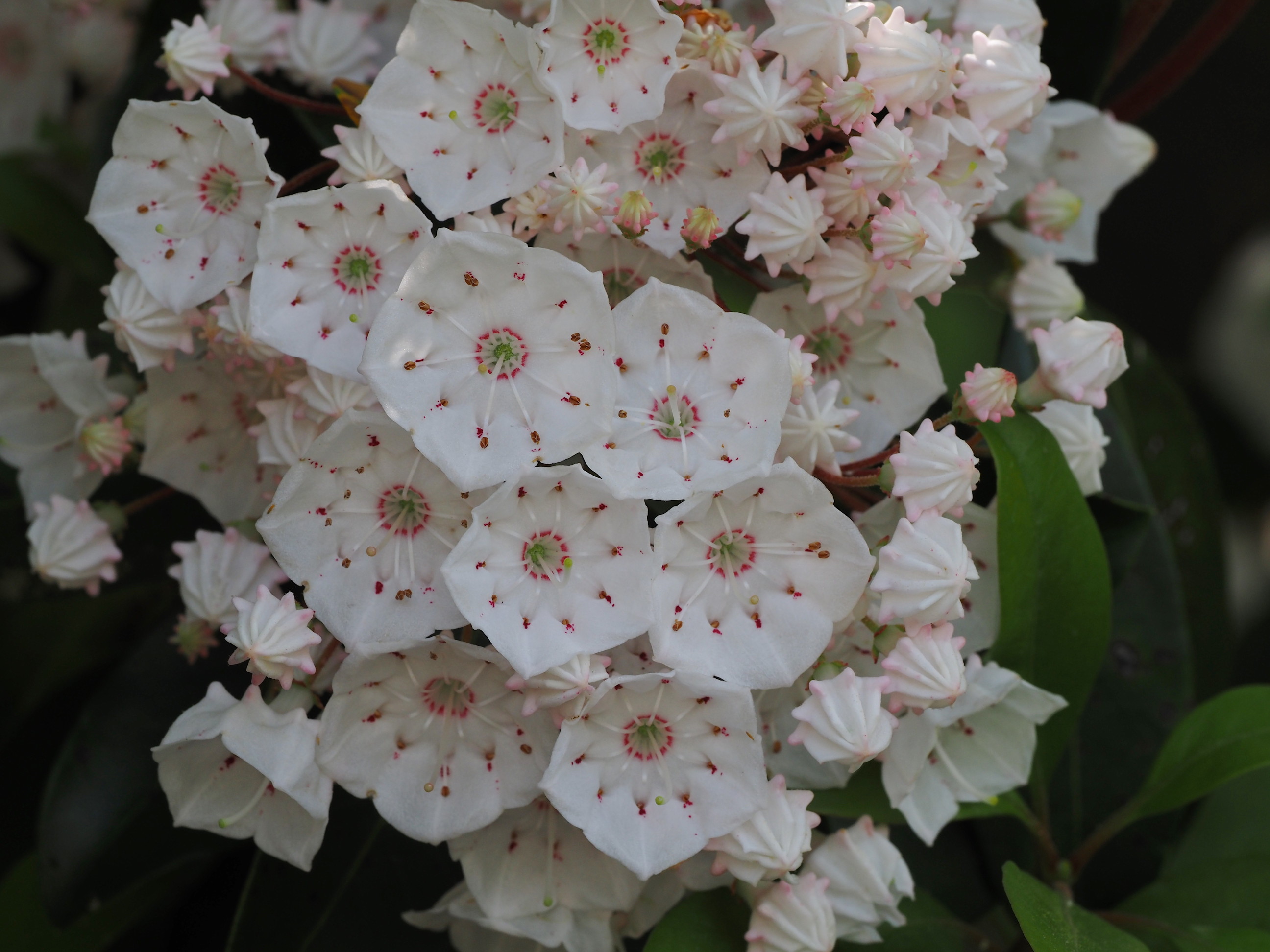
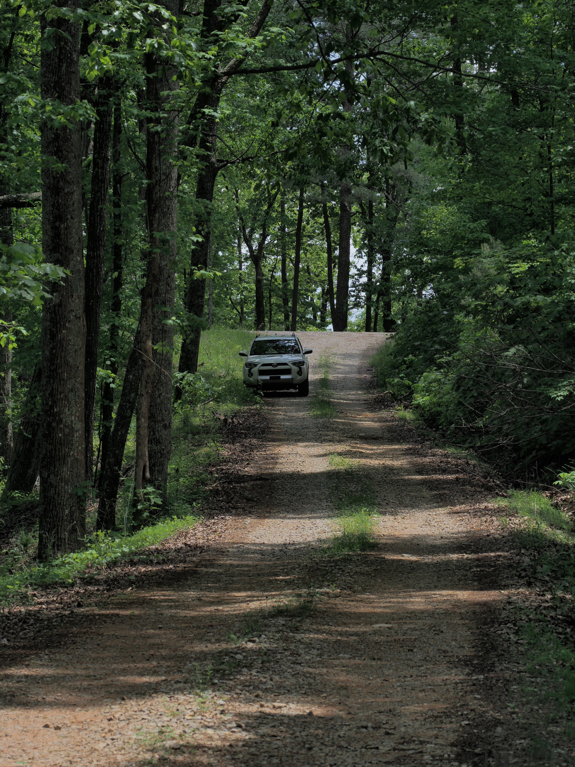
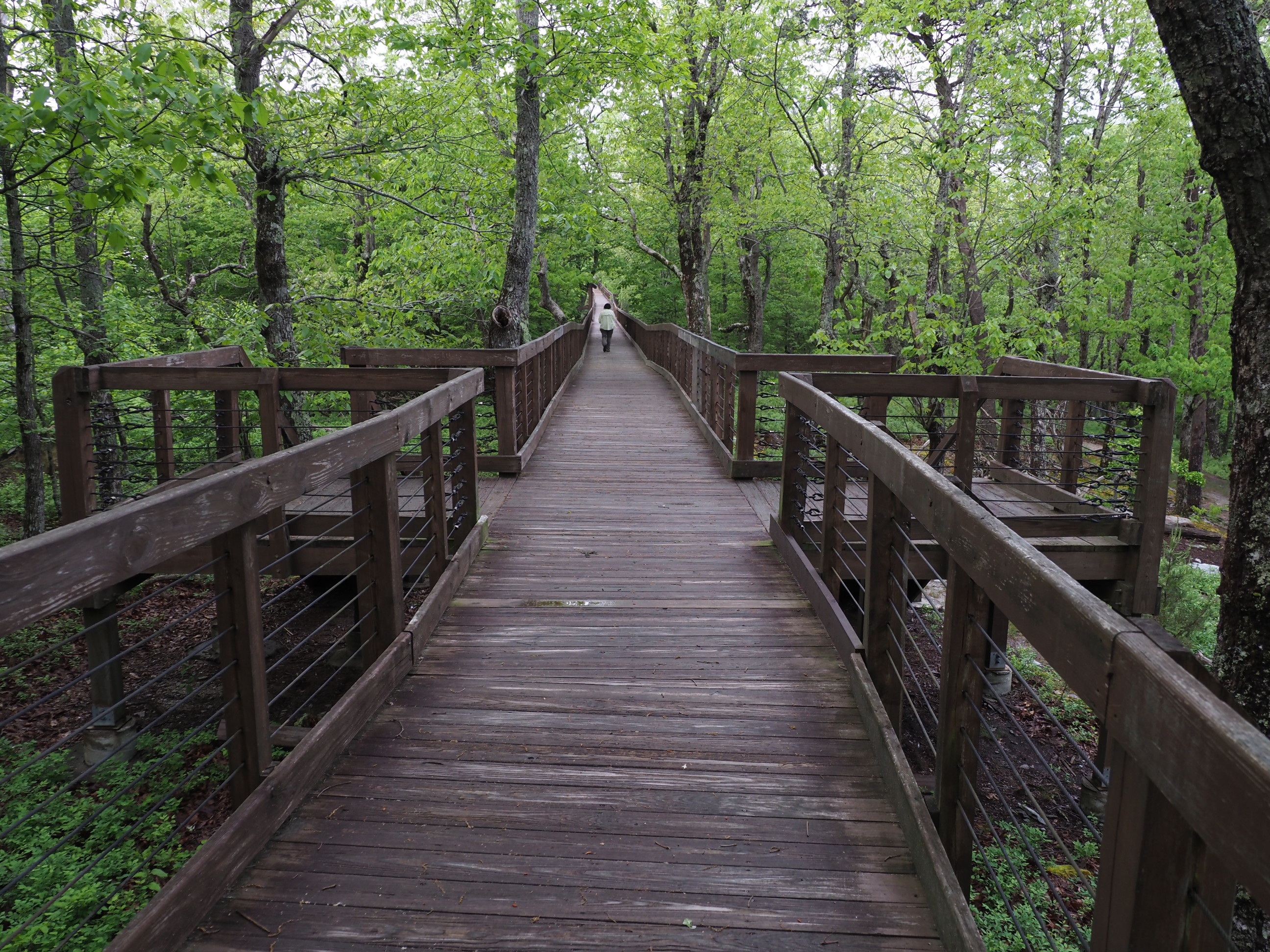
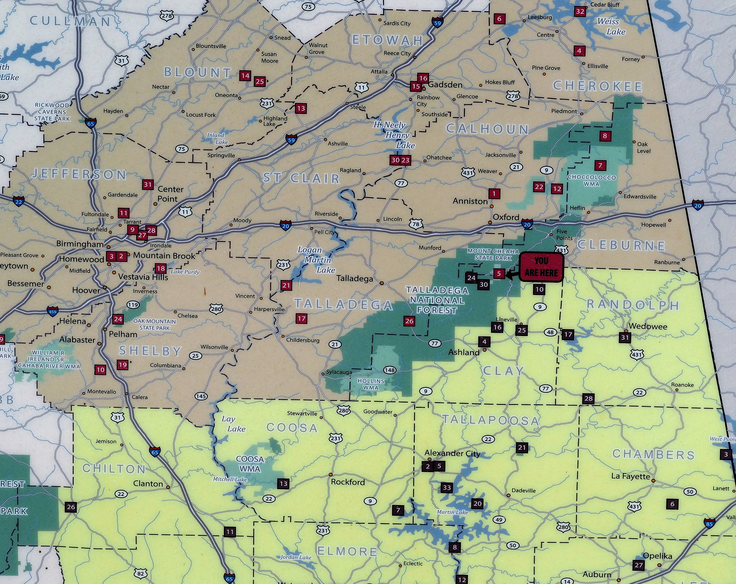
Cheaha State Park and Talladega National Forest
Cheaha State Park is small, but it is surrounded by Talladega National Forest land that runs along the ridge that forms the highest part of Alabama. Though not high (2500 ft max elevation) compared with the Appalachian Mountains farther to the northeast, Cheaha has nice vantage points and an excellent accessible boardwalk through the mountaintop forest. Several short trails extend through the park and much longer ones run the length of the Talladega National Forest.


The elevation of Cheaha State Park (about 2000-2500 ft) made for somewhat cooler temperature than the lower elevation parts of Alabama. Unfortunately, many people had camp fires during the evening and conditions were a bit smoky at times.
Below: Some photos from our two-night stay at Cheaha State Park.


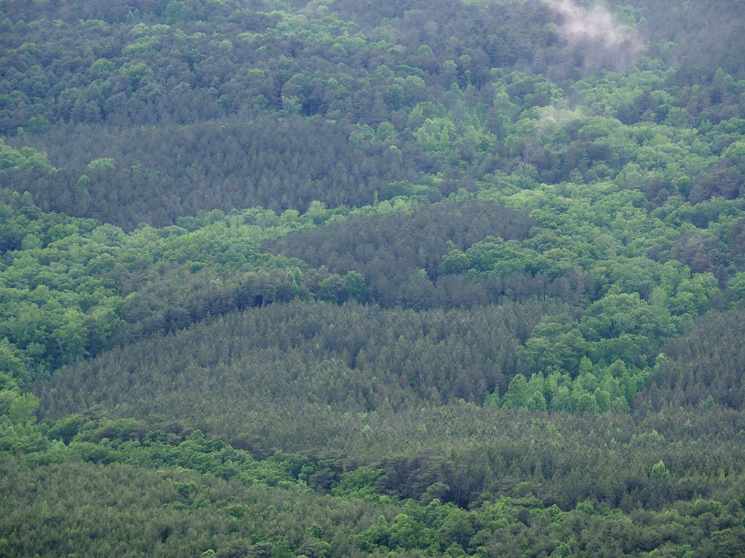

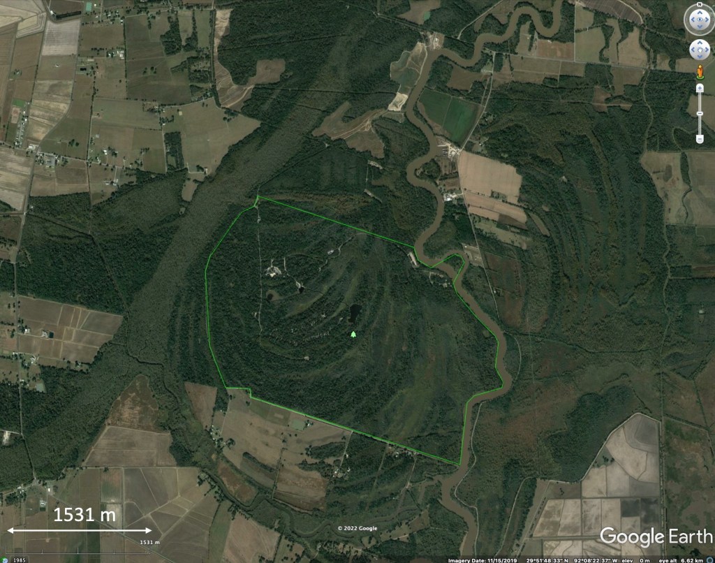
Meeman-Shelby Forest State Park
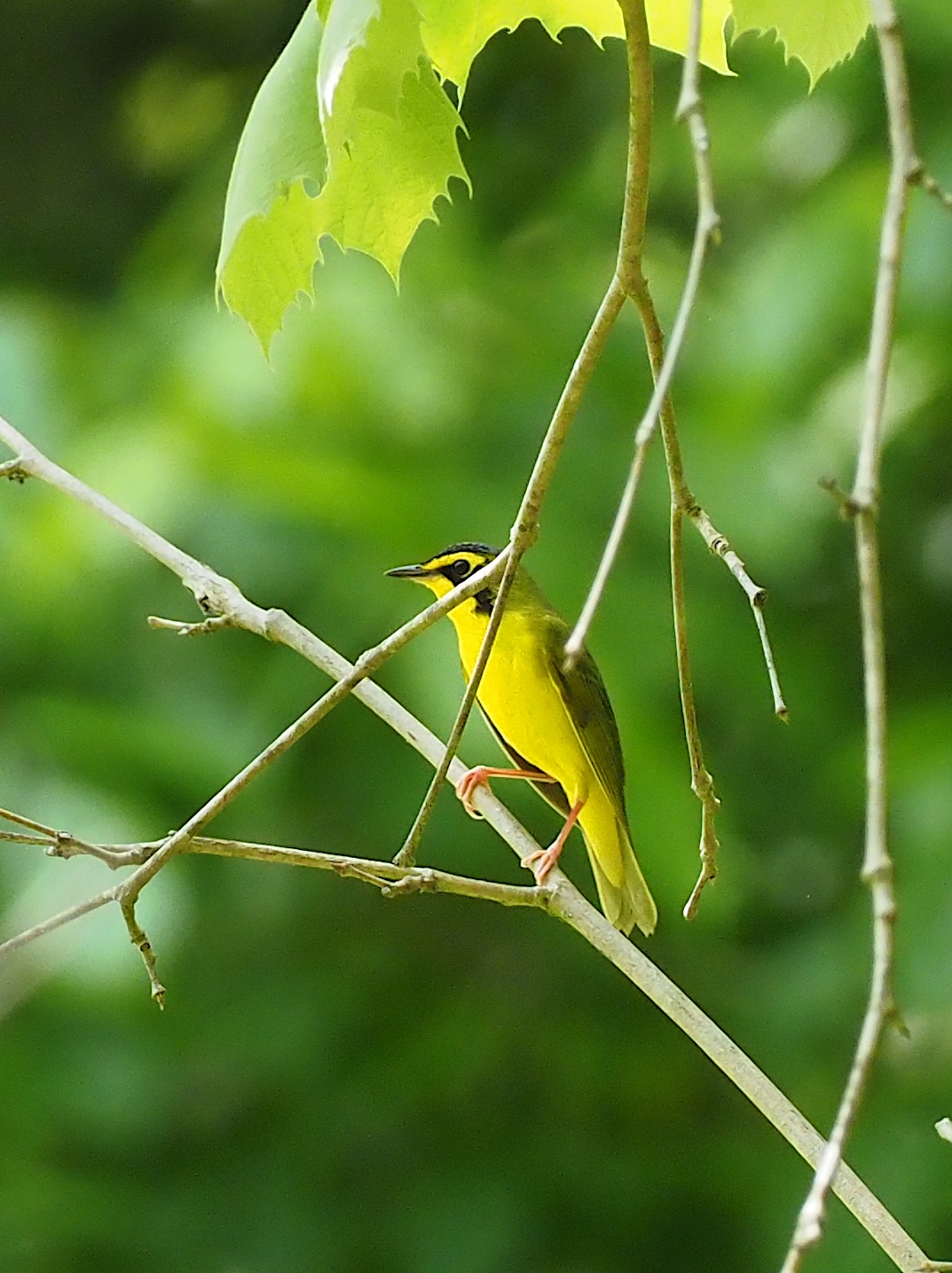
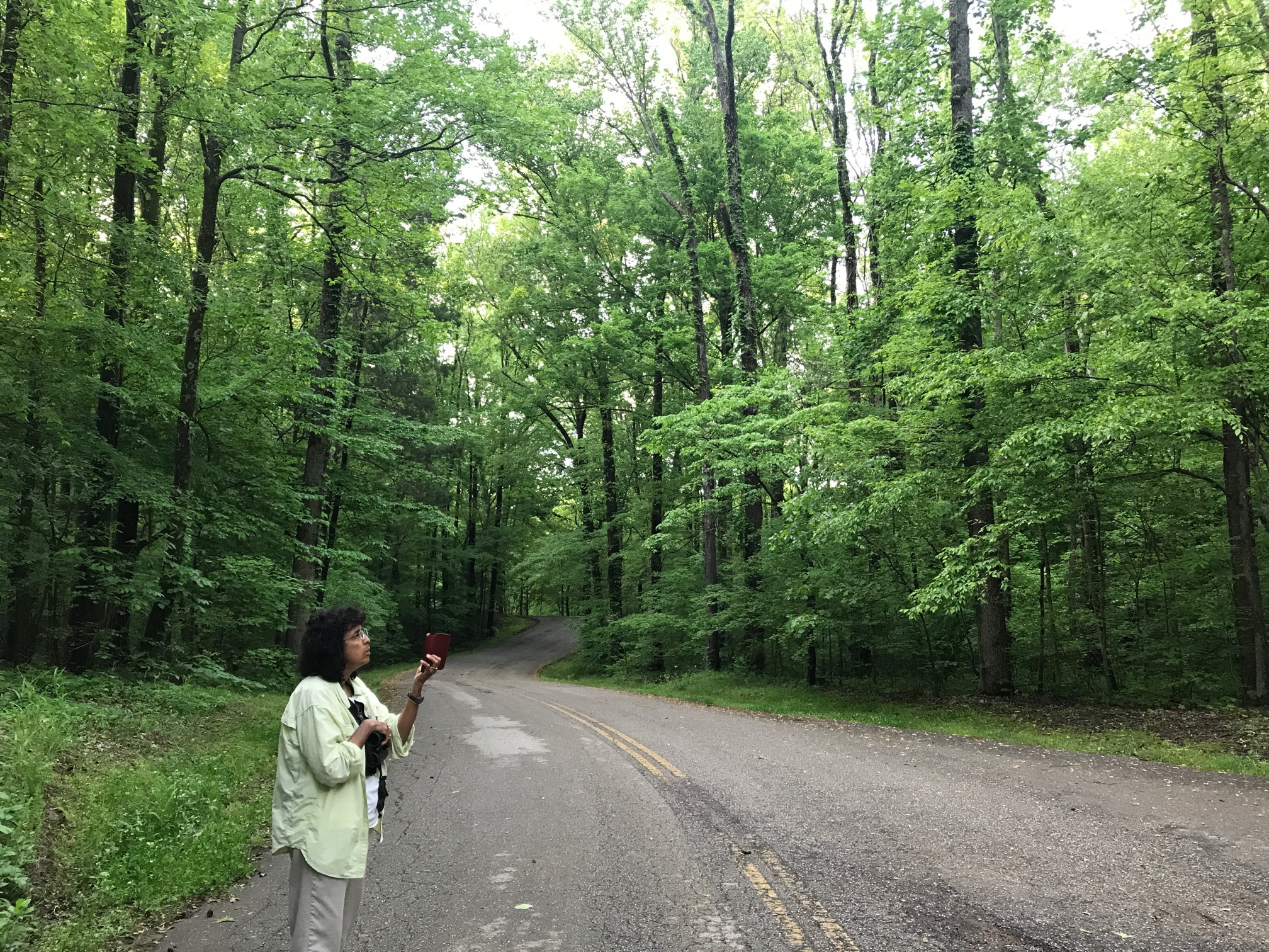
The state park lies along the Mississippi River, just north of Memphis. We expected it to be crowded with day visitors on the weekend nights we were there, but the park campground was not full. It is relatively large, and has only a small lake. And though it borders the Mississippi River, access to the river is limited and the actual park area that is most frequented by visitors and campers is several hundred feet above the Mississippi’s floodplain. There is considerable relief and the forest was impressively tall and full of migrating songbirds when we visited in early May.
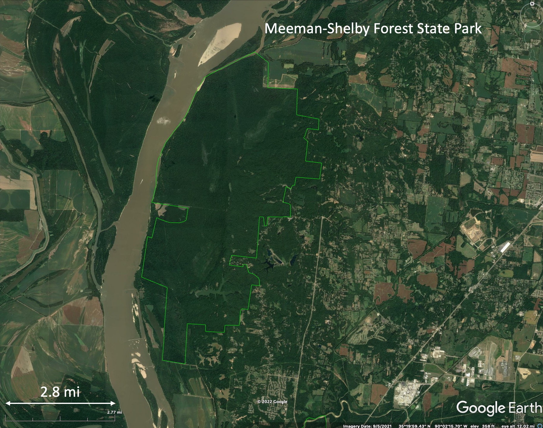

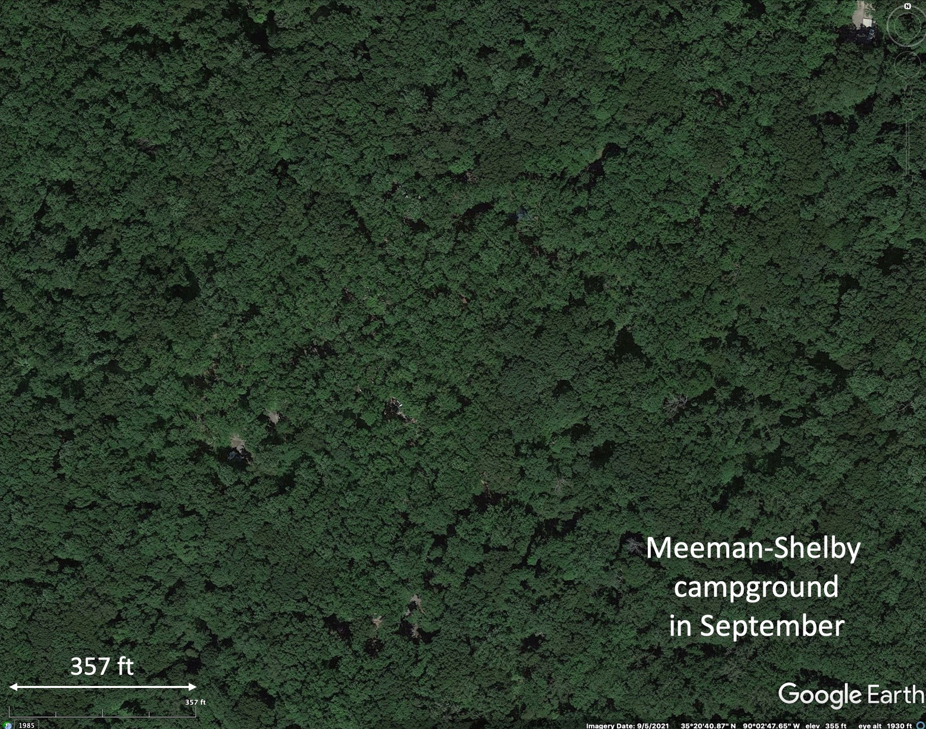
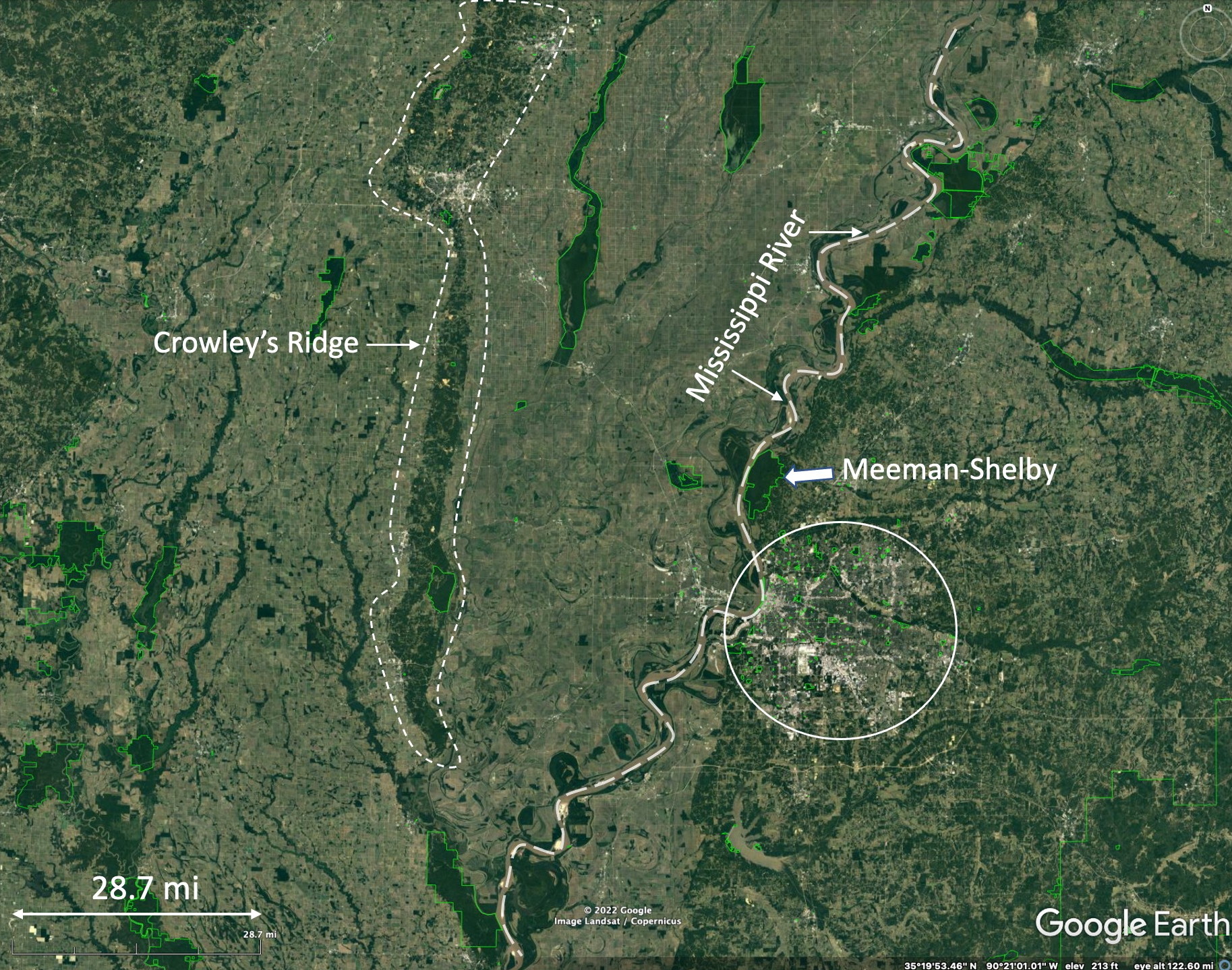

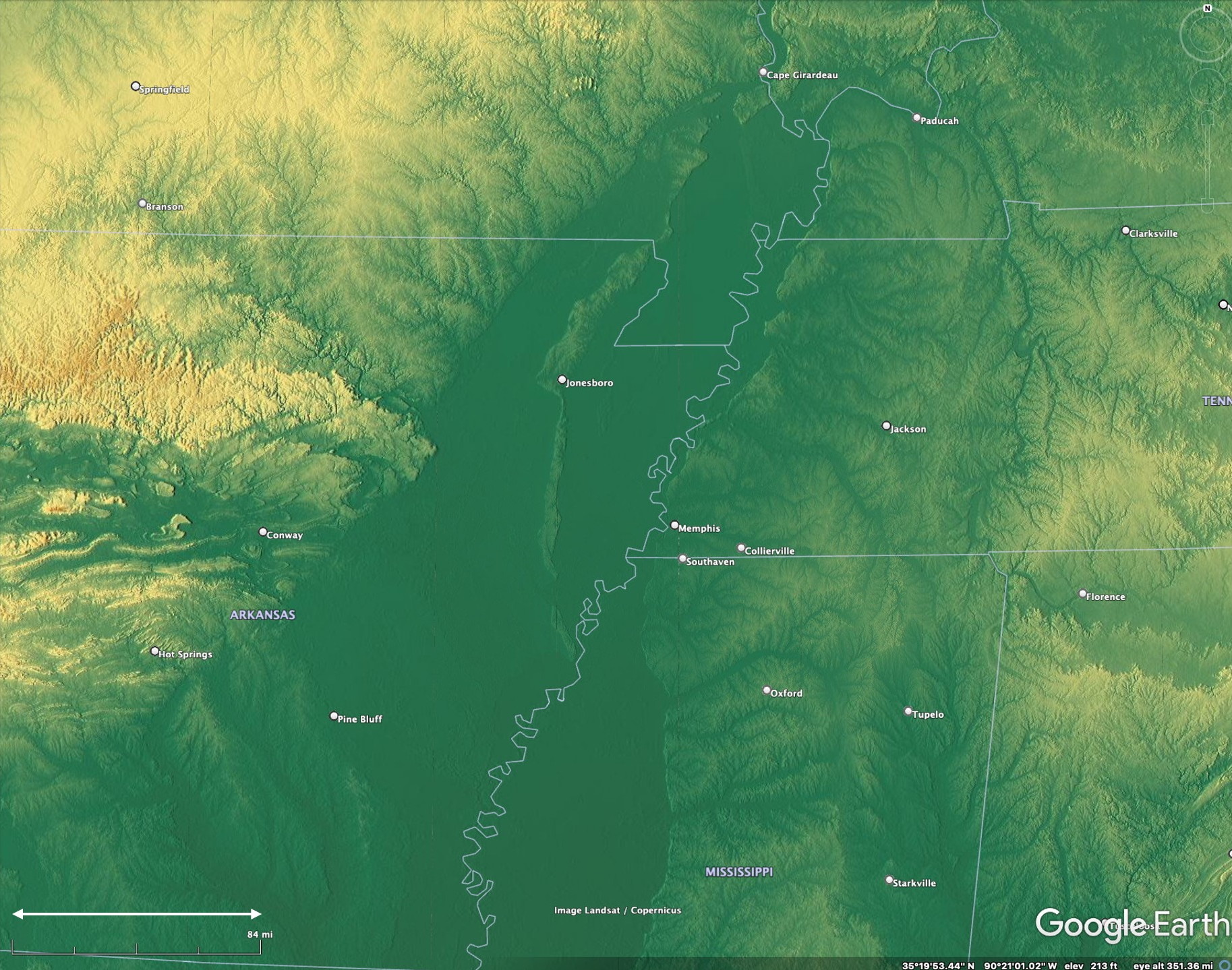
Above: Maps relevant to Meeman-Shelby State Park and its surroundings. Text with each image explains the maps.
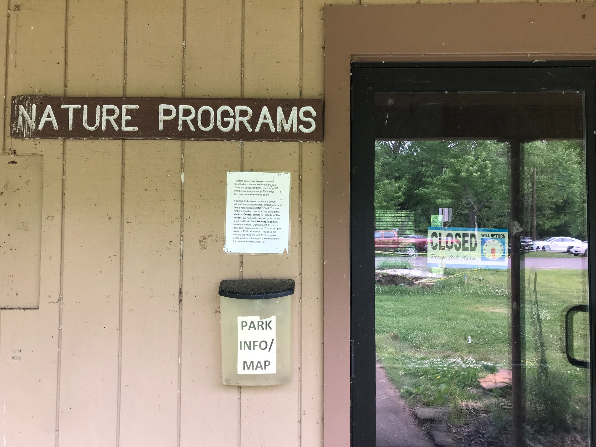
Below: Photos from Meeman-Shelby Forest State Park.


Our return from the Memphis area was relatively uneventful, and we chose to spend only two nights along the way. We spent one night at Lake Sylvia Recreation area, now being incorporated into the Arkansas State Park System and Beavers Bend State Park, in extreme southeast Oklahoma. The crowds at Beavers Bend, combined with the campfires and general undesirable ambience, encouraged us to leave and we drove home, arriving after midnight. Not a recommended strategy, though the route was via country roads.