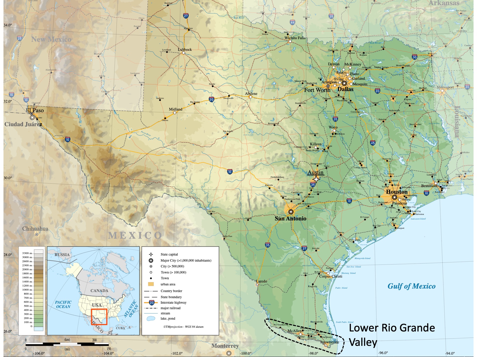
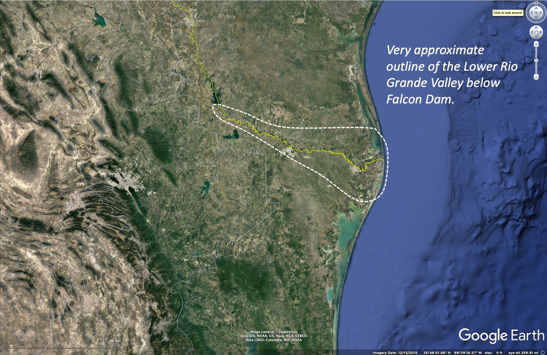
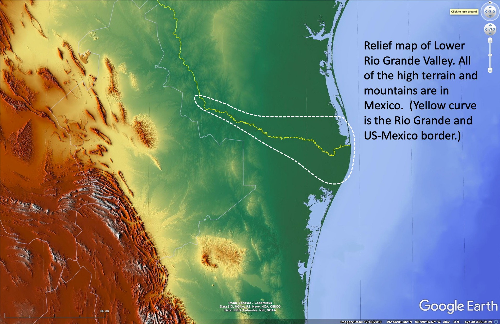
The lower Rio Grande Valley is a geographical region that straddles the Rio Grande River before it empties into the western Gulf of Mexico. The Rio Grande is the border between Mexico and the US throughout all of Texas, from El Paso in the west to Brownsville in the east. The “Lower” Rio Grande refers to the nearly flat portion of the River below Falcon Dam, where the river historically meandered widely and formed a large delta. Since many dams were constructed upstream in the 1940’s the river no longer meanders widely and the flooding that can still occur in wet years is constrained by large levees.
The “Valley”, as it is somewhat incorrectly called, is a mixing zone between US and Mexican cultures and has been for several hundred years. Here we will focus on the natural history attractions – from the perspective of tourists from the US who don’t want to travel south into Mexico.
Some basic geography
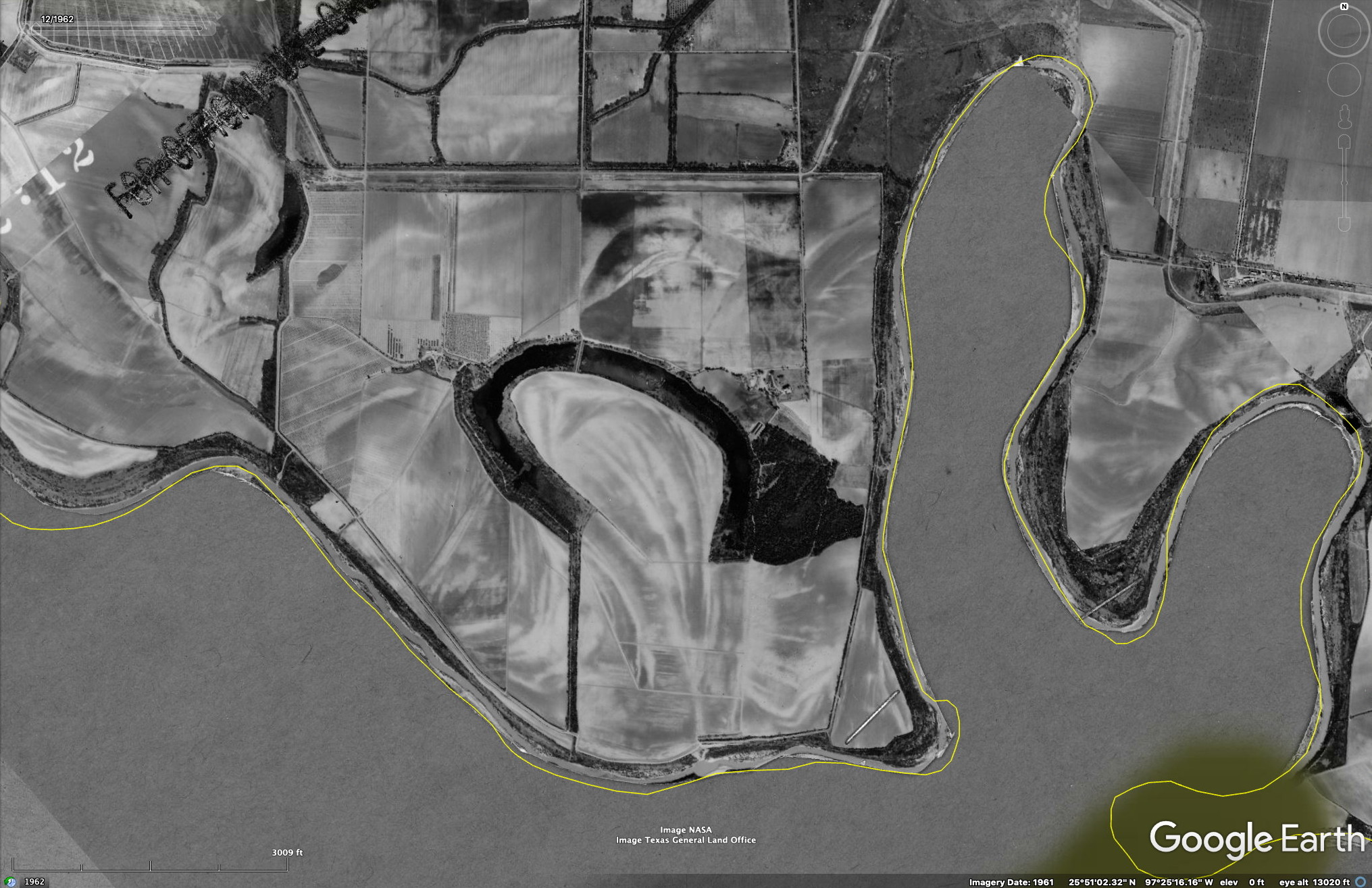
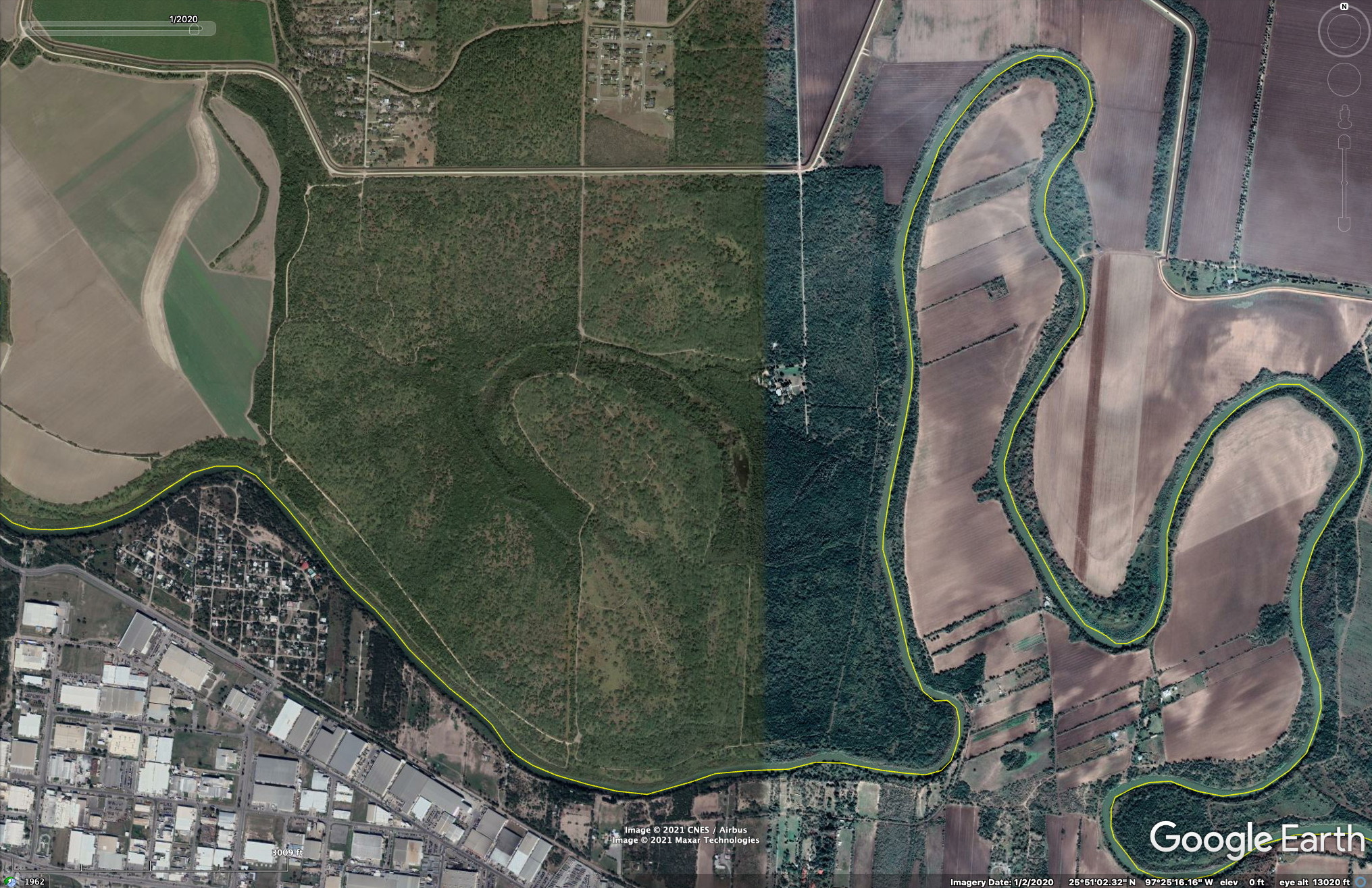
The lower valley is dominated by the delta of the Rio Grande. Today, with the numerous levees, agricultural fields, and urban development the delta is not nearly as obvious as it would have been 100 years ago. Old oxbow lakes, locally called resacas in the Valley are scattered across the old floodplain. These are more obvious in Mexico, since the delta features are clearer there. A good article on the geomorphological features of the Rio Grande delta can be found in this article.
Today, the main channel of the Rio Grande is constrained by large levees that reduce the chances of floodwaters leaving the main channel and flooding surrounding agricultural fields and human development. These levees, coupled with major dams upstream that smooth out extreme flooding events, have changed the vegetation along the Valley. Plants that depend on regular flooding have diminished while those that cannot tolerate standing water have thrived.
The main town/cities of the Lower Rio Grande Valley are McAllen in the west and Brownsville in the east, but some towns tend to merge with McAllen and there is not always a clear distinction between the urban areas – at least when you are driving the east-west Interstate 2 that connects (along with I-69E) the lower Valley towns. McAllen is more modern and better off economically than Brownsville.
The Lower Rio Grande Valley of Texas is farther south than any other part of the US mainland except for extreme southern Florida. Brownsville, Texas is about the same latitude (~26˚N) as Miami, Florida. However, south Florida is warmer than southern Texas due, in large part, to the proximity of warm water on both sides of the Florida peninsula. Hard freezes are very rare in southern Florida but are occasional in the lower Rio Grande Valley. The coldest days in south Texas are when the winds are from the north or northwest after the passage of cold fronts. In addition, rainfall in the Valley is about half that in Florida. The regular freezing conditions in south Texas, together with much lower rainfall than in Florida, leads to much different floras.

There is an east-west gradient of mean rainfall and aridity across the Rio Grande Valley, with Brownsville averaging about 27 inches of rain, McAllen with 22 and Falcon Dam area (Roma) having about 20 inches. In addition, the daytime temperatures are higher inland so the overall potential evaporation is higher inland. Thus the vegetation becomes increasingly xeric as one proceeds west in south Texas.
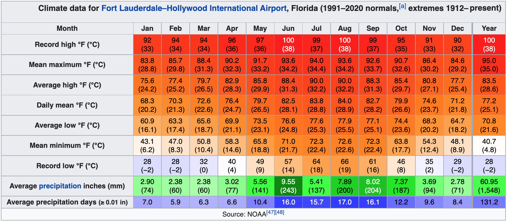

Comparing the above data for McAllen and Brownsville one sees that the rainfall is slightly higher along the coast, the summer temperatures are lower along the coast and higher inland, but the winter temperatures are warmer along the coast.
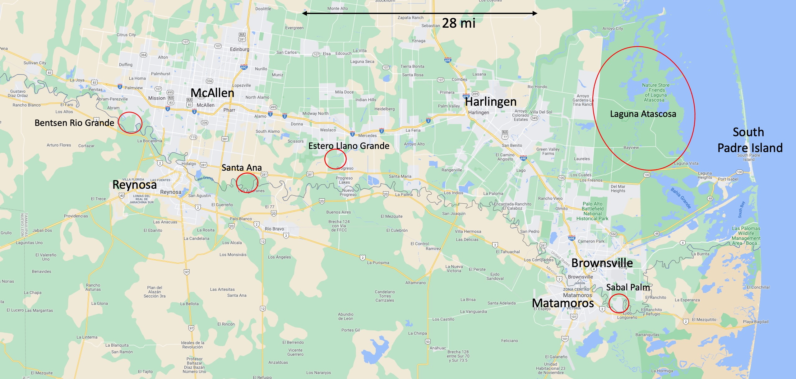
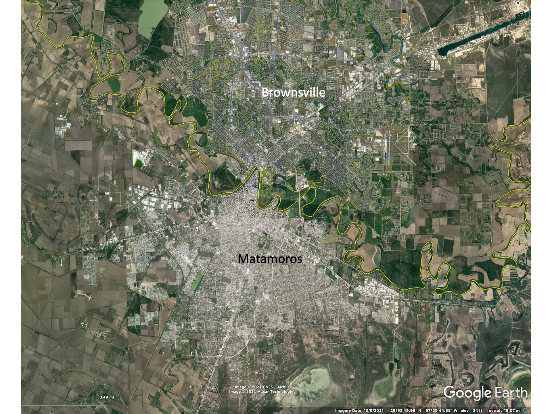
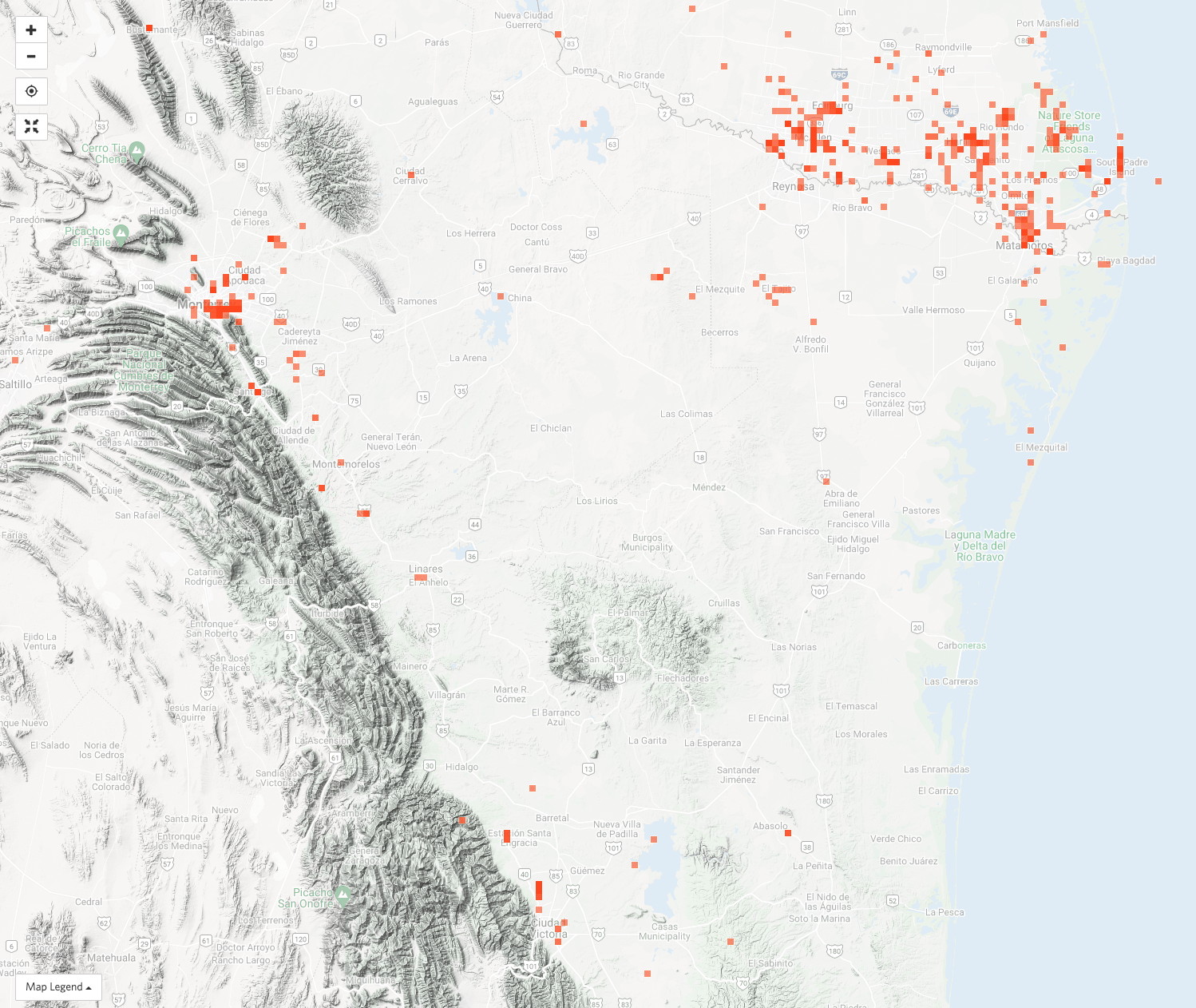
Though we are not discussing in detail the Mexican side of the Rio Grande Valley here, it is clear from the image below that most Mexican towns are very densely populated relative to the US-side towns. Their populations are also larger – Matamoros having over 500,000 people versus Brownsville’s 175,000. The combined metropolitan area of Brownsville-Matamoros is just over 1 million people. The McAllen-Reynosa complex has approximately 1.5 million inhabitants, with about two-thirds living on the Mexican side. McAllen’s population is about 150,000.
The Valley’s attraction for naturalists
Unique species for the US
Why do naturalists travel south to the lower Rio Grande Valley? There are a variety of reasons. This part of Texas is warmest in the winter and huge numbers of “Winter Texans” move southward in late Fall to escape northern winters. Trailer or RV parks are found all across the Valley. A certain percentage of these seasonal visitors have an interest in natural history.
Many other short-term visitors to the Valley come specifically to see the birds or butterflies that only are found in the US in the lower Rio Grande Valley. These visitors hope to see many of the rarities that we mention below. Just why many species are best seen in the Valley we discuss next.
Freezing weather determines the northern limit of many tropical plant species. In turn, these plant communities support animals – from insects to birds to mammals – that are adapted to such non-freezing environments. As a consequence, many tropical species reach their northern limits in the US in south Texas. Unlike south Florida, there is no oceanic barrier to the south to restrict migration of mammals or many birds that prefer to not fly over large ocean stretches, so “rarities” often appear in south Texas, having come up temporarily or seasonally from more favorable environments in Mexico. Also, many northern species of birds winter in the coastal marshes of southern Texas, adding to the diversity of birds present.
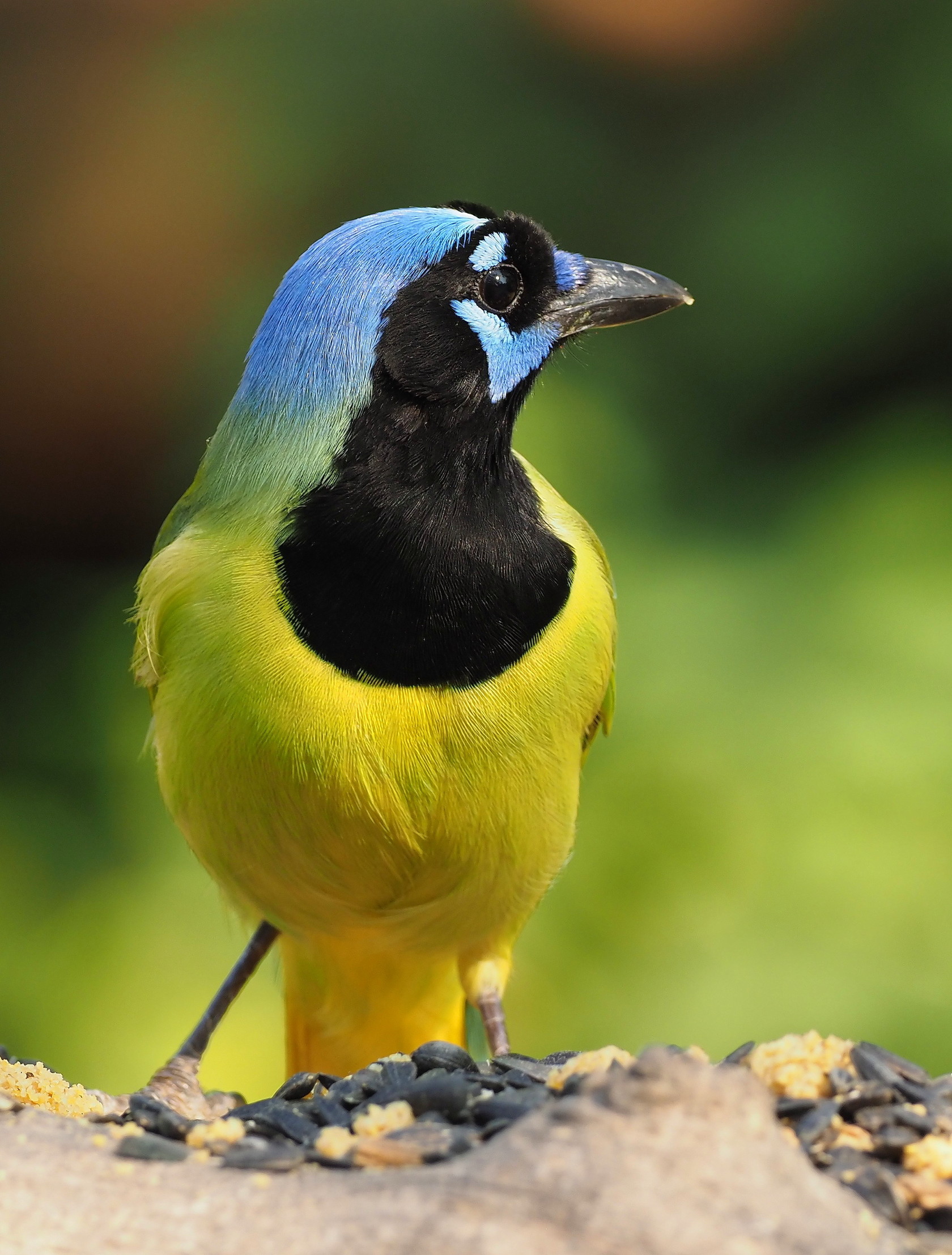
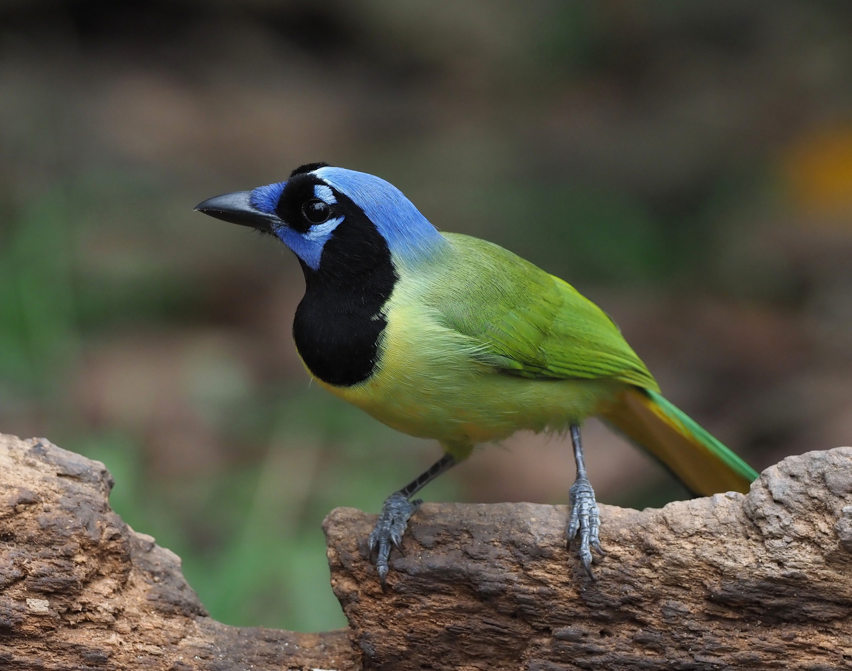
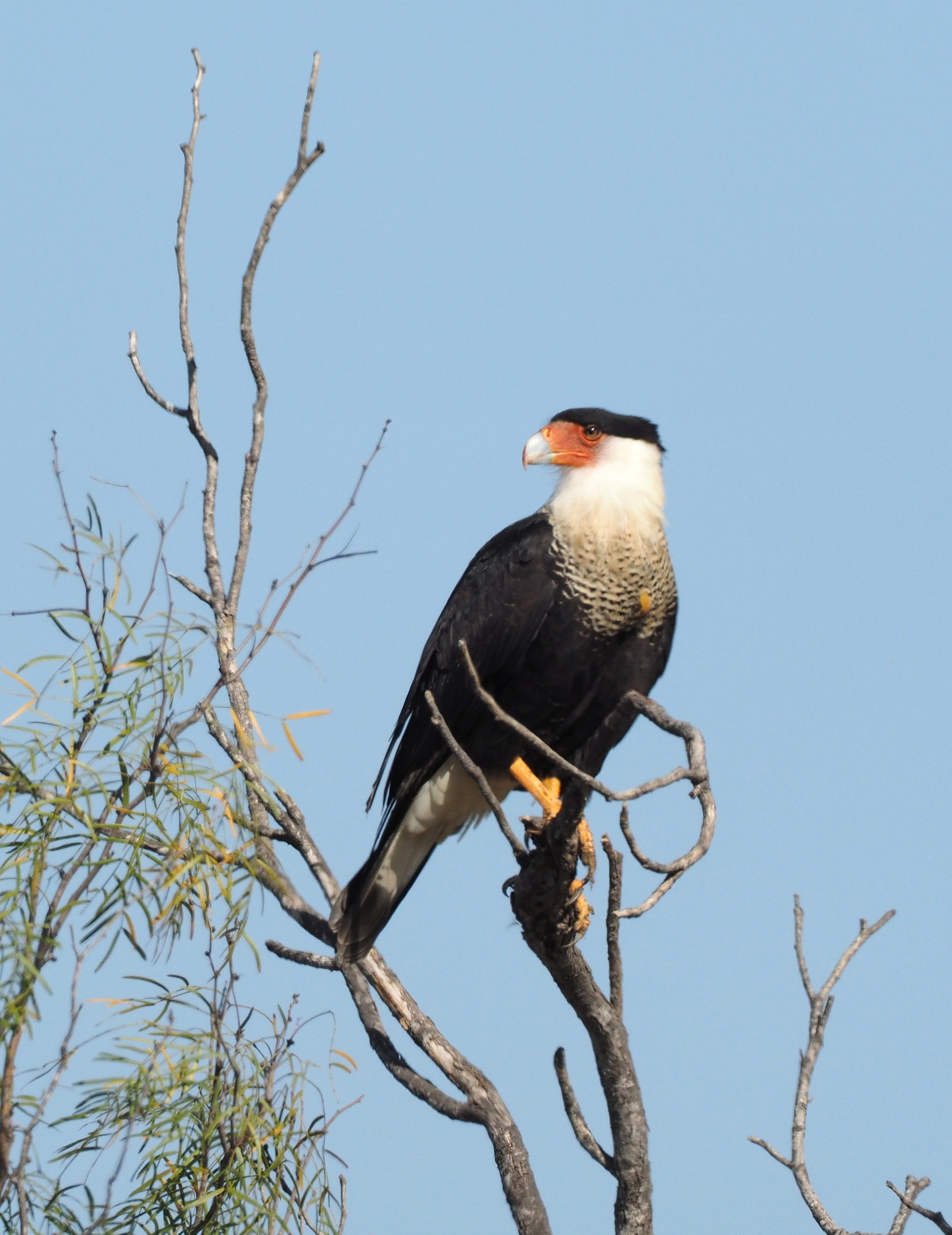
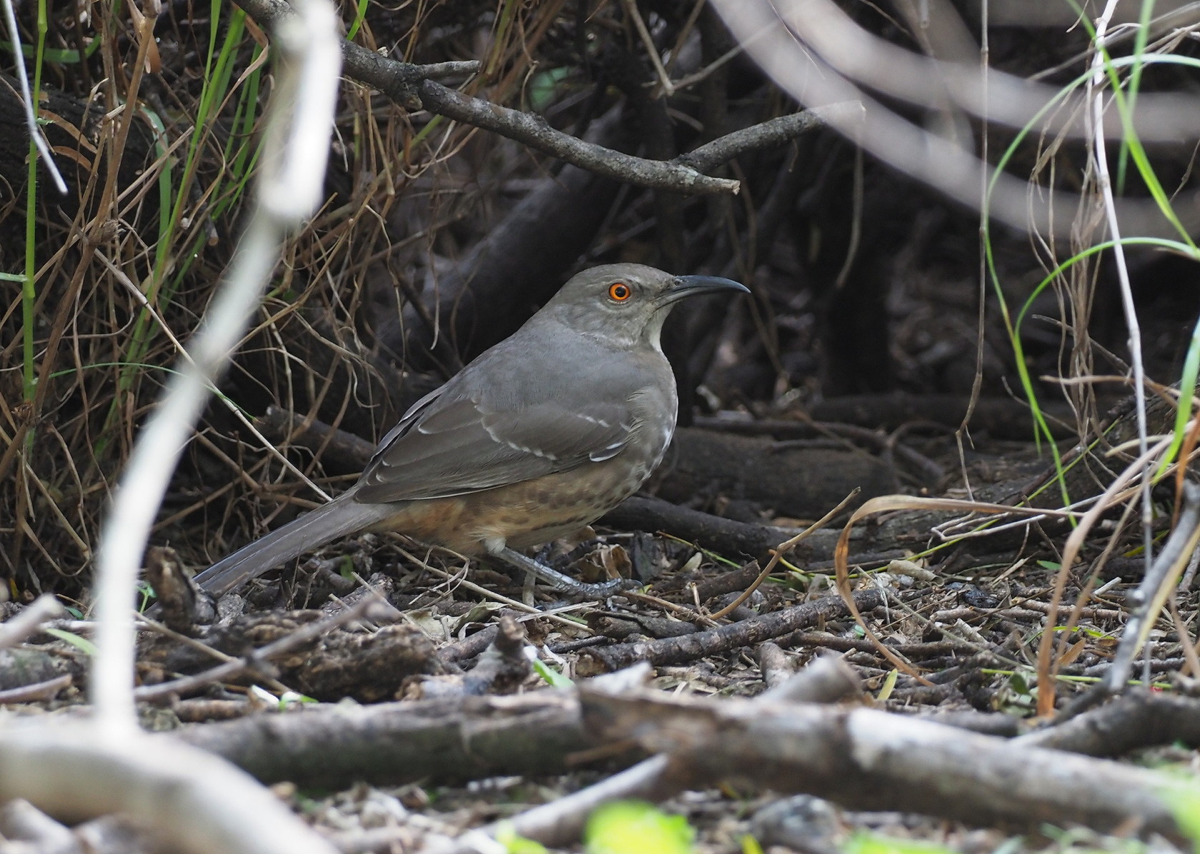
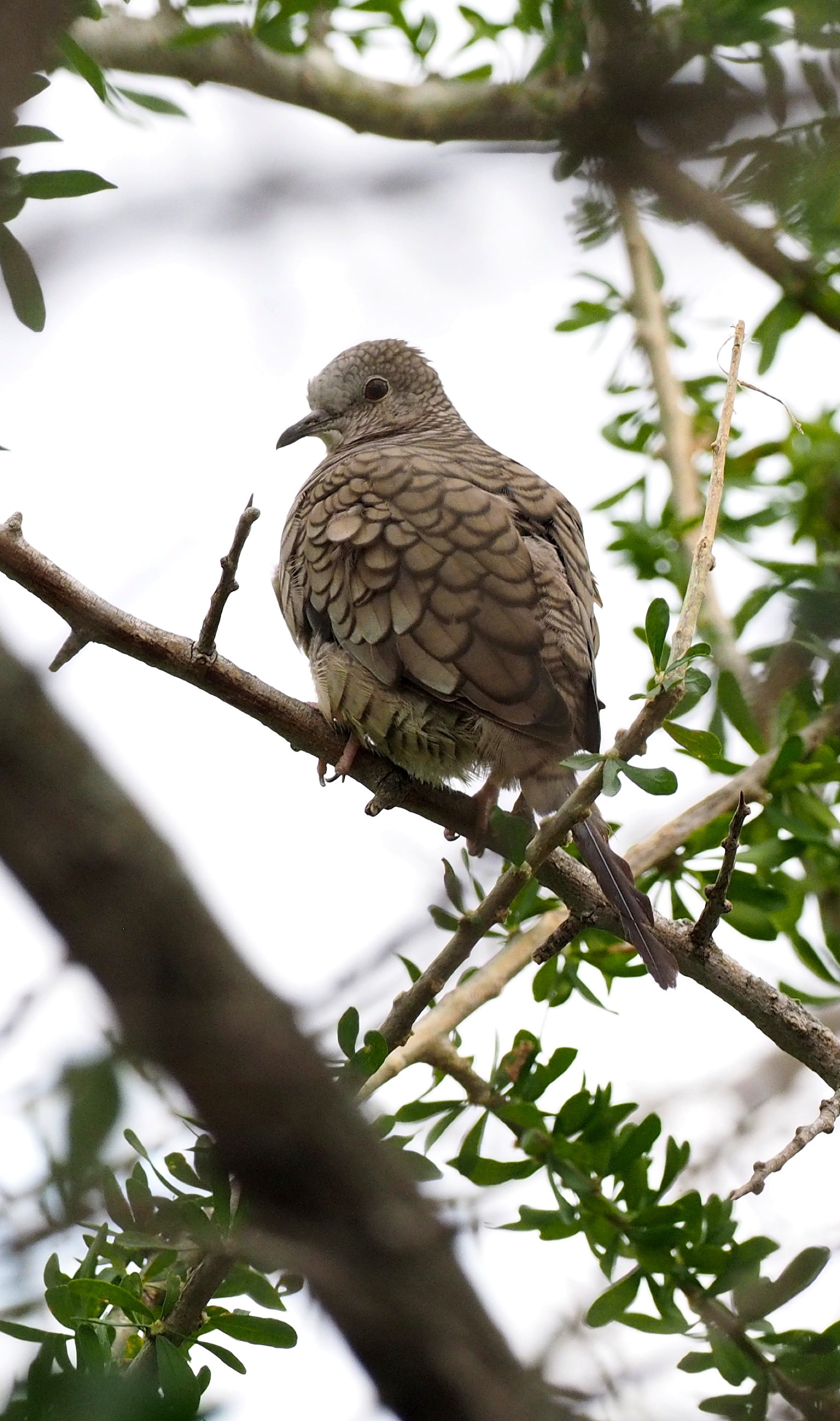
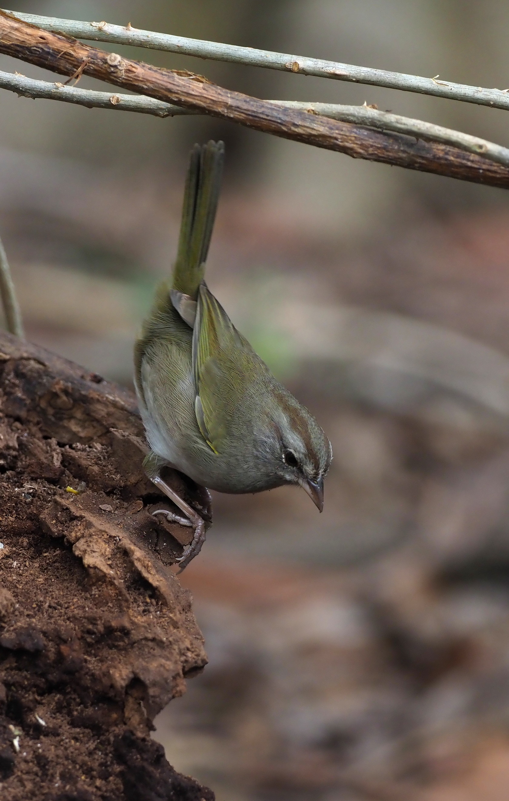
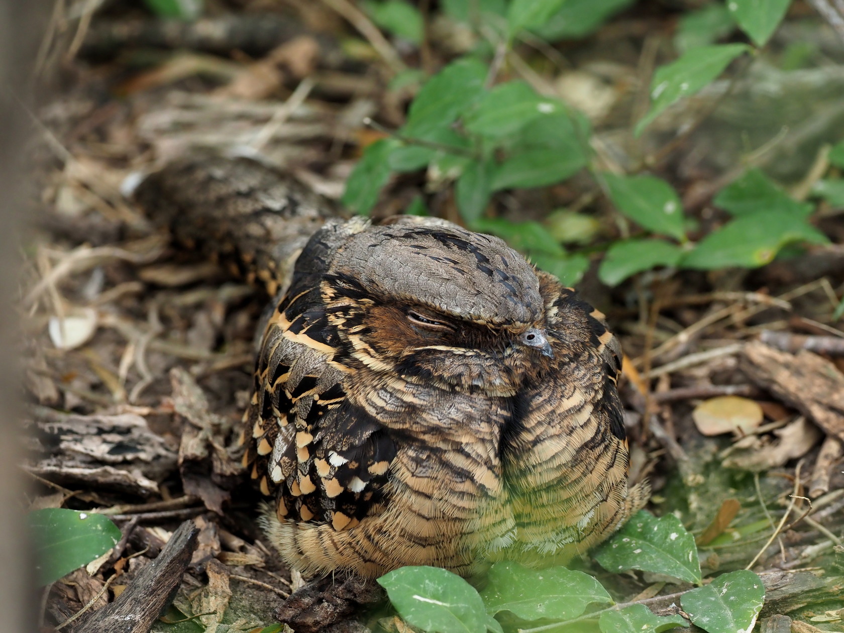
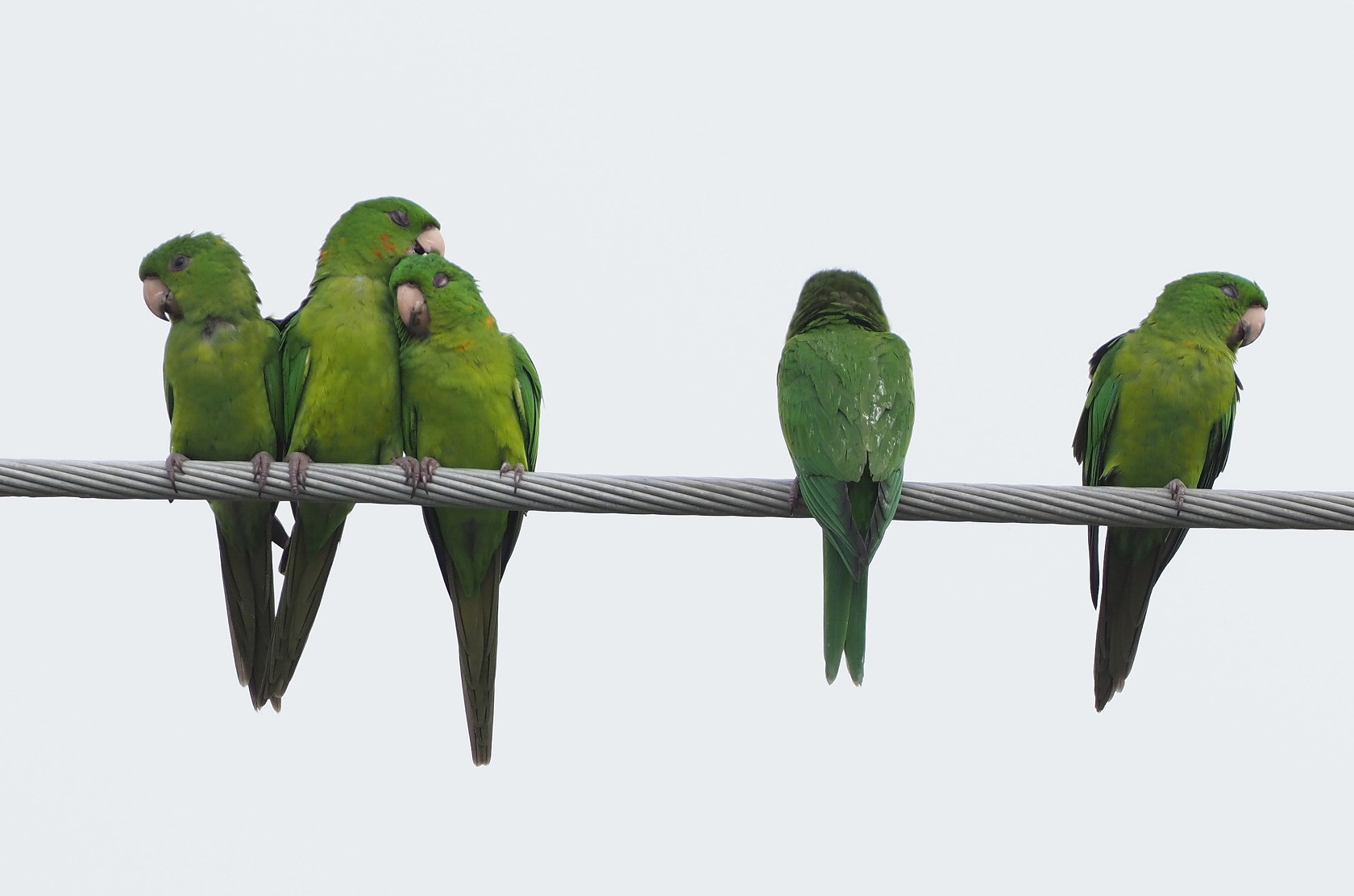
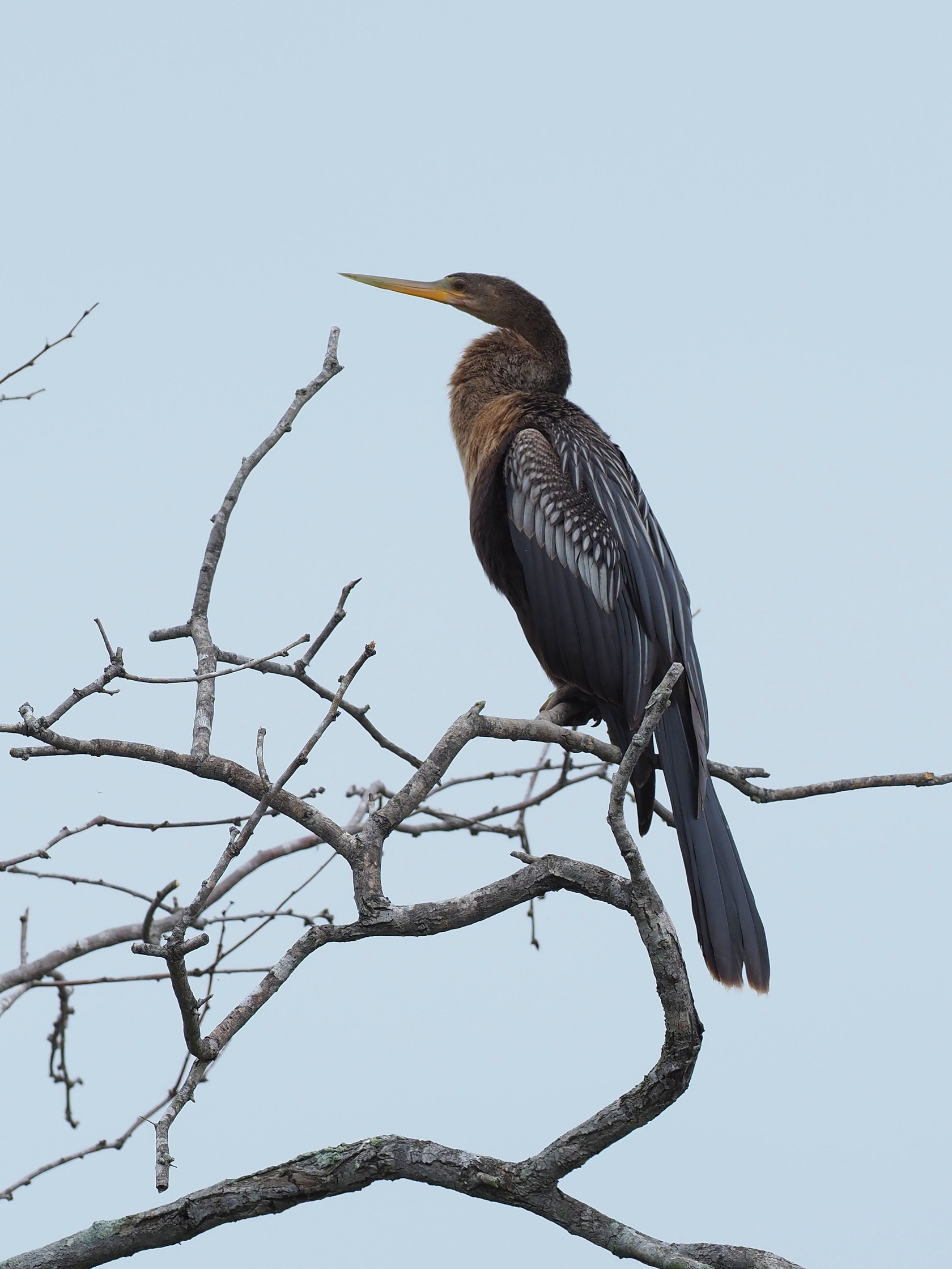
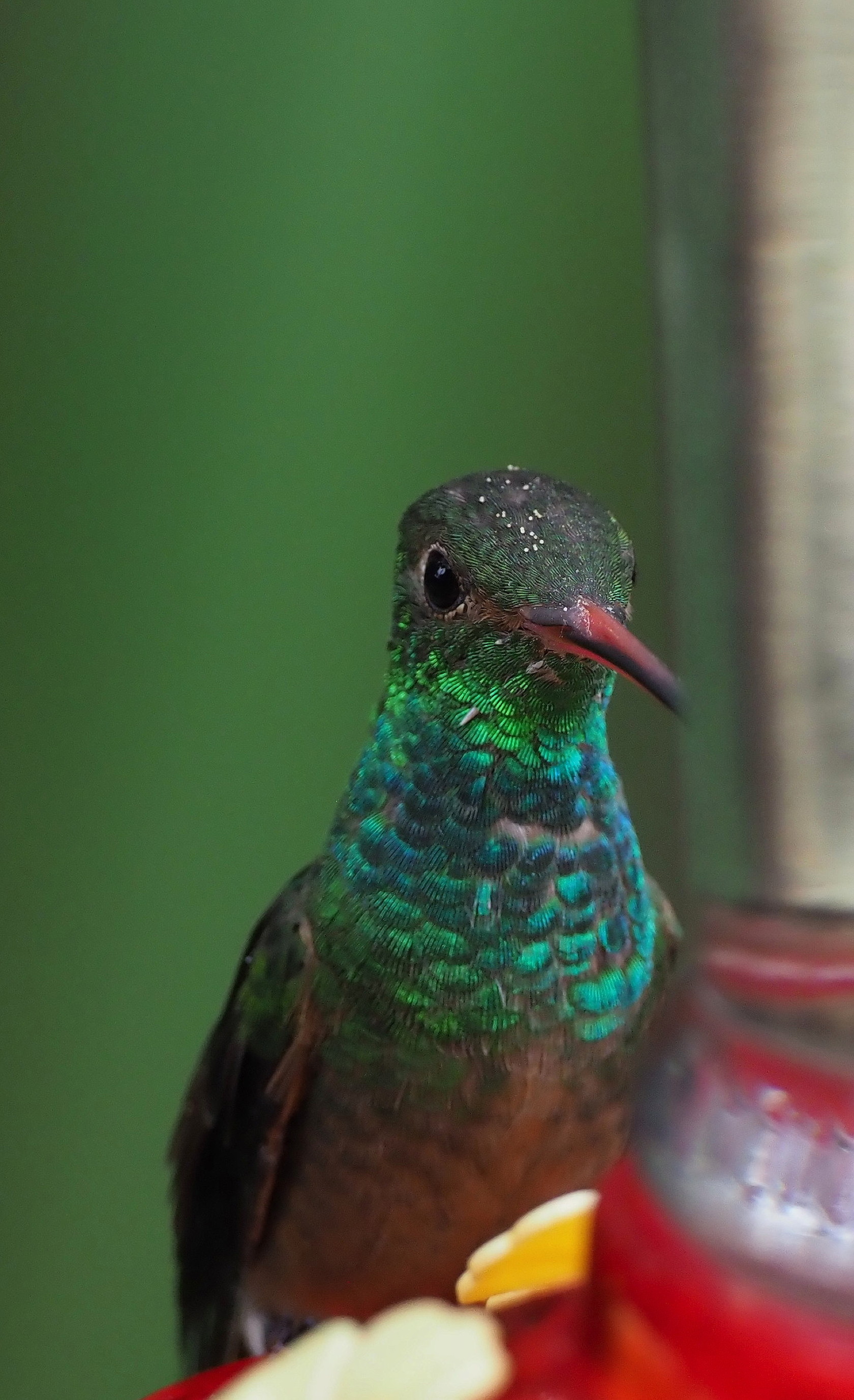
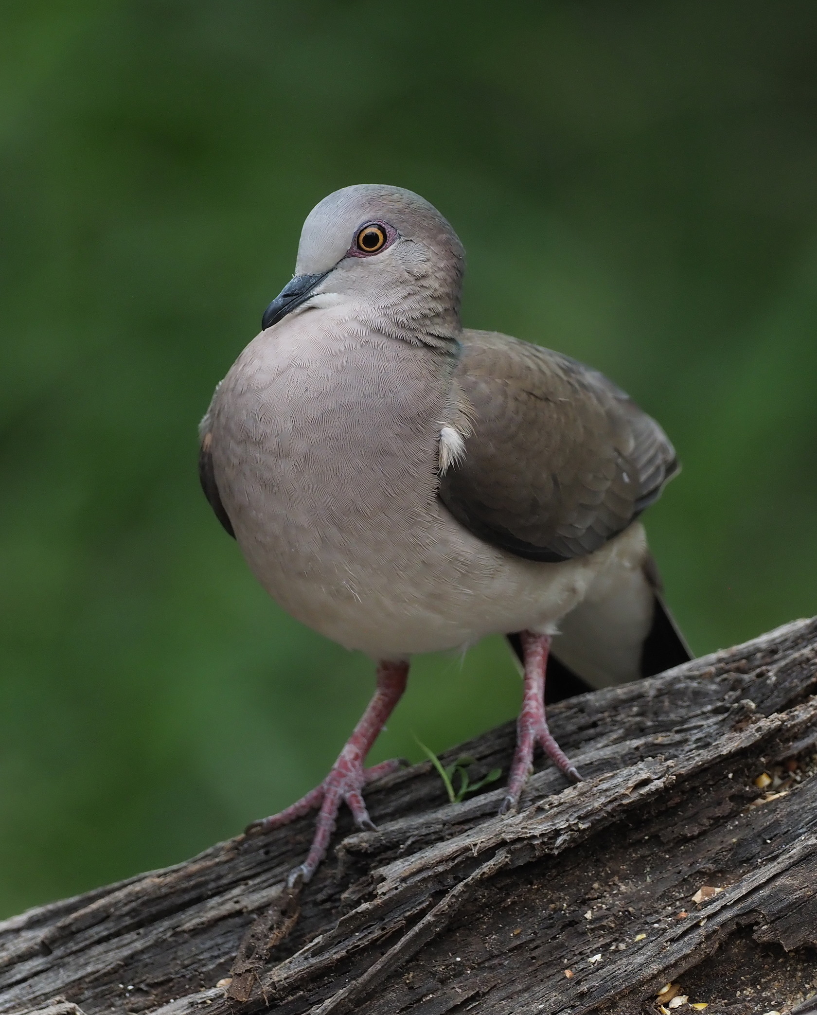
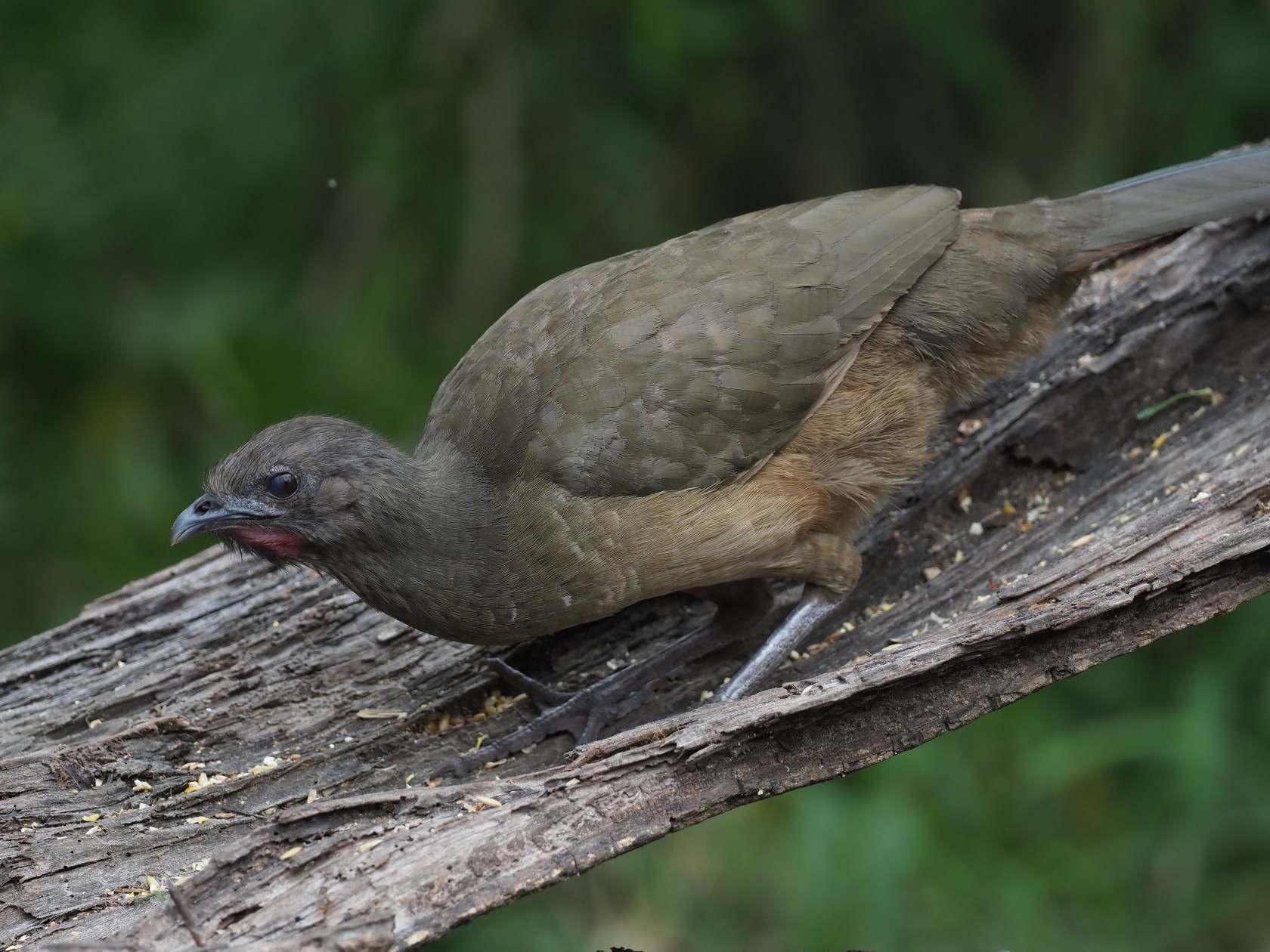
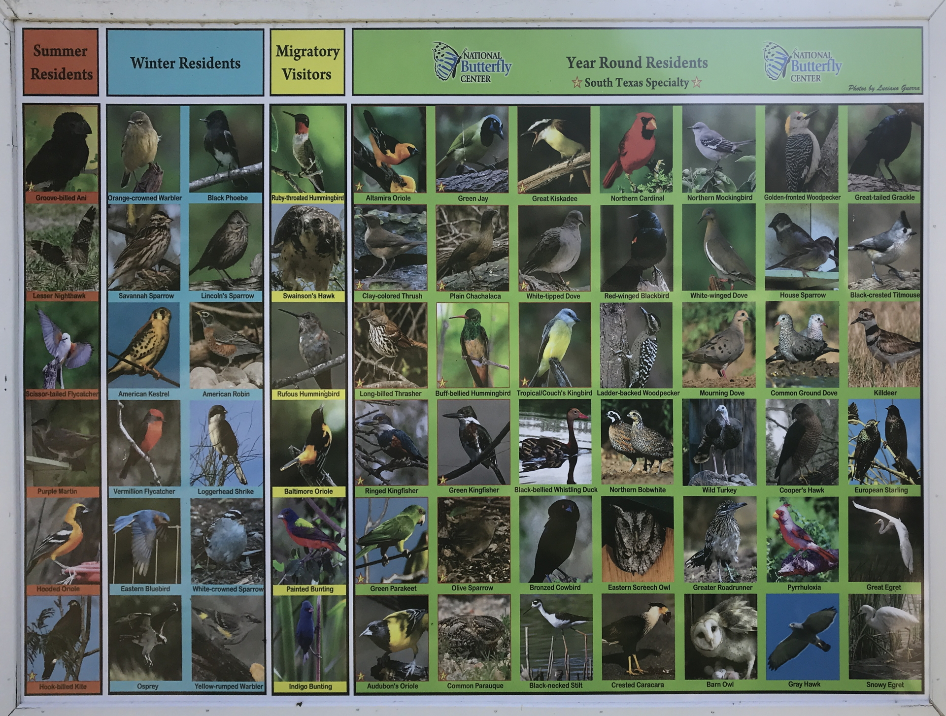
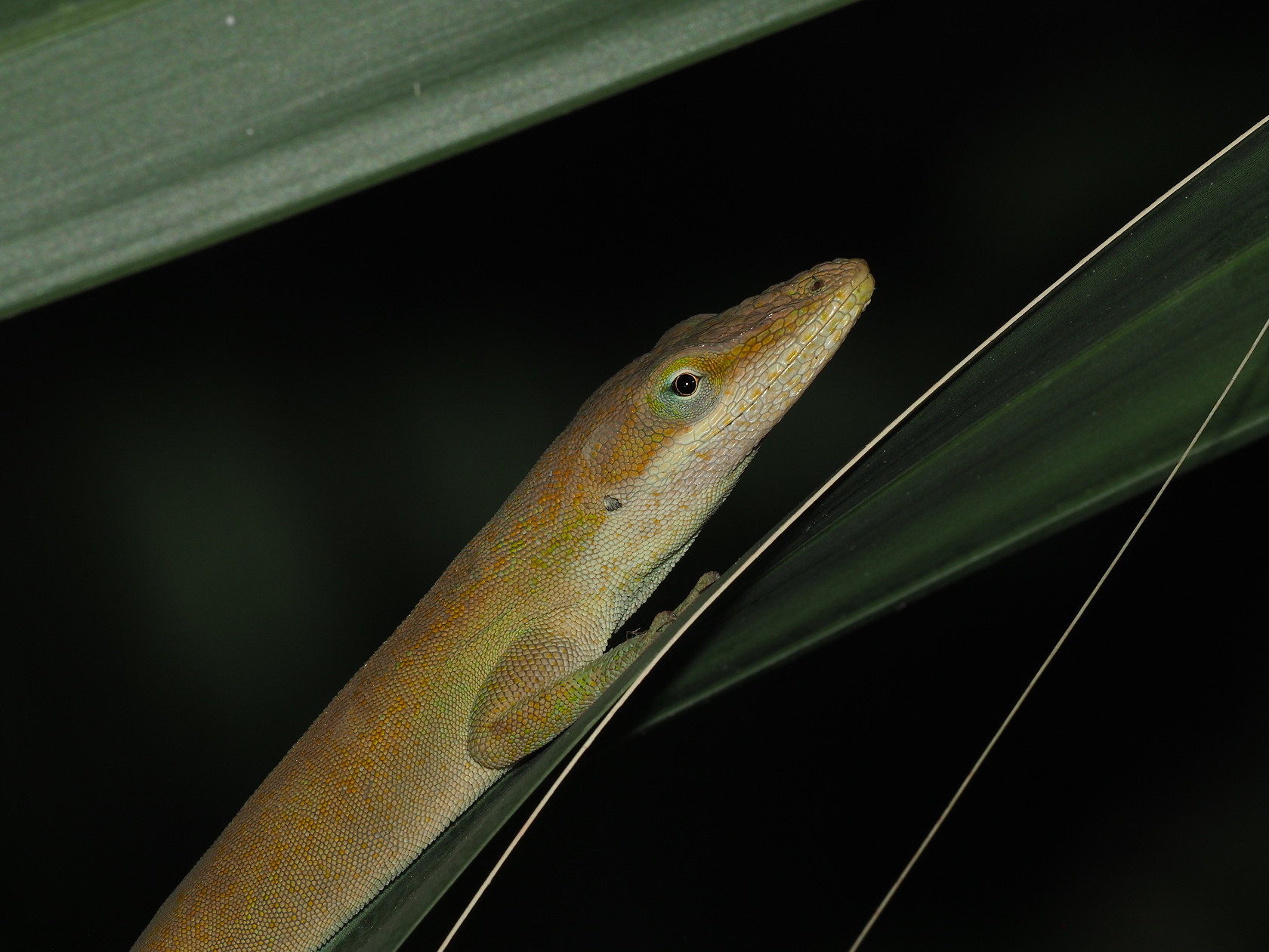
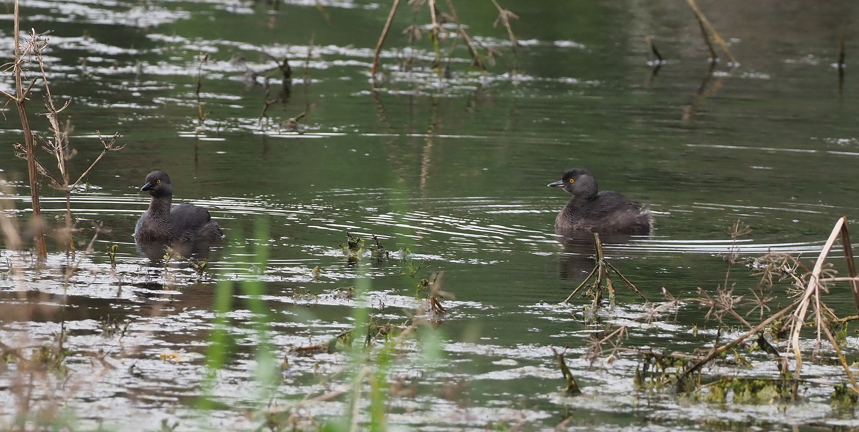
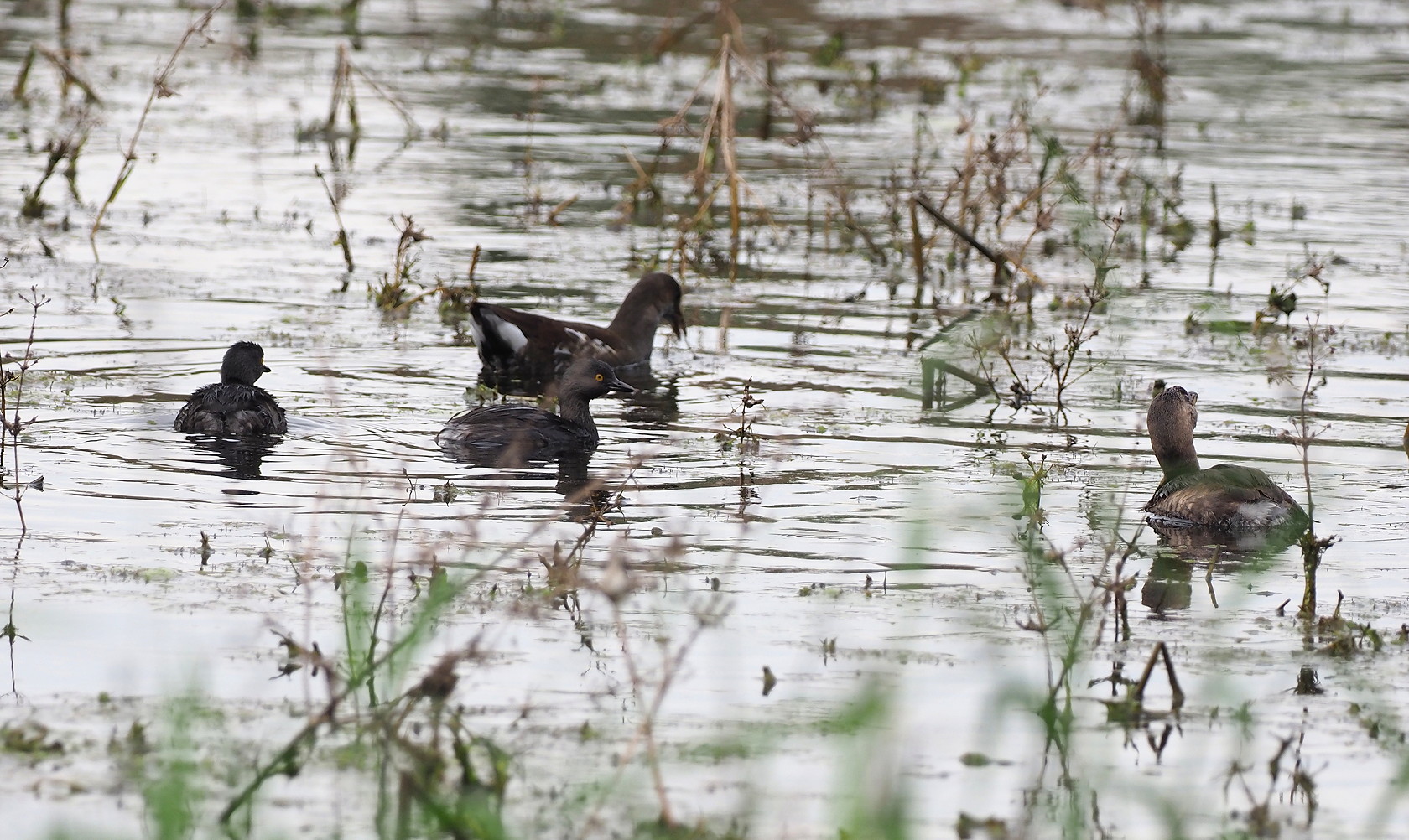
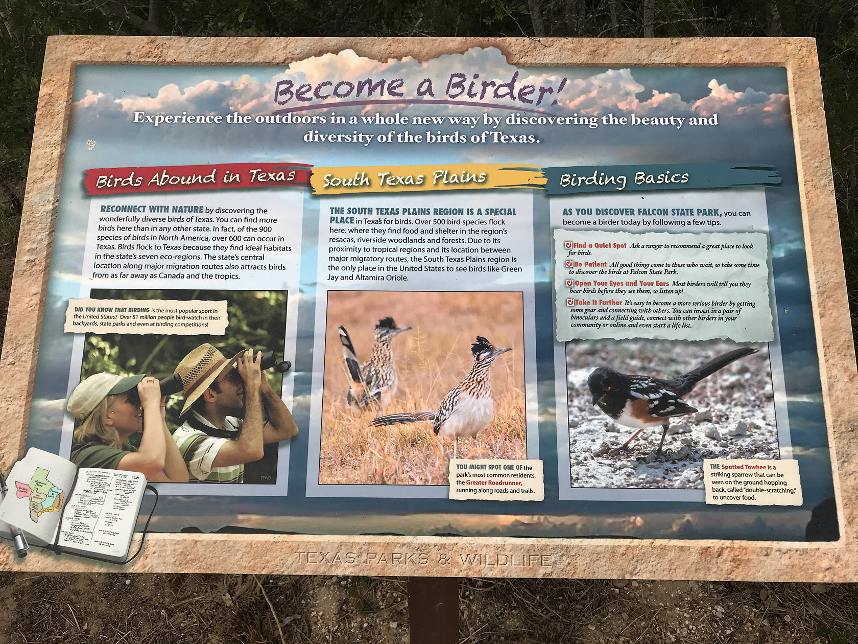
Some birds that are only found in south Texas (in the US) include the Plain Chachalaca, Green Jay, Brown Jay (very rare), Green and Ringed Kingfishers, Least Grebe, Hook-billed Kite, White-tipped Dove, Red-billed Pigeon, Green Parakeet, Red-crowned Parrot, Common Pauraque, Buff-bellied Hummingbird, Olive Sparrow, Grove-Billed Ani and Altamira Oriole. There are many others that occur farther north in Texas, but that are not found outside of Texas. Although many of these species are common farther south in Mexico – with some extending to South America, many US birders are reluctant to carry out foreign travel. As a result the Rio Grande Valley has a concentration of bird watching destinations – one figure I saw estimated birding as a $150 million component of the Valley economy. There is a major birding festival held in November in the Valley. The website for the 2021 festival gives a flavor for what to expect in future ones.


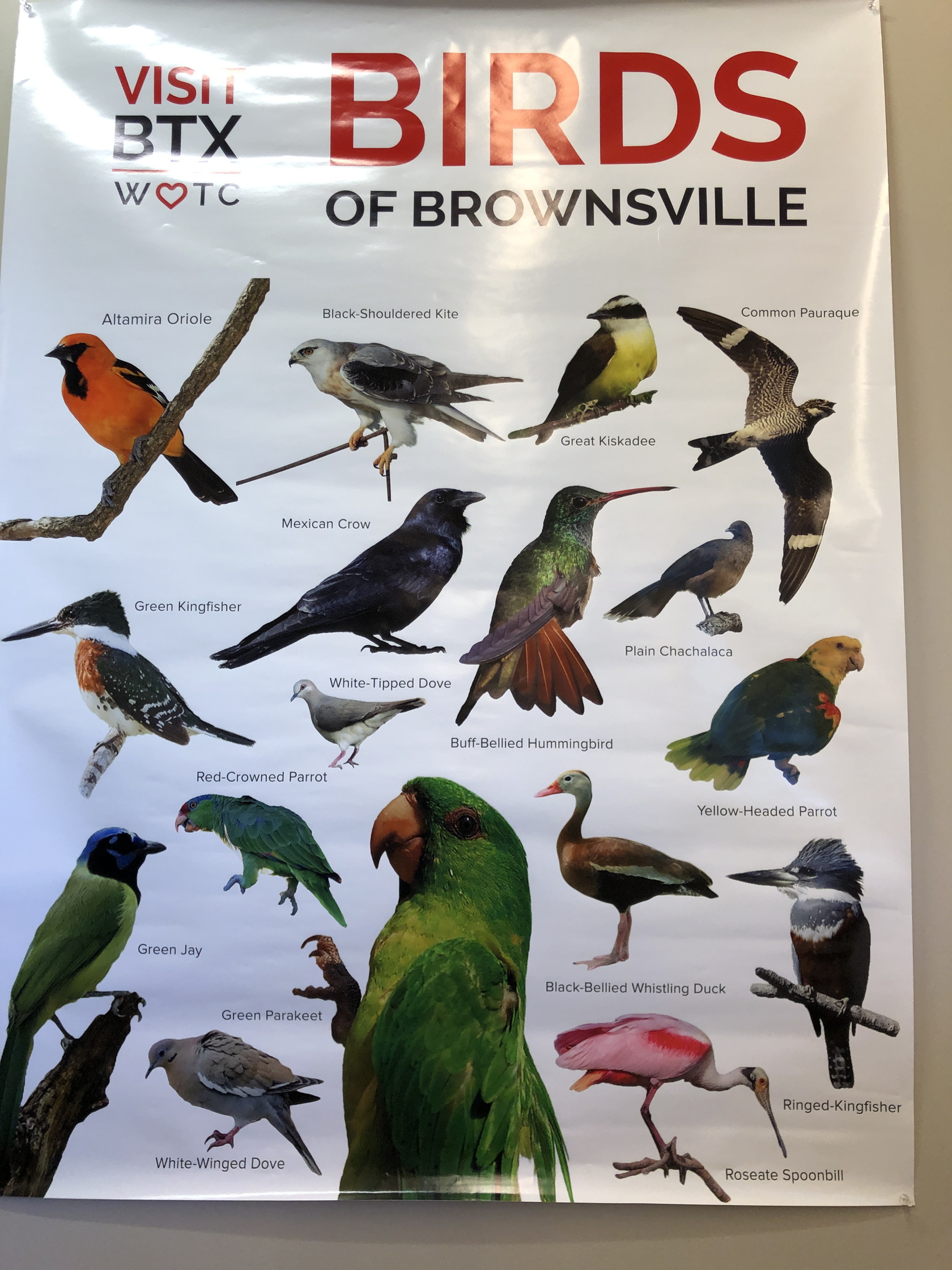
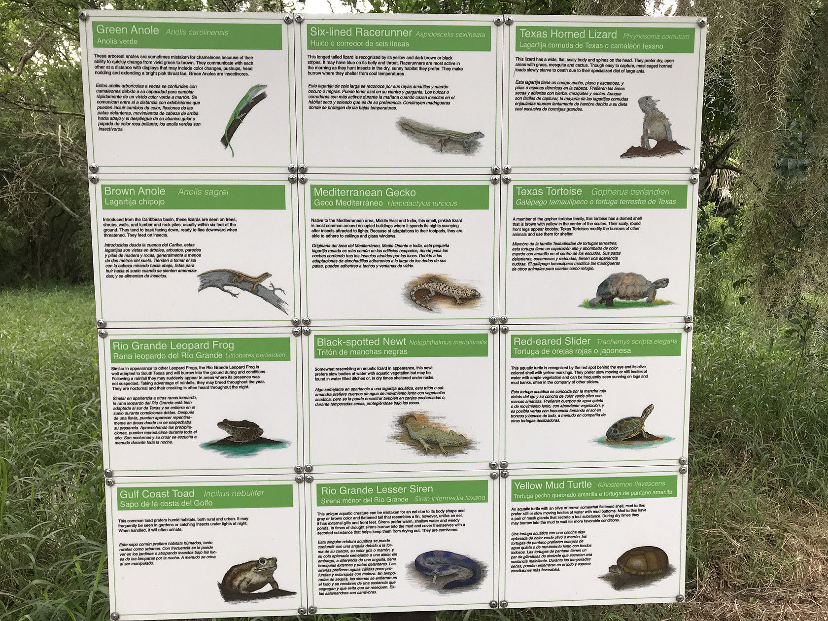
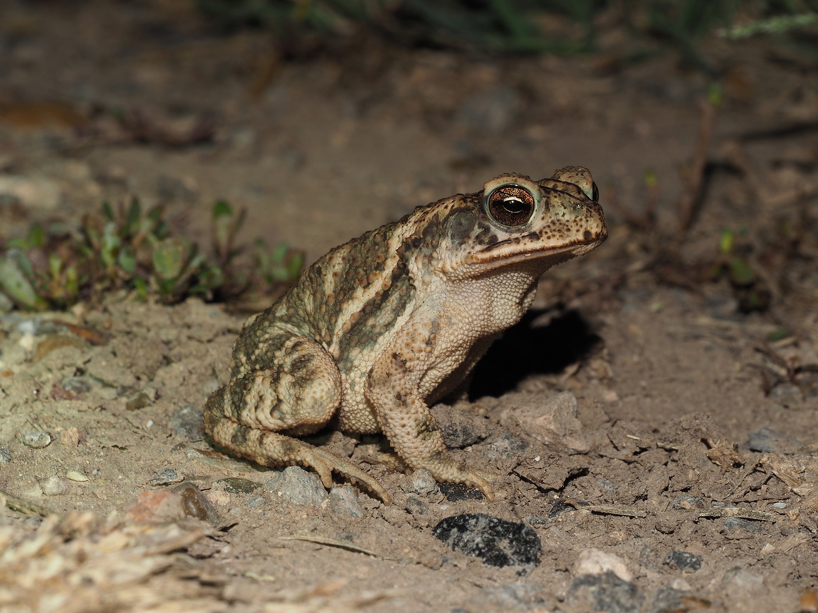
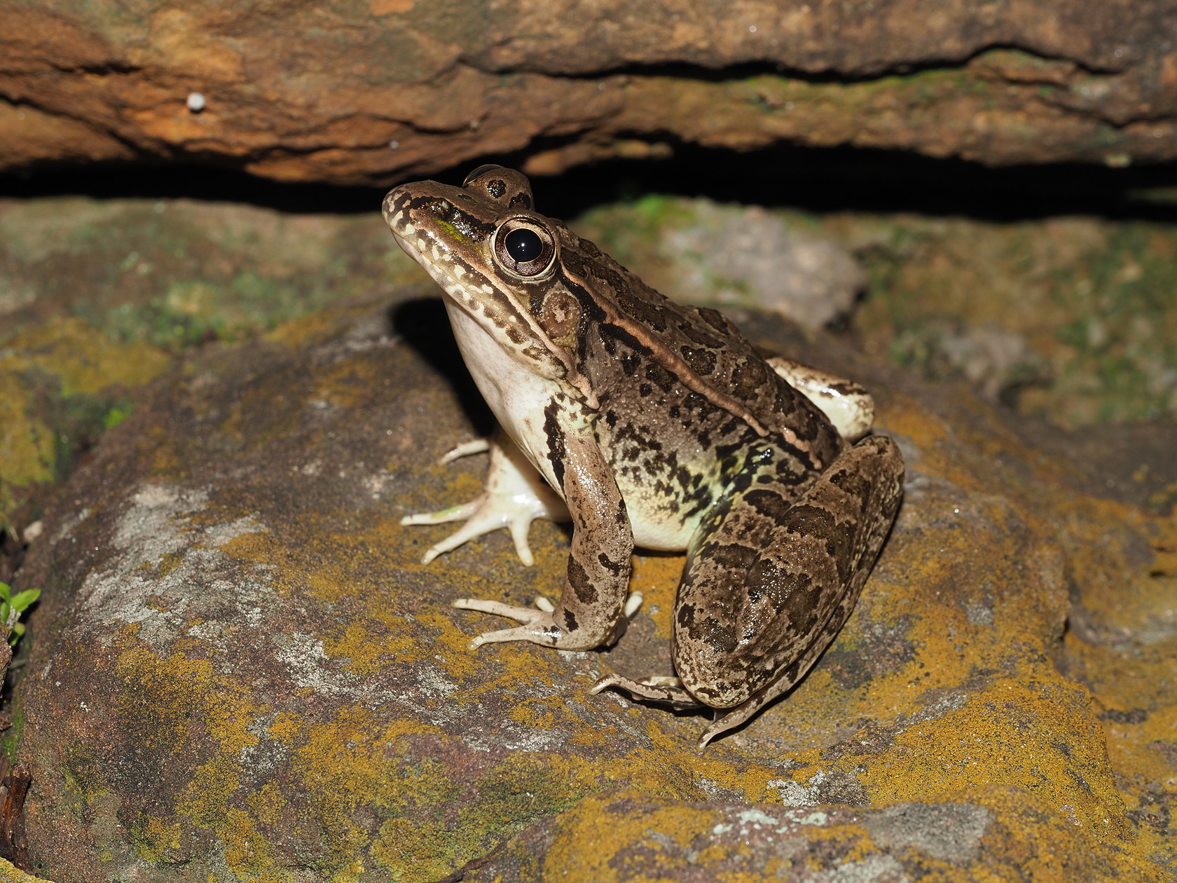
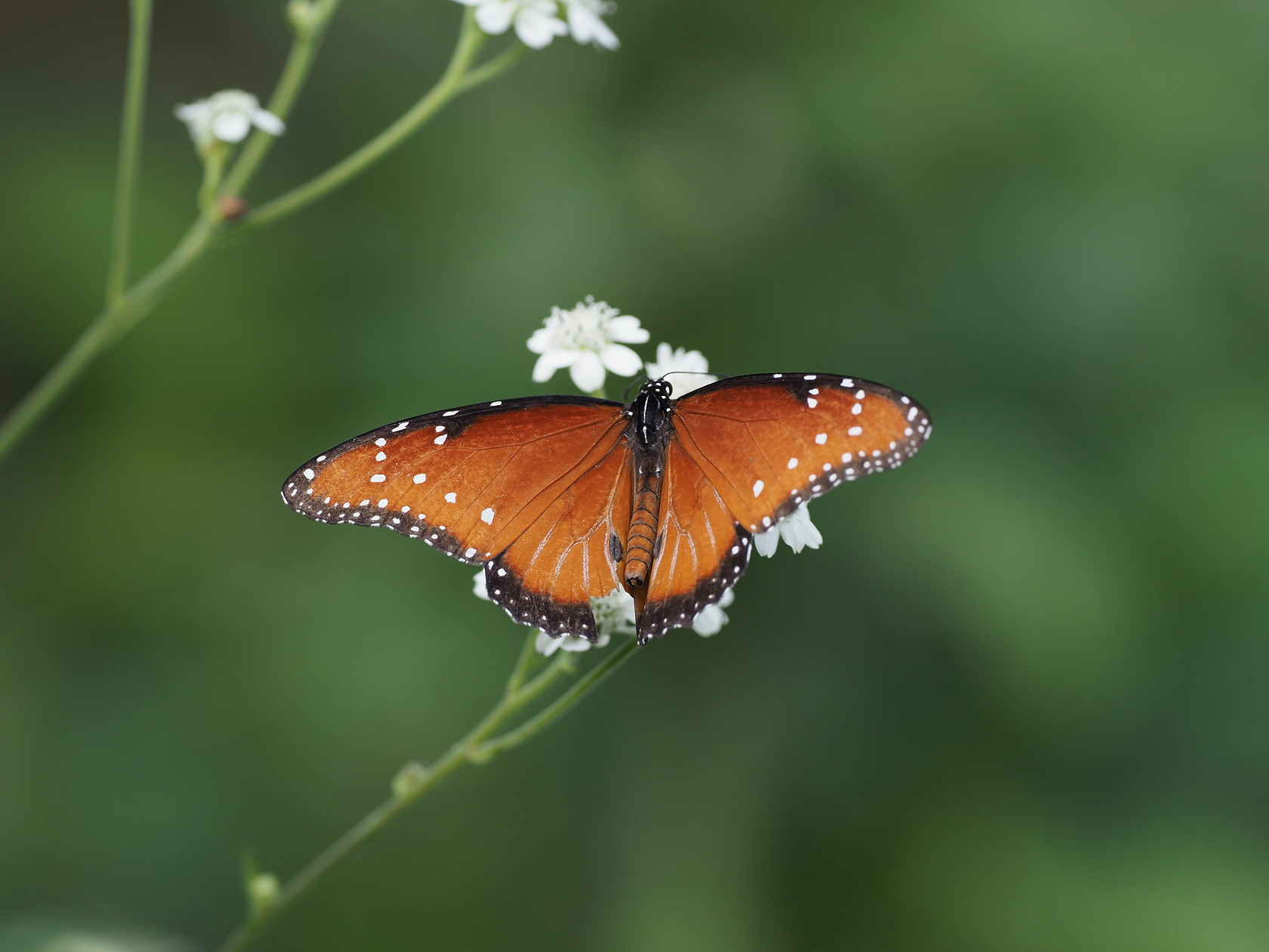
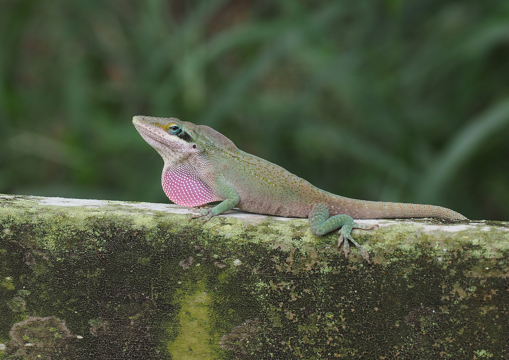
Although birders are by far the largest group of naturalists to visit the Rio Grande Valley, butterflies are also an attraction for many people since, like birds, many species reach their northern limits in southern Texas. The “National Butterfly Center” boasts the greatest diversity of butterflies in the US. And then there are those seeking reptiles and amphibians that only occur in the US in south Texas like the Spectacled Racer, Sheep Frog, Giant Toad, Mexican Tree Frog, Cat-Eyed Snake, Mexican Burrowing Toad and White-Lipped Frog. Unlike Florida, with its southern ocean barrier, reptiles and amphibians can migrate (albeit slowly) up the coastal plain from Mexico into Texas.
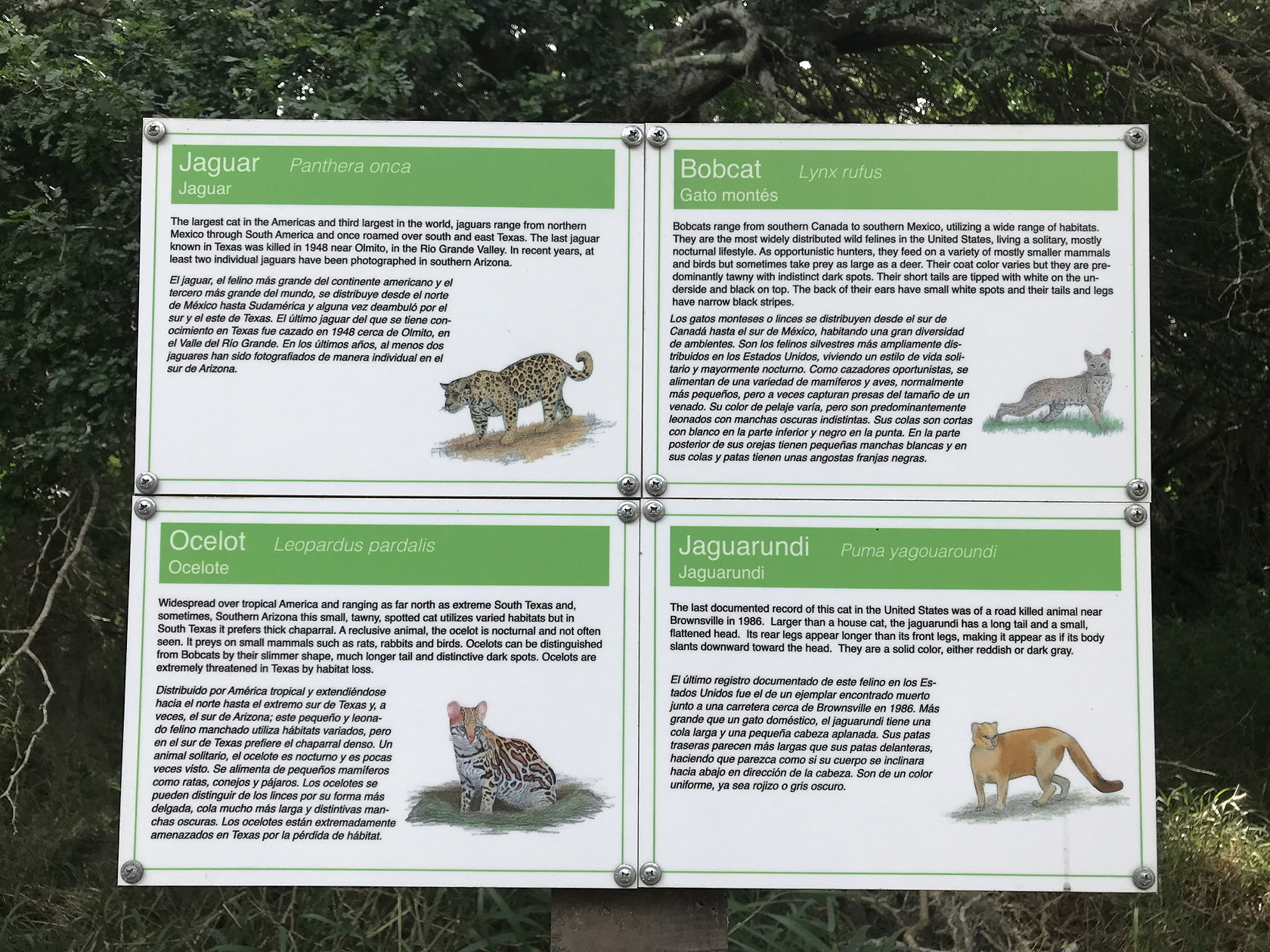
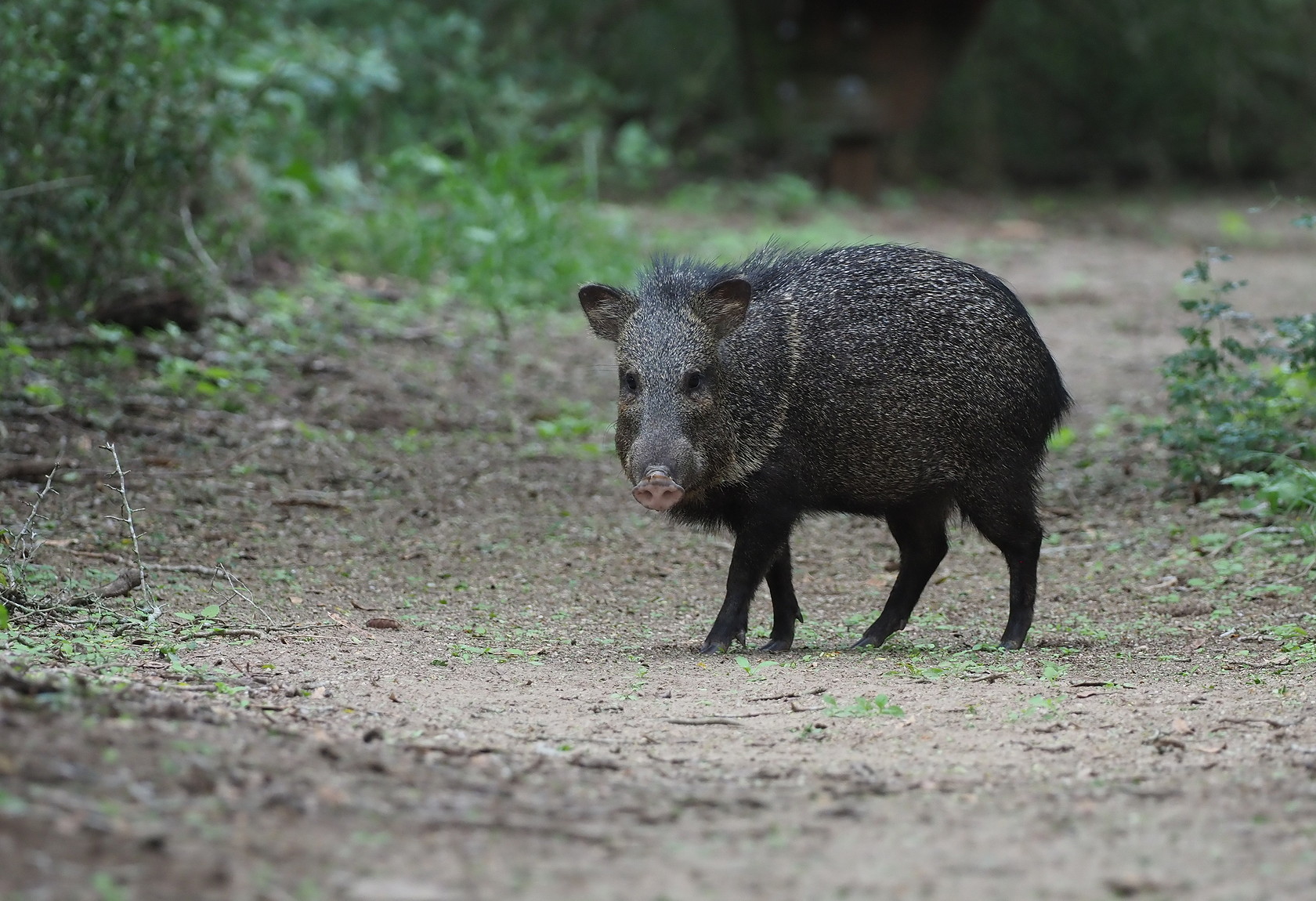
Finally, there are the mammals of the Rio Grande Valley. There are about 30 ocelots in the region (Laguna Atascosa National Wildlife Refuge) and Jaguarundi were reported some decades ago. Jaguar are probably found within 100 miles of the border. Visitors shouldn’t expect to see any of these cats, but just the possible existence of them adds a taste of “tropicality” to the region.
Some southern species reaching the Lower Rio Grande Valley
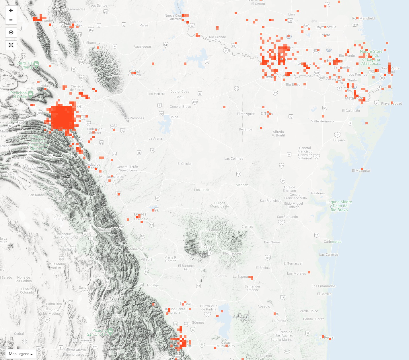
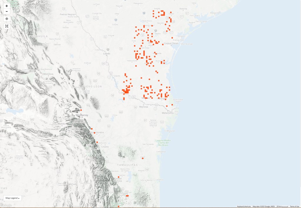
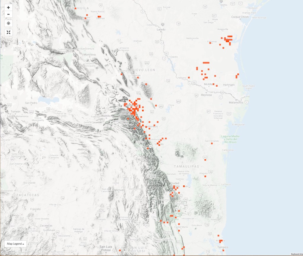
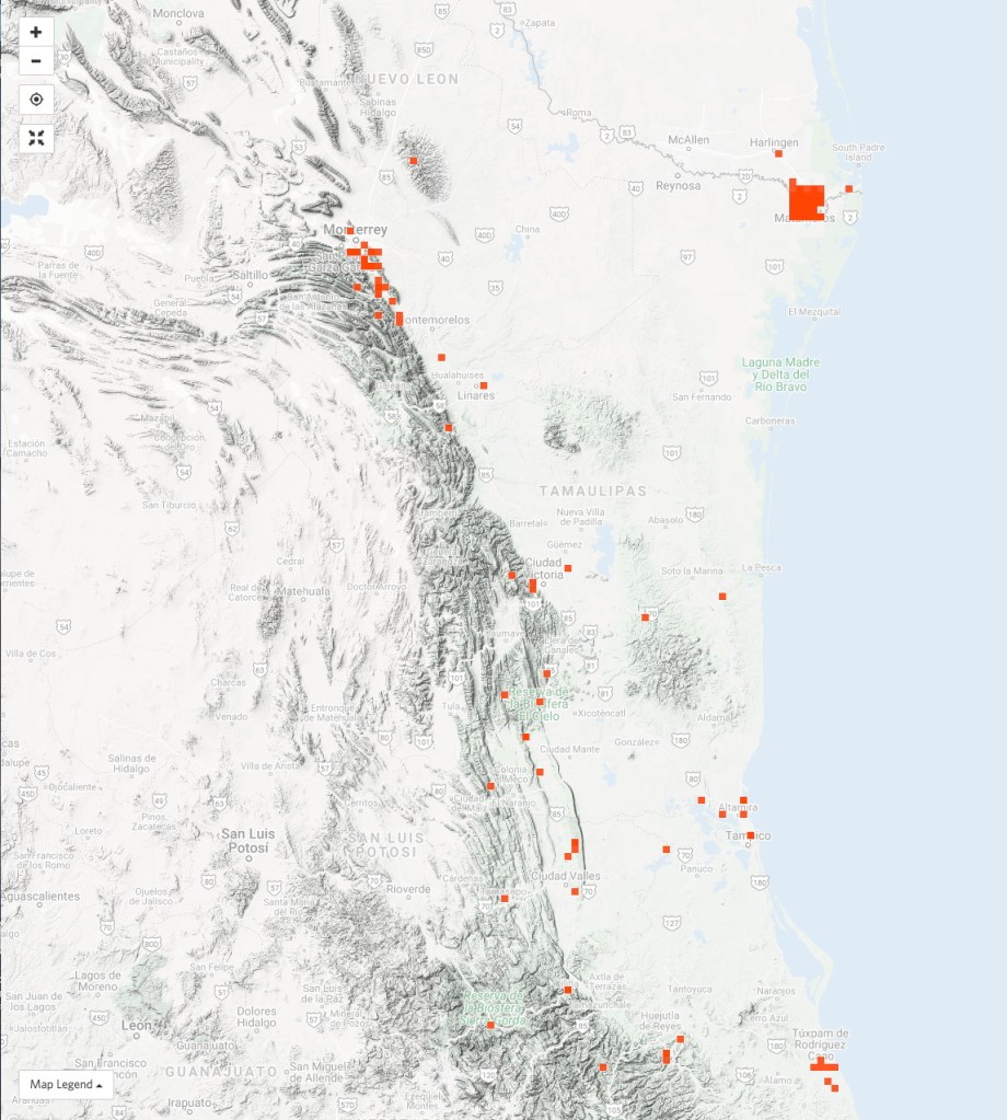
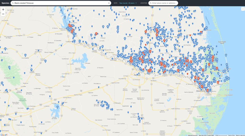
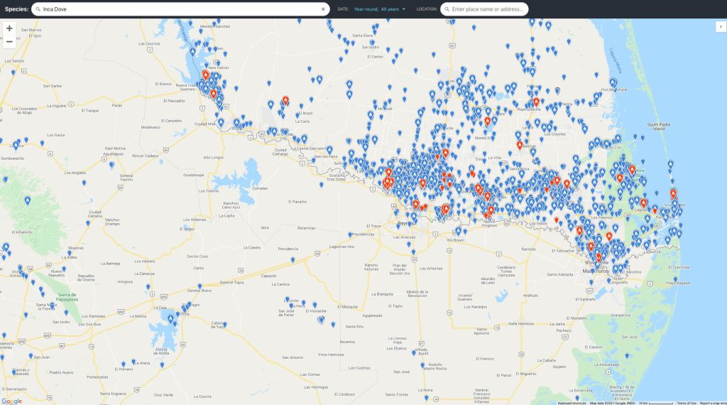
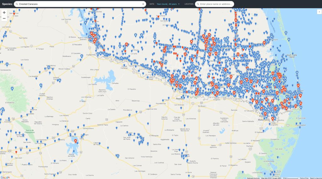
Below are some plots in iNaturalist of occurrences reported for select birds and reptiles and amphibians that reach their northern limits in southern Texas. Most plots show similar patterns – with many US observations in the Valley and relatively few Mexican observations. This difference is most pronounced for some species like Hummingbirds and certain frogs. Why might this be?
The iNaturalist patterns likely reflect several issues of sampling. First, the main difference between US and Mexico lies with the number of people using iNaturalist. Few nature tourists visit this region of northern Mexico – compared with the US side of the border. There is no equivalent large winter influx of Mexican tourists to the region. A second factor shaping the observed distributions is likely the fact that much of the land north of the Valley in Texas is private property dominated by large ranches with no public access. Tourists and Winter Texas travel quickly through this region making relatively few iNaturalist observations. The Valley’s preserves offer a more suitable environment to observe nature. Taken together these factors produce an apparent richness of observations in the Lower Rio Grande Valley – that may or may not reflect reality.
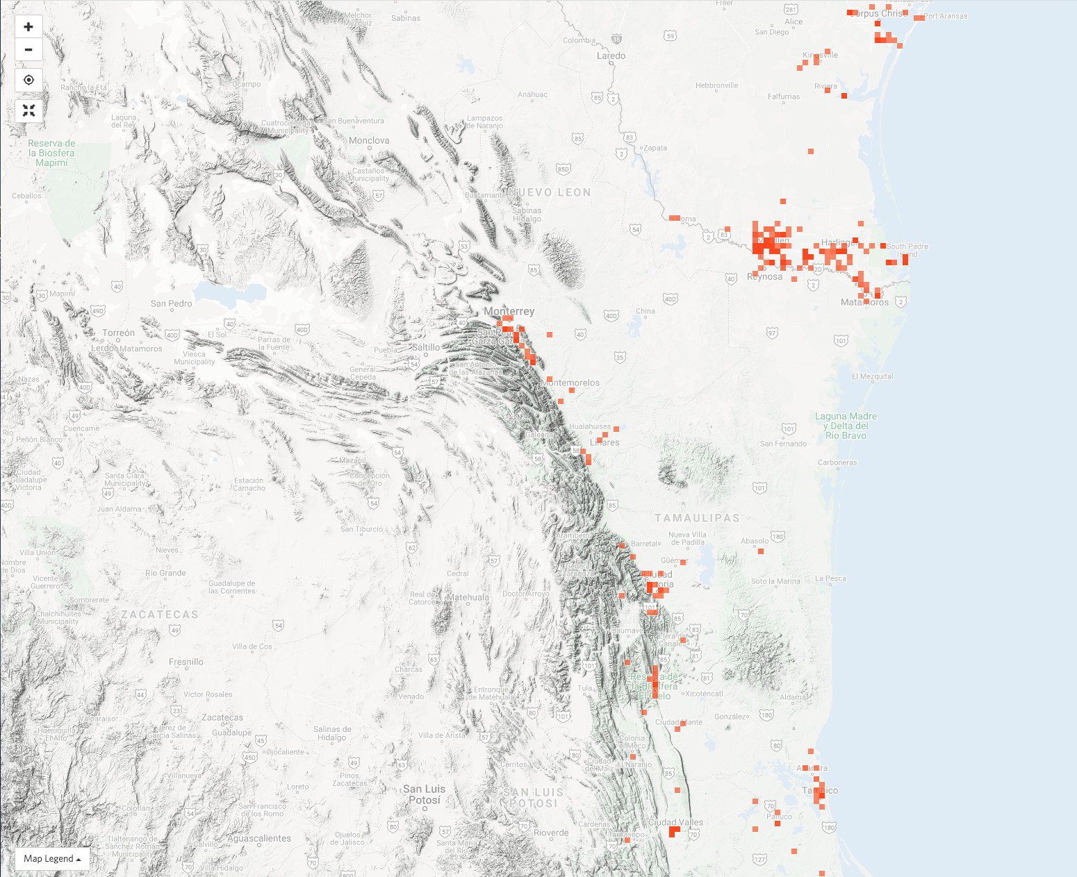
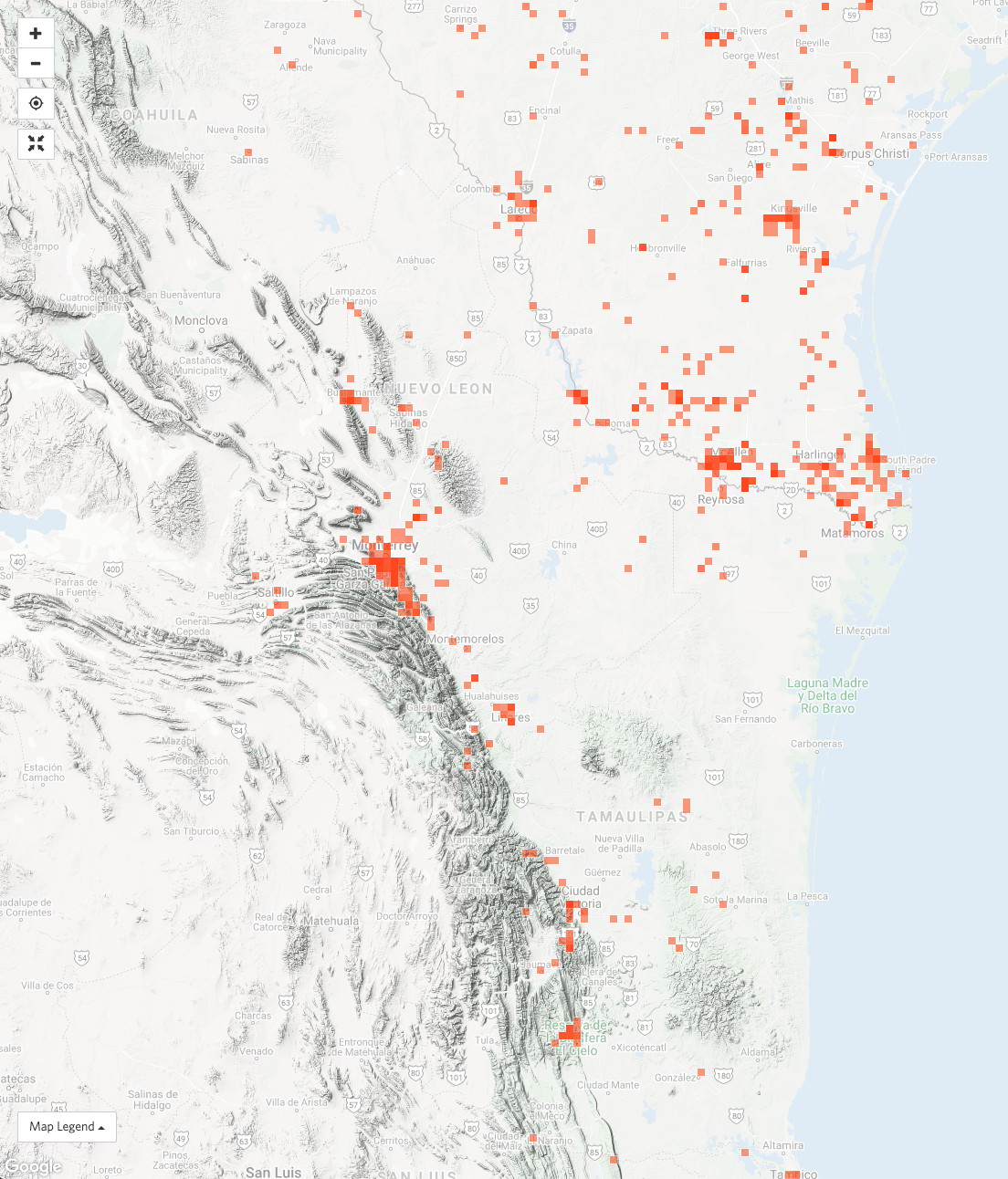
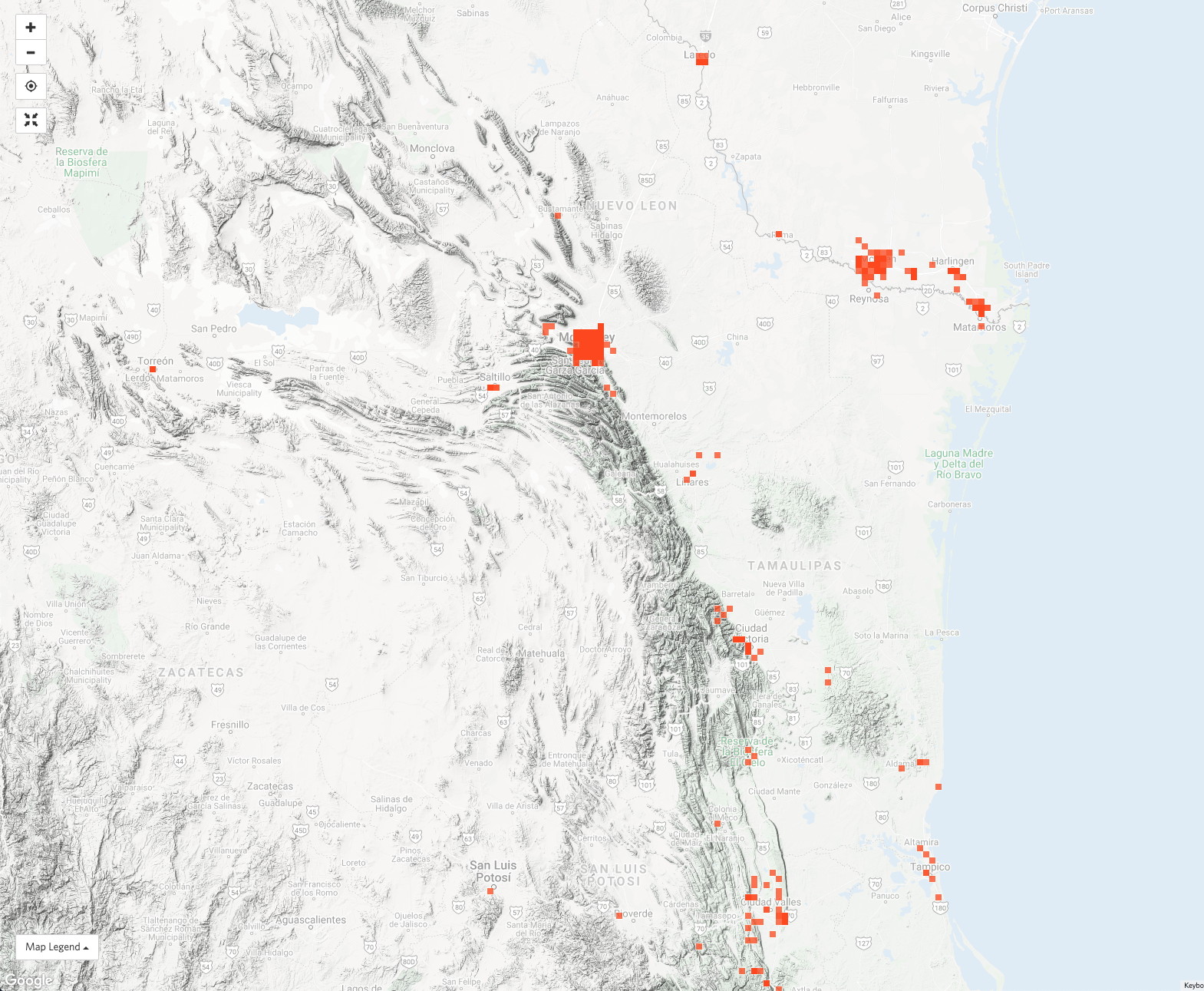
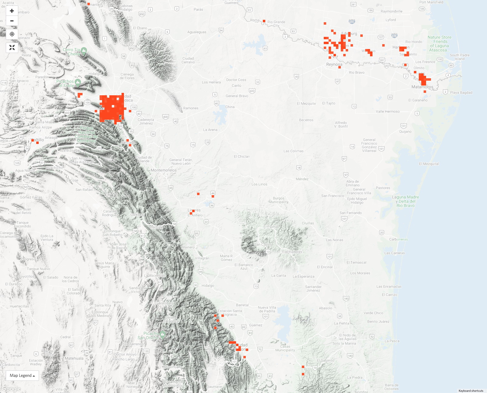

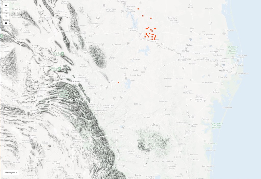
Below are eBird observation plots for select species of birds that tend to reach their northern limits in southern Texas. A few widespread birds are also included to highlight the sampling issues across the US-Mexico border. Some of these plots can be compared with the iNaturalist plots above. The eBird plots have many more observations than iNaturalist, probably because iNaturalist prefers images for quality control purposes and most observations today for iNaturalist come from smart phones that are not well-suited for bird photography that benefits from telephoto lenses.
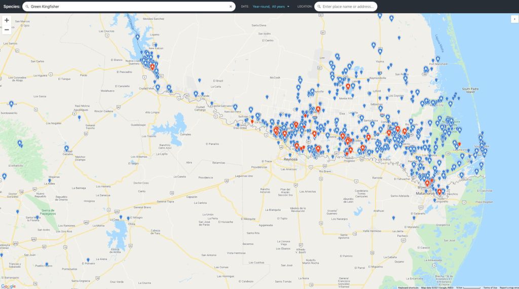
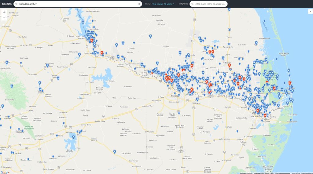
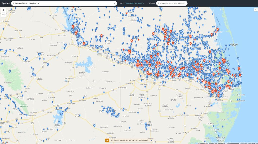
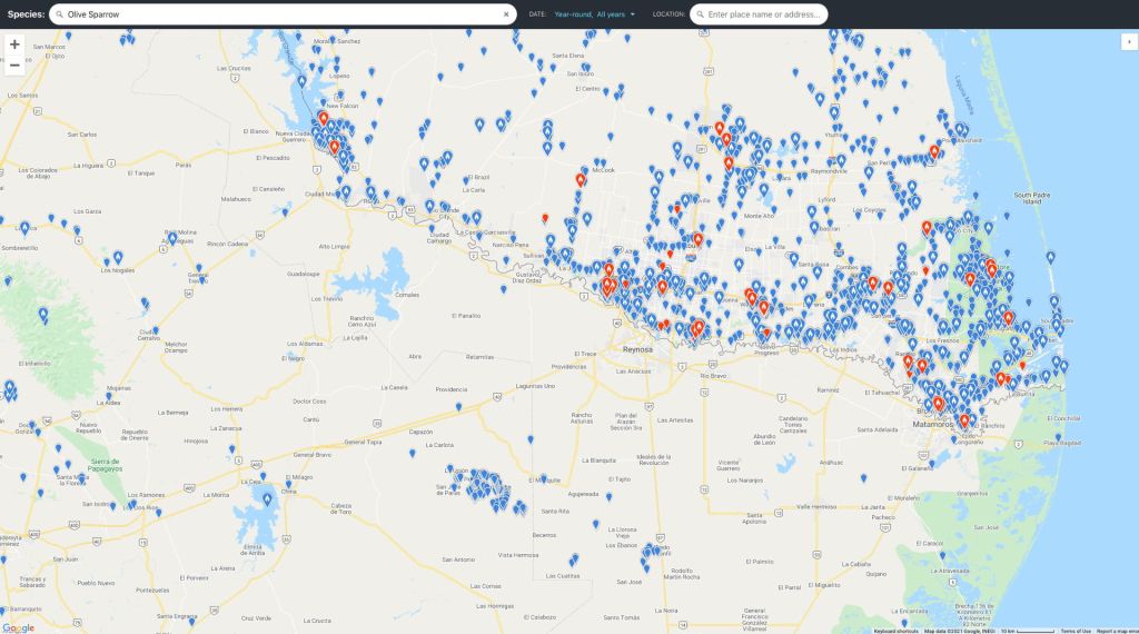
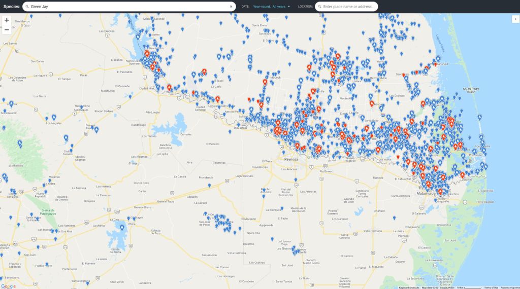
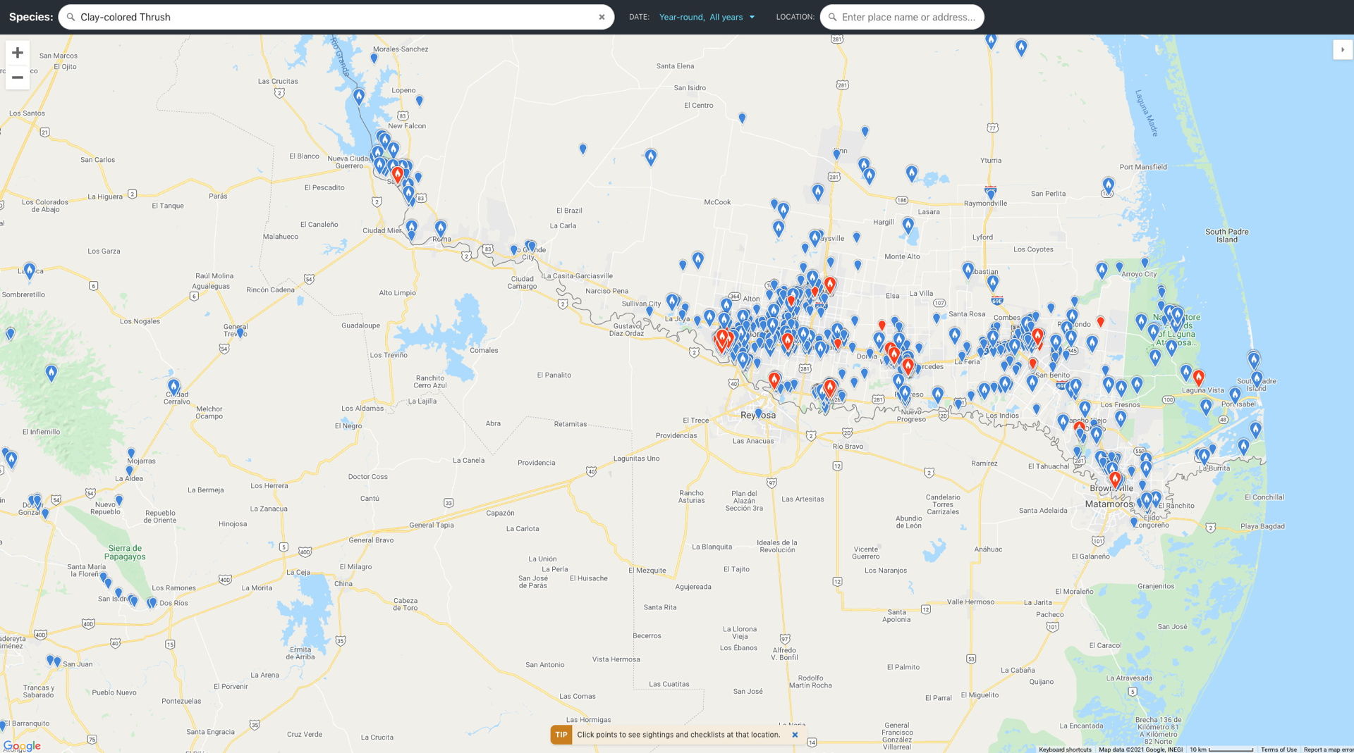
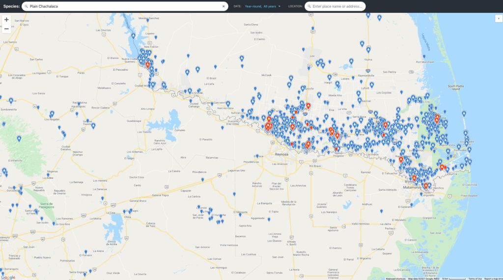
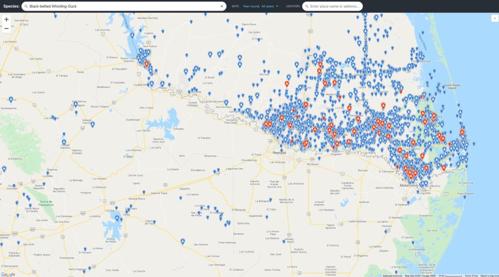
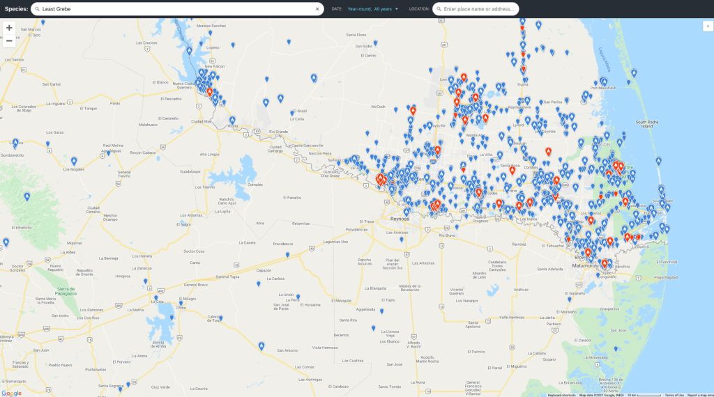
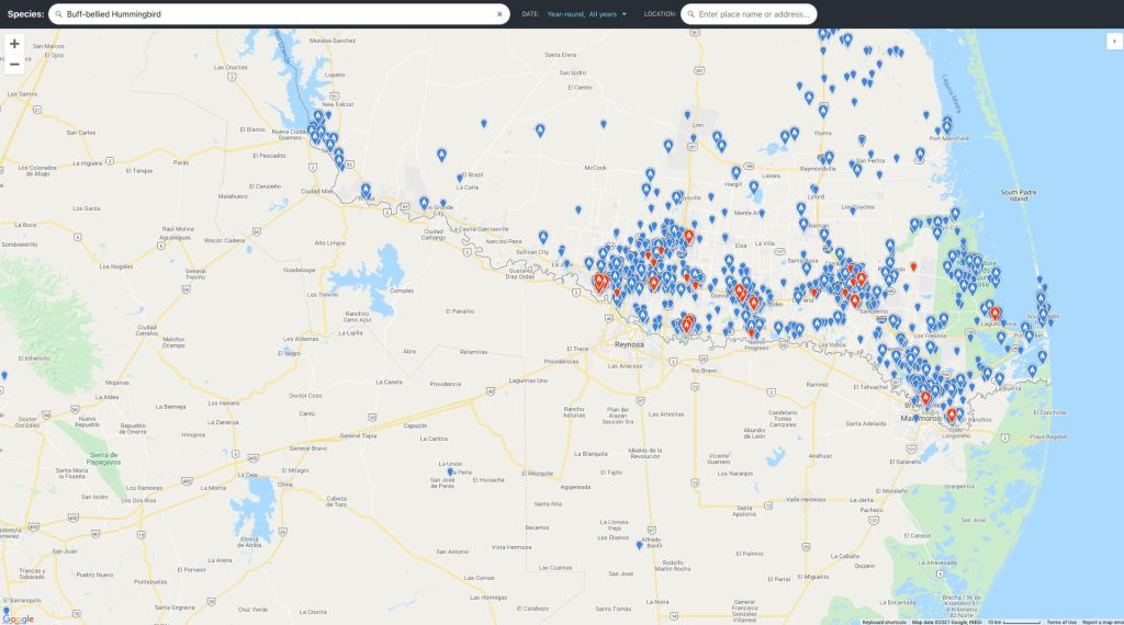

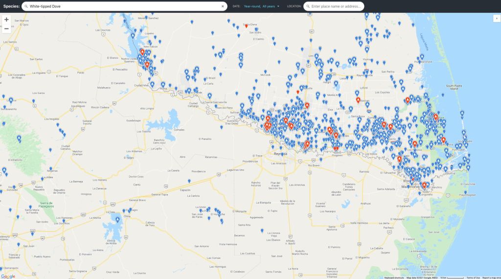

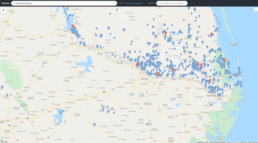
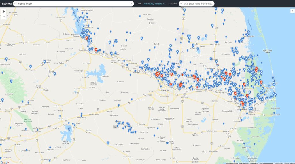
Observations on eBird are extremely useful, especially since they are usually “quality-controlled” by independent curators. But they tend to suffer from the “herd instinct” behavior of birders. An observation of an uncommon bird by one birder, publicized via eBird, stimulates visits of other birders to try to see the bird. This results in a clustering of observations that probably doesn’t reflect the real distribution of the bird. And, not surprisingly, many eBird observations come from locations like parks and refuges that are most convenient for birdwatching.
The main point of showing the eBird and iNaturalist observations above is to make it apparent that much work needs to be done to reduce the sampling biases that currently exist in such citizen science data bases.
Protected areas in the Lower Rio Grande Valley
The essential ingredient for birding tourism in the lower Rio Grande Valley is the availability of preserves to visit that protect some semblance of the natural landscape of the Valley’s flora and fauna. The Valley has a diverse mix of protected areas. These preserves include National Wildlife refuges, Texas State Parks, Texas Wildlife Management Areas and smaller private nature reserves. Most have well-maintained trails through natural vegetation, self-guided nature trails, boardwalks over wet areas, bird feeders and wildlife blinds, and some also have visitor centers with extensive information and staffed with knowledgeable volunteers.
Some years back local city governments and conservation organizations in the Valley formulated the concept of “World Birding Center” (WBC) with the first one being the lower Rio Grande Valley. There are 9 sites that are designated as part of this WBC. However, this appears more as a mechanism to encourage birding tourism to the Valley. The three Texas State Parks in the Valley are formally part of the World Birding Center.
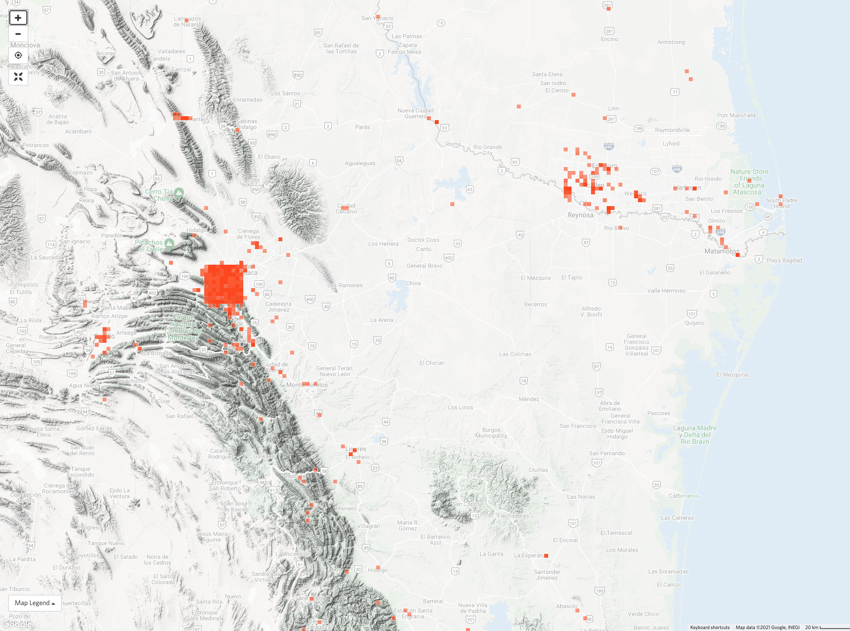
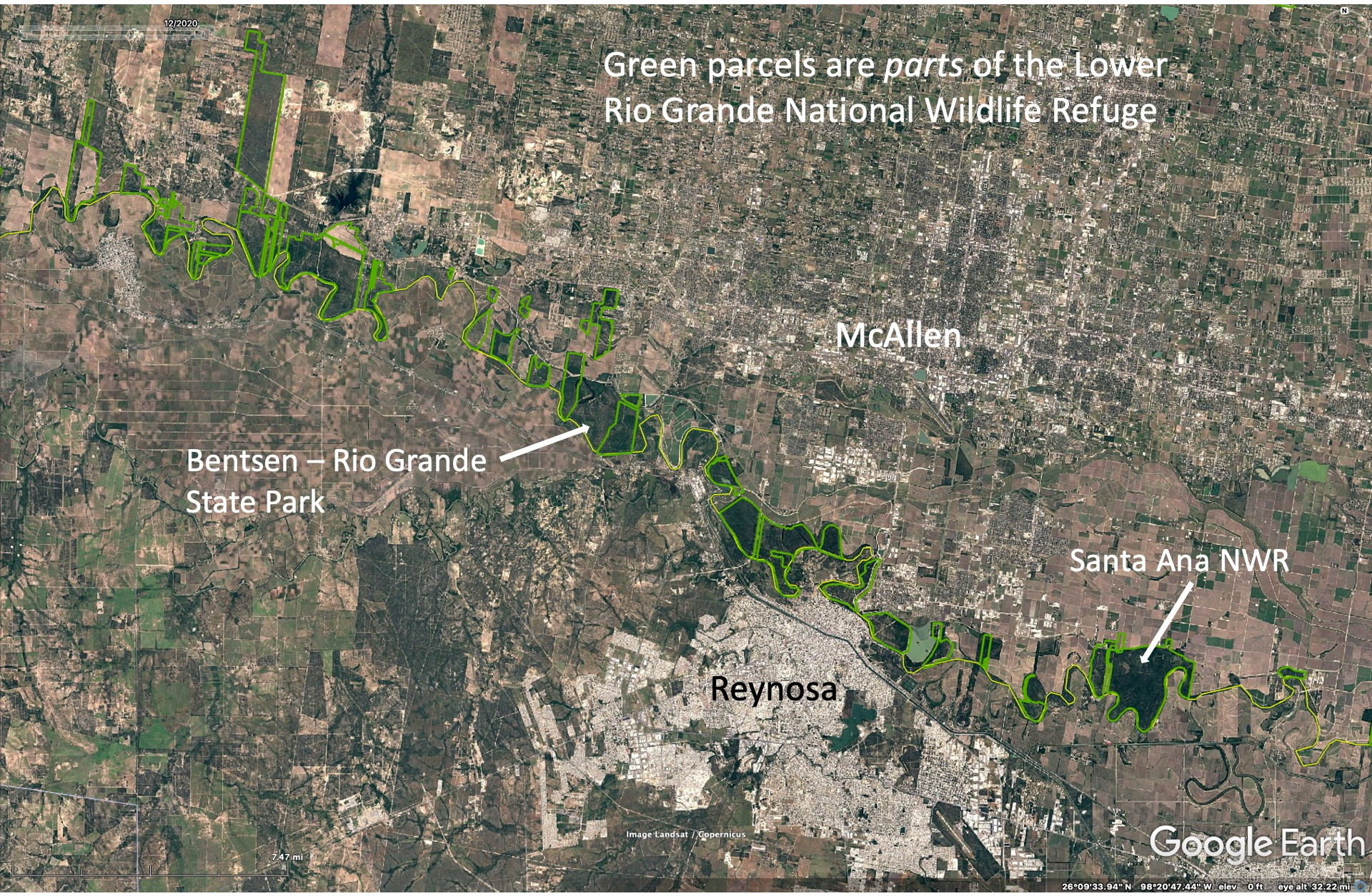
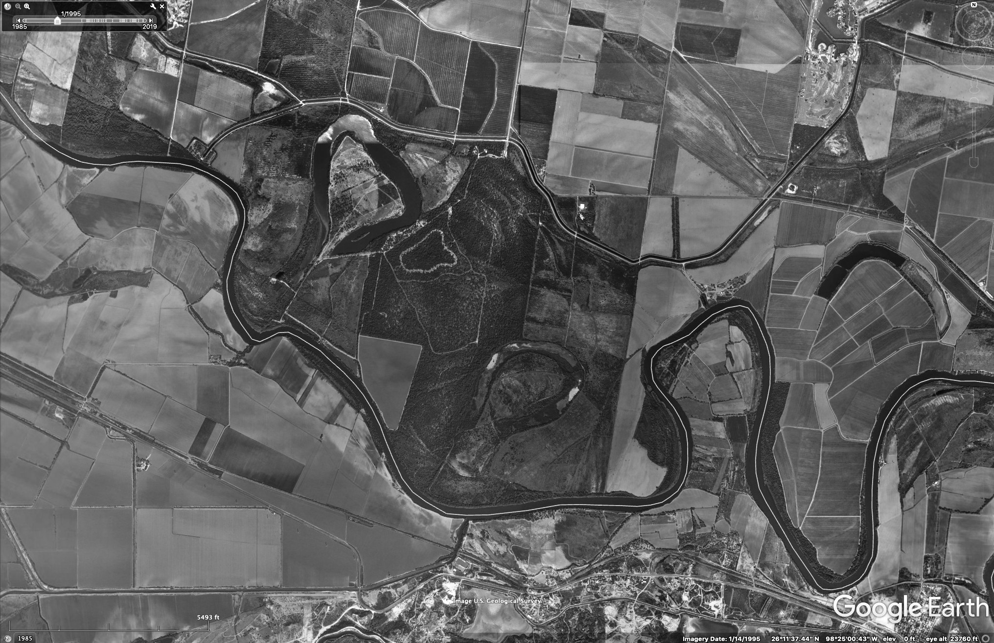
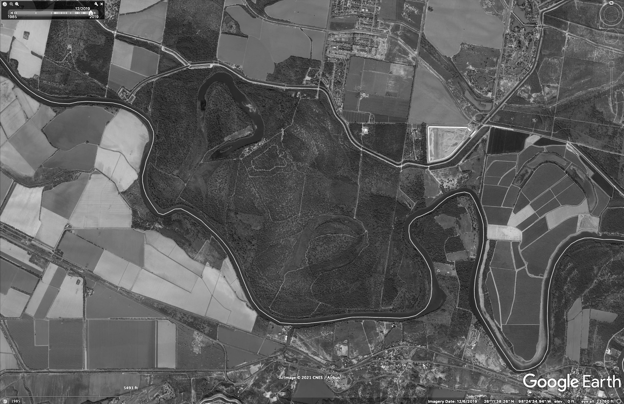
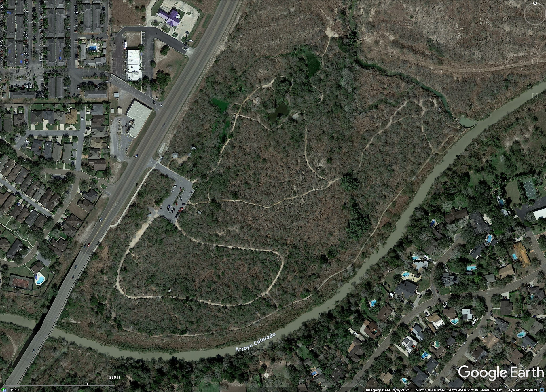
Undoubtably the most important preserve in terms of protecting or restoring native flora and fauna is the Lower Rio Grande Valley National Wildlife Refuge which is an agglomeration of many separate parcels along the Valley. Though many of these don’t have visitor facilities, they collectively protect much more land than any of the Texas State Parks or private reserves. The image below shows most, but not all, of the refuge’s parcels along the Rio Grande near McAllen. The Refuge’s parcels extend to the Gulf of Mexico, east of Brownsville.
The Rio Grande Conservation Corridor
An over-arching reason for the Lower Rio Grande National Wildlife Refuge is to try to connect separate parcels of land to create a continuous reserve along the Rio Grande. Isolated parcels cannot support wildlife that needs larger ranges (e.g. Javelina, ocelots) and decreases over time the genetic diversity of such species by interbreeding. Large agricultural fields are barriers to many forest-dwelling species, so by purchasing land along the river a suitable corridor for such species to travel will eventually exist. This is a long-term strategy, likely to take many decades, since funding and landowner agreement is needed. Unfortunately, little has been done on the Mexican side of the river to complement the US-side activities.
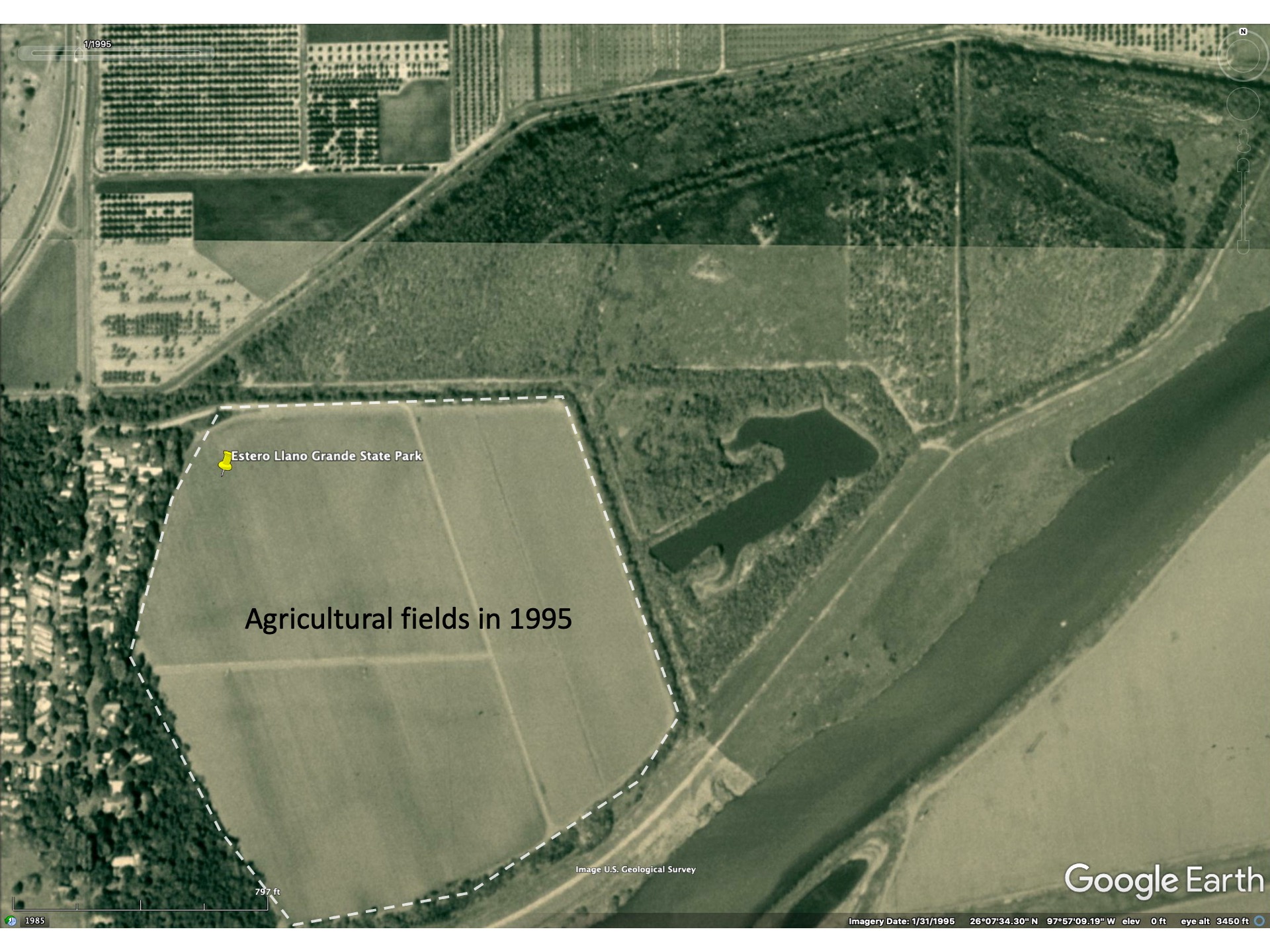
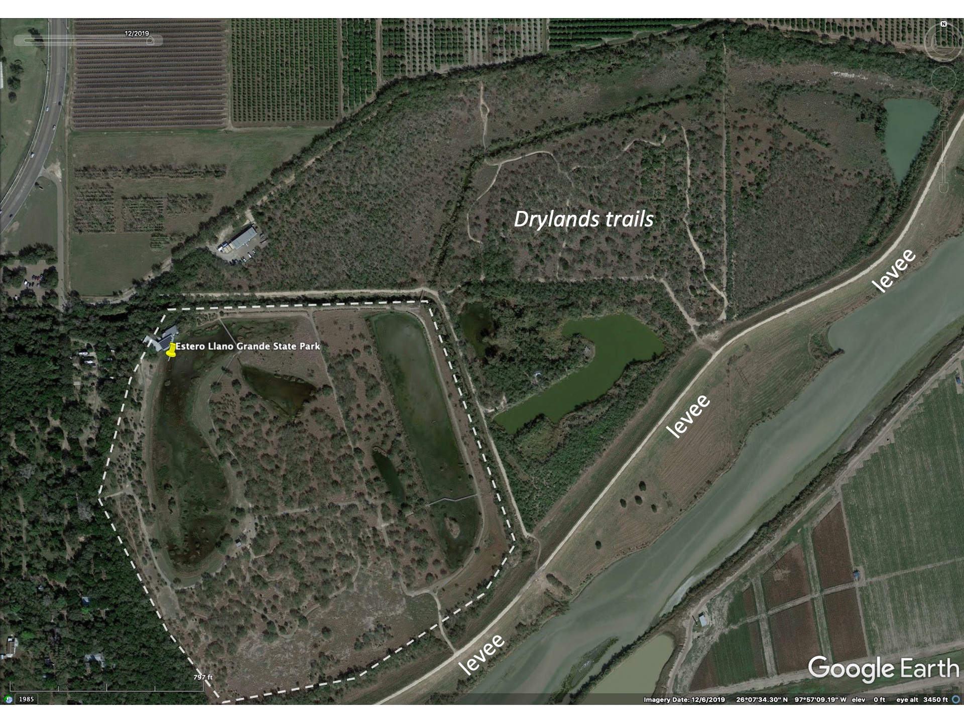
While it has not been easy to develop a continuous corridor along the Rio Grande from Falcon Dam to the the Gulf of Mexico some progress has been made in the past 30 years. This can be seen from Google Earth imagery that shows the changes in land use from 1984 (first satellite imagery generally available) to the present for the area between Bentsen Rio Grande State Park and Santa Ana NWR and the area between Brownsville and Matamoros.
The Wall
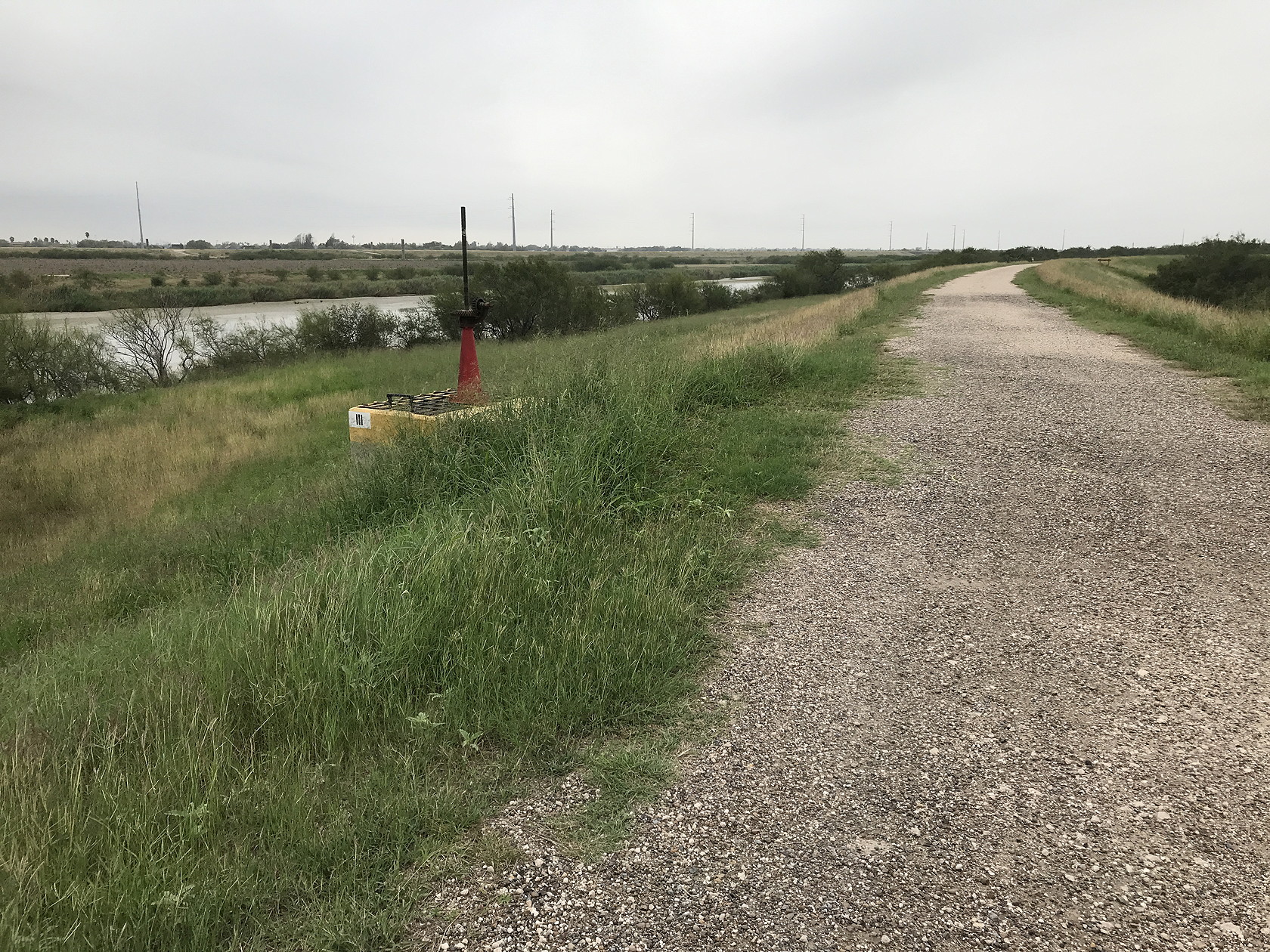
No discussion about the Lower Rio Grande Valley would be complete without mention of the infamous Wall. Running along the top of an earthen levee that prevents water from the Rio Grande spilling during floods into agricultural fields is a fence that functions to slow down the crossing of immigrants or smugglers who decide to cross the Rio Grande. The river itself is not a major barrier to people who choose to float across it, but the fence, atop the levee is a more effective barrier. The barrier can be several miles from the actual river, but the levee with a dirt access road running along it and with a 30 ft tall fence/wall in many places, is an imposing barrier. There are breaks in the wall (mostly a fence/wall mix with gaps) for roads to cross it, but these are monitored by either National Guard or boarder patrol personnel. Some of the main refuges, like the Santa Ana NWR and the Bentsen Rio Grande State Park, lie between the main levee and the border/river. A Washington Post article, albeit dated, describes aspects of the border wall in South Texas. Independent of any political perspectives the reader may have, the maps and photos in this article are informative.
Whatever your views on the suitability of a border wall, the main problem with wildlife conservation in the Valley remains agricultural use of land and urban expansion. The Mexican side of the Rio Grande has virtually no preserves or formal protection of the natural landscape in most places. This is apparent from inspection of some of the satellite images above.
Some Valley places for exploring flora and fauna
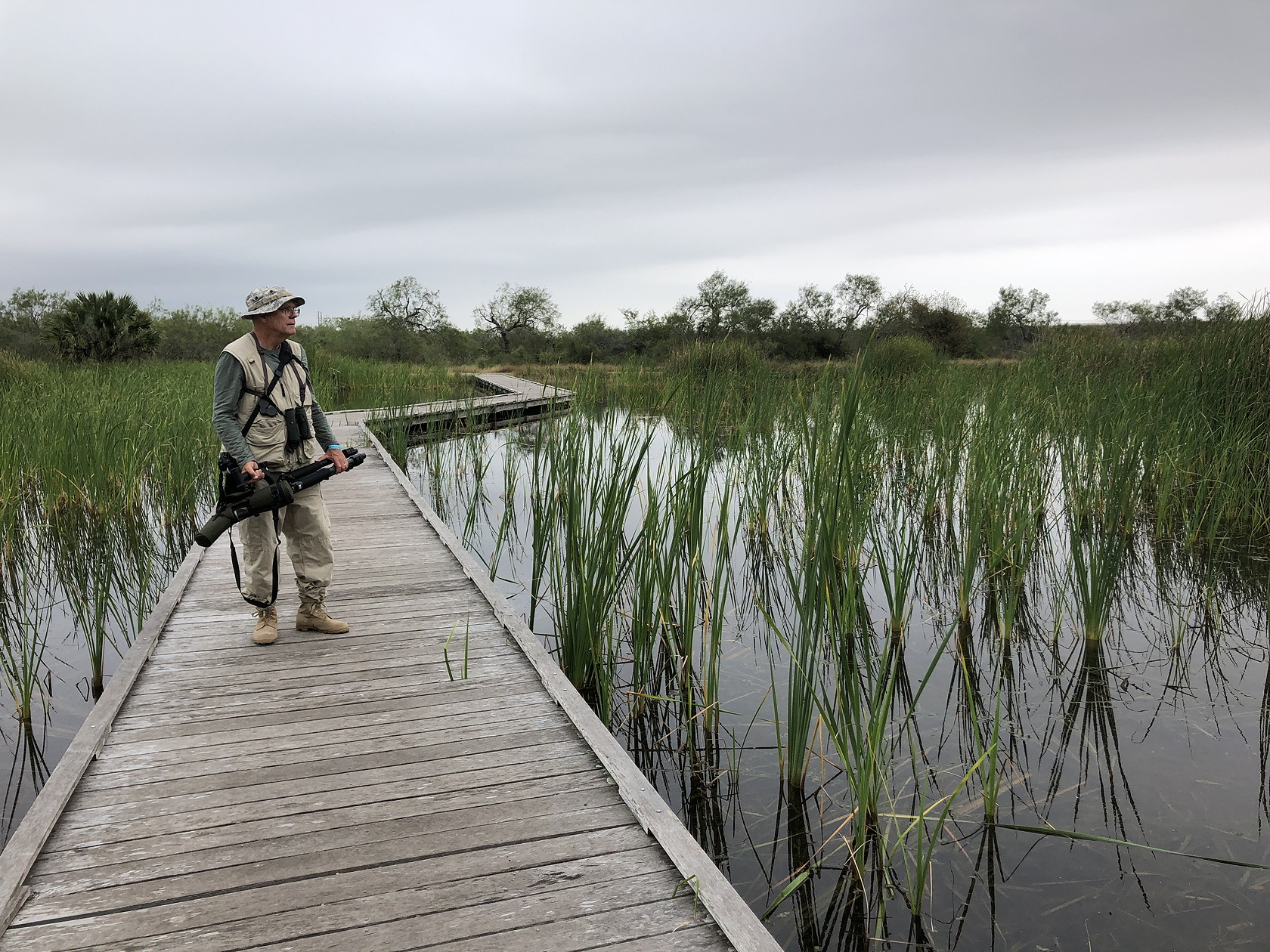
Our travel (~10 days camping with our teardrop trailer) in the Lower Rio Grande Valley (LRGV) area in Dec 2021 (and a few shorter trips many years ago) allowed us to explore some of the main destinations for visitors interested in natural history. Some of the sites are detailed below – from east to west across the Valley. A kmz file of some of the locations we visited and some we didn’t is here (download, then open in Google Earth). A few locations north of the Valley are also included since any traveler to the Valley via land will likely have to pass through this area. We found that some boardwalks around Port Aransas, not well-known outside the region, were especially good for coastal and wading birds.
A comprehensive summary of birding sites across the Valley – and indeed all of Texas, can be found at a Texas Parks and Wildlife site. One part of this website summarizes the Great Texas Coastal Birding Trail – other parts of the same website cover birding locations everywhere in Texas. A 2008 (not 2018 as stated in Amazon) book describing birding locations in the LRGV can be purchased on Amazon. And finally, a website by a resident of the RV campground we stayed at in McAllen has a tremendous number of photos showing most of the major birding sites in the Valley. It has far more detail that we present here.
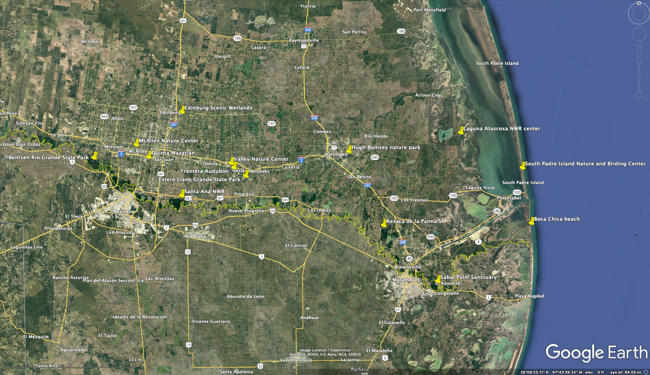
“Major” nature destinations in the Valley
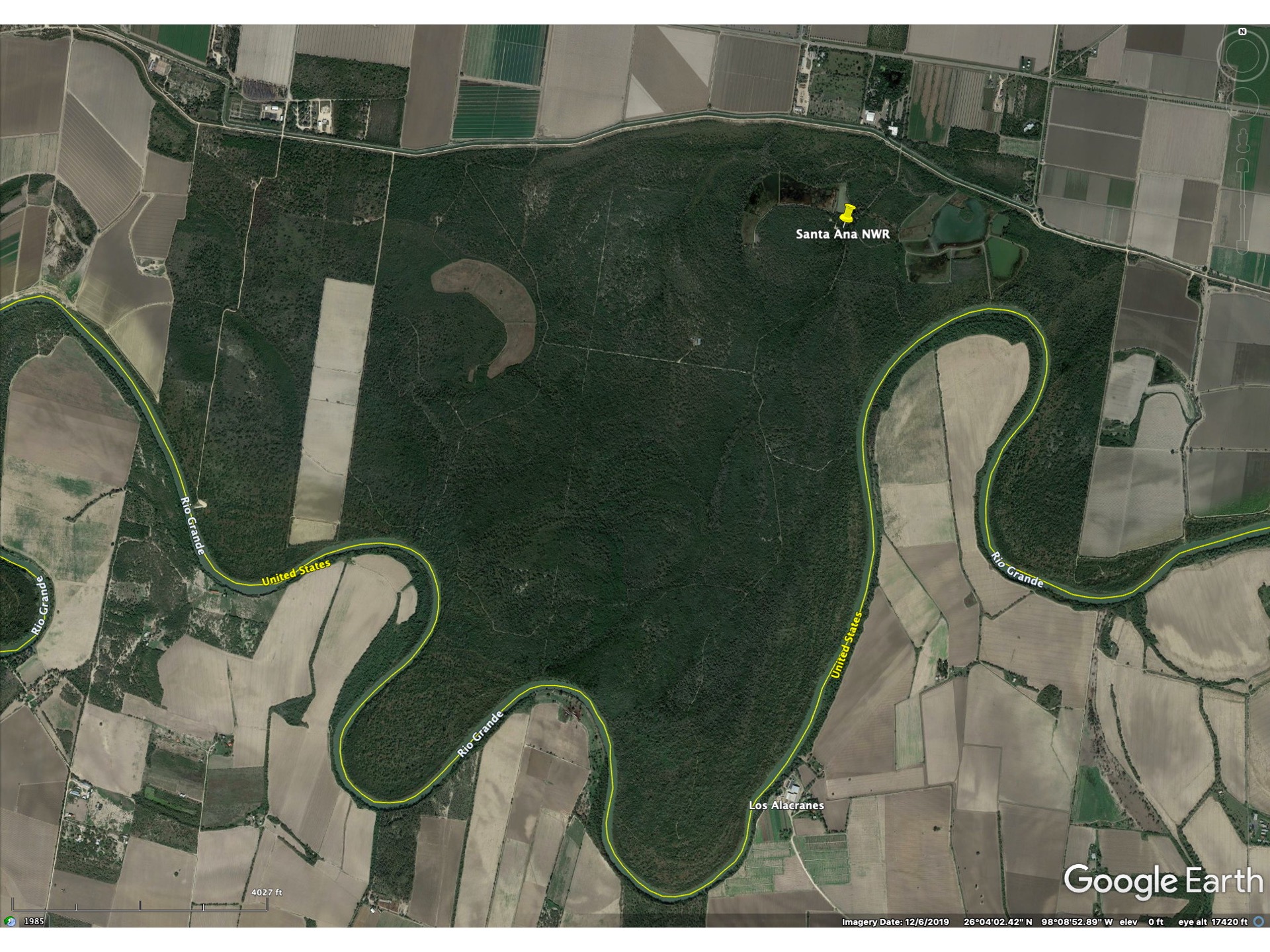
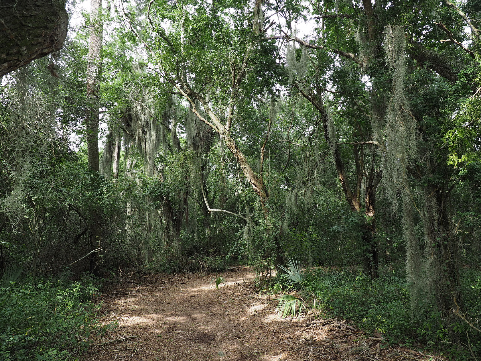
Santa Ana National Wildlife Refuge
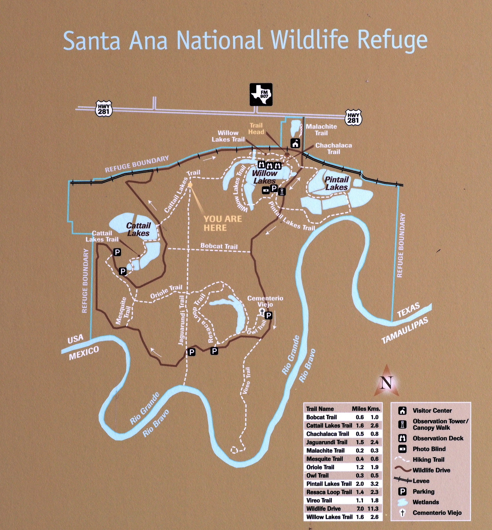
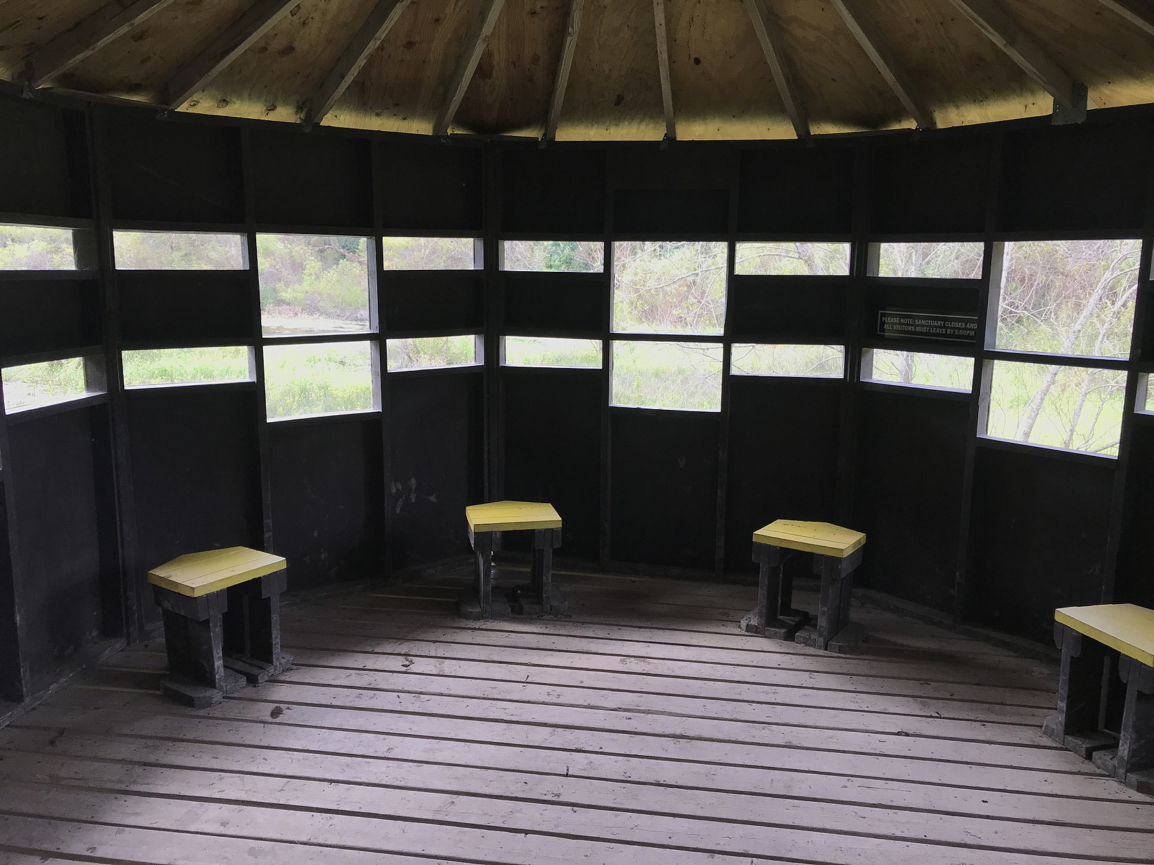
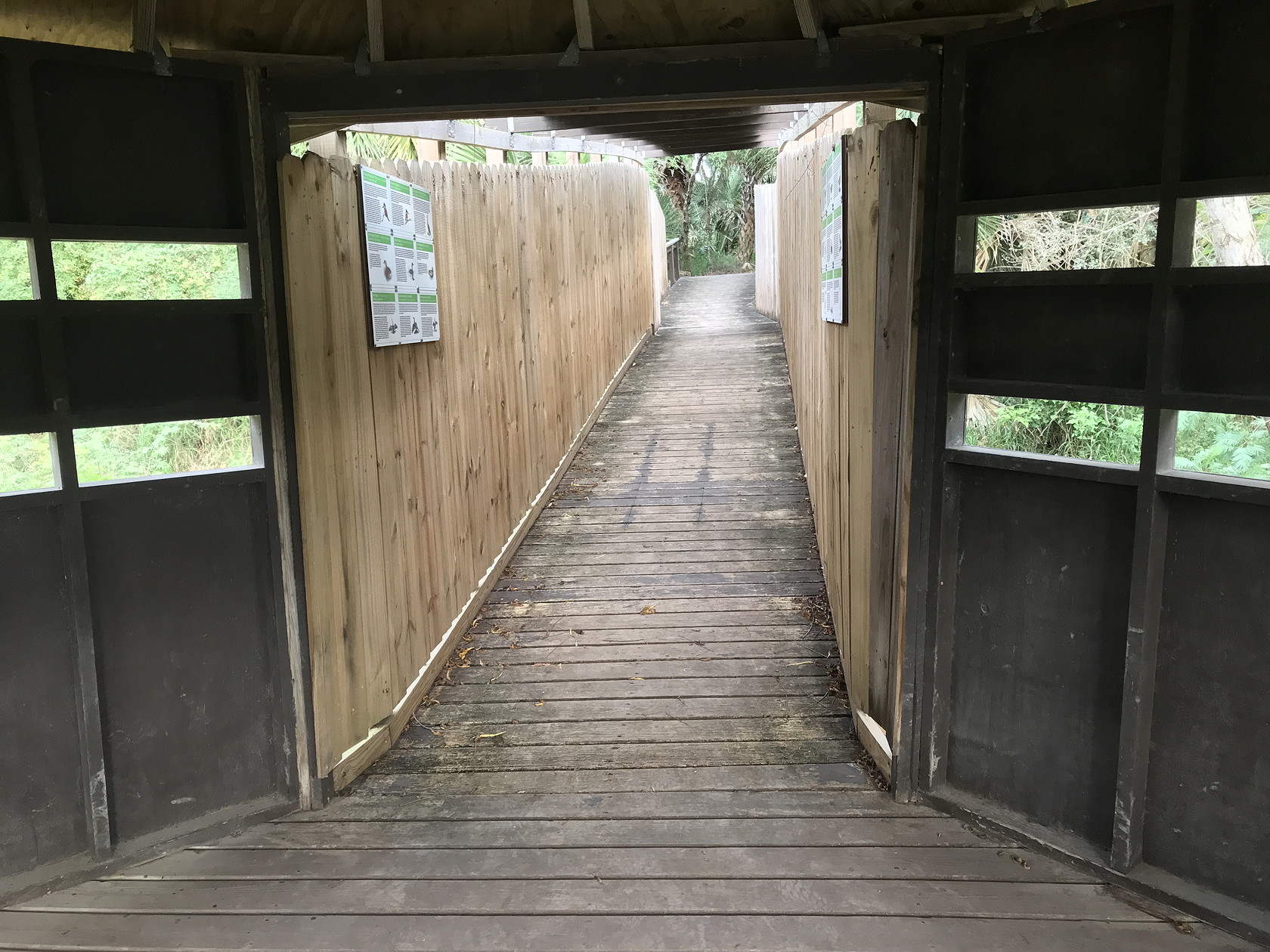
The best known of the Valley’s reserves is the Santa Ana National Wildlife Refuge, established in 1943. It is small by National Wildlife Refuge standards – only about 2000 acres (about 3 square miles). However, it has some relatively mature tracts of bottomland forest and related vegetation. Both artificial ponds and natural oxbow lakes provide habitat for waterbirds. And several towers allow views from above the forest canopy. Although COVID has impacted this and other refuges, there was a motorized trail through the refuge prior to COVID and presumably this will resume. The Visitor Center was also undergoing improvements (and was closed) in Dec 2021 when we visited.
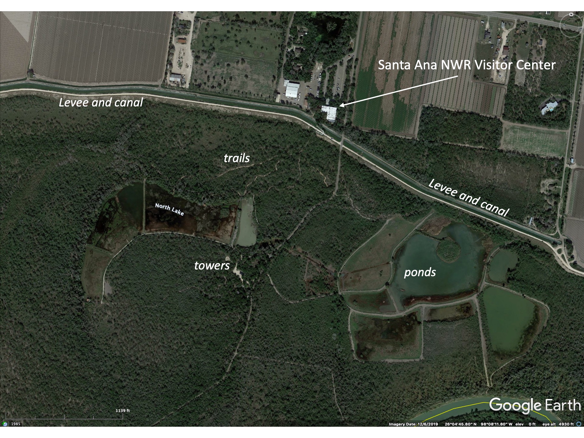
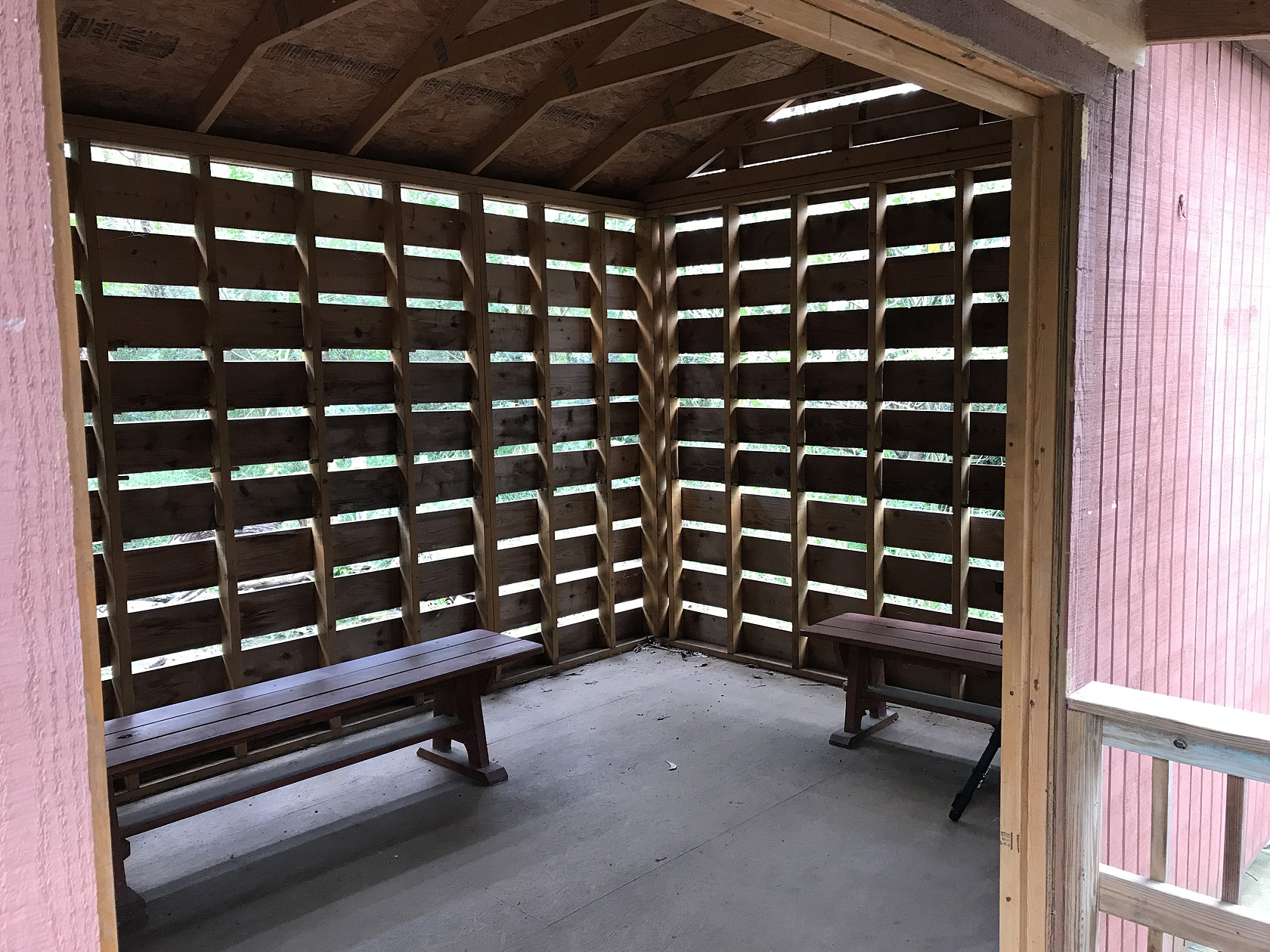
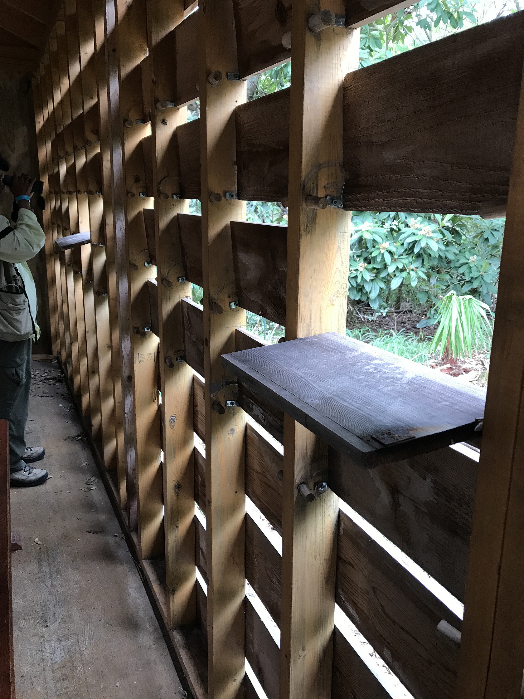
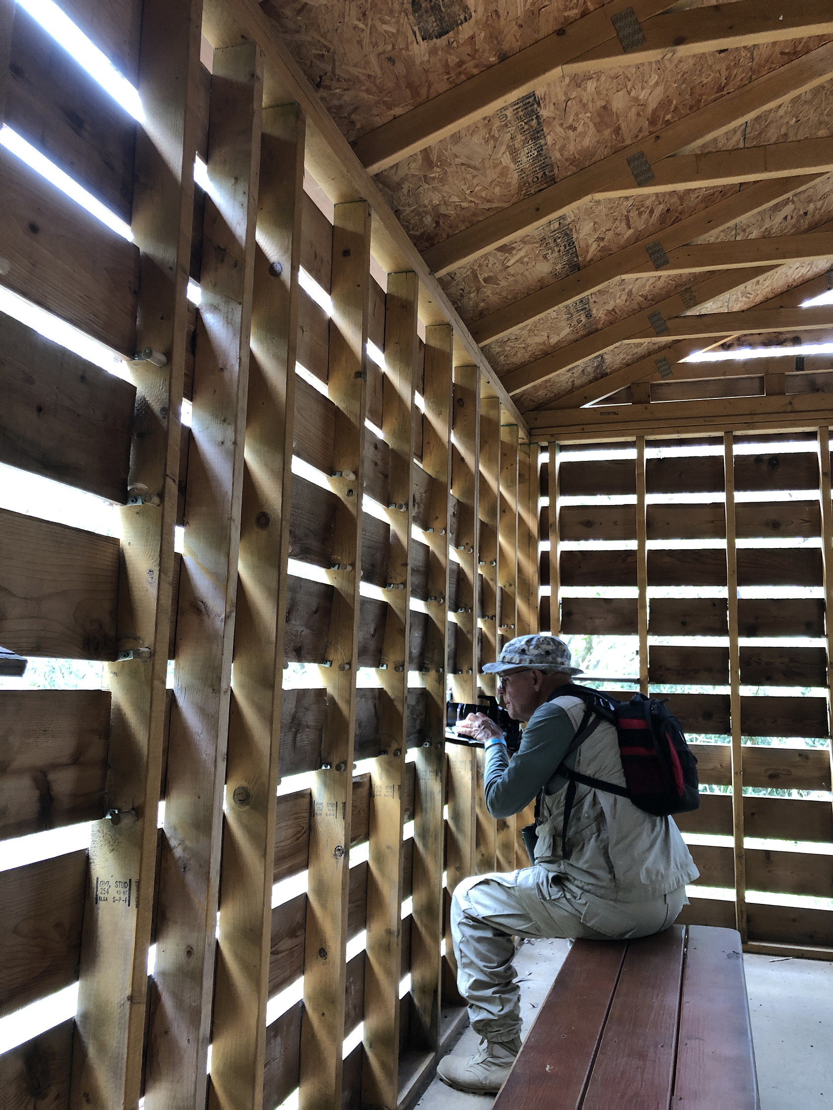
There are a variety of shorter and longer trails that lead to ponds or blinds in the Refuge and we found the Tower interesting. On a previous visit there was a suspension bridge allowing views of the canopy but the Tower, new to us (but present for more than 10 years), was higher and had no visitors because it required more steps and didn’t have a “swing bridge”. Better for birders as a result.

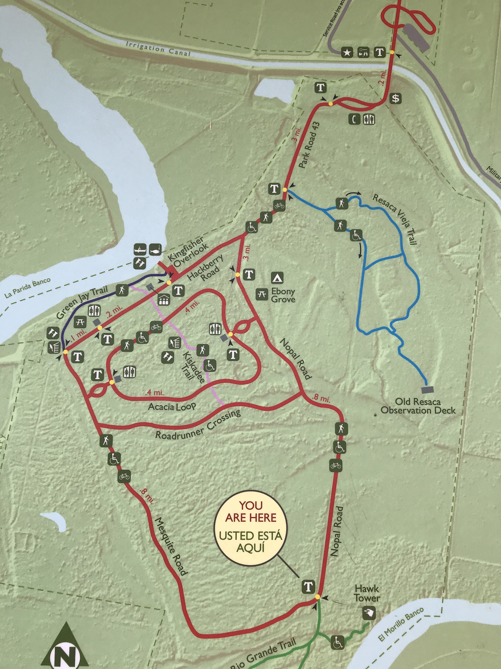
Bentsen-Rio Grande State Park
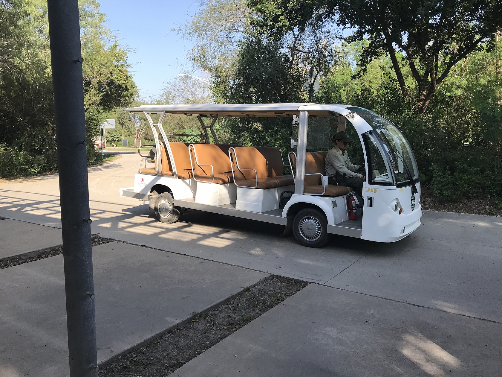
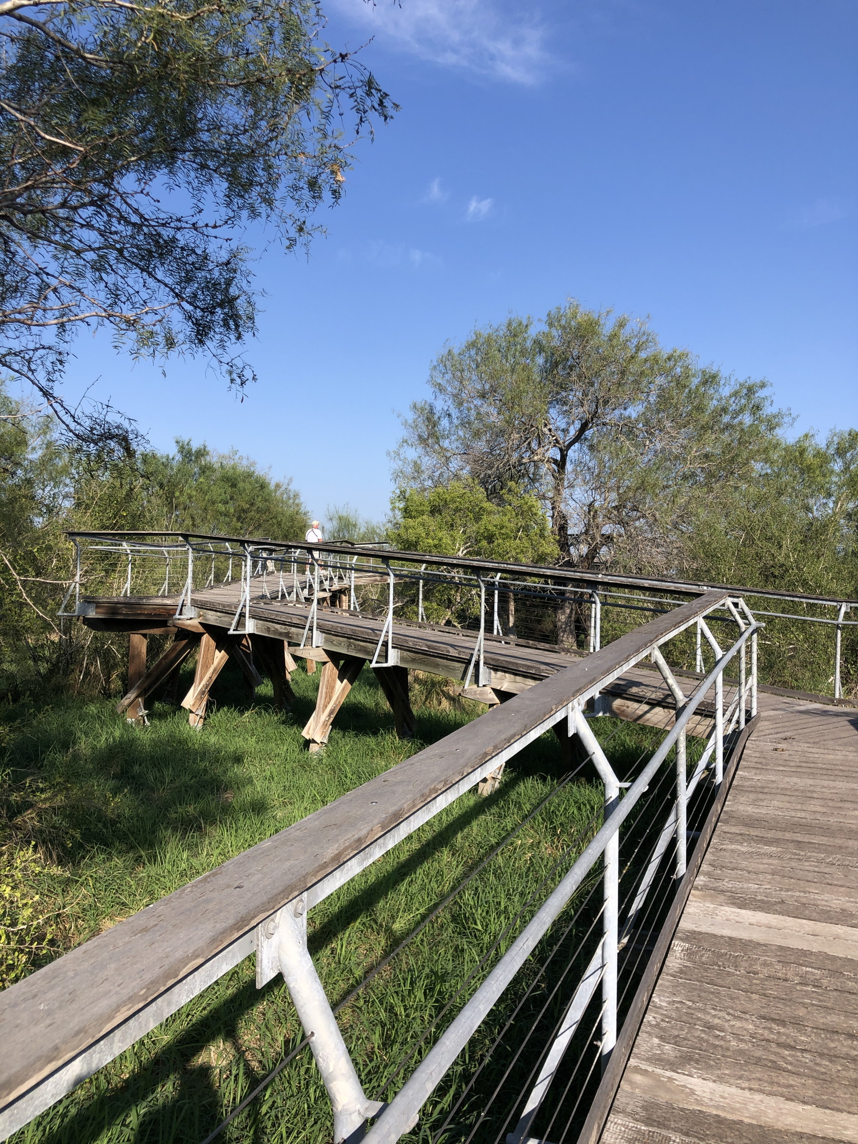
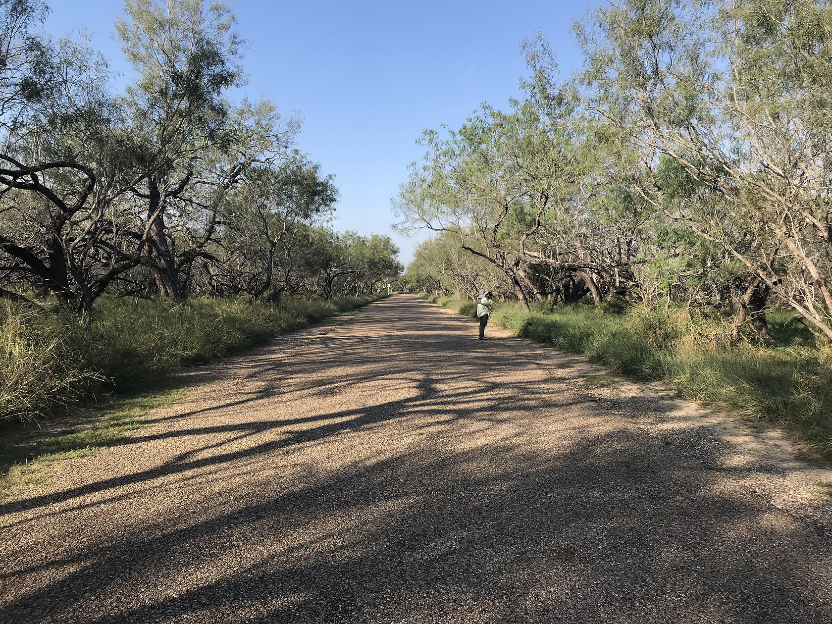
The next best-known reserve after Santa Ana along the Rio Grande is probably the Bentsen-Rio Grande State Park. This park has walk-in camping and an hourly electric tram to move visitors around. The lack of cars in the park makes the experience much quieter and less congested – most visitors either bicycle from the entrance (bikes are available for rent) or take the tram to various stops inside the park. There are quite a few bird feeders and an elevated viewing platform for Hawk-watching and looking for water and wading birds in a nearby resaca.
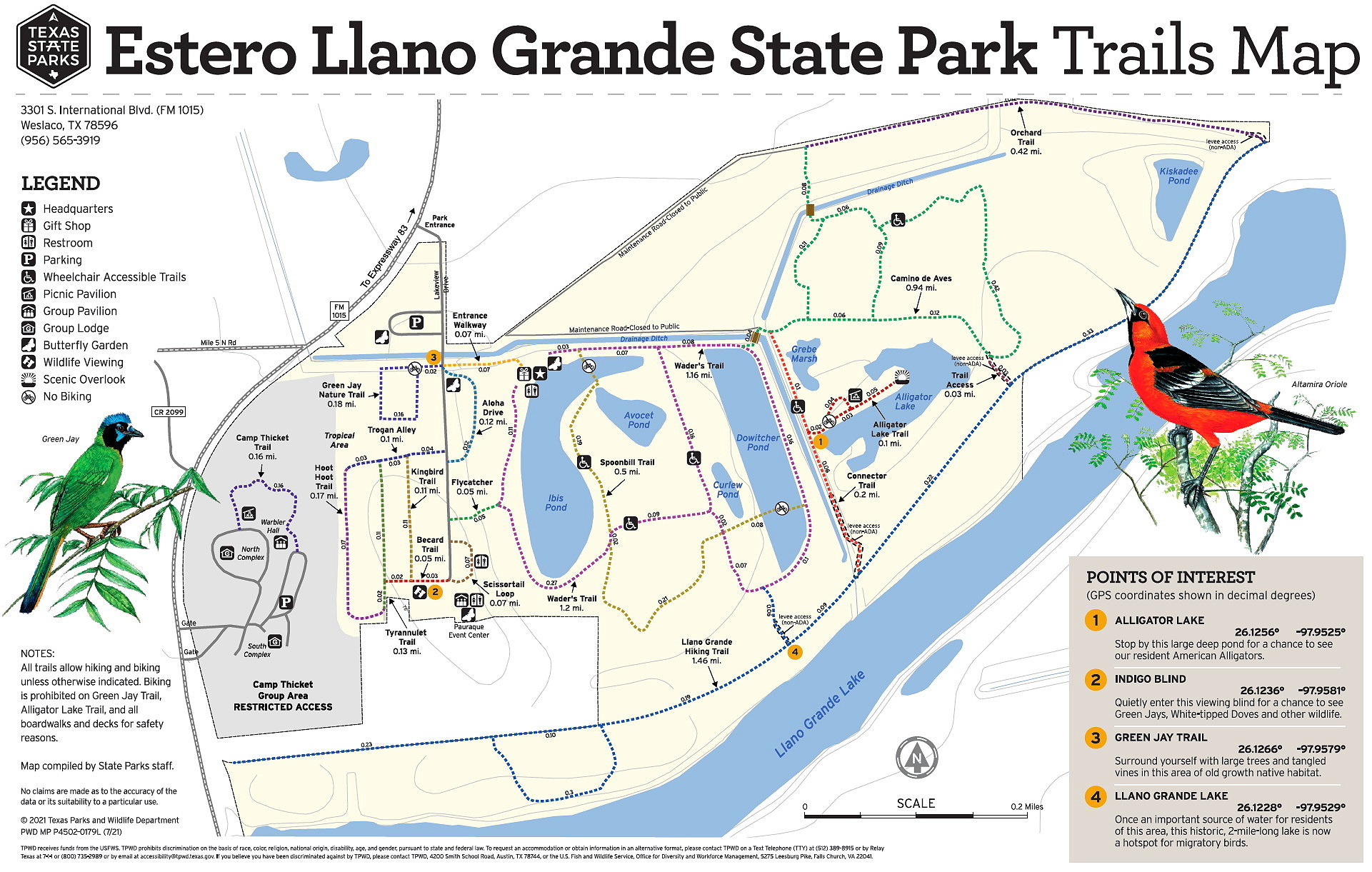
Estero Llano Grande State Park
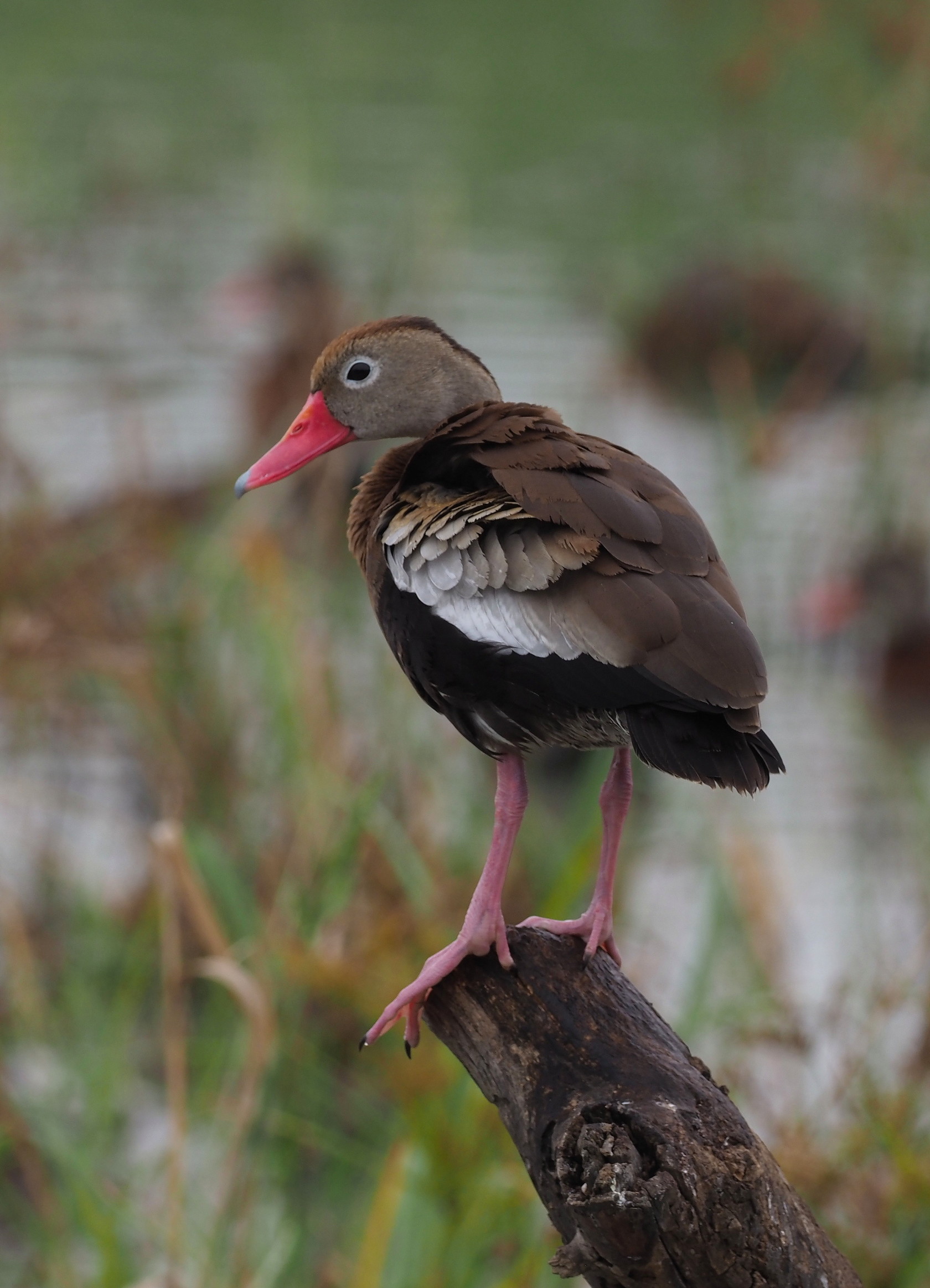
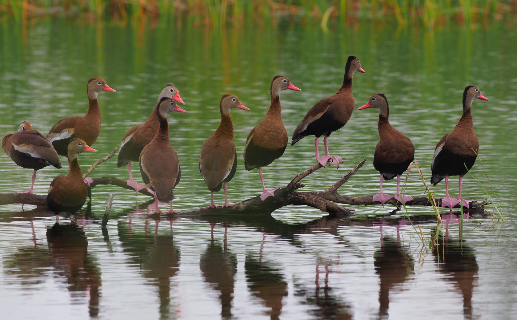
Several experienced birders we met during our stay in the Valley recommended that we visit Estero Llano Grande State Park, east of McAllen. This is a small state park – but rich in bird habitats. It is a semi-artificial park, with the main pools having been dug out (from prior flat agricultural fields) to optimal depths for waterfowl and wading birds. The birding was excellent and we had our best views of large numbers of Black-bellied Whistling Ducks in this park. One excellent feeder was visited by many different species of birds. The park is a good example of what restoration of originally unfavorable environments can provide for wildlife.

A somewhat similar Texas State Park, Resaca de la Palma, is closer to Brownsville (we did not visit it because it was closed the days we were available to visit (Monday and Tuesday).
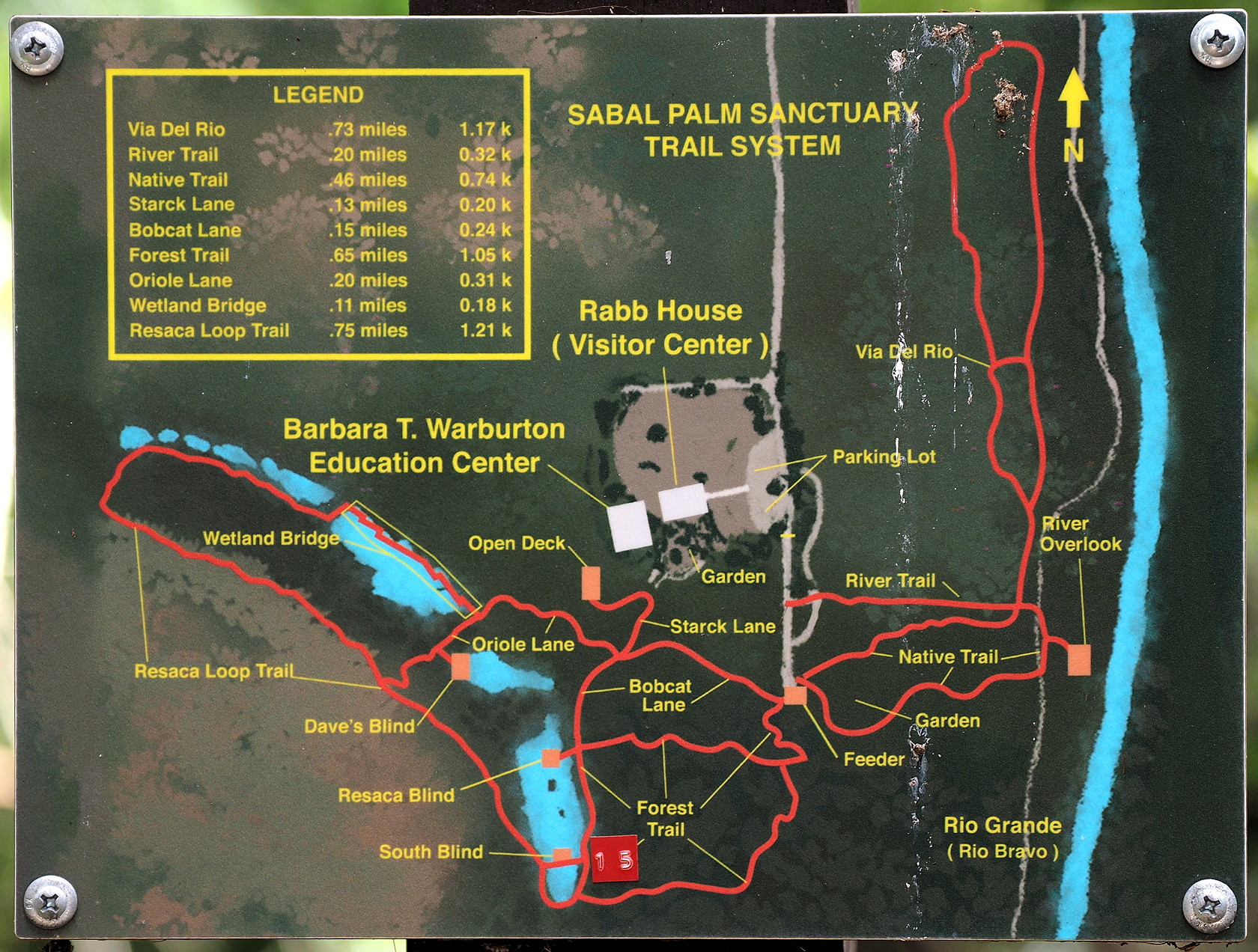
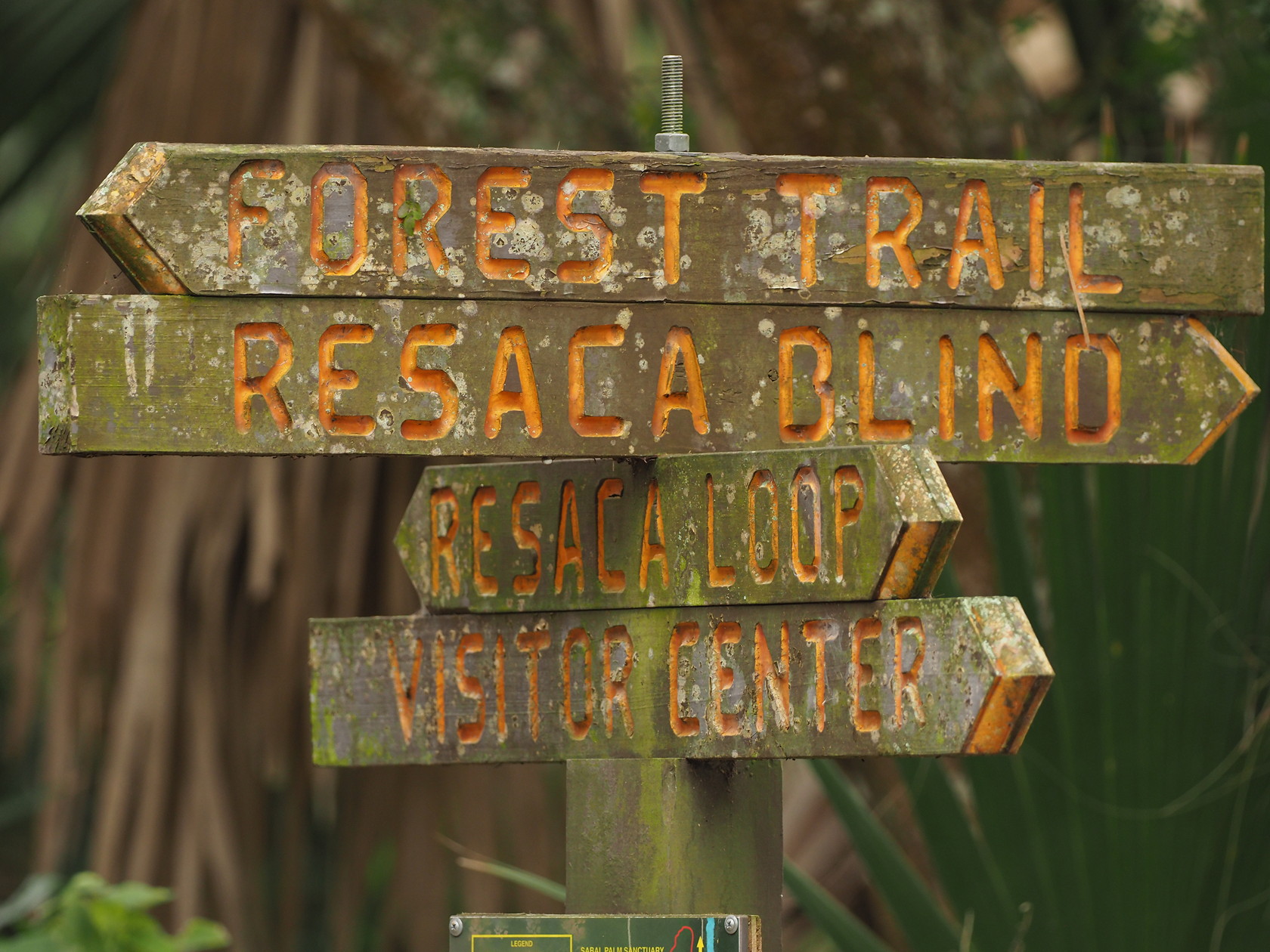
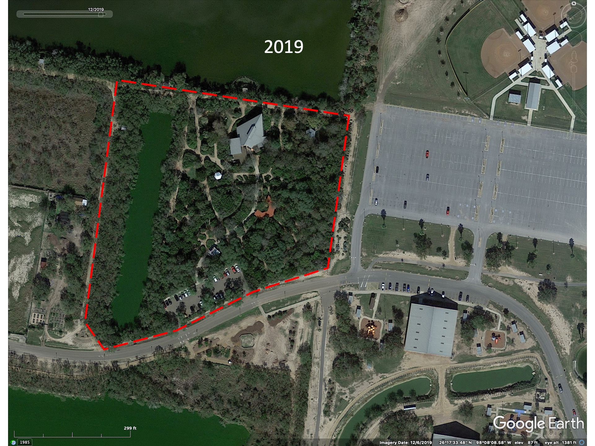
Sabal Palm Sanctuary
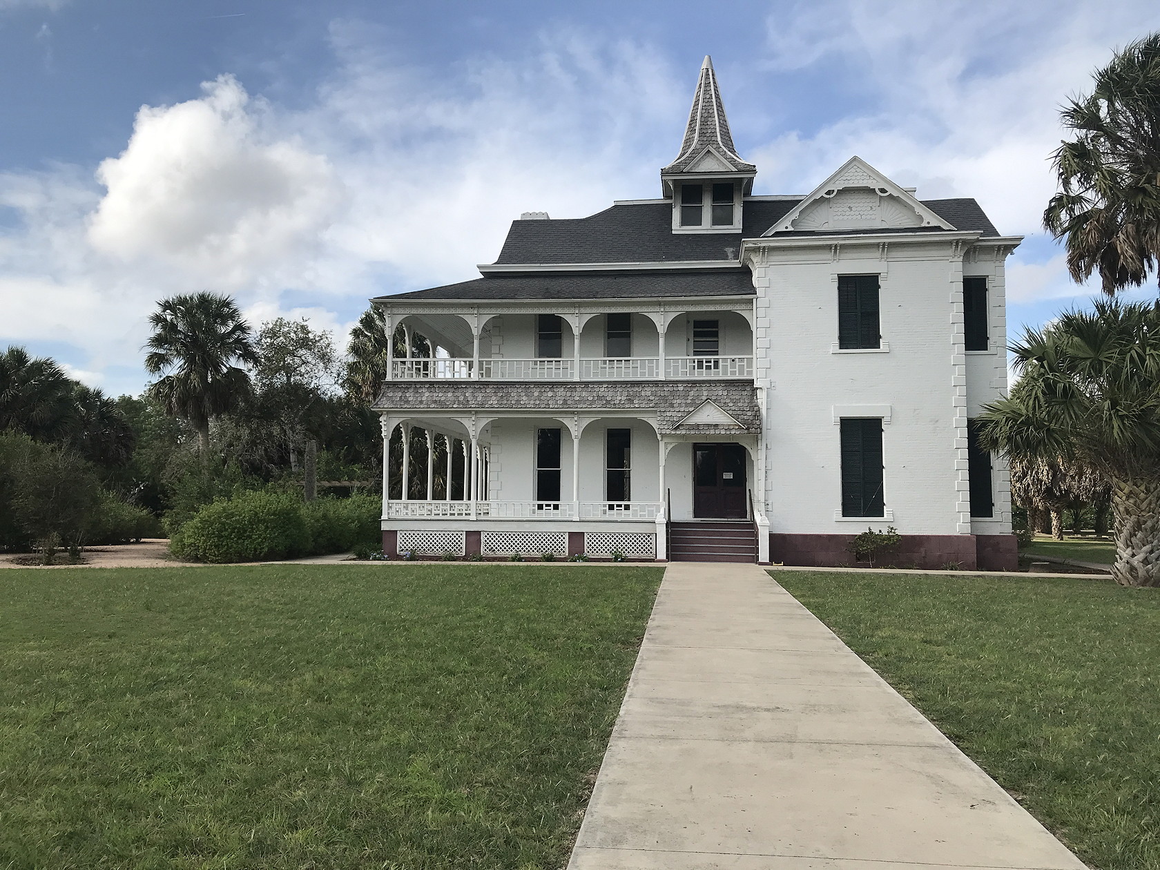
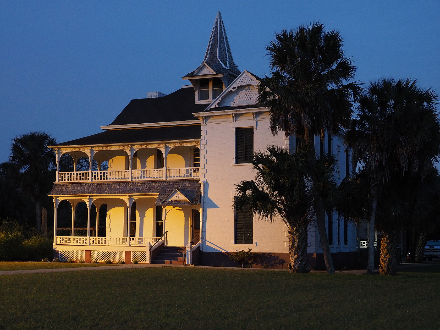
A less well-known preserve, originally associated with the Audubon Society, is the Sabal Palm Sanctuary south of Brownsville – essentially the farthest south you can dive in Texas. It protects a large grove of Mexican Sabal Palms (Sabal mexicana). The trails lead to resacas (local term for oxbow lakes) – often populated with Least Grebes and Ringed and Green Kingfishers. The Sanctuary also has feeders and butterfly gardens that bring in the usual birds and insects of the Valley. We stayed one night at the Historic Mansion – a B&B known as the Rabb House – to explore for nocturnal wildlife. Only one room is available – for up to 2 guests . There is no shortage of Javelina and several different frog and toad species were seen because they have permanent (artificial) ponds near the house. The Sanctuary is south of the border wall and one could in principal walk any of the trails at night if you stay there. We didn’t walk that far at night because there are an estimated 30 Nilgai antelope on the property (they are invasive in South Texas like feral hogs). Nilgai can weigh up to 600 lbs! Although they are mostly diurnal, we didn’t want one to startle us at night (to put it mildly).
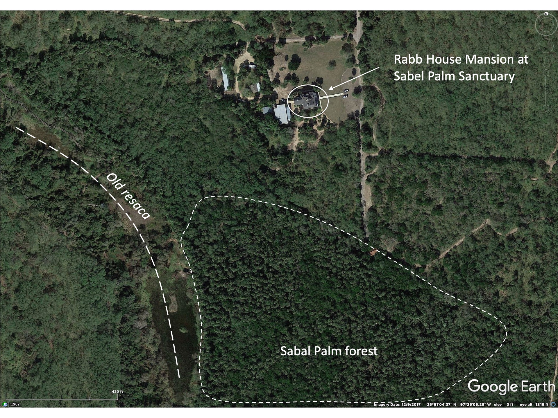
Although the main Sabal Palm grove has been protected for many years, the preserved area has become larger with the the addition of surrounding agricultural lands that have been incorporated into the overall protected area. Some of this land (the western half approximately) is part of the Lower Rio Grande National Wildlife Refuge. A time sequence of Google Earth imagery shows the gradual restoration of the landscape – we noticed that former agricultural lands tended to be dominated by trees of the same species with an underlying layer of non-native grasses. Restoration of natural, native vegetation can be a very long process.


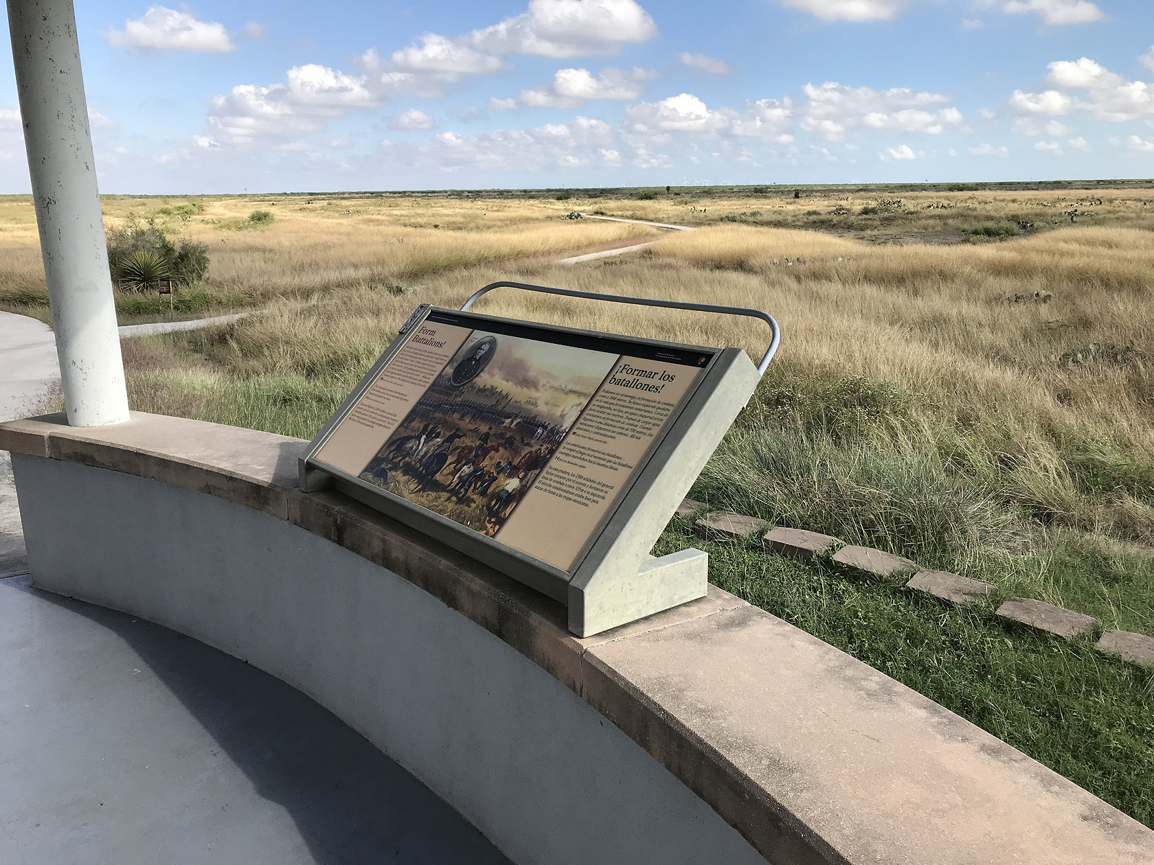
Although not shown on our map of birding locations the Palo Alto Battlefield National Historic Park operated by the US National Park Service is a large tract of land with resacas and a long trail/boardwalk. It is a good location for a visit, both for grassland birding and learning about the history of the Mexican-American War and the early history of Texas. It is on the outskirts of Brownsville, to the northeast of the town.

Laguna Atascosa National Wildlife Refuge covers a variety of environments from Tamaulipan thorn thicket to coastal salt marshes. It extends approximately 15 miles north-south just inland from the Laguna Madre. Another large part of the Refuge lies south of the main tract of land and includes the Bahia Grande and surrounding lands north of the Brownsville Shipping Canal and west of Port Isabel.
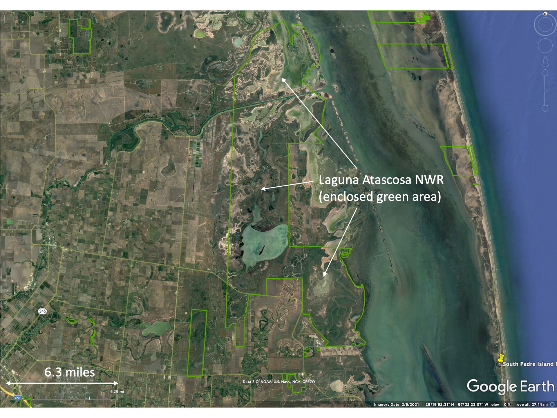

Laguna Atascosa National Wildlife Refuge is best known for its resident Ocelot population (something like 30+ individuals) but these are not likely to be seen. When we visited in Dec 2021 the Visitor’s Center and the main loop road were closed due to COVID-19. However, several short trails extending out from the main parking lot through the native vegetation (Tamaulipan thornscrub) were open and several feeders and water drips for birds were working. This allowed us to see some of the Valley’s specialty birds.
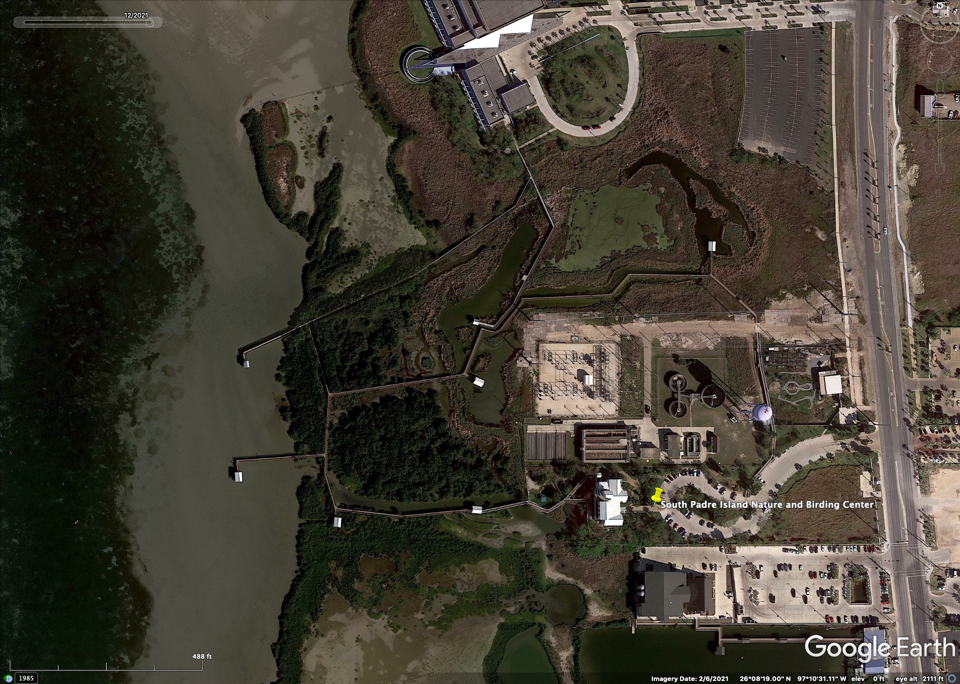
Farthest to the east of the birding destinations is South Padre Island and the South Padre Island Birding and Nature Center. We did not visit this site because of its entrance fee (2021: $10 for adults) and we thought we had experienced enough similar coastal boardwalks farther north in Texas. But for many people the added attractions of the Nature Center might be sufficient and the long boardwalks (3300 ft total length!) might provide good photo opportunities for marsh and mudflat birds. A Google Earth image of the nature center is shown below. But the Google imagery can’t hint at the displays inside the nature center… see the previously mentioned birding website to see more details of this World Birding Center.
Other nature destinations
There are many smaller and less frequently visited natural history destinations in the Valley. Some of these are actually better for seeing some wildlife close-up – if they have suitable habitat and for birds, feeders. Often the informational plaques and displays are better in small nature centers than in large tracts of preserve that are rarely visited. We did not visit three of the following sites but show Google Earth imagery to provide some context.
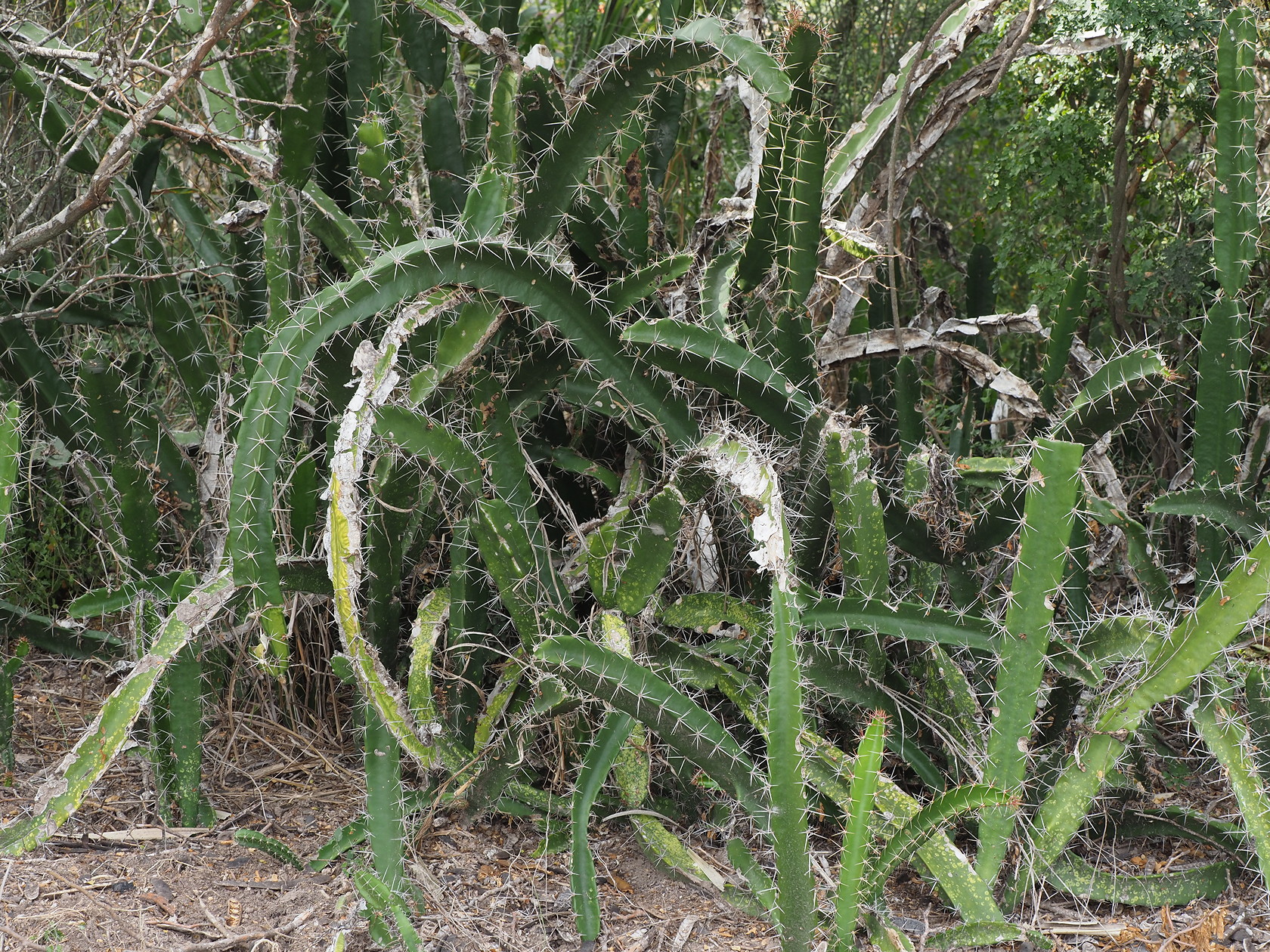
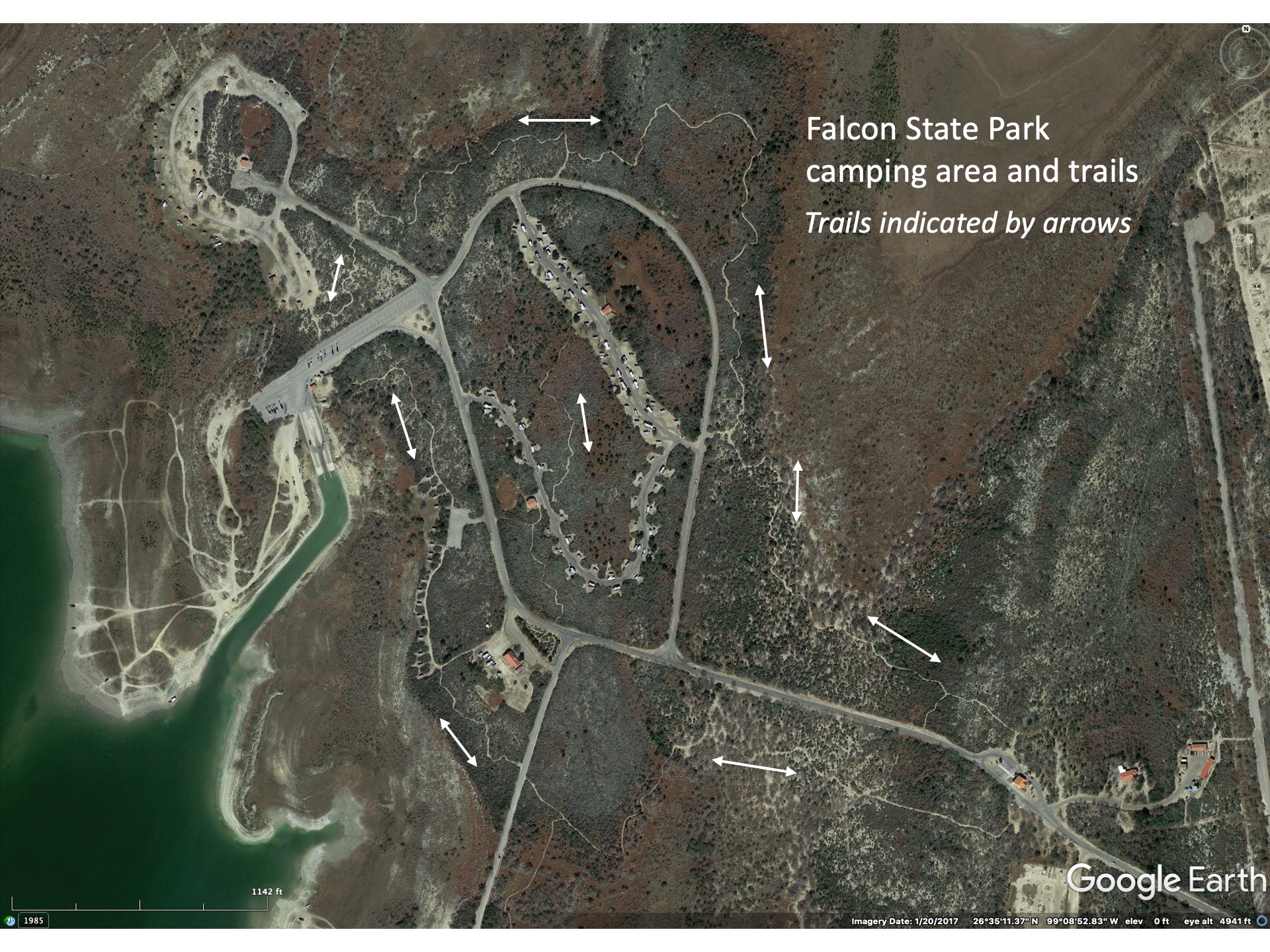
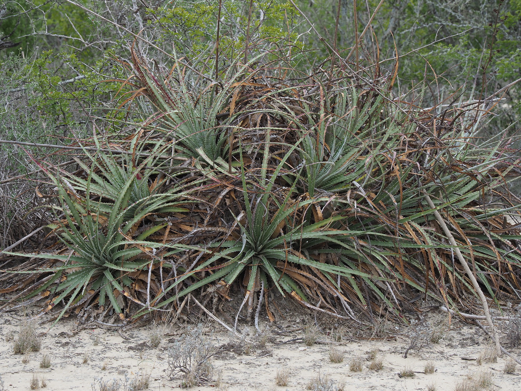
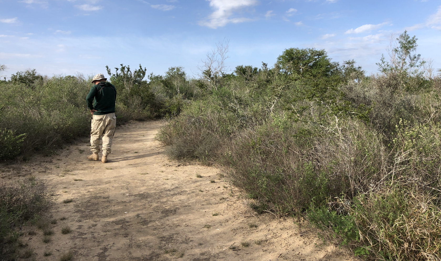
Falcon State Park: This small state park is the uppermost portion of the Lower Rio Grande Valley and is the only state park with regular camping facilities for vehicles. The Tamaulipan thornscrub vegetation here is interesting, with considerable diversity of shrubs, and handful of smaller cacti, and a variety of smaller animals (up to Javalina and deer). Most people have used the park as a base camp for fishing in Falcon Lake – formed by the large Falcon Dam. But water levels in the lake were so low when we visited that boats cannot be put into the lake from the State Park’s boat ramps. So the campground sites were not near capacity. Lots of photos and text at this site.
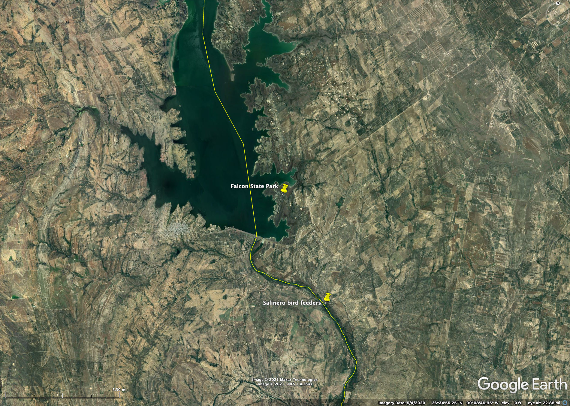


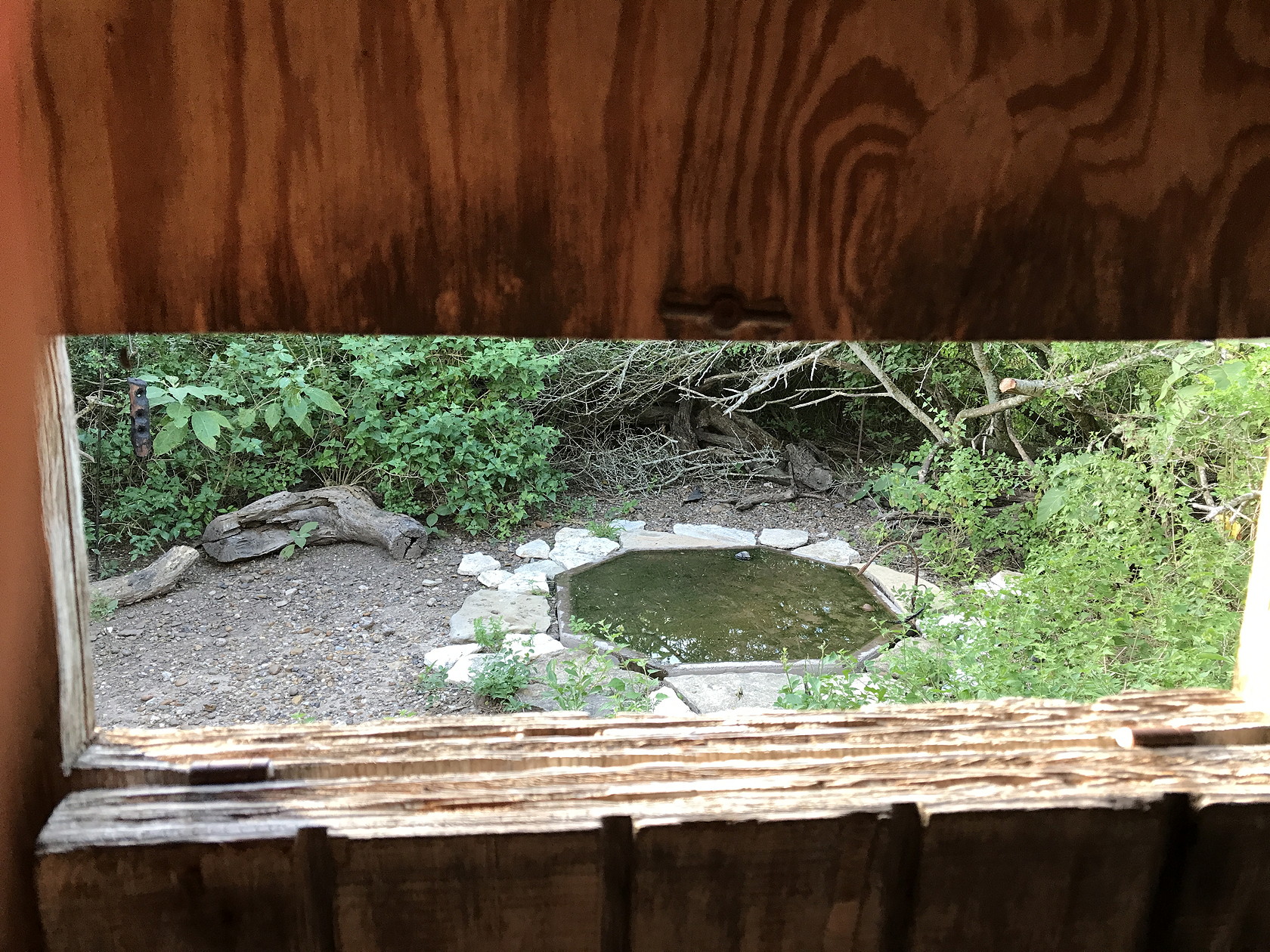
Salineño Area: This very small (3 acre) plot is famous among birders because it was initially started as a private bird feeding house by a couple from Michigan that spent their winters there for many years. Because it was well-known it is now run by a volunteer from the Fish and Wildlife Service. Salineño’s claim-to-fame was that it was the only place in the US that the Brown Jay could occasionally be seen (no sightings in recent years). Other rarities are also found there like the Red-billed Pigeon. Plus you can easily access the Rio Grande there and see Ospreys, the three south Texas Kingfishers and other birds there. We also saw sliders and soft shell turtles basking on rocks in the river.

Hugh Ramsey Nature Park: We visited this park, which has some educational plaques but no visitor center and only an open parking lot. We were somewhat discouraged against a longer stay because of homeless people in the park and people sitting in vehicles that seemed just to be waiting. With valuable camera and other optical equipment in our vehicle we weren’t sure about the safety of the parking lot – just off a highway. There were several ponds and some feeders but our visit was relatively short. However, there is apparently quite a bit here.
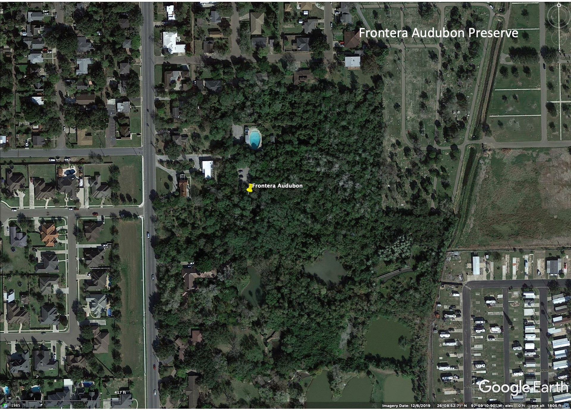
Frontera Audubon: This small park has a good visitor’s center but we arrived late in the day and didn’t want to pay the entrance fee for only a few minutes time. But we did see, from the parking lot, that large numbers of vultures were roosting in the park. Online reviews that we read complained about the ambience due to the vultures and their guano. But see this detailed report from a birding and butterfly perspective.
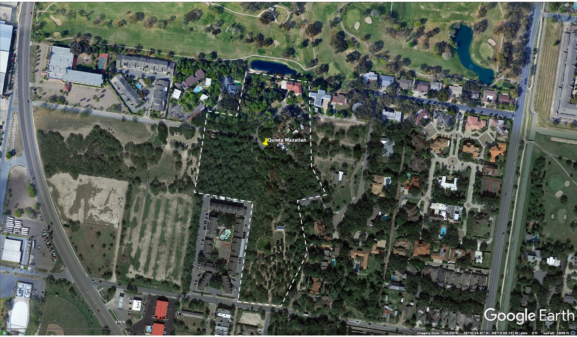
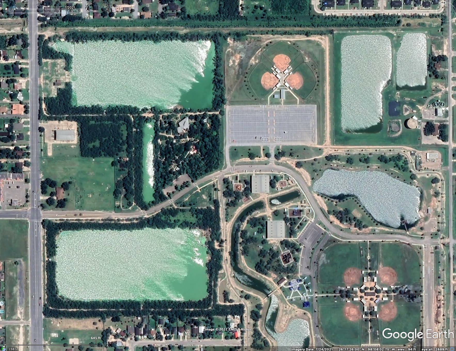
Quinta Mazatlan: We only spent about 30 minutes at the Quinta (a large country estate), a part of the World Birding Center, before it closed in the afternoon but the 15 acres of natural landscapes are well signposted with educational plaques and displays. It is also a venue for wedding photography shoots and social events as well as a nature center, but the two blend reasonably well in the small location. Despite being in the city of McAllen, it is somewhat isolated from city noise by a golf course on the north side and the City’s airport (relatively light traffic) on the southwest side. An interesting short history is here and a brief description here. Many more photos and much text is here.
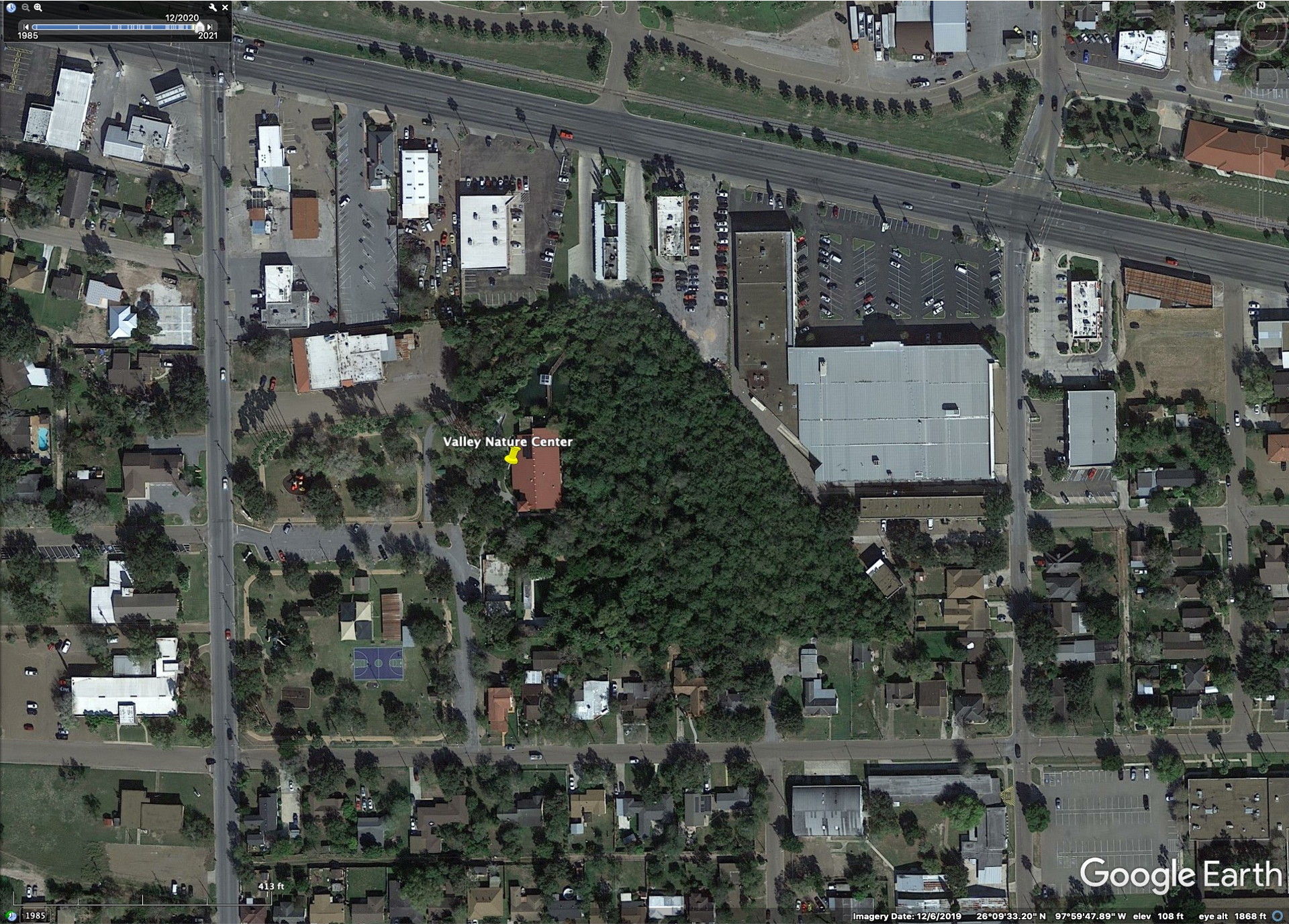
The Valley Nature Center in Weslaco has a small naturalistic parcel of land as well as a nature center. However, it is only 6 acres in size. Having just said this see a much more detailed summary of the Valley Nature Center here. This website’s nature center photos may be dated as they were apparently building a newer center. Apparently the Center has extensive educational activities.
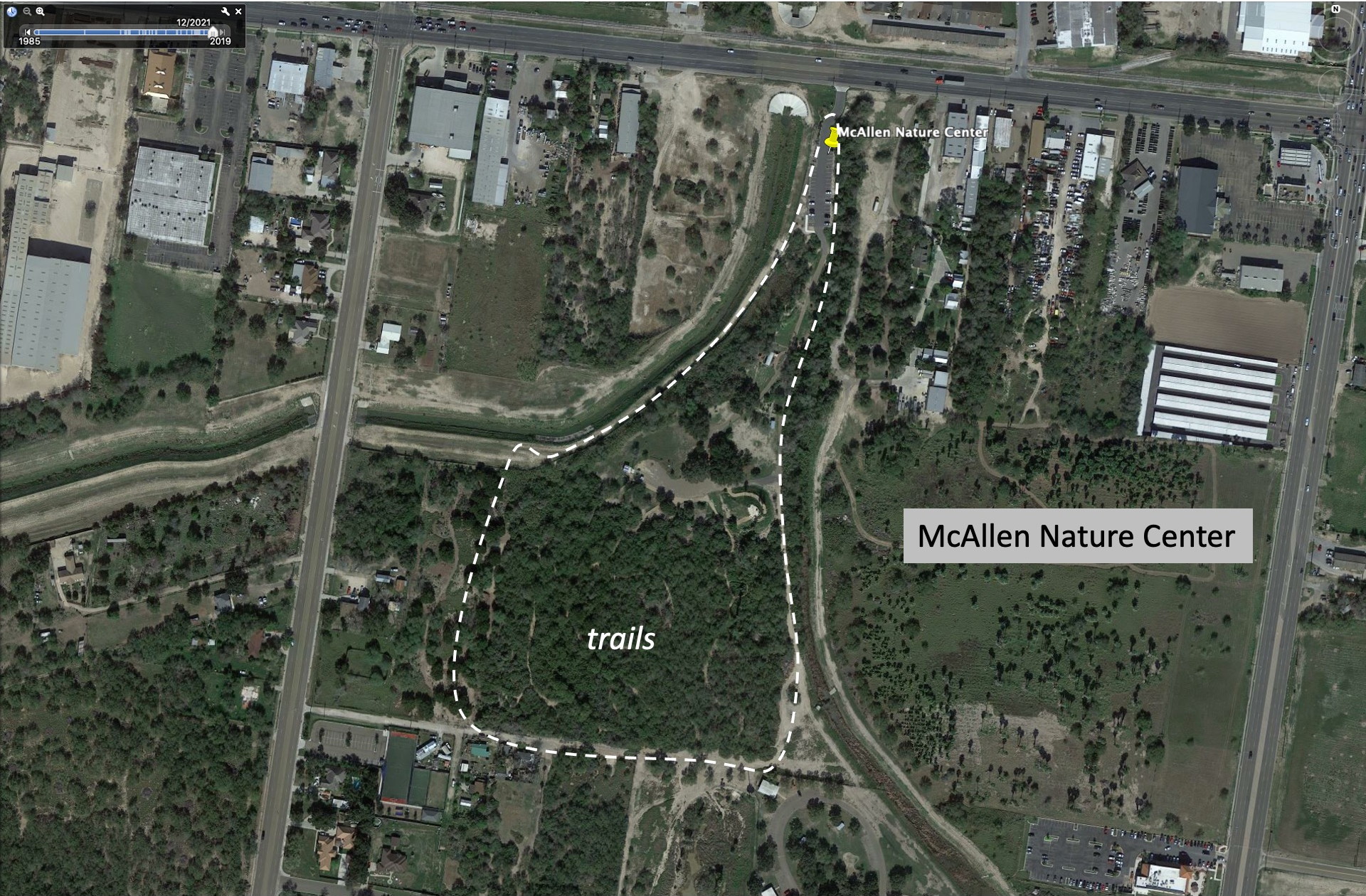
McAllen Nature Center: We did not visit this but you can see the general layout in the Google Earth image below.
Edinburg Scenic Wetlands: We did not have time to visit this location, somewhat north of the main Rio Grande Valley. It is a restored landscape with a major nature center. For many more details you should see this page. A Google Earth image sequence of this location is below.
A sequence of images showing closer views of the evolution of the Gardens from 2006 to 2019 is available here in Google slides. An explanation for the slides is shown below.

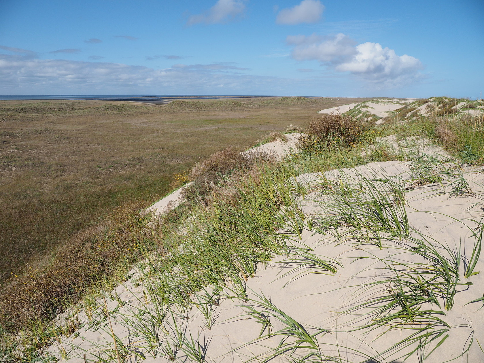
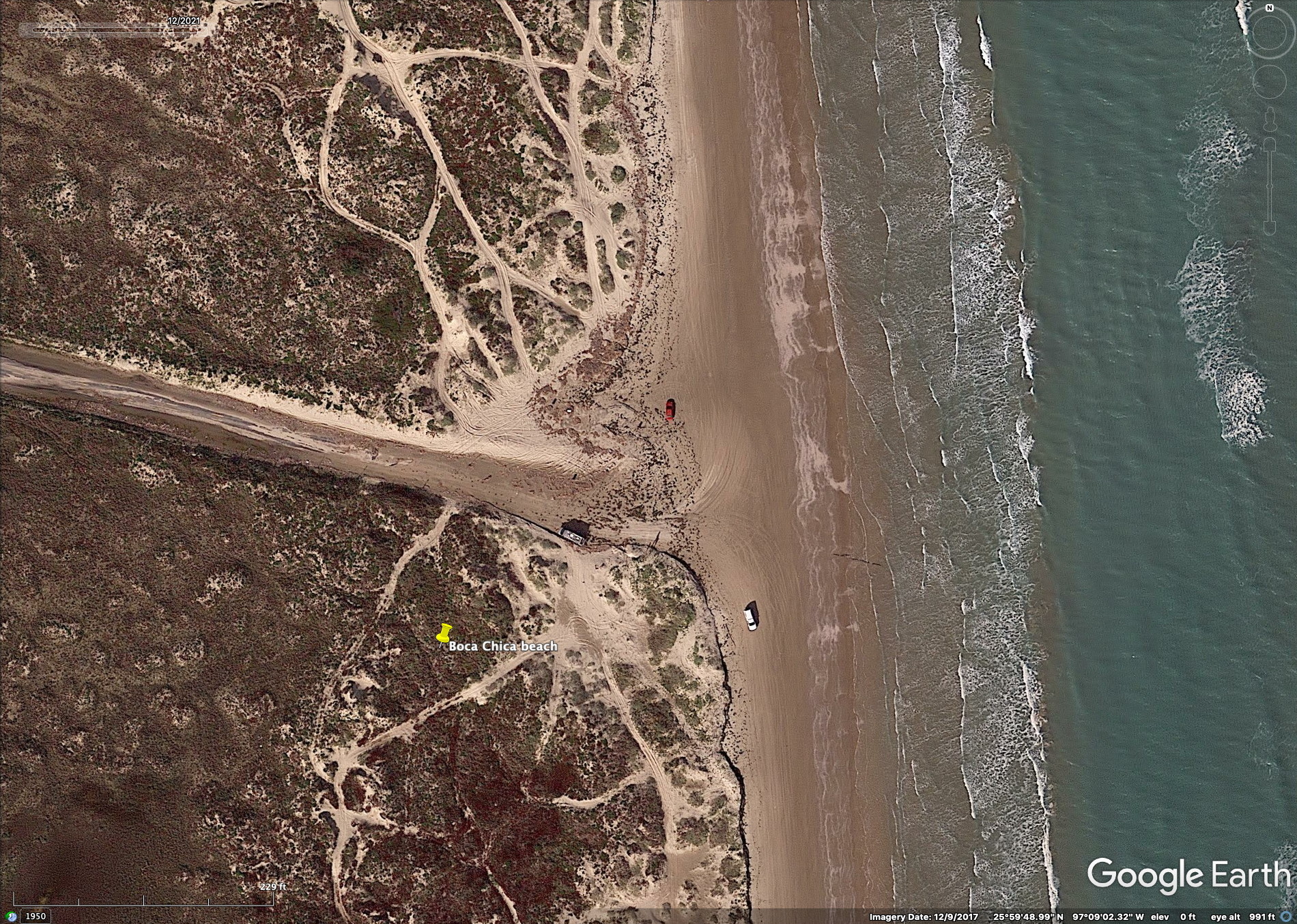
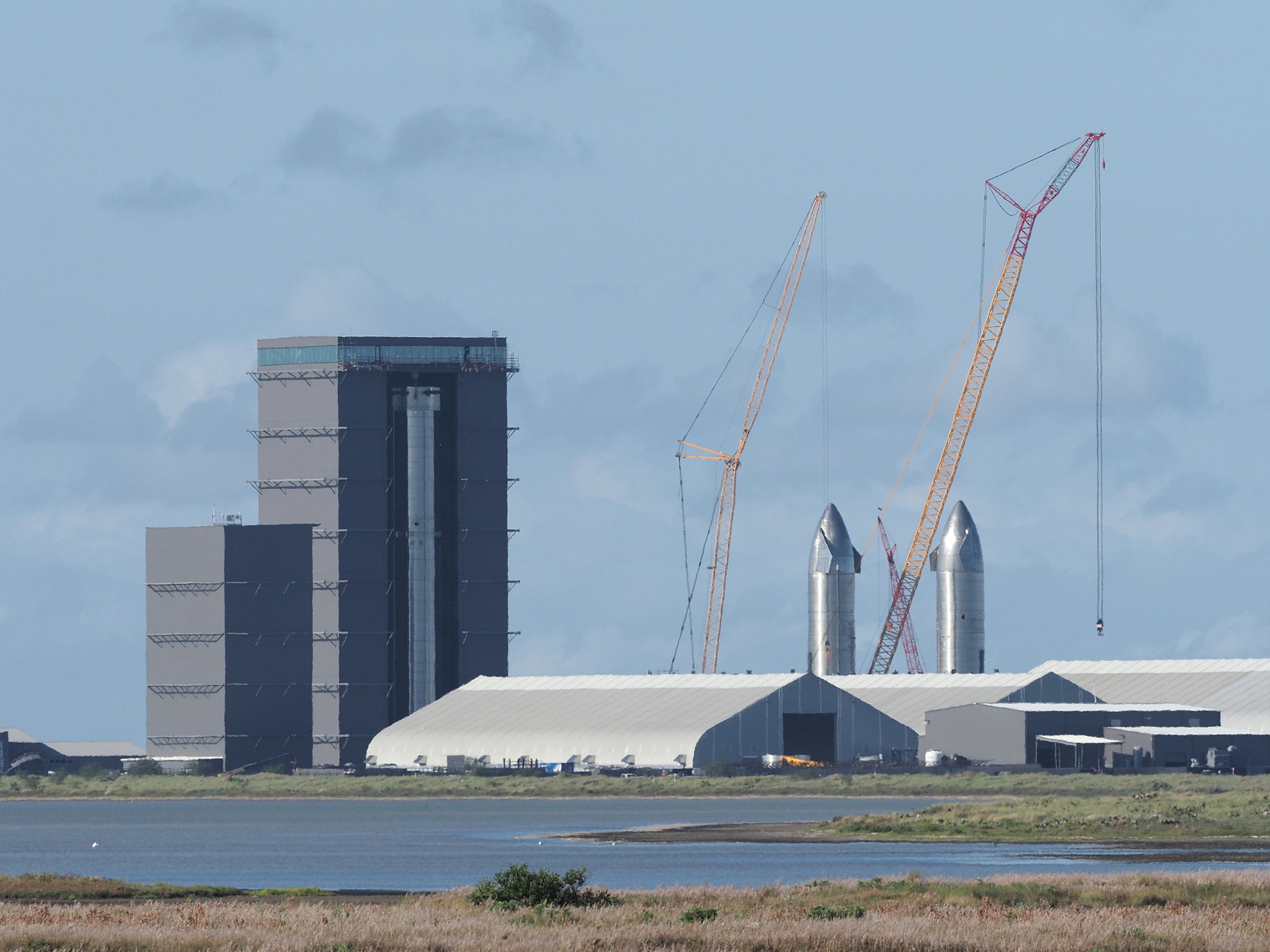
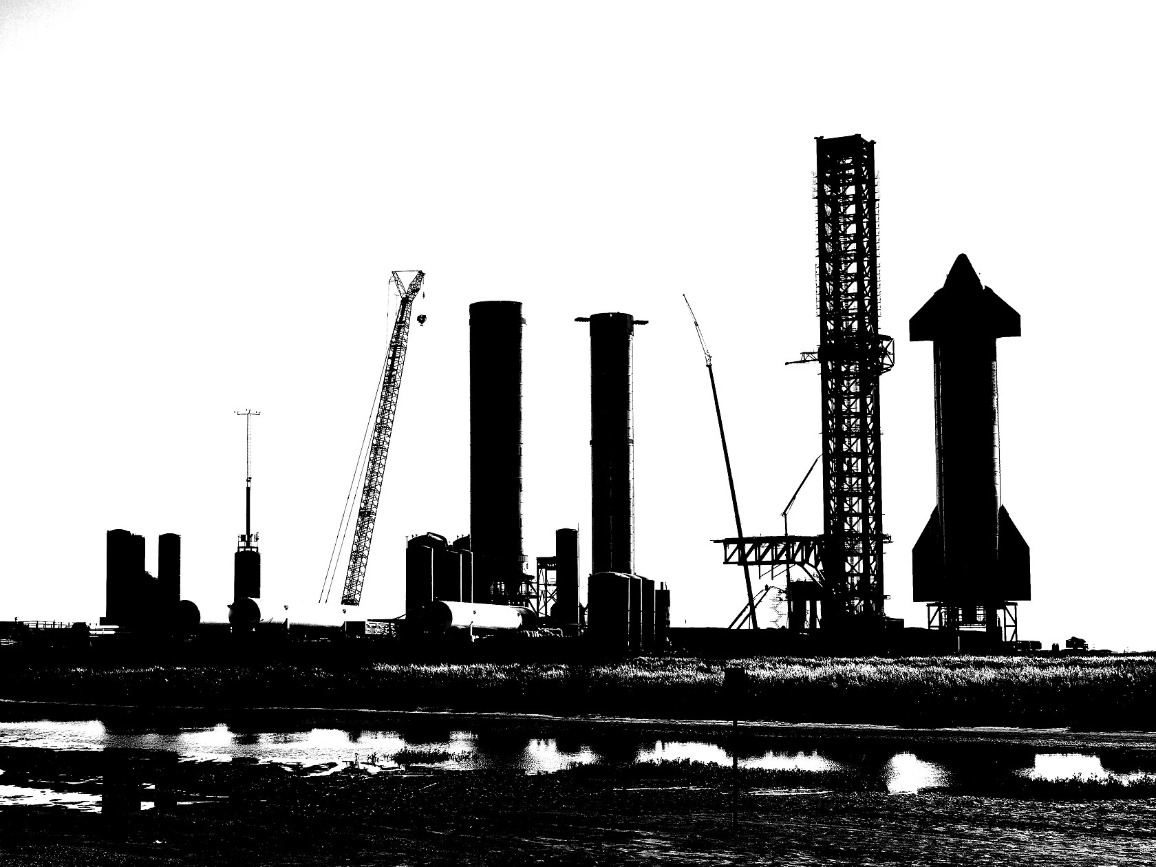
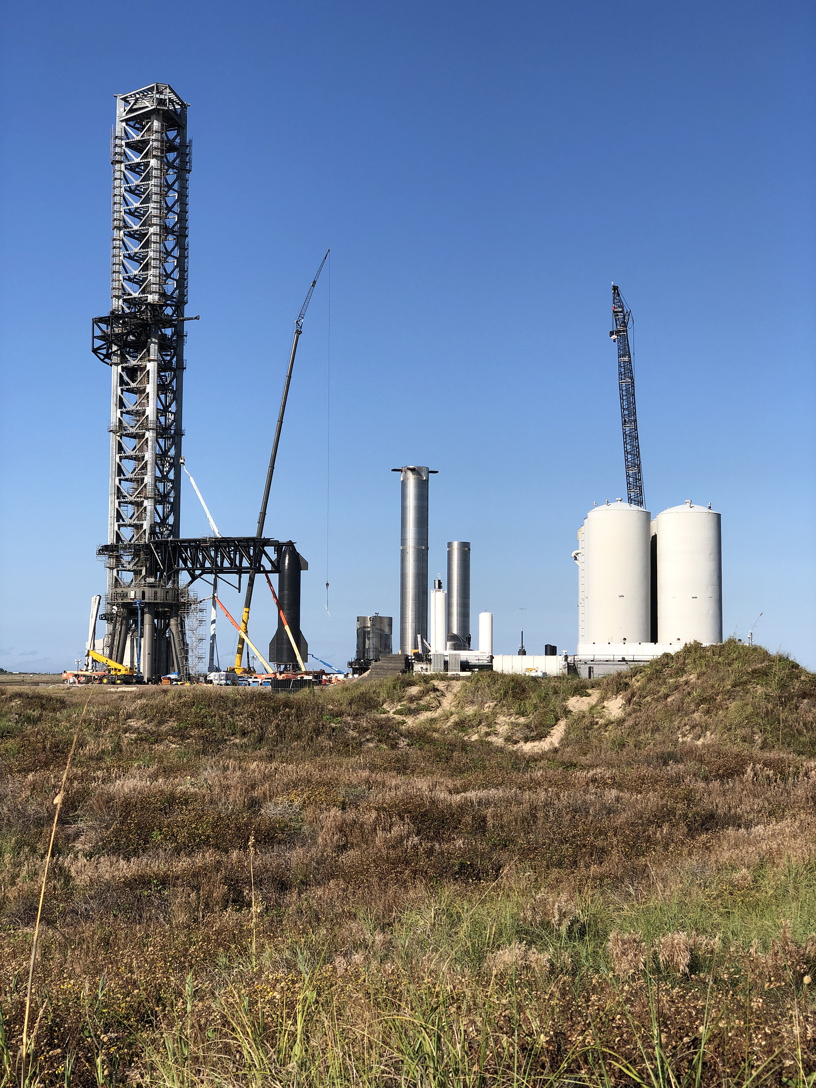
Boca Chica Beach: The road to Boca Chica State Park and its beach passes through low coastal marsh and saline flats on the way to the beach. Some interesting shorebirds and wading birds can be seen on the mud flats and roadside ditches on this road stretch. However, the most interesting feature along this road – for most people, is the SpaceX complex for rocket construction and testing. The construction has mostly taken place in the last 2 years and Google Earth imagery doesn’t show its enormous scale. A few photos are included here because it is becoming a major tourist attraction in the Brownsville area. The novel aspect of all of this is that you can literally drive right past the construction activities and watch from various vantage points. You cannot do this at Cape Kennedy or any other rocket testing/launch site. Much of the work putting rockets together is being done almost out-in-the-open.

Practical matters
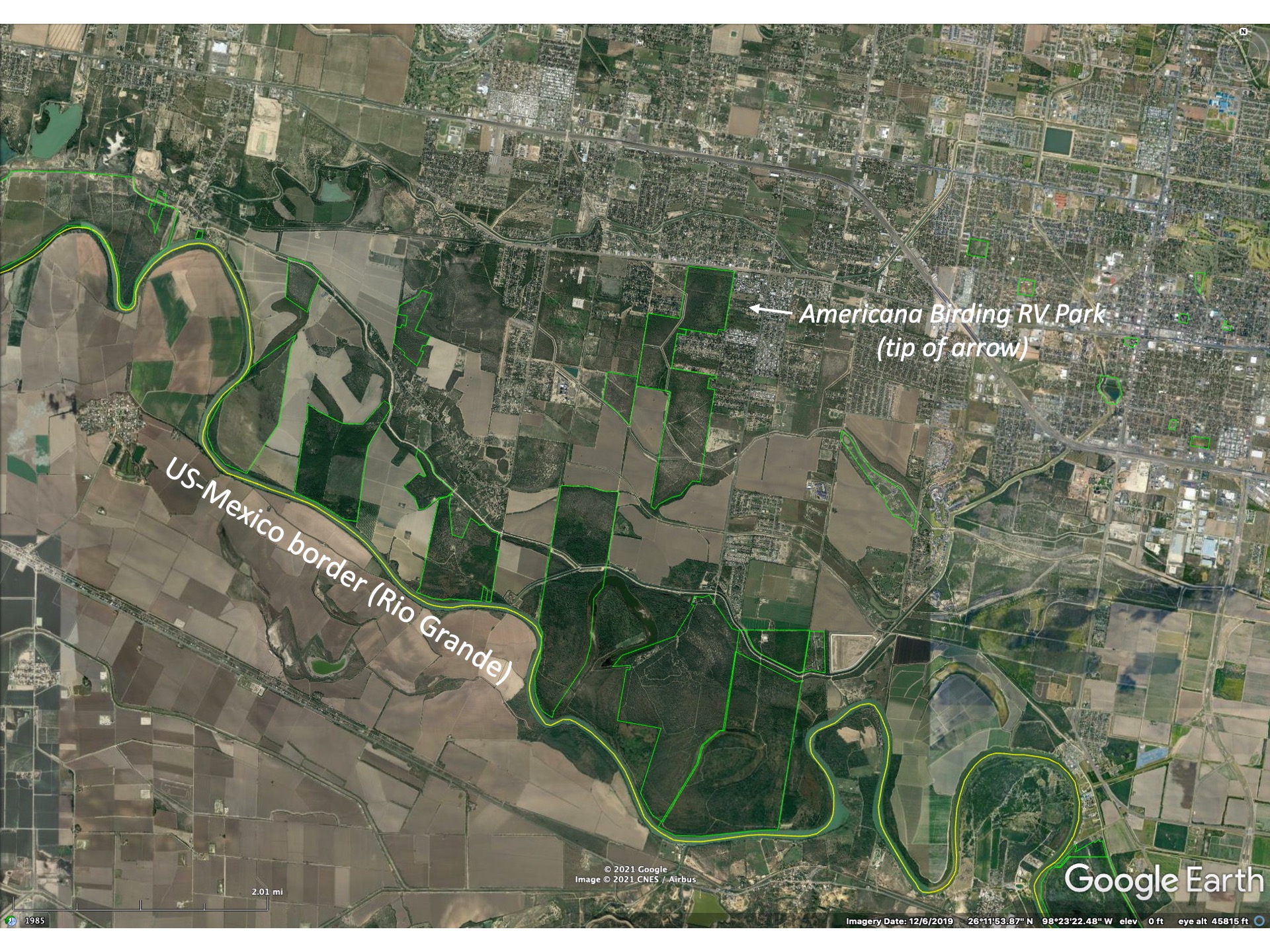
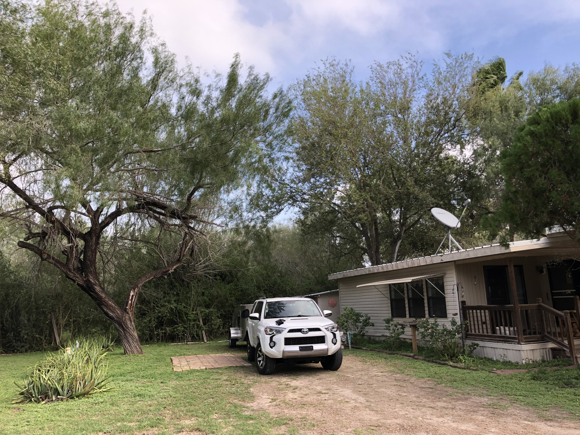
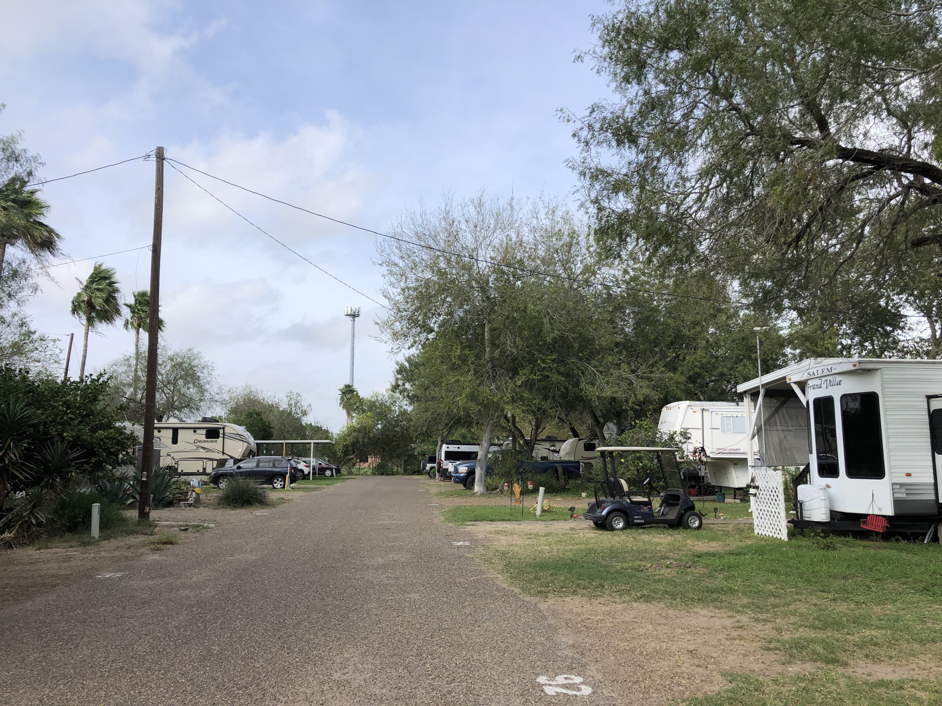
Accommodations in the Rio Grande Valley are mostly via standard hotels and motels. There are no state parks in the lower Valley with campgrounds for car or RV camping. The Bentsen Rio Grande State Park allows camping – but you must walk in about 1000 ft with your gear. None of the wildlife refuges or other state parks have camping options. This leaves Recreational Vehicle (RV) parks as the main option for camping. One RV park (Americana The Birding Center RV Resort) is well-known among birders, just over 2 miles north of the Bentsen Rio Grande State Park entrance. We stayed there 5 nights and there is one particular aspect that attracts birders. The park has its own nature trail and bird feeders in a naturalistic setting. See the Google Earth images below.
The Valley’s nature attractions extend about 150 miles from Falcon State Park in the west to Boca Chica beach or South Padre Island in the east. This makes it time consuming to reach all sites from a central location despite Interstate 2 which runs along the Valley. It may be more practical to base one’s visit from two locations, one closer to Brownsville and another closer to McAllen to minimize the driving to daily destinations. Most of the preserves are closer to McAllen and eastward, so a location between McAllen and Brownsville is more suitable if staying at a single location is preferable.


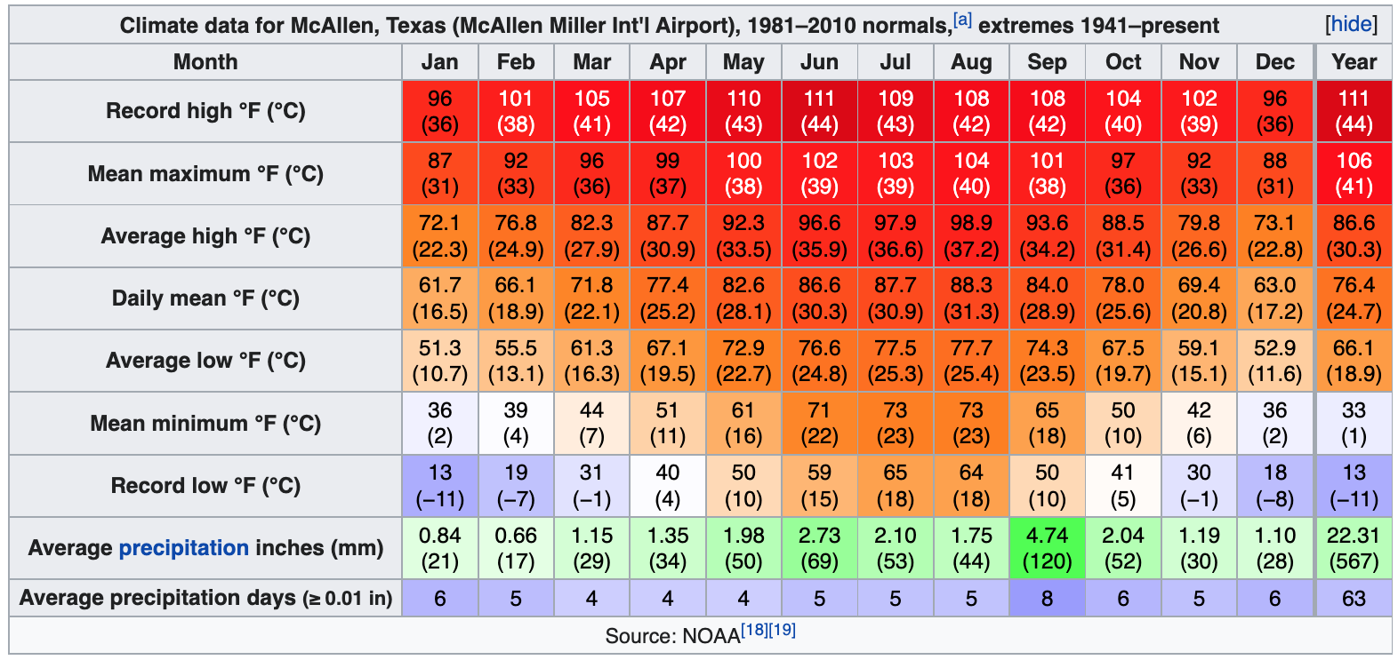
Any visit to the Valley, or most of coastal Texas for that matter, should take into account the climate. We repeat McAllen’s climate table from Wikipedia here for convenience:
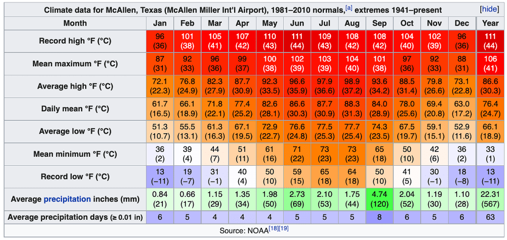
From the above table it is apparent that summer (May-Sept) conditions are very warm with warm nights. Though rainfall is not high, the dew point temperatures are high because of the warm Gulf of Mexico nearby. If insects and reptile and amphibians are your primary interest summer and early fall is a good time to visit south Texas. Also, some birds only visit during this time of year. Of course, keep in mind the insects like mosquitos and ticks during the warm/wet season. If comfort is really important during your daytime hikes then the months from November to March are best. The same applies to Florida or much of the Gulf coast of the US.
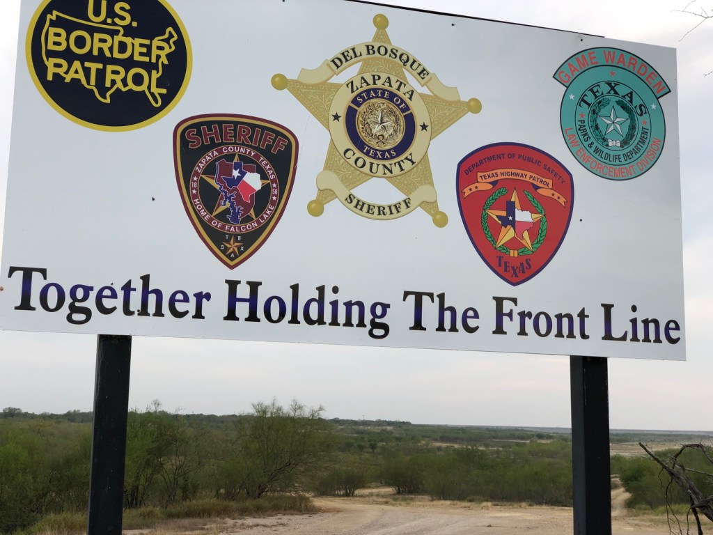
Despite the publicity given to the border immigration issues in recent years, the US Rio Grande Valley is relatively safe – at least where the tourists go – and if one is prudent with any expensive optical equipment (parking lots almost anywhere require this). In part this safety is due to the highly-visible presence of US Border Patrol, National Guard, Texas State Police and other local law enforcement personnel. The serious crime associated with Mexican drug cartels, still a very real issue for travelers in Mexico, is confined almost entirely to Mexico. Many of the interesting Valley preserves like Sabal Palm, Bentsen-Rio Grande State Park and Santa Ana National Wildlife Refuge literally border the Rio Grande and Mexico, but the border security fence/levee/aqueduct and associated personnel just north of these preserves deters people from crossing the Rio Grande – which would be easy to do in a small boat.
Getting to the Valley
Most visitors to the Lower Rio Grande Valley will drive, since having a vehicle is necessary to visit the various sites and the Valley is within a day’s drive (albeit long) from much of Texas. Many visitors are winter Texans, with residences in the Valley for the cooler part of the year. Visitors can fly to McAllen or Brownsville (both have commercial airports), or to Corpus Christi or one of the larger metropolitan areas farther north like San Antonio or Austin.
Any birder visiting from the north should consider all of the possibilities along their route south. There are many worthwhile sites to visit when traveling down the Texas coast, depending on the time of year. We recommend the Texas Sate Parks site that covers the Coastal Birding Route.
Summary
The Lower Rio Grande Valley merits visits of several weeks or longer. Some time is needed during the rather unpleasant (hot/humid) summer to see specialties that are most obvious at this time of year. Many of the birds that birders seek are now relatively common throughout the Valley such as Green Jays and Whistling Ducks. Some birds and butterflies may be seasonal and dependent on the amount of summer rainfall (peak rainfall month is September). Despite the less-then-ideal weather during the summer months this period favors insects and their attendant birds. The activity of amphibians and reptiles will also be greater during the warmer months.
We have traveled extensively in Mexico and many other Latin American countries and know that many of the “specialty” birds of the Rio Grande Valley are common farther south. But security, language and financial reasons may discourage many Americans from traveling south of the border. The birding infrastructure (accessible parks, nature trails, feeders, visitor centers etc.) in the US Rio Grande Valley is excellent compared with anywhere in Mexico and many other Latin American countries where it is almost non-existent. This makes seeing the birds and other natural history subjects much easier, more enjoyable, and more educational. The efforts to expand protected areas along the Rio Grande is encouraging. For naturalists there is much to be seen in the Valley, despite its limited topography and the considerable disturbance due to agriculture and urban development.
